|
|
 |
|
||||||||||||||||||||||||
|
 |
|
||||||||||||||||||||||||
|
 |
|
||||||||||||||||||||||||
|
 |
|
||||||||||||||||||||||||
|
 |
|
||||||||||||||||||||||||
|
 |
|
||||||||||||||||||||||||
|
 |
|
||||||||||||||||||||||||
|
 |
|
||||||||||||||||||||||||
|
 |
|
||||||||||||||||||||||||
|
 |
|
||||||||||||||||||||||||
|
 |
|
||||||||||||||||||||||||
|
 |
|
||||||||||||||||||||||||
|
 |
|
||||||||||||||||||||||||
|
 |
|
||||||||||||||||||||||||
|
 |
|
||||||||||||||||||||||||
|
 |
 |
|
||||||||||||||||||||
Sheet 1 |
Sheet 2 |
|||||||||||||||||||||
| Viewing options: |
Viewing options: |
|||||||||||||||||||||
 |
 |
|||||||||||||||||||||
Sheet 3 |
Sheet 4 |
|||||||||||||||||||||
| Viewing options: |
Viewing options: |
|||||||||||||||||||||
 |
|
||||||||||||||||||||||||
|
 |
|
||||||||||||||||||||||||
|
 |
|
||||||||||||||||||||||||
|
 |
|
||||||||||||||||||||||||
|
 |
|
||||||||||||||||||||||||
|
 |
 |
|
||||||||||||||||||||
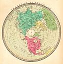
Northwest |
Northeast |
|||||||||||||||||||||
| Viewing options: |
Viewing options: |
|||||||||||||||||||||
 |
 |
|||||||||||||||||||||
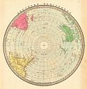
Southwest |
Southeast |
|||||||||||||||||||||
| Viewing options: |
Viewing options: |
|||||||||||||||||||||
 |
 |
|
||||||||||||||||||||
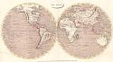
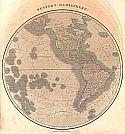
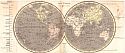
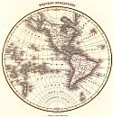
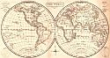
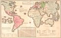
Western Hemisphere |
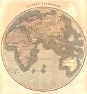
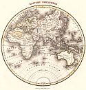
Eastern Hemisphere |
|||||||||||||||||||||
| Viewing options: |
Viewing options: |
|||||||||||||||||||||
 |
 |
|
||||||||||||||||||||
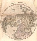
Northern Hemisphere |
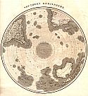
Southern Hemisphere |
|||||||||||||||||||||
| Viewing options: |
Viewing options: |
|||||||||||||||||||||
 |
|
||||||||||||||||||||||||
|
 |
|
|
|||||||||||||||||||||||||
| Viewing options: |
|
||||||||||||||||||||||||||
 |
|
||||||||||||||||||||||||
|
 |
|
||||||||||||||||||||||||
|
 |
|
||||||||||||||||||||||||
|
 |
|
||||||||||||||||||||||||
|
 |
|
||||||||||||||||||||||||
|
 |
 |
|
||||||||||||||||||||
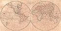
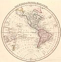
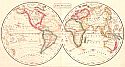
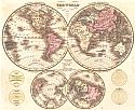
Western Hemisphere |
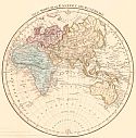
Eastern Hemisphere |
|||||||||||||||||||||
| Viewing options: |
Viewing options: |
|||||||||||||||||||||
 |
|
||||||||||||||||||||||||
|
 |
|
||||||||||||||||||||||||
|
 |
|
||||||||||||||||||||||||
|
 |
|
||||||||||||||||||||||||
|
 |
|
||||||||||||||||||||||||
|
 |
|
||||||||||||||||||||||||
|
 |
|
||||||||||||||||||||||||
|
 |
|
||||||||||||||||||||||||
|
 |
|
||||||||||||||||||||||||
|
 |
|
||||||||||||||||||||||||
|
 |
|
||||||||||||||||||||||||
|
 |
|
||||||||||||||||||||||||
|
 |
|
||||||||||||||||||||||||
|
 |
|
||||||||||||||||||||||||
|
 |
|
||||||||||||||||||||||||
|
 |
|
||||||||||||||||||||||||
|
 |
|
||||||||||||||||||||||||
|
 |
|
||||||||||||||||||||||||
|
 |
|
||||||||||||||||||||||||
|
 |
|
||||||||||||||||||||||||
|
 |
|
||||||||||||||||||||||||
|
 |
|
||||||||||||||||||||||||
|