Historical Maps of Other Southeastern States


  Main Author:   Cram, George F.
  Title/Description:   
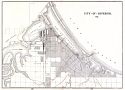
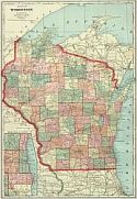
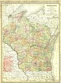
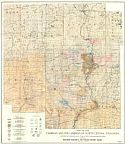
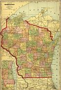
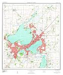
City of Superior, Wis.
  Publication Info:   
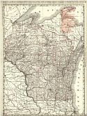
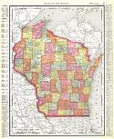
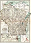
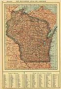
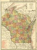
Chicago: George F. Cram, 1898; from Cram's Universal Atlas, Geographical, Astronomical and Historical
  Date:   1898
  Scale:   1:95,000
  Original Source:   Courtesy of Adams Antiques, Northport, Alabama
Viewing options:


  Main Author:    
  Title/Description:   Wisconsin
  Publication Info:   New York: Funk & Wagnalls Company, 1898; from A Standard Atlas of the World
  Date:   1898
  Scale:   1:2,788,000
  Original Source:   University of Alabama Map Library
Viewing options:


  Main Author:   Cram, George F.
  Title/Description:   Wisconsin (Railroad Map)
  Publication Info:   Chicago: George F. Cram
  Date:   1899
  Scale:   1:1,235,000
  Original Source:   University of Alabama Map Library
Viewing options:


  Main Author:   Grant, U.S.
  Title/Description:   Geological Map of Douglas County, Wisconsin
  Publication Info:   Madison: Wisconsin Geological and Natural History Survey, 1899; Bulletin VI Plate I
  Date:   1899
  Scale:   1:253,000
  Original Source:   University of Alabama Map Library
Viewing options:


  Main Author:   Smith, Benjamin E.
  Title/Description:   Wisconsin
  Publication Info:   New York: The Century Company, 1899; from The Century Atlas of the World
  Date:   1899
  Scale:   1: 1,710,720
  Original Source:   University of Alabama Map Library
Viewing options:


  Main Author:   Buckley, E.R.
  Title/Description:   Map of Wisconsin Showing the approximate distribution of the Clays and Shales and the location of brick and drain tile factories, June 1, 1900
  Publication Info:   Madison: Wisconsin Geological and Natural History Survey, 1899; Bulletin VII Plate I
  Date:   1900
  Scale:   1:1,267,000
  Original Source:   University of Alabama Map Library
Viewing options:


  Main Author:   Johnston, W. and A.K.
  Title/Description:   Wisconsin, Michigan
  Publication Info:   Edinburgh: W. and A.K. Johnston, 1901
  Date:   1901
  Scale:   1:4,992,000
  Original Source:   Courtesy of Adams Antiques, Northport, Alabama
Viewing options:


  Main Author:   Mast, Crowell, and Kirkpatrick
  Title/Description:   Map of Wisconsin
  Publication Info:   Buffalo, N.Y.: Matthews-Northrup Co., 1901
  Date:   1901
  Scale:   1:1,584,000
  Original Source:   Courtesy of Murray Hudson, Halls, Tennessee
Viewing options:


  Main Author:    
  Title/Description:   Wisconsin
  Publication Info:   Chicago: Rand McNally and Company, 1901; from Enlarged Business Atlas and Shippers Guide
  Date:   1901
  Scale:   1:1,013,760
  Original Source:   Courtesy of Murray Hudson, Halls, Tennessee
Viewing options:


  Main Author:   Rand McNally and Company
  Title/Description:   Wisconsin
  Publication Info:   Chicago: Rand McNally and Company, 1901; from the Universal Atlas of the World
  Date:   1901
  Scale:   1:2,217,600
  Original Source:   Courtesy of Murray Hudson, Halls, Tennessee
Viewing options:


  Main Author:   Rand McNally and Co.
  Title/Description:   Wisconsin
  Publication Info:   Chicago: Rand McNally and Co., [1902]
  Date:   1902
  Scale:   1:2,218,000
  Original Source:   University of Alabama Map Library
Viewing options:


  Main Author:   The Century Company
  Title/Description:   Wisconsin
  Publication Info:   Buffalo: The Matthew-Northrup Company, 1902; from the 1902 edition of the Century Atlas
  Date:   1902
  Scale:   1:1,711,000
  Original Source:   From the personal collection of Dr. Robert Burckhalter
Viewing options:


  Main Author:   Wisconsin Geological and Natural History Survey
  Title/Description:   Geologic Map of Grant, Iowa and Layfayette Counties, Wisconsin
  Publication Info:   Madison: Wisconsin Geological and Natural History Survey, 1899; Bulletin IX Plate II
  Date:   1903
  Scale:   1:253,000
  Original Source:   University of Alabama Map Library
Viewing options:


  Main Author:    
  Title/Description:   Map of Wisconsin
  Publication Info:   Chicago: George F. Cram, 1903; from Cram's Modern Atlas
  Date:   1903
  Scale:   1:1,393,920
  Original Source:   Courtesy of Murray Hudson, Halls, Tennessee
Viewing options:


  Main Author:   Hammond, C.S.
  Title/Description:   Hammond's Map of Wisconsin
  Publication Info:   New York: C.S. Hammond & Co., 1904; from Encyclopedia Americana
  Date:   1904
  Scale:   1:2,408,000
  Original Source:   Courtesy of Murray Hudson, Halls, Tennessee
Viewing options:


  Main Author:    
  Title/Description:   Wisconsin
  Publication Info:   Chicago: Rand McNally and Company, 1906; from the Business Atlas and Shippers Guide
  Date:   1906
  Scale:   1:1,013,760
  Original Source:   Courtesy of Murray Hudson, Halls, Tennessee
Viewing options:


  Main Author:   Weidman, Samuel
  Title/Description:   Map of the Cambrian and Pre-Cambrian of North Central Wisconsin
  Publication Info:   Madison: Wisconsin Geological and Natural History Survey, 1907; Bulletin IX Plate II
  Date:   1907
  Scale:   1:190,000
  Original Source:   University of Alabama Map Library
Viewing options:


  Main Author:   Cram, George F.
  Title/Description:   Map of Wisconsin
  Publication Info:   Chicago: George F. Cram, 1907; from Cram's Standard American Atlas
  Date:   1907
  Scale:   1:1,393,920
  Original Source:   University of Alabama Map Library
Viewing options:


  Main Author:   Patten, William and J.E. Homas
  Title/Description:   Wisconsin
  Publication Info:   New York: P.F. Collier and Son, 1909; from The New Encyclopedic Atlas and Gazetteer of the World
  Date:   1909
  Scale:   1: 2,084,210
  Original Source:   University of Alabama Map Library
Viewing options:


  Main Author:   Thwaites, F.T.
  Title/Description:   Geologic Map part of West End of Lake Superior
  Publication Info:   Madison: Wisconsin Geological and Natural History Survey, 1911
  Date:   1911
  Scale:   1:190,000
  Original Source:   University of Alabama Map Library
Viewing options:


Main Author:   Hotchkiss, W.O. and F.T. Twaites
Title/Description:   Map of Wisconsin Showing Geology and Roads
Publication Info:   Wisconsin Geological Survey, 1911
Date:   1911
Scale:   1:380,160
Original Source:   Geological Survey of Alabama
 
 
Viewing options:
 
 
Viewing options:


  Main Author:   Rand McNally and Co.
  Title/Description:   Wisconsin
  Publication Info:   Chicago: Rand McNally and Company, 1912; from The Library Atlas of the World
  Date:   1912
  Scale:   1:1,013,760
  Original Source:   Courtesy of Murray Hudson, Halls, Tennessee
Viewing options:


  Main Author:   Rand McNally and Co.
  Title/Description:   Rand McNally & Co.'s New Map of Wisconson
  Publication Info:   Chicago: Rand McNally & Co., 1913; from Rand McNally's Bankers' Directory and List of Attorneys
  Date:   1913
  Scale:   1:2,218,000
  Original Source:   Courtesy of Murray Hudson, Halls, Tennessee
Viewing options:


  Main Author:    
  Title/Description:   Wisconsin
  Publication Info:   New York: The Century Company, 1913; from the Century Atlas of the World
  Date:   1913
  Scale:   1: 1,710,720
  Original Source:   University of Alabama Map Library
Viewing options:


  Main Author:    
  Title/Description:   Wisconsin
  Publication Info:   Chicago: Rand McNally and Company, 1914; from Commercial Atlas of America
  Date:   1914
  Scale:   1:1,013,760
  Original Source:   Courtesy of Murray Hudson, Halls, Tennessee
Viewing options:


  Main Author:   Hotchkiss, W.O.
  Title/Description:   Map Showing Geology of Part of Northwestern Wisconsin
  Publication Info:   Madison: Wisconsin Geological and Natural History Survey, 1915: Bulletin XLIV Plate I
  Date:   1915
  Scale:   1:380,000
  Original Source:   University of Alabama Map Library
Viewing options:


  Main Author:   Wisconsin Geological and Natural History Survey
  Title/Description:   Map Showing Land of Wisconsin
  Publication Info:   Madison: Wisconsin Geological and Natural History Survey, 1915; Bulletin XLV
  Date:   1915
  Scale:   1:1,521,000
  Original Source:   University of Alabama Map Library
Viewing options:


  Main Author:   Weidman, Samuel
  Title/Description:   Geological Map of Wisconsin showing Artesian Conditions and Elevations of the Pre-Cambrian
  Publication Info:   Madison: Wisconsin Geological and Natural History Survey, 1915; Bulletin XXXV Plate I
  Date:   1915
  Scale:   1:1,000,000
  Original Source:   University of Alabama Map Library
Viewing options:


  Main Author:   Martin, Lawrence
  Title/Description:   Relief Map of Wisconsin
  Publication Info:   Madison: Wisconsin Geological and Natural History Survey, 1915; Bulletin XXXVI Plate I
  Date:   1915
  Scale:   1:1,000,000
  Original Source:   University of Alabama Map Library
Viewing options:


  Main Author:   U.S. Geological Survey
  Title/Description:   State of Wisconsin
  Publication Info:   Washington, D.C.: Department of the Interoir, U.S. Geological Survey, 1918; compiled 1911, reprinted 1944
  Date:   1918
  Scale:   1:1,000,000
  Original Source:   W. S. Hoole Special Collections Library
Viewing options:


  Main Author:   Rand McNally and Company
  Title/Description:   Wisconsin
  Publication Info:   Chicago: Rand McNally and Company; from the Commercial Atlas of America
  Date:   1921
  Scale:   1: 1,013,760
  Original Source:   University of Alabama Map Library
Viewing options:


  Main Author:   Rand McNally and Company
  Title/Description:   Wisconsin- Black and White Mileage Map
  Publication Info:   Chicago: Rand McNally and Company; from the Commercial Atlas of America
  Date:   1921
  Scale:   1: 1,394,000
  Original Source:   University of Alabama Map Library
Viewing options:


  Main Author:   The Geographical Publishing Company
  Title/Description:   Wisconsin
  Publication Info:   Chicago: The Geographical Publishing Company, 1922; from the New International Atlas of the World
  Date:   1922
  Scale:   1:2,217,600
  Original Source:   Courtesy of Murray Hudson, Halls, Tennessee
Viewing options:


  Main Author:   U.S. Geological Survey
  Title/Description:   Madison and Vicinity
  Publication Info:   Washington D.C.: Department of the Interior, U.S. Geological Survey, 1959
  Date:   1959
  Scale:   1:24,000
  Original Source:   University of Alabama Map Library
Viewing options: