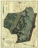
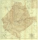
Viewing Options
Main Author:
West Virginia Geological Survey
Title/Description:
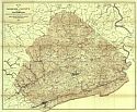
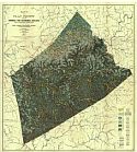
Map I of Mercer County Showing Topography
Publication Info:
Morgantown: West Virginia Geological Survey, 1916
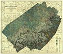
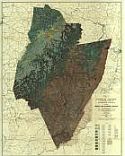
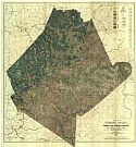
Viewing Options
Main Author:
West Virginia Geological Survey
Title/Description:
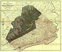
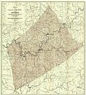
Map II of Mercer County Showing General and Economic Geology
Publication Info:
Morgantown: West Virginia Geological Survey, 1916
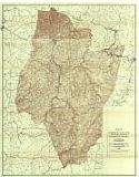
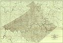
Viewing Options
Main Author:
West Virginia Geological Survey
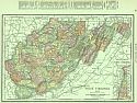
Title/Description:
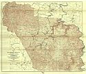
Map I of Raleigh County and Western Part Of Summers County Showing Topography
Publication Info:
Morgantown: West Virginia Geological Survey, 1916
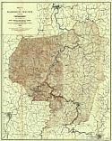
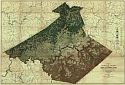
Viewing Options
Main Author:
West Virginia Geological Survey
Title/Description:
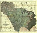
Map II of Raleigh County and Western Part of Summers County Showing General and Economic Geology
Publication Info:
Morgantown: West Virginia Geological Survey, 1916
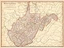
Viewing Options
Main Author:
Rand McNally and Company
Title/Description:
West Virginia
Publication Info:
Chicago: Rand McNally and Co., 1916; from The Ideal Atlas of the World
Viewing Options
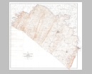
Main Author:
West Virginia Geological Survey
Title/Description:
Map of Jefferson, Berkeley, and Morgan Counties Showing Topography
Publication Info:
Morgantown: West Virginia Geological Survey, 1916
Original Source:
Geological Survey of Alabama
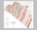
Viewing Options
Main Author:
West Virginia Geological Survey
Title/Description:
Map of Jefferson, Berkeley, and Morgan Counties Showing General and Economic Geology
Publication Info:
Morgantown: West Virginia Geological Survey, 1916
Original Source:
Geological Survey of Alabama
Viewing Options
Main Author:
West Virginia Geological Survey
Title/Description:
Map II of Braxton County Showing General and Economic Geology
Publication Info:
Morgantown: West Virginia Geological Survey, 1917
Viewing Options
Main Author:
West Virginia Geological Survey
Title/Description:
Map II of Clay County Showing General and Economic Geology
Publication Info:
Morgantown: West Virginia Geological Survey, 1917
Viewing Options
Main Author:
West Virginia Geological Survey
Title/Description:
Map I of Clay County Showing Topography
Publication Info:
Morgantown: West Virginia Geological Survey, 1917
Viewing Options
Main Author:
West Virginia Geological Survey
Title/Description:
Map I of Braxton County Showing Topography
Publication Info:
Morgantown: West Virginia Geological Survey, 1917
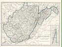
Viewing Options
Main Author:
U.S. Geological Survey
Title/Description:
State of West Virginia
Publication Info:
Washington: Department of the Interior, U.S. Geological Survey, 1918; reprinted 1935
Viewing Options
Main Author:
West Virginia Geological Survey
Title/Description:
Map II of Barbour County Showing General and Economic Geology
Publication Info:
Morgantown: West Virginia Geological Survey, 1918
Viewing Options
Main Author:
West Virginia Geological Survey
Title/Description:
Map IV of Upshur County and Western Portion of Randolph County General and Economic Geology
Publication Info:
Morgantown: West Virginia Geological Survey, 1918
Viewing Options
Main Author:
West Virginia Geological Survey
Title/Description:
Map III of Upshur County and Western Portion of Randolph County showing topography
Publication Info:
Morgantown: West Virginia Geological Survey, 1918
Viewing Options
Main Author:
West Virginia Geological Survey
Title/Description:
Map I of Barbour County Showing Topography
Publication Info:
Morgantown: West Virginia Geological Survey, 1918
Viewing Options
Main Author:
West Virginia Geological Survey
Title/Description:
Map I of Webster County Showing Topography
Publication Info:
Morgantown: West Virginia Geological Survey, 1919
Viewing Options
Main Author:
West Virginia Geological Survey
Title/Description:
Map II of Webster County Showing General and Economic Geology
Publication Info:
Morgantown: West Virginia Geological Survey, 1919
Viewing Options
Main Author:
West Virginia Geological Survey
Title/Description:
Map I of Nicholas County Showing Topography
Publication Info:
Morgantown: West Virginia Geological Survey, 1920
Viewing Options
Main Author:
West Virginia Geological Survey
Title/Description:
Map II of Nicholas County Showing General and Economic Geology
Publication Info:
Morgantown: West Virginia Geological Survey, 1920
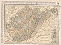
Viewing Options
Main Author:
Cram, George F.
Title/Description:
West Virginia
Publication Info:
Chicago: George F. Cram, 1920; from Descriptive Review Showing Development of the State of Pennsylvania
Viewing Options
Main Author:
C.S. Hammond and Company
Title/Description:
West Virginia
Publication Info:
New York: C.S. Hammond and Company, 1920; from The New Reference Atlas of the World
Original Source:
Courtesy of Shawn Carter
Viewing Options
Main Author:
Leslie-Judge Company
Title/Description:
West Virginia
Publication Info:
New York: Leslie-Judge Company1920; from Leslie's New World Atlas

