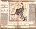
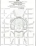
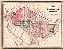
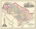
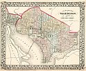
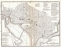
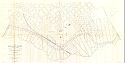
Historical Maps of Other Southeastern States

Before 1900
Before 1900
After 1900

Next Page

  Main Author:   Carey and Lea
  Title/Description:   Geographical, Statistical, and Historical Map of the District of Columbia
  Publication Info:   Philadelphia: Carey and Lea, 1822
  Date:   1822
  Scale:   not indicated
  Original Source:   Birmingham Public Library Cartography Collection
Viewing options:


  Main Author:   Melish, John
  Title/Description:   District of Columbia
  Publication Info:   Philadelphia: John Melish, 1822; from A Geographical Description of the United States
  Date:   1822
  Scale:   1:316,000
  Original Source:   Courtesy of Murray Hudson, Halls, Tennessee
Viewing options:


  Main Author:   Bradford, Thomas G.
  Title/Description:   District of Columbia
  Publication Info:   Boston: William D. Ticknor, 1835; from A Comprehensive Atlas Geographical, Historical, and Commercial
  Date:   1835
  Scale:   1:126,720
  Original Source:   Courtesy of Murray Hudson, Halls, Tennessee
Viewing options:


  Main Author:   Mitchell, Samuel A.
  Title/Description:   City of Washington
  Publication Info:   Philadelphia: S.A. Mitchell, 1847
  Date:   1847
  Scale:   1:22,000
  Original Source:   Courtesy of Murray Hudson, Halls, Tennessee
Viewing options:


  Main Author:   Phelps, Fanning and Company
  Title/Description:   Washington D.C.
  Publication Info:   New York: Phelps, Fanning and Company, 1853; from The Illustrated Gazetteer of the United States
  Date:   1853
  Scale:   1:42,240
  Original Source:   Courtesy of Murray Hudson, Halls, Tennessee
Viewing options:


  Main Author:   French, Benjamin B./ William Forsyth
  Title/Description:   Plan Submitted for the Alteration of the Streets and Av. Around the Capitol
  Publication Info:   New York: J.H. Colton and Company, 1856
  Date:   1854
  Scale:   1:3,600
  Original Source:   Courtesy of Murray Hudson, Halls, Tennessee
Viewing options:


  Main Author:   Colton, Joseph Hutchin
  Title/Description:   Georgetown and The City of Washington
  Publication Info:   New York: J.H. Colton and Company, 1856
  Date:   1856
  Scale:   1:20,000
  Original Source:   Courtesy of Murray Hudson, Halls, Tennessee
Viewing options:


  Main Author:   Gamble, William H.
  Title/Description:   Plan of the City of Washington, the Capitol of the United States of America
  Publication Info:   Philadelphia: S.A. Mitchell, 1861
  Date:   1861
  Scale:   1:28,000
  Original Source:   Courtesy of Murray Hudson, Halls, Tennessee
Viewing options:


  Main Author:   Johnson, A.J.
  Title/Description:   Johnson's Georgetown and the City of Washington
  Publication Info:   New York: Johnson and Ward, 1864; from The New Illustrated Family Atlas
  Date:   1864
  Scale:   1:21,000
  Original Source:   Courtesy of Murray Hudson, Halls, Tennessee
Viewing options:


  Main Author:   Johnson's Alvin J.
  Title/Description:   Johnson's Washington and Georgetown
  Publication Info:   New York: A.J. Johnson, 1870
  Date:   1870
  Scale:   1:20,000
  Original Source:   Courtesy of Murray Hudson, Halls, Tennessee
Viewing options:


  Main Author:   Gray, Frank A.
  Title/Description:   Georgetown and the City of Washington, The Capital of the United States of America
  Publication Info:   Philadelphia: Frank A. Gray, 1873
  Date:   1873
  Scale:   1:25,000
  Original Source:   Courtesy of Murray Hudson, Halls, Tennessee
Viewing options:


  Main Author:   Mitchell, S. Augustus
  Title/Description:   Plan of the City of Washington
  Publication Info:   Philadelphia: S. Augustus Mitchell, 1874
  Date:   1874
  Scale:   1:30,000
  Original Source:   Courtesy of Murray Hudson, Halls, Tennessee
Viewing options:


  Main Author:   D. Appleton and Company
  Title/Description:   Washington, D.C.
  Publication Info:   New York: D. Appleton and Company, 1879; from Appleton's General Guide to the United States and Canada
  Date:   1879
  Scale:   1:43,200
  Original Source:   Courtesy of Murray Hudson, Halls, Tennessee
Viewing options:


  Main Author:   U.S. Army Corps of Engineers
  Title/Description:   Harbors of Washington and Georgetown, D.C.
  Publication Info:   Washington: U.S. Army Corps of Engineers, 1881; to accompany report of S.T. Albert, for the year ending June 30th, 1880
  Date:   1881
  Scale:   1:25,000
  Original Source:   Courtesy of Murray Hudson, Halls, Tennessee
Viewing options:


  Main Author:   Swinton, William
  Title/Description:   Map of the District of Columbia
  Publication Info:   New York: Ivision, Blakeman, Taylor and Company, 1881; from Swinton's Grammer School Geography
  Date:   1881
  Scale:   1:86,000
  Original Source:   Courtesy of Murray Hudson, Halls, Tennessee
Viewing options:


  Main Author:   Mitchell, S. Augustus
  Title/Description:   Plan of the City of Washington
  Publication Info:   Philadelphia: William M. Bradley and Brother, 1884; from The Atlas of the World
  Date:   1884
  Scale:   1:30,000
  Original Source:   Courtesy of Murray Hudson, Halls, Tennessee
Viewing options:


  Main Author:   Gamble William H.
  Title/Description:   Plan of the City of Washington, the Capitol of the United States of America
  Publication Info:   Philadelphia: William M. Bradley and Brother, 1888
  Date:   1888
  Scale:   1:25,000
  Original Source:   Courtesy of Murray Hudson, Halls, Tennessee
Viewing options:


  Main Author:   Cram, George F.
  Title/Description:   Washington
  Publication Info:   Chicago: George F. Cram, 1888; from The Standard American Atlas
  Date:   1888
  Scale:   1:31,680
  Original Source:   Courtesy of Murray Hudson, Halls, Tennessee
Viewing options:


  Main Author:    
  Title/Description:   Map of the City of Washington, location of deaths for the year ending June 30, 1888
  Publication Info:   Washington: N. Peters, (1888)
  Date:   1888
  Scale:   1:13,800
  Original Source:   Courtesy of Murray Hudson, Halls, Tennessee
Viewing options:


  Main Author:   Lusk, James Loring
  Title/Description:   Map of the City of Washington, the location of sewers, October 1, 1888
  Publication Info:   Washington: N. Peters, 1888
  Date:   1888
  Scale:   1:13,800
  Original Source:   Courtesy of Murray Hudson, Halls, Tennessee
Viewing options:


  Main Author:    
  Title/Description:   Map of the City of Washington, (showing the location of water mains)
  Publication Info:   Washington: N. Peters, 1888
  Date:   1888
  Scale:   1:15,600
  Original Source:   Courtesy of Murray Hudson, Halls, Tennessee
Viewing options:


  Main Author:    
  Title/Description:   Map of the City of Washington, location of fatal cases of zymotic diseases for the year ending June 30, 1888
  Publication Info:   Washington: N. Peters, 1888
  Date:   1888
  Scale:   1:15,600
  Original Source:   Courtesy of Murray Hudson, Halls, Tennessee
Viewing options:


  Main Author:    
  Title/Description:   Map of the City of Washington, location of fatal cases of lung diseases for the year ending June 30, 1888
  Publication Info:   Washington: N. Peters, 1888
  Date:   1888
  Scale:   1:15,600
  Original Source:   Courtesy of Murray Hudson, Halls, Tennessee
Viewing options:


  Main Author:   U.S. Army Corps of Engineers
  Title/Description:   Washington and Georgetown Harbors, District of Columbia, 1882 (with) Proposed improvement of James Creek Canal
  Publication Info:   Washington: U.S. House of Representatives, 50th Congress, 1st Session, Doc. No. 97, 1888
  Date:   1888
  Scale:   1:15,840
  Original Source:   Courtesy of Murray Hudson, Halls, Tennessee
Viewing options:


  Main Author:   Hering, Rudolph, Samuel M. Gray, and F.P. Sterns
  Title/Description:   Map of the City of Washington Showing Present Main Sewerage and Sewage Outfalls Also The Territory Flooded in June 1889
  Publication Info:   Washington: U.S. Army Corps of Engineers, 1890; Report of Board of Sanitary Engineers, Plate I
  Date:   1890
  Scale:   1:254,440
  Original Source:   Courtesy of Murray Hudson, Halls, Tennessee
Viewing options:


  Main Author:   U.S. Army Corps of Engineers
  Title/Description:   Map of the City of Washington Showing the Varieties of Street Pavements Laid and Under Contract on January 1st, 1889
  Publication Info:   Washington: U.S. Army Corps of Engineers, 1890; To Accompany the Annual Report of Capt. T.W. Symons
  Date:   1890
  Scale:   1:13,000
  Original Source:   Courtesy of Murray Hudson, Halls, Tennessee
Viewing options:


  Main Author:   Cole, Charles D.
  Title/Description:   Map of the Proposed Main Sewage and Drainage Works for the improvement of the Sanitory Conditon of the District of Columbia
  Publication Info:   Washington: U.S. Government Printing Office, 1890; House Document 445, 50th Congress, 1st Session
  Date:   1890
  Scale:   1:20,000
  Original Source:   Courtesy of Murray Hudson, Halls, Tennessee
Viewing options:


  Main Author:   U.S. Geological Survey
  Title/Description:   Washington
  Publication Info:   Washington: Department of the Interior, U.S. Geological Survey, 1891
  Date:   1891
  Scale:   1:62,500
  Original Source:   University of Alabama Map Library
Viewing options:


  Main Author:   Averill, F.L.
  Title/Description:   Map of Washington, D.C. and Suburbs, Showing the Latest Streets and all the New Street-Car Routes
  Publication Info:   Washington: U.S. Army Corps of Engineers, 1892
  Date:   1892
  Scale:   1:20,000
  Original Source:   Courtesy of Murray Hudson, Halls, Tennessee
Viewing options:


  Main Author:   U.S. Army Corps of Engineers
  Title/Description:   Map of the City of Washington Showing Location of Fatal Cases of Zymotic Diseases for the Year Ending June 30, 1892
  Publication Info:   Washington: U.S. Army Corps of Engineers, 1892
  Date:   1892
  Scale:   1:13,800
  Original Source:   Courtesy of Murray Hudson, Halls, Tennessee
Viewing options:


  Main Author:   Rand McNally and Company  
  Title/Description:   Map of Washington, D.C.
  Publication Info:   Washington: Rand McNally and Company, 1893
  Date:   1893
  Scale:   1:15,120
  Original Source:   University of Alabama Map Library
Viewing options:


  Main Author:   U.S. Army Corps of Engineers
  Title/Description:   Map of the City of Washington Showing Location of Fatal Cases of Lung Diseases for the Year Ending June 30, 1893
  Publication Info:   Washington: U.S. Army Corps of Engineers, 1893
  Date:   1893
  Scale:   1:13,800
  Original Source:   Courtesy of Murray Hudson, Halls, Tennessee
Viewing options:


  Main Author:   Philips, A.E.
  Title/Description:   Plan for the Improvement of Rock Creek from Massachusetts Avenue to the Potomac River
  Publication Info:   Washington: National Lithographic Company, 1893
  Date:   1893
  Scale:   1:1,200
  Original Source:   Courtesy of Murray Hudson, Halls, Tennessee
Viewing options:


  Main Author:   Lukesh, G.M.
  Title/Description:   Map of the City of Washington Showing Sewers: To Accompany the Annual Report of the Engineering Department, D.C.
  Publication Info:   Washington: National Lithographic Company, 1893
  Date:   1893
  Scale:   1:13,800
  Original Source:   Courtesy of Murray Hudson, Halls, Tennessee
Viewing options:


  Main Author:   Lukesh, G.M.
  Title/Description:   Map of the City of Washington Showing location of deaths for the year ending June 30, 1893
  Publication Info:   Washington: National Lithographic Company, 1893
  Date:   1893
  Scale:   1:13,800
  Original Source:   Courtesy of Murray Hudson, Halls, Tennessee
Viewing options:


  Main Author:   District of Columbia Engineering Department
  Title/Description:   Map showing Suburban Subdivisions of the District of Columbia
  Publication Info:   Washington: The Department, 1894
  Date:   1894
  Scale:   1:24,000
  Original Source:   Courtesy of Murray Hudson, Halls, Tennessee
Viewing options:


  Main Author:   District of Columbia Engineering Department
  Title/Description:   Map of the City of Washington showing water mains
  Publication Info:   Washington: The Department, 1894
  Date:   1894
  Scale:   1:13,800
  Original Source:   Courtesy of Murray Hudson, Halls, Tennessee
Viewing options:


  Main Author:   Cole, Charles D.
  Title/Description:   Drainage Area of Rock Creek within the District of Columbia
  Publication Info:   [Washington: 1894]
  Date:   1890
  Scale:   1:16,000
  Original Source:   Courtesy of Murray Hudson, Halls, Tennessee
Viewing options:


  Main Author:   District of Columbia Engineering Department
  Title/Description:   Map of the City of Washington showing the varieties of Street Pavements Laid under contract on January 1, 1894
  Publication Info:   Washington: The Department, 1894
  Date:   1894
  Scale:   1:13,800
  Original Source:   Courtesy of Murray Hudson, Halls, Tennessee
Viewing options:


  Main Author:   Johnson, Alvin J.
  Title/Description:   Washington [D.C.]
  Publication Info:   New York: A.J. Johnson, 1895
  Date:   1895
  Scale:   1:42,000
  Original Source:   Courtesy of Murray Hudson, Halls, Tennessee
Viewing options:


  Main Author:   Rand McNally and Company
  Title/Description:   Map of the Main Portion of Washington, D.C.
  Publication Info:   Chicago: Rand McNally and Company, 1895
  Date:   1895
  Scale:   1:18,000
  Original Source:   Courtesy of Murray Hudson, Halls, Tennessee
Viewing options:


  Main Author:   U.S. Army Corps of Engineers
  Title/Description:   [Extensions of Connecticut Avenue]
  Publication Info:   Washington: U.S. House of Representatives, 54th Congress, 2nd Session, Doc. No. 53, 1896
  Date:   1896
  Scale:   1:2,400
  Original Source:   Courtesy of Murray Hudson, Halls, Tennessee
Viewing options:


  Main Author:   U.S. Army Corps of Engineers
  Title/Description:   Map Showing Portion of Washington, D.C. between distributing reservoir and new reservoir
  Publication Info:   Washington: U.S. House of Representatives, 54th Congress, 1st Session, Doc. No. 166, 1896
  Date:   1896
  Scale:   1:15,840
  Original Source:   Courtesy of Murray Hudson, Halls, Tennessee
Viewing options:


  Main Author:   U.S. Army Corps of Engineers
  Title/Description:   Chart of the Head of Navigation of the Potomac River with a view to the improvement of the Georgetown Canal, 1857
  Publication Info:   Washington: U.S. House of Representatives, 54th Congress, 1st Session, Doc. No. 296, 1896
  Date:   1896
  Scale:   1:5,000
  Original Source:   Courtesy of Murray Hudson, Halls, Tennessee
Viewing options:


  Main Author:   U.S. Army Corps of Engineers
  Title/Description:   Plat of (Potomac) River Front from 27th Street West to 17th Street west
  Publication Info:   Washington: U.S. House of Representatives, 54th Congress, 1st Session, Doc. No. 296, 1896
  Date:   1896
  Scale:   1:3,600
  Original Source:   Courtesy of Murray Hudson, Halls, Tennessee
Viewing options:


  Main Author:   U.S. Army Corps of Engineers
  Title/Description:   Sketch of Washington in Embryo
  Publication Info:   Washington: U.S. House of Representatives, 54th Congress, 1st Session, Doc. No. 296, 1896
  Date:   1896
  Scale:   1:30,000
  Original Source:   Courtesy of Murray Hudson, Halls, Tennessee
Viewing options:


  Main Author:   D. Appleton and Company
  Title/Description:   Washington, D.C.
  Publication Info:   New York: D. Appleton and Company, 1896; from Appleton's General Guide to the United States and Canada
  Date:   1896
  Scale:   1:31,680
  Original Source:   Courtesy of Murray Hudson, Halls, Tennessee
Viewing options:


  Main Author:   U.S. Geological Survey
  Title/Description:   Washington and Vicinity
  Publication Info:   Washington: U.S. Geological Survey, 1898
  Date:   1898
  Scale:   1:62,500
  Original Source:   University of Alabama Map Library
Viewing options:


  Main Author:   Cram, George F.
  Title/Description:   Washington D.C.
  Publication Info:   Chicago: George F. Cram, 1898; from The Universal Atlas, Geographical, Astronomical and Historical
  Date:   1898
  Scale:   not indicated
  Original Source:   Courtesy of Adams Antiques, Northport, Alabama
Viewing options:


  Main Author:   U.S. Army Corps of Engineers
  Title/Description:   Map of Anacostia River in the District of Columbia, Sheet 1, From the mouth to Navy Yard Bridge
  Publication Info:   Washington: U.S. House of Representatives, 55th Congress, 3rd Session, Doc. No. 87, 1898
  Date:   1898
  Scale:   1:4,560
  Original Source:   Courtesy of Murray Hudson, Halls, Tennessee
Viewing options:


  Main Author:   U.S. Army Corps of Engineers
  Title/Description:   Map of Anacostia River in the District of Columbia, Sheet 2, From Navy Yard Bridge to Bennings Bridge
  Publication Info:   Washington: U.S. House of Representatives, 55th Congress, 3rd Session, Doc. No. 87, 1898
  Date:   1898
  Scale:   1:4,560
  Original Source:   Courtesy of Murray Hudson, Halls, Tennessee
Viewing options:


  Main Author:   U.S. Army Corps of Engineers
  Title/Description:   Map of Anacostia River in the District of Columbia, Sheet 3, From Bennings Bridge to District Line
  Publication Info:   Washington: U.S. House of Representatives, 55th Congress, 3rd Session, Doc. No. 87, 1898
  Date:   1898
  Scale:   1:4,560
  Original Source:   Courtesy of Murray Hudson, Halls, Tennessee
Viewing options:


  Main Author:   U.S. Army Corps of Engineers
  Title/Description:   Index Map of Land between Anacostia River, District of Columbia, between District Line and Baltimore and Potomac R.R.
  Publication Info:   Washington: U.S. House of Representatives, 55th Congress, 3rd Session, Doc. No. 87, 1898
  Date:   1898
  Scale:   1:4,800
  Original Source:   Courtesy of Murray Hudson, Halls, Tennessee
Viewing options:


Next Page

© University of Alabama
To purchase map reproductions, submit a quote request.
Download MrSID Plugin