Historical Maps of Other Southeastern States

1885 - 1900

Before 1885
1885-1900
1901-1915
After 1915

Previous Page
Next Page

  Main Author:   Cram, George F.
  Title/Description:   Washington Ty.
  Publication Info:   Chicago: George F. Cram, 1885
  Date:   1885
  Scale:   1:2,281,000
  Original Source:   Courtesy of Murray Hudson, Halls, Tennessee
Viewing options:


  Main Author:   Wilmore, J.A.
  Title/Description:   Washington Territory
  Publication Info:   Richmond, VA: J.A. Wilmore, 1885
  Date:   1885
  Scale:   1:3,951,000
  Original Source:   Courtesy of Murray Hudson, Halls, Tennessee
Viewing options:


  Main Author:   Tunison, Henry Cuthbert
  Title/Description:   Washington Territory
  Publication Info:   Jacksonville, IL: H.C. Tunison, 1885
  Date:   1885
  Scale:   1:3,168,000
  Original Source:   Courtesy of Murray Hudson, Halls, Tennessee
Viewing options:


  Main Author:   Cram, George F.
  Title/Description:   Washington
  Publication Info:   Chicago: Henry S. Stebbing, 1885; from Cram's Unrivaled Family Atlas of the World
  Date:   1885
  Scale:   1:2,344,320
  Original Source:   Courtesy of Murray Hudson, Halls, Tennessee
Viewing options:


  Main Author:   Watson, Gaylord
  Title/Description:   Watson's Atlas Map of Washington
  Publication Info:   New York: Gaylord Watson, 1886
  Date:   1886
  Scale:   1:2,218,000
  Original Source:   University of Alabama Map Library
Viewing options:


  Main Author:   Bradley, William M.
  Title/Description:   Washington and Oregon
  Publication Info:   Philadelphia: William M. Bradley and Brother, 1886;
  Date:   1886
  Scale:   1:1,774,080
  Original Source:   Courtesy of Murray Hudson, Halls, Tennessee
Viewing options:


  Main Author:   Cram, George F.
  Title/Description:   Washington Ty.
  Publication Info:   Chicago: George F. Cram, 1887
  Date:   1887
  Scale:   1:2,344,000
  Original Source:   Courtesy of Murray Hudson, Halls, Tennessee
Viewing options:


  Main Author:   Cram, George F.
  Title/Description:   Railroad and County Map of Washington
  Publication Info:   New York: A.A. Grant, 1887; from The Standard American Atlas of the World
  Date:   1887
  Scale:   1:1,394,000
  Original Source:   Courtesy of Murray Hudson, Halls, Tennessee
Viewing options:


  Main Author:   People's Publishing Company
  Title/Description:   Washignton Ty
  Publication Info:   Chicago: The People's Publishing Company, 1887; from The Peoples Unrivaled Family Atlas of the World
  Date:   1887
  Scale:   1:2,217,600
  Original Source:   Courtesy of Murray Hudson, Halls, Tennessee
Viewing options:


  Main Author:   Cram, George F.
  Title/Description:   Washington
  Publication Info:   Chicago: George F. Cram, 1888
  Date:   1888
  Scale:   1:2,,281,000
  Original Source:   Courtesy of Murray Hudson, Halls, Tennessee
Viewing options:


  Main Author:   Rand McNally and Company
  Title/Description:   Washington Territory
  Publication Info:   Chicago: Rand McNally and Company, 1888; from The New Indexed Atlas of the World
  Date:   1888
  Scale:   1:1,584,000
  Original Source:   Courtesy of Murray Hudson, Halls, Tennessee
Viewing options:


  Main Author:   Rand McNally and Company
  Title/Description:   Washington
  Publication Info:   Chicago: Rand McNally and Company, 1889; from The Enlarged Business Atlas and Shippers Guide
  Date:   1889
  Scale:   1:1,520,640
  Original Source:   Courtesy of Murray Hudson, Halls, Tennessee
Viewing options:


Main Author:   Rand McNally and Company
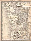
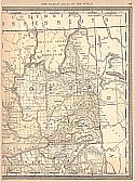
Title/Description:   Washington
Publication Info:   Chicago: Rand McNally and Company, 1890; from The Family Atlas of the World
Date:   1890
Scale:   1:1,520,600
Original Source:   University of Alabama Map Library
West
East
Viewing options:
Viewing options:
JPEG or Plugin
JPEG or Plugin


  Main Author:   Cram, George F.
  Title/Description:   Washington
  Publication Info:   Rochester: W.H. Stewart, c. 1890; from Cram's Unrivaled Atlas of the World
  Date:   1890
  Scale:   1:2,217,600
  Original Source:   Courtesy of Murray Hudson, Halls, Tennessee
Viewing options:


  Main Author:   Rand McNally and Company
  Title/Description:   Washington
  Publication Info:   Chicago: Rand McNally and Company, 1891; from The Indexed Atlas of the World
  Date:   1891
  Scale:   1:950,400
  Original Source:   Courtesy of Murray Hudson, Halls, Tennessee
Viewing options:


  Main Author:   Tunison, H.C.
  Title/Description:   Tunison's Washington
  Publication Info:   Jacksonville, IL: H.C. Tunison, c.1891
  Date:   1891
  Scale:   1:3,168,000
  Original Source:   Courtesy of Murray Hudson, Halls, Tennessee
Viewing options:


  Main Author:   Folger, L.B.
  Title/Description:   Washington and Oregon
  Publication Info:   New York: Hunt and Eaton, 1892; from The Columbian Atlas of the World We Live In
  Date:   1892
  Scale:   1:2,534,000
  Original Source:   Courtesy of Murray Hudson, Halls, Tennessee
Viewing options:


  Main Author:   Mast, Cromwell and Kirkpatrick
  Title/Description:   Map of Oregon and Washington
  Publication Info:   Chicago: Benedict and Company, 1893; from The Popular Atlas
  Date:   1893
  Scale:   1:2,534,000
  Original Source:   University of Alabama Map Library
Viewing options:


  Main Author:   Carlton, William H
  Title/Description:   Portion of the Map of the Indian Nations and Tribes of the Territory of Washington and of the Territory of Nebraska West of the mouth of the Yellowstone
  Publication Info:   unknown: an 1893 copy of an 1857 map made under the direction of Isaac I. Stevens, Supt. of Ind. Affairs
  Date:   1893
  Scale:   1:1,812,000
  Original Source:   Courtesy of Murray Hudson, Halls, Tennessee
Viewing options:


  Main Author:   Cram, George F.
  Title/Description:   Washington
  Publication Info:   Chicago: George F. Cram, c.1893; from Gaskell's Family and Business Atlas
  Date:   1893
  Scale:   1:2,218,000
  Original Source:   Courtesy of Murray Hudson, Halls, Tennessee
Viewing options:


  Main Author:   Rand McNally and Company
  Title/Description:   Rand McNally and Company's Washington
  Publication Info:   Chicago: Rand McNally and Company, 1893; from The Indexed County and Township Pocket Map and Shippers' Guide of Washington
  Date:   1893
  Scale:   1:1,014,000
  Original Source:   Courtesy of Murray Hudson, Halls, Tennessee
Viewing options:


  Main Author:   Rand McNally and Company
  Title/Description:   Washington
  Publication Info:   Chicago: Rand McNally and Company, 1893; from The Universal Atlas of the World
  Date:   1893
  Scale:   1:1,984,133
  Original Source:   University of Alabama Map Library
Viewing options:


  Main Author:   Rand McNally and Company
  Title/Description:   Washington
  Publication Info:  

Chicago: Rand McNally and Company, 1893; from The Enlarged Business Atlas and Shippers Guide

  Date:   1893
  Scale:   1:1,077,120
  Original Source:   Courtesy of Murray Hudson, Halls, Tennessee
Viewing options:


  Main Author:   Cram, George F.
  Title/Description:   Washington
  Publication Info:   Chicago: John F. Waite; from the International Office and Family Atlas of the World
  Date:   1893
  Scale:   1:2,217,600
  Original Source:   Courtesy of Murray Hudson, Halls, Tennessee
Viewing options:


  Main Author:   Rand McNally and Company
  Title/Description:   Washington
  Publication Info:   Chicago: Rand McNally and Company, 1894; from Library Atlas of the World
  Date:   1894
  Scale:   1:2,027,520
  Original Source:   Courtesy of Murray Hudson, Halls, Tennessee
Viewing options:


  Main Author:   Cram, George F.
  Title/Description:   Washington
  Publication Info:   Chicago: H.B. Walker, 1895; from The International Atlas
  Date:   1895
  Scale:   1:1,394,000
  Original Source:   Courtesy of Murray Hudson, Halls, Tennessee
Viewing options:


  Main Author:   Cram, George F.
  Title/Description:   Seattle
  Publication Info:   Chicago: H.B. Walker, 1895; compiled from latest official records by O.P. Anderson and Company, Engineers and Draughtsmen, March 1892
  Date:   1895
  Scale:   1:43,000
  Original Source:   Courtesy of Murray Hudson, Halls, Tennessee
Viewing options:


  Main Author:   Rand McNally and Company
  Title/Description:   Washington
  Publication Info:   Chicago: The Encyclopedia Britannica Company, c.1895
  Date:   1895
  Scale:   1:2,344,000
  Original Source:   Courtesy of Murray Hudson, Halls, Tennessee
Viewing options:


  Main Author:   Rand McNally and Company
  Title/Description:   Washington
  Publication Info:   Chicago: Rand McNally and Company, 1895; from The New General Atlas of the World
  Date:   1895
  Scale:   1:1,995,840
  Original Source:   Courtesy of Murray Hudson, Halls, Tennessee
Viewing options:


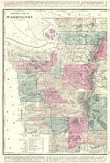
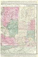
Main Author:   Walker, H.B.
Title/Description:   Western and Eastern Parts of Washington
Publication Info:   Chicago: H.B. Walker, 1895; from The International Atlas
Date:   1895
Scale:   1:760,320
Original Source:   Courtesy of Murray Hudson, Halls, Tennessee
West
East
Viewing options:
Viewing options:
JPEG or Plugin
JPEG or Plugin


  Main Author:   Walker, H.B.
  Title/Description:   Washington
  Publication Info:   Chicago: H.B. Walker, 1895; from The International Atlas
  Date:   1895
  Scale:   1:1,267,200
  Original Source:   Courtesy of Murray Hudson, Halls, Tennessee
Viewing options:


  Main Author:   Walker, H.B.
  Title/Description:   Official Map of the City of Spokane Falls, Washington
  Publication Info:   Chicago: H.B. Walker, 1895; from The International Atlas
  Date:   1895
  Scale:   1:30,000
  Original Source:   Courtesy of Murray Hudson, Halls, Tennessee
Viewing options:


  Main Author:   U.S. Geological Survey
  Title/Description:   Topographic map, Wilkeson Coal Field, Pierce Company, Washington
  Publication Info:   Washington: Department of the Interior, U.S. Geological Survey, 1897; 18th Annual Report, Part 3, Plate 59
  Date:   1897
  Scale:   1:24,000
  Original Source:   Geological Survey of Alabama
Viewing options:


  Main Author:   U.S. Geological Survey
  Title/Description:   Structure map of the Wilkeson Carbonado District
  Publication Info:   Washington: Department of the Interior, U.S. Geological Survey, 1897; 18th Annual Report, Part 3, Plate 60
  Date:   1898
  Scale:   1:24,000
  Original Source:   Geological Survey of Alabama
Viewing options:


  Main Author:   Cram, George F.
  Title/Description:   Washington
  Publication Info:   Chicago: George F. Cram, 1898; from The Universal Atlas, Geographical, Astronomical and Historical
  Date:   1898
  Scale:   1:1,900,000
  Original Source:   Courtesy of Adams Antiques, Northport, Alabama
Viewing options:


  Main Author:   Cram, George F.
  Title/Description:   City of Tacoma, Washington
  Publication Info:   Chicago: George F. Cram, 1898; from The Universal Atlas, Geographical, Astronomical and Historical
  Date:   1898
  Scale:   not indicated
  Original Source:   Courtesy of Adams Antiques, Northport, Alabama
Viewing options:


  Main Author:   Rand McNally and Company
  Title/Description:   Washington
  Publication Info:   Chicago: Rand McNally and Company, 1898; from The Indexed Atlas of the World
  Date:   1898
  Scale:   1:1,014,000
  Original Source:   Courtesy of Murray Hudson, Halls, Tennessee
Viewing options:


  Main Author:   Mast, Crowell and Kirkpatrick
  Title/Description:   Map of Washington and Oregon
  Publication Info:   Springfield, OH: Mast, Crowell and Kirkpatrick, 1898; from The Peerless Atlas of the World
  Date:   1898
  Scale:   1:2,534,000
  Original Source:   Courtesy of Murray Hudson, Halls, Tennessee
Viewing options:


  Main Author:   Rankine, John W. and Geo. H. Plummer
  Title/Description:   Map of Western Washington Showing Classification of Lands
  Publication Info:   Washington: Department of the Interior, U.S. Geological Survey, 1898; from the 19th Annual Report, Part V Plate III
  Date:   1898
  Scale:   1:380,000
  Original Source:   Courtesy of Murray Hudson, Halls, Tennessee
Viewing options:


  Main Author:   U.S. Geological Survey
  Title/Description:   Map of Western Washington Showing Density of Merchantable Timber
  Publication Info:   Washington: Department of the Interior, U.S. Geological Survey, 1898; 19th Annual Report, Part V, Plate IV
  Date:   1898
  Scale:   1:887,000
  Original Source:   University of Alabama Map Library
Viewing options:


  Main Author:   Plummer, G.H., Plummer, F.G., Rankine, J.H.
  Title/Description:   Map of Washington Showing Classification of Lands
  Publication Info:   Washington: Department of the Interior, U.S. Geological Survey, 1898
  Date:   1898
  Scale:   1:389,908
  Original Source:   Courtesy of Murray Hudson, Halls, Tennessee
Viewing options:


  Main Author:   Smith, Benjamin E.
  Title/Description:   Washington
  Publication Info:   New York: The Century Company, 1899; from The Century Atlas of the World
  Date:   1899
  Scale:   1:1,615,680
  Original Source:   University of Alabama Map Library
Viewing options:


  Main Author:   Cram, George F.
  Title/Description:   Washington
  Publication Info:   Chicago: George F. Cram, 1899; from Cram's Standard American Railway System Atlas
  Date:   1899
  Scale:   1:1,077,120
  Original Source:   Courtesy of Murray Hudson, Halls, Tennessee
Viewing options:


  Main Author:   Cram, George F.
  Title/Description:   Map of Washington
  Publication Info:   Chicago: George F. Cram, c.1900
  Date:   1900
  Scale:   1:1,331,000
  Original Source:   Courtesy of Murray Hudson, Halls, Tennessee
Viewing options:
 

  Main Author:   Rand McNally and Company.
  Title/Description:   Washington Railroads
  Publication Info:   Chicago: Rand McNally and Company, 1900; from The Enlarged Business Atlas and Shipper's Guide
  Date:   1900
  Scale:   1:1,013,760
  Original Source:   Courtesy of Murray Hudson, Halls, Tennessee
Viewing options:


Previous Page
Next Page


© University of Alabama
To purchase map reproductions, submit a quote request.
Download MrSID Plugin