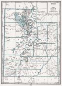
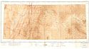
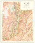
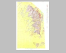
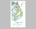
Viewing Options
Main Author:
Branom, Frederick K. and Lloyd Edwin Smith
Publication Info:
Chicago: Geographical Publishing Company, 1936; from Capper's 1936 Atlas of the World
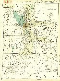
Viewing Options
Main Author:
Rand McNally and Company
Title/Description:
Standard Map of Utah
Publication Info:
Chicago: Rand McNally and Company, 1936
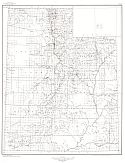
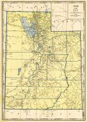
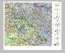
Viewing Options
Main Author:
U.S. Geological Survey
Title/Description:
State of Utah
Publication Info:
Washington: Department of the Interior, U.S. Geological Survey, 1940; compiled 1921 and 1922
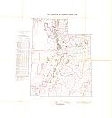
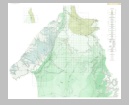
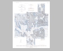
Viewing Options
Main Author:
U.S. Geological Survey
Title/Description:
Geologic Map Of The Areas Between Green And Colorado Rivers, Grand And San Juan Counties, Utah
Publication Info:
Washington: Department of the Interior, U.S. Geological Survey, 1940; Bulletin 908, Plate 1
Viewing Options
Main Author:
U.S. Coast and Geodetic Survey
Title/Description:
Grand Junction Sectional Aeronautical Chart
Publication Info:
Washington: U.S. Coast and Geodetic Survey, 1941
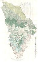
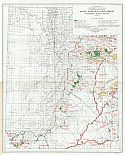
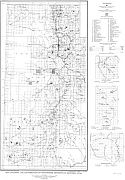
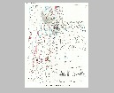
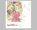
Viewing Options
Main Author:
Bureau of the Census
Title/Description:
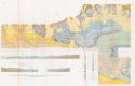
Utah Irrigation by Drainage Basin, 1939
Publication Info:
Washington: U.S. Government Printing Office, 1942
Viewing Options
Main Author:
Geographical Publishing Company
Publication Info:
Chicago: Geographical Publishing Company, 1942; from The New International Atlas of the World, War Edition
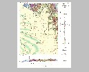
Viewing Options
Main Author:
U.S. Department of the Interior
Title/Description:
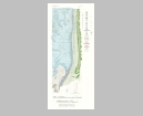
Water Resources Development, Colorado River Basin, Utah
Publication Info:
Washington: U.S. Department of the Interior, Bureau of Reclamation, 1946; from The Colorado River, A Natural Menace Becomes a National Resource
Viewing Options
Main Author:
U.S. Department of the Interior, U.S. Geological Survey
Title/Description:
Releif Map of Utah
Publication Info:
Salt Lake City: The State of Utah, Department of Publicity and Industrial Development, 1947
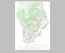
Viewing Options
Main Author:
U.S. Geological Survey
Title/Description:
Geologic Map and Section of the Green River Desert-Cataract Canyon Region Emery, Wayne, and Garfield Counties, Utah (North Sheet)
Publication Info:
Washington: Department of the Interior, US Geological Survey, 1947; Bulletin 951, Plate 2
Viewing Options
Main Author:
U.S. Geological Survey
Title/Description:
Geologic Map and Section of the Green River Desert-Cataract Canyon Region Emery, Wayne, and Garfield Counties, Utah (South Sheet)
Publication Info:
Washington: Department of the Interior, US Geological Survey, 1947; Bulletin 951, Plate 1
Viewing Options
Main Author:
U.S. Geological Survey
Title/Description:
Map Showing the Distribution of Manganese Deposits in Western Utah
Publication Info:
Washington: Department of the Interior, U.S. Geologic Survey, 1950; Bulletin 979, Plate 1
Viewing Options
Main Author:
U.S. Geological Survey
Title/Description:
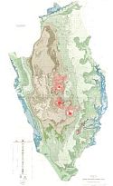
Geologic Map of the Henry Mountains Region, Utah
Publication Info:
Washington: Department of the Interior, U.S. Geologic Survey, 1953; Professional Paper 228, Plate 1
Viewing Options
Main Author:
U.S. Geological Survey
Title/Description:
Geologic Map and Structure Sections of the Uinta River-Brush Creek Area, Duchesne and Uintah Counties, Utah
Publication Info:
Washington: Department of the Interior, U.S. Geological Survey, 1955; Bulletin No. 1007
Viewing Options
Main Author:
U.S. Geological Survey
Title/Description:
Geologic Map and Sections of Comb Ridge and Vicinity North of San Juan River, San Juan County, Utah
Publication Info:
Washington: Department of the Interior, U.S. Geological Survey, 1956; Bulletin 1021-E Plate 17
Viewing Options
Main Author:
U.S. Geological Survey
Title/Description:
Geologic Map and Section of the Clay Hills Area, San Juan County, Utah
Publication Info:
Washington: Department of the Interior, U.S. Geological Survey, 1959; Bulletin 1087-D Plate 27
Viewing Options
Main Author:
U.S. Geological Survey
Title/Description:
Geologic and Topographic Map of the Thomas Range Fluorspar District, Juab County, Utah
Publication Info:
Washington: Department of the Interior, U.S. Geological Survey, 1959; Bulletin 1069 Plate 1
Viewing Options
Main Author:
U.S. Geological Survey
Title/Description:
Botannical Anomalies in Strata at the Base of the Chinle Formation, Elk Ridge, San Juan County, Utah
Publication Info:
Washington: Department of the Interior, U.S. Geological Survey, 1962; Bulletin 1085-D Plate 9
Viewing Options
Main Author:
U.S. Geological Survey
Title/Description:
Geologic Map and Section of the Tintic Junction Quadrangle, Juab, Tooele, and Utah Counties, Utah
Publication Info:
Washington: Department of the Interior, U.S. Geological Survey, 1963; Bulletin 1142-L Plate 1
Viewing Options
Main Author:
U.S. Geological Survey
Title/Description:
Map Showing the Oxidized Zinc Deposits of Utah
Publication Info:
Washington: Department of the Interior, U.S. Geological Survey, 1963; Bulletin 1135-B Plate 1
Viewing Options
Main Author:
U.S. Geological Survey
Title/Description:
Geologic Map of the Deer Flat Area, White Canyon District, San Juan County, Utah
Publication Info:
Washington: Department of the Interior, U.S. Geological Survey, 1963; Bulletin 1132 Plate 1
Viewing Options
Main Author:
U.S. Geological Survey
Title/Description:
Geologic Map and Section of the Eureka Quadrangle, Juab and Utah Counties, Utah
Publication Info:
Washington: Department of the Interior, U.S. Geological Survey, 1964; Bulletin 1142-K Plate 1
Viewing Options
Main Author:
U.S. Geological Survey
Title/Description:
Geologic Map of the White Canyon Area, San Juan and Garfield Counties, Utah
Publication Info:
Washington: Department of the Interior, U.S. Geological Survey, 1964; Bulletin 1125 Plate 1
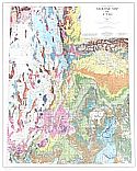
Viewing Options
Main Author:
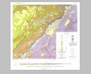
Hintze, Lehi F.
Title/Description:
Geologic Map of Utah
Publication Info:
Salt Lake City: Utah Geological and Mineral Survey, 1980

