Viewing Options
Main Author:
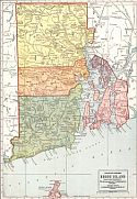
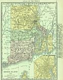
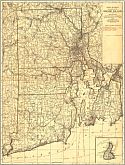
The Geographical Publishing Company
Title/Description:
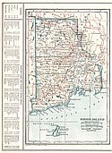
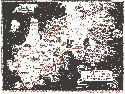
Rhode Island
Publication Info:
Chicago: Geographical Publishing Company, 1911
Viewing Options
Main Author:
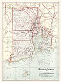
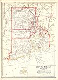
Cram, George F.
Title/Description:
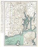
Rhode Island
Publication Info:
Chicago: George F. Cram, 1911; from Cram's Unrivaled Atlas of the World
Viewing Options
Main Author:
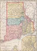
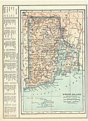
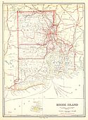
Rand McNally and Company
Title/Description:
Rhode Island
Publication Info:
Chicago: Rand McNally and Company, 1912; from The Rand McNally Imperial Atlas of the World
Viewing Options
Main Author:
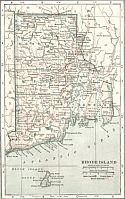
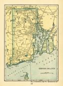
Reynolds, Francis J.
Title/Description:
Rhode Island
Publication Info:
New York: P.F. Collier and Son, 1914; from The New Encyclopedic Atlas and Gazatteer of the World
Viewing Options
Main Author:
Rand McNally and Company
Title/Description:
Rhode Island
Publication Info:
Chicago: Rand McNally and Co., 1916; from The Ideal Atlas of the World
Viewing Options
Main Author:
Reynolds, Francis J.
Title/Description:
Rhode Island
Publication Info:
New York: P.F. Collier and Son Company, 1920; from The New World Atlas and Gazetteer
Viewing Options
Main Author:
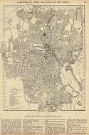
Reynolds, Francis J.
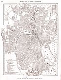
Title/Description:
Providence
Publication Info:
New York: P.F. Collier and Son Company, 1920; from The New World Atlas and Gazetteer
Viewing Options
Main Author:
Cram, George F.
Title/Description:
Rhode Island
Publication Info:
Chicago: James R. Gray and Company, 1920; from Cram's Unrivaled Atlas of the World
Viewing Options
Main Author:
Rand McNally and Company
Title/Description:
Rhode Island
Publication Info:
Chicago: Rand McNally and Company, 1921; from The Commercial Atlas of America
Viewing Options
Main Author:
Cram, George F.
Title/Description:
Rhode Island
Publication Info:
Chicago: George F. Cram Company, 1921; from Cram's Unrivaled Atlas of the World
Viewing Options
Main Author:
Cram, George F.
Title/Description:
Rhode Island
Publication Info:
Chicago: George F. Cram Company, 1923; from Cram's Unrivaled Atlas of the World
Viewing Options
Main Author:
Funk and Wagnalls Company
Title/Description:
Rhode Island
Publication Info:
New York: Funk and Wagnalls Company, 1923; from Atlas of the World and Gazetteer
Viewing Options
Main Author:
Reynolds, Francis J.
Title/Description:
Rhode Island
Publication Info:
New York: P.F. Collier and Son Company, 1924; from The New World Atlas and Gazetteer
Viewing Options
Main Author:
Reynolds, Francis J.
Title/Description:
Providence
Publication Info:
New York: P.F. Collier and Son Company, 1924; from The New World Atlas and Gazetteer
Viewing Options
Main Author:
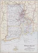
Rand McNally and Company
Title/Description:
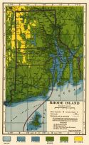
Rhode Island
Publication Info:
Chicago: Rand McNally and Company, 1925; from Premier Atlas of the World
Viewing Options
Main Author:
C.S. Hammond and Company
Title/Description:
Rhode Island
Publication Info:
New York: C.S. Hammond and Company, c. 1930; from The New World Loose Leaf Atlas, Sixth Edition
Viewing Options
Main Author:
Mount Hope Bridge Corporation
Title/Description:
Newport's Famous Ten Mile Drive
Publication Info:
Bristol, R.I.: Mount Hope Bridge Corporation, 1933
Original Source:
Murray Hudson
Viewing Options
Main Author:
Department of Public Works, Division of Roads and Bridges
Title/Description:
Highway Map of Rhode Island
Publication Info:
Providence: The Providence Lithograph Company, 1935
Original Source:
Murray Hudson
Viewing Options
Main Author:
U.S. Geological Survey
Title/Description:
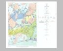
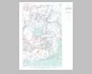
Surficial Geology of the Kingston Quadrangle, Rhode Island
Publication Info:
Washington: Department of the Interior, U.S. Geological Survey, 1960; Bulletin 1071-I Plate 32
Viewing Options
Main Author:
U.S. Geological Survey
Title/Description:
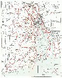
Pattern of Ice Wastage in Five Arbitrarily Selected Intervals, Kingston Quadrangle, Rhode Island
Publication Info:
Washington: Department of the Interior, U.S. Geological Survey, 1960; Bulletin 1071-I Plate 33
Viewing Options
Main Author:
U.S. Geological Survey
Title/Description:
Suggested Depositional Sequence of Pleistocene Deposits, Kingston Quadrangle, Rhode Island
Publication Info:
Washington: Department of the Interior, U.S. Geological Survey, 1960; Bulletin 1071-I Plate 34
Viewing Options
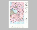
Main Author:
U.S. Geological Survey
Title/Description:
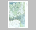
Bedrock Geologic Map and Sections of the Crompton Quadrangle, Rhode Island
Publication Info:
Washington: Department of the Interior, U.S. Geological Survey, 1963; Bulletin 1158-B Plate 1
Viewing Options
Main Author:
U.S. Geological Survey
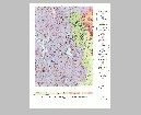
Title/Description:
Bedrock Geology of the Coventry Center Quadrangle, Rhode Island
Publication Info:
Washington: Department of the Interior, U.S. Geological Survey, 1963; Bulletin 1158-A Plate 1
Viewing Options
Main Author:
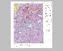
U.S. Geological Survey
Title/Description:
Bedrock Geologic Map and Sections of the Kingston Quadrangle, Rhode Island
Publication Info:
Washington: Department of the Interior, U.S. Geological Survey, 1964; Bulletin 1158-E Plate 1
Viewing Options
Main Author:
U.S. Geological Survey
Title/Description:
Bedrock Geologic Map and Sections of the Tiverton Quadrangle, Rhode Island-Massachusetts
Publication Info:
Washington: Department of the Interior, U.S. Geological Survey, 1964; Bulletin 1158-D Plate 1
Viewing Options
Main Author:
U.S. Geological Survey
Title/Description:
Bedrock Geologic Map and Sections of the Wickford Quadrangle, Rhode Island
Publication Info:
Washington: Department of the Interior, U.S. Geological Survey, 1964; Bulletin 1158-C Plate 1

