| |
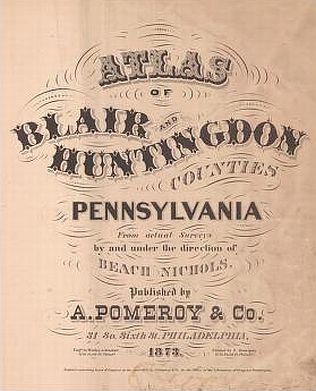
| Title
Page |
 |
| Viewing
options: |
Title |
Scale |
||
| Map of the State of Pennsylvania | 1:1,349,570 | |||
| Outline Map of Huntington and Blair Counties | 1:221,760 | |||
| Alleghany, Blair County | 1:39,600 | |||
| Duncanville, Foot of Ten, Bells Mills, Fostoria & Tipton, Blair County | : | various | ||
| Antis, Blair County | 1:39,600 | |||
| Blair & Newry, Blair County | 1:39,600 | |||
| Hollidaysburg & Extension of Hollidaysburg, Blair County | 1:3,600 | |||
| Catharine, Blair County | 1:39,600 | |||
| Frankstown, Blair County | 1:39,600 | |||
| Freedom and East Freedom, Blair County | 1:39,600 | |||
| Greenfield and Claysburg, Blair County | 1:39,600 | |||
| Huston, Blair County | 1:39,600 | |||
| Juniata, Blair County | 1:39,600 | |||
| Logan, East Altoona, Calvertville & McCartneyville, Altoona City, Blair County | 1:39,600 | |||
| Official Map of Altoona, Blair County | 1:5,760 | |||
| West Altoona, Blair County | 1:5,940 | |||
| Fairview, Altoona City, Blair County | 1:3,000 | |||
| Belleview, Hamilton's Extension, Caldwell's Extension (Altoona) Wapsononic, Blair County | various | |||
| North Woodberry, Martinsburg & Fredericksburg, Blair County | various | |||
| Snyder, Blair County | 1:59,400 | |||
| Tyrone, Blair County | 1:3,960 | |||
| Grazierville, Blair County | 1:5,940 | |||
| Tyrone Forges, Ironville & East Tyrone, Blair County | 1:3,960 | |||
| Taylor & East Stroudsburg, Blair County | 1:39,600 | |||
| Tyrone & Roaring Spring, Blair County | various | |||
| Woodberry & Williamsburg, Blair County | various | |||
| Barree, Manor Hill, Huntington County | 1:39,600 | |||
| Brady & Mill Creek, Huntington County | various | |||
| Carbon, Broadtop City, & Coalmont, Huntington County | various | |||
| Dudley & Barnettstown, Huntington County | 1:3,960 | |||
| Cass, Cassville & Three Springs, Huntington County | various | |||
| Clay, Huntington County | 1:39,600 | |||
| Cromwell, Orbisonia & Saitillo, Huntington County | various | |||
| Dublin, Snade Gap, McAlevy's Fort & Ennisville, Huntington County | various | |||
| Franklin, Spruce Creek & Franklinville, Huntington County | 1:39,600 | |||
| Henderson, Huntington County | 1:39,600 | |||
| Jackson, Huntington County | 1:59,400 | |||
| Juniata, Huntington County | 1:39,600 | |||
| Lincoln & Hopewell, Huntington County | 1:39,600 | |||
| Morris, Shaffersville & Water Street, Huntington County | 1:39,600 | |||
| Oneida, Huntington County | 1:39,600 | |||
| First, Second & Third Wards of Huntington County | 1:59,400 | |||
| Forth Ward of Huntington, Grafton & Marklesburg, Huntington County | 1:3,600 | |||
| Penn, Huntington County | 1:39,600 | |||
| Porter & Alexandria, Huntington County | various | |||
| Shirley, Huntington County | 1:39,600 | |||
| Mt. Union, Huntington County | 1:3,960 | |||
| Shirleysburg, Huntington County | 1:3,960 | |||
| Springfield, Huntington County | 1:39,600 | |||
| Tell & Todd, Huntington County | various | |||
| Union & Mapleton, Huntington County | various | |||
| Warriors Mark, Huntington County | 1:3,960 | |||
| McConnellstown, Warriors Mark & Birmingham, Huntington County | various | |||
| Walker, Huntington County | 1:39,600 | |||
| West, Petersburg, Neffs Mills & Fairfield, Huntington County | various |
| |
||
| ©
University of Alabama |
To purchase map reproductions, submit
a quote request. |
|