| |
| Title
Page |
 |
| Viewing
options: |
Title |
Scale |
||
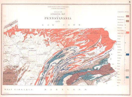
| Skeleton Geological Map of Pennsylvania, 1884 | 1:1,900,800 |
|||
| Geological Map of Adams County, 1876 | 1:380,160 |
|||
| Geological Map of Allegheny County, 1878 | 1:380,160 |
|||
| Geological Map of Armstrong County, 1878 | 1:380,160 |
|||
| Geological Map of Beaver County, 1878 Geological Map of Lawrence County, 1878 |
1:380,160 |
|||
| Geological Map of Bedford County, 1878 | 1:380,160 |
|||
| Geological Map of Berks County, 1884 | 1:380,160 |
|||
| Geological Map of Blair County, 1884 | 1:380,160 |
|||
| Geological Map of Bradford County, 1878 | 1:380,160 |
|||
| Geological Map of Bucks County, 1884 | 1:380,160 |
|||
| Geological Map of Butler County, 1878 | 1:380,160 |
|||
| Geological Map of Cambria County, 1884 | 1:380,160 |
|||
| Geological Map of Cameron County, 1881 | 1:380,160 |
|||
| Geological Map of Carbon County, 1884 | 1:380,160 |
|||
| Geological Map of Centre County, 1884 | 1:380,160 |
|||
| Geological Map of Chester County, 1881 | 1:380,160 |
|||
| Geological Map of Clarion County, 1878 | 1:380,160 |
|||
| Geological Map of Clearfield County, 1884 | 1:380,160 |
|||
| Geological Map of Clinton County, 1878 | 1:380,160 |
|||
| Geological Map of Columbia County, 1884 | 1:380,160 |
|||
| Geological Map of Crawford County, 1879 | 1:380,160 |
|||
| Geological Map of Cumberland County, 1881 | 1:380,160 |
|||
| Geological Map of Dauphin and Lebanon Counties, 1878 | 1:380,160 |
|||
| Geological Map of Delaware County, 1884 | 1:380,160 |
|||
| Geological Map of Elk County, 1878 | 1:380,160 |
|||
| Geological Map of Erie County, 1879 | 1:380,160 |
|||
| Geological Map of Fayette County, 1878 | 1:380,160 |
|||
| Geological Map of Forest County, 1878 | 1:380,160 |
|||
| Geological Map of Franklin County, 1881 | 1:380,160 |
|||
| Geological Map of Fulton County, 1878 | 1:380,160 |
|||
| Geological Map of Greene County, 1878 | 1:380,160 |
|||
| Geological Map of Huntingdon County, 1878 | 1:380,160 |
|||
| Geological Map of Indiana County, 1878 | 1:380,160 |
|||
| Geological Map of Jefferson County, 1881 | 1:380,160 |
|||
| Geological Map of Lackawanna County, 1881 | 1:380,160 |
|||
| Geological Map of Lancaster County, 1878 | 1:380,160 |
|||
| Geological Map of Lehigh and Northampton Counties, 1878 | 1:380,160 |
|||
| Geological Map of Luzerne County, 1878 | 1:380,160 |
|||
| Geological Map of Lycoming County, 1878 | 1:380,160 |
|||
| Geological Map of McKean County, 1878 | 1:380,160 |
|||
| Geological Map of Mercer County, 1878 | 1:380,160 |
|||
| Geological Map of Mifflin and Juniata Counties, 1878 | 1:380,160 |
|||
| Geological Map of Monroe County, 1884 | 1:380,160 |
|||
| Geological Map of Montgomery County, 1878 | 1:380,160 |
|||
| Geological Map of Northumberland and Montour Counties, 1878 | 1:380,160 |
|||
| Geological Map of Perry County, 1878 | 1:380,160 |
|||
| Geological Map of Philadelphia County with parts of Bucks and Montgomery Counties, 1881 | 1:380,160 |
|||
| Geological Map of Pike County, 1884 | 1:380,160 |
|||
| Geological Map of Potter County, 1878 | 1:380,160 |
|||
| Geological Map of Schuylkill County, 1884 | 1:380,160 |
|||
| Geological Map of Somerset County, 1884 | 1:380,160 |
|||
| Geological Map of Sullivan County, 1878 | 1:380,160 |
|||
| Geological Map of Susquehana County, 1881 | 1:380,160 |
|||
| Geological Map of Tioga County, 1878 | 1:380,160 |
|||
| Geological Map of Union and Snyder Counties, 1878 | 1:380,160 |
|||
| Geological Map of Verango County, 1878 | 1:380,160 |
|||
| Geological Map of Warren County, 1884 | 1:380,160 |
|||
| Geological Map of Washington County, 1878 | 1:380,160 |
|||
| Geological Map of Wayne County, 1881 | 1:380,160 |
|||
| Geological Map of Westemoreland County, 1878 | 1:380,160 |
|||
| Geological Map of Wyoming County, 1881 | 1:380,160 |
|||
| Geological Map of York County, 1878 | 1:380,160 |
|
|
||
|
©
University of Alabama
|
To purchase map reproductions, submit a quote
request.
|
|