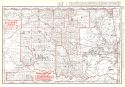
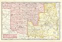
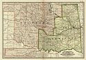
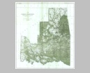
Viewing Options
Main Author:
Rand McNally and Company
Title/Description:
Indian Territory and Oklahoma
Publication Info:
Chicago: Rand McNally and Company, 1896; from Enlarged Business Atlas
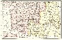
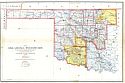
Viewing Options
Main Author:
Rand McNally and Company
Title/Description:
Oklahoma
Publication Info:
Chicago: Rand McNally and Company,1896; from Indexed Atlas of the World
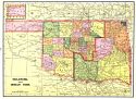
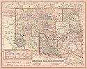
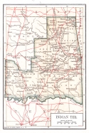
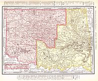
Viewing Options
Main Author:
Cram, George F.
Title/Description:
Oklahoma and Indian Territory
Publication Info:
Chicago: George F. Cram, 1898; from Cram's Universal Atlas, Geographical, Astronomical and Historical
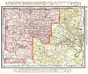
Viewing Options
Main Author:
Rand McNally and Company
Title/Description:
Oklahoma
Publication Info:
Chicago: Rand McNally & Co., 1898; from The Universal Atlas of the World
Viewing Options
Main Author:
Rand McNally and Company
Title/Description:
Oklahoma
Publication Info:
Chicago: Rand McNally and Company, c.1898
Viewing Options
Main Author:
Mast, Crowell and Kirkpatrick
Title/Description:
Oklahoma and Indian Territory
Publication Info:
Springfield, Ohio: Mast, Crowell and Kirkpatrick, 1898; from The New Peerless Atlas of the World
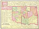
Viewing Options
Main Author:
Cram, George F.
Title/Description:
Oklahoma and Indian Territories
Publication Info:
Chicago: George F. Cram, 1899
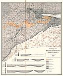
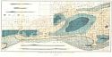
Viewing Options
Main Author:
U.S. Geological Survey
Title/Description:
Geological Map of the McAlester-Lehigh Coal-Field (Lehigh District)
Publication Info:
Washington: Department of the Interior, U.S. Geological Survey, 1899; Nineteenth Annual Report, Part III Plate LXV
Viewing Options
Main Author:
U.S. Geological Survey
Title/Description:
Geological Map of the McAlester-Lehigh Coal-Field (McAlester District)
Publication Info:
Washington: Department of the Interior, U.S. Geological Survey, 1899; Nineteenth Annual Report, Part III, Plate LXIV
Viewing Options
Main Author:
Smith, Benjamin E.
Title/Description:
Oklahoma & Indian Territory
Publication Info:
New York: The Century Company, 1899; from The Century Atlas of the World
Viewing Options
Main Author:
The Bradstreet Company
Title/Description:
Indian Ter.
Publication Info:
New York: The Bradstreet Company, 1899; from Bradstreet's Pocket Atlas of the United States
Viewing Options
Main Author:
The Bradstreet Company
Title/Description:
Oklahoma Ter.
Publication Info:
New York: The Bradstreet Company, 1899; from Bradstreet's Pocket Atlas of the United States
Viewing Options
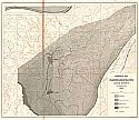
Main Author:
U.S. Geological Survey
Title/Description:
Map of Indian Territory Showing Distribution of Woodland
Publication Info:
Washington, D.C.: U.S. Geological Survey, 1899
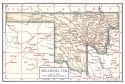
Viewing Options
Title/Description:
Map of Oklahoma Territory
Publication Info:
General Land Office, 1900
Viewing Options
Main Author:
Taff, Joseph A. and George J. Adams
Title/Description:
Geological Map of part of the Eastern Choctaw Coal Fields
Publication Info:
Washington, D.C.: Department of the Interior, U.S. Geological Survey, 1900; 21st Annual Report, Part 2, Plate 37
Viewing Options
Main Author:
Rand McNally and Company
Title/Description:
Oklahoma and Indian Territory
Publication Info:
Philadelphia: The Gebbie Publishing Company, 1900; from Spofford's Cabinet Cyclopedia Atlas of the World

