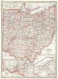
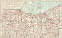
Viewing Options
Main Author:
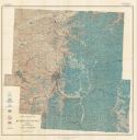
U.S. Geological Survey
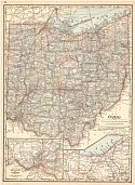
Title/Description:
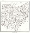
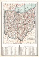
State of Ohio
Publication Info:
Washington: Department of the Interior, U.S. Geological Survey, 1916; compiled 1910 and 1911; reprinted 1944
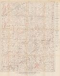
Viewing Options
Main Author:
U.S. Geological Survey
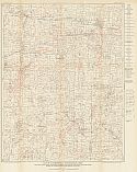
Title/Description:
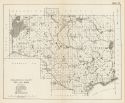
Map of Summerfield Quadrangle, Ohio showing Structure Contours on Berea Sand, Oil and Gas Wells, and Farm Lines in parts of Guernsey, Noble and Monroe Counties
Publication Info:
Washington: Department of the Interior, U.S. Geological Survey, 1916; Bulletin 621 Plate XXII
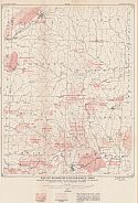
Viewing Options
Main Author:
U.S. Geological Survey
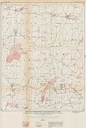
Title/Description:
Map of Summerfield Quadrangle, Ohio showing Areas Productive of Oil and Gas in parts of Guernsey, Noble and Monroe Counties
Publication Info:
Washington: Department of the Interior, U.S. Geological Survey, 1916; Bulletin 621 Plate XXIII
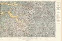
Viewing Options
Main Author:
U.S. Geological Survey
Title/Description:
Map of Woodsfield Quadrangle, Ohio showing Structure Contours on Berea Sand, Oil and Gas Wells, and Farm Lines in parts of Belmont, Monroe, Noble and Guernsey Counties
Publication Info:
Washington: Department of the Interior, U.S. Geological Survey, 1916; Bulletin 621 Plate XXIV
Viewing Options
Main Author:
U.S. Geological Survey
Title/Description:
Map of Woodsfield Quadrangle, Ohio showing Areas Productive of Oil and Gas in parts of Belmont, Monroe, Noble and Guernsey Counties
Publication Info:
Washington: Department of the Interior, U.S. Geological Survey, 1916; Bulletin 621 Plate XXV
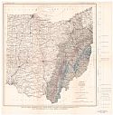
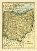
Viewing Options
Main Author:
U.S. Geological Survey
Title/Description:
Map of Ohio Showing Coal field with Outcrop of Upper Freeport (No. 7) and Pittsburgh (No.8) Coal beds or horizons
Publication Info:
Washington: U.S. Department of the Interior, Geological Survey, 1917
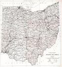
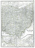
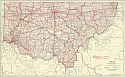
Viewing Options
Main Author:
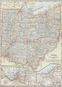
U.S. Geological Survey
Title/Description:
State of Ohio
Publication Info:
Washington: Department of the Interior, U.S. Geological Survey, 1918- reprinted 1929
Viewing Options
Main Author:
Stout, Wilber
Title/Description:
Areal Geologic Map of Muskingum County, Ohio showing important Coal Outcrops
Publication Info:
Columbus: Ohio Geological Survey, 1918; Fourth Series, Bulletin 21
Viewing Options
Main Author:
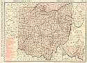
Rand McNally & Co.
Publication Info:
Chicago: Rand McNally & Co., 1920; from Rand McNally & Co.'s Commercial Atlas of America
Viewing Options
Main Author:
Reynolds, Francis J.
Publication Info:
New York: P.F. Collier and Son Company, 1920; from The New World Atlas and Gazetteer
Viewing Options
Main Author:
Cram, George F.
Publication Info:
Chicago: James R. Gray and Company, 1920; from Cram's Unrivaled Atlas of the World
Viewing Options
Main Author:
Cram, George F.
Publication Info:
Chicago: George F. Cram, 1920; from Descriptive Review Showing Development of the State of Pennsylvania
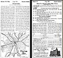
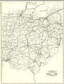
Title/Description:
Official Automobile Bluebook, Vol. 4, 1920, Ohio, Indiana, Kentucky and Lower Michigan
Publication Info:
New York: Automobile Blue Book Publishing Co., 1920
Viewing Options
Main Author:
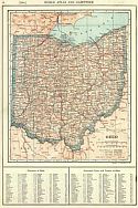
Rand McNally and Company
Title/Description:
Ohio- Black and White Mileage Map
Publication Info:
Chicago: Rand McNally and Company, 1921; from The Commercial Atlas of America

Viewing Options
Main Author:
Rand McNally and Company
Title/Description:
Toledo and Vicinity
Publication Info:
Chicago: Rand McNally and Company, 1921; from The Commercial Atlas of America
Viewing Options
Main Author:
Ohio Geological Survey
Title/Description:
Surficial Geology of Wayne County
Publication Info:
Columbus: Ohio Geological Survey, 1921; Fourth Series, Bulletin 24
Viewing Options
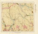
Main Author:
Ohio Geological Survey
Title/Description:
Camp Sherman Quadrangle
Publication Info:
Columbus: Ohio Geological Survey, 1921; Fourth Series, Bulletin 23
Viewing Options
Main Author:
Cram, George F.
Publication Info:
Chicago: George F. Cram Company, 1921; from Cram's Unrivaled Atlas of the World
Viewing Options
Main Author:
National Map Company
Publication Info:
Indianapolis: National Map Company, 1921; from Auto Trails and Commercial Survey of the United States
Viewing Options
Main Author:
National Map Company
Publication Info:
Indianapolis: National Map Company, 1921; from Auto Trails and Commercial Survey of the United States
Viewing Options
Main Author:
The Geographical Publishing Co.
Publication Info:
Chicago: The Geographical Publishing Co., 1922; from The New International Atlas of the World
Viewing Options
Viewing Options
Main Author:
C.S. Hammond
Publication Info:
New York: C.S. Hammond and Company, 1922; from The New World Loose-leaf Atlas
Viewing Options
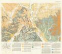
Main Author:
U.S. Geological Survey
Title/Description:
Map of Summerfield and Woodsfield Quadrangles, Ohio showing Economic Geology and Structure
Publication Info:
Washington: Department of the Interior, U.S. Geological Survey, 1922; Bulletin 720 Plate XII

Viewing Options
Main Author:
Cram, George F.
Publication Info:
Chicago: George F. Cram Company, 1923; from Cram's Unrivaled Atlas of the World
Viewing Options
Main Author:
Funk and Wagnalls Company
Publication Info:
New York: Funk and Wagnalls Company, 1923; from Atlas of the World and Gazetteer
Viewing Options
Main Author:
Stout, Wilber and R.E. Lamborn
Title/Description:
Columbiana County Oil and Gas
Publication Info:
Columbus: Geological Survey of Ohio, 1924; Fourth Series, Bulletin 28
Viewing Options
Main Author:
Reynolds, Francis J.
Publication Info:
New York: P.F. Collier and Son Company, 1924; from The New World Atlas and Gazetteer