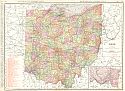
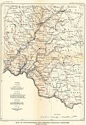
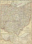
Viewing Options
Main Author:
Rand McNally and Company
Publication Info:
Chicago: Rand McNally and Company, 1911; from the Commercial Atlas of America
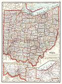
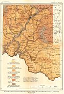
Viewing Options
Main Author:
Cram, George F.
Publication Info:
Chicago: George F. Cram, 1911; from Cram's Unrivaled Atlas of the World
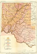
Viewing Options
Main Author:
Ravenstein, E.G.
Publication Info:
Chicago: The Reilly and Britton Company, 1911; from The New Census Atlas of the World
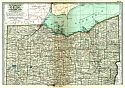
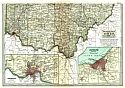
Viewing Options
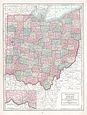
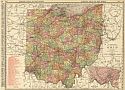
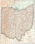
Main Author:
Rand McNally & Company
Title/Description:
Rand McNally and Co.'s New Map of Ohio
Publication Info:
Chicago: Rand McNally & Co., 1912; from The Rand McNally Bankers' Directory and List of Attorneys, 76th Edition
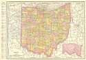
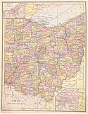
Viewing Options
Main Author:
Rand McNally and Co.
Publication Info:
Chicago: Rand McNally and Co., 1912; from the Library Atlas of the World
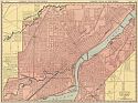
Viewing Options
Main Author:
Rand McNally and Co.
Title/Description:
Toledo and Environs.
Publication Info:
Chicago: Rand McNally and Co., 1912; from the Library Atlas of the World
Viewing Options
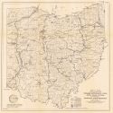
Main Author:
U.S. Geological Survey
Title/Description:
Geologic Map of Ohio and Indiana
Publication Info:
Washington: Department of the Interior, U.S. Geological Survey, 1912; Bulletin 522, Plat XV
Viewing Options
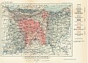
Main Author:
U.S. Geological Survey
Title/Description:
Geologic map of Southwestern Ohio
Publication Info:
Washington: Department of the Interior, U.S. Geological Survey, 1912; Water Supply Paper No. 259 Plate 1
Viewing Options
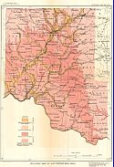
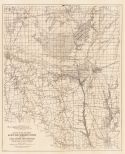
Main Author:
U.S. Geological Survey
Title/Description:
Map of Southwestern Ohio, Showing Artesian Conditions
Publication Info:
Washington: Department of the Interior, U.S. Geological Survey, 1912; Water Supply Paper No. 259 Plate 4
Viewing Options
Main Author:
U.S. Geological Survey
Title/Description:
Map of Southwestern Ohio showing thickness of water-bearing surface deposits
Publication Info:
Washington: Department of the Interior, U.S. Geological Survey, 1912; Water Supply Paper No. 259 Plate 3
Viewing Options
Main Author:
U.S. Geological Survey
Title/Description:
Map of Southwestern Ohio, showing Quaternary Deposits
Publication Info:
Washington: Department of the Interior, U.S. Geological Survey, 1912; Water Supply Paper No. 259 Plate 2
Viewing Options
Viewing Options
Main Author:
The Century Company
Publication Info:
New York: The Century Company, 1913; from The Century Atlas of the World
Viewing Options
Main Author:
Cram, George F.
Publication Info:
Chicago: George F. Cram, 1913; from Cram's Unrivaled Atlas of the World
Viewing Options
Main Author:
Redway, Jaques W. and Russell Hinman
Publication Info:
New York: American Book Company, 1913; from The Natural School Geography
Viewing Options
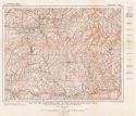
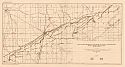
Main Author:
U.S. Geological Survey
Title/Description:
Map of the Northern Part of the Cadiz Quadrangle
Publication Info:
Washington: Department of the Interior, U.S. Geological Survey, 1913; Bulletin 541 Plate I
Viewing Options
Main Author:
Reynolds, Francis J.
Publication Info:
New York: P.F. Collier and Son, 1914; from The New Encyclopedic Atlas and Gazetteer of the World
Viewing Options
Main Author:
U.S. Geological Survey
Title/Description:
Map of Ice Ramparts on the Shore of Glacial Lake Maumee near Columbus Grove, Ohio
Publication Info:
Washington: Department of the Interior, U.S. Geological Survey, 1914; Monograph 53 Plate 15
Viewing Options
Main Author:
Sherman, C.E.
Title/Description:
Map of Ohio showing principal streams, watersheds, cities, state canal system and proposed Sandusky-Scioto Reservoirs
Publication Info:
Columbus: Ohio State University, 1915; From The Ohio Water Problem, Vol XX, No. 10
Viewing Options
Main Author:
Sherman, C.E.
Title/Description:
Map of divide between Scioto and Sandusky Rivers, showing flood control and navigation possibilities of both streams
Publication Info:
Columbus: Ohio State University, 1915; From The Ohio Water Problem, Vol XX, No. 10

