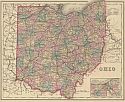
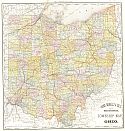
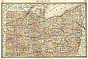
Viewing Options
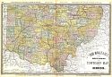
Main Author:
Gray, Ormando W.
Publication Info:
Philadelphia: O.W. Gray and Son, 1876; from Gray's National Atlas with Descriptions
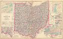
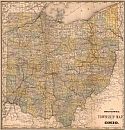
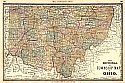
Viewing Options
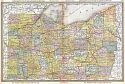
Main Author:
Gray, Frank A.
Title/Description:
Gray's New Map of Ohio
Publication Info:
Philadelphia: O.W. Gray & Son, 1877; from an early Hardesty Historical Atlas of the World
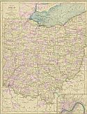
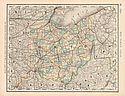
Viewing Options
Main Author:
von Steinwehr, A., D.G. Brinton
Publication Info:
Cincinnati: Van Antwerp, Bragg and Company, 1877; from An Intermediate Geography with Lessons in Map Drawing
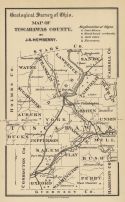
Viewing Options
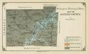
Main Author:
Newberry, J.S.
Title/Description:
Map of Tuscarawas County
Publication Info:
Columbus: Geological Survey of Ohio, 1878; Report of the Geological Survey of Ohio, Volume III
Viewing Options
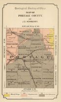
Main Author:
Newberry, J.S.
Title/Description:
Map of Portage County
Publication Info:
Columbus: Geological Survey of Ohio, 1878; Report of the Geological Survey of Ohio, Volume III
Viewing Options
Title/Description:
Map of Huron County
Publication Info:
Columbus: Geological Survey of Ohio, 1878; Report of the Geological Survey of Ohio, Volume III
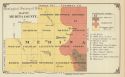
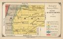
Viewing Options
Main Author:
Wheat, Alfred W.
Title/Description:
Map of Medina County
Publication Info:
Columbus: Geological Survey of Ohio, 1878; Report of the Geological Survey of Ohio, Volume III
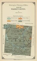
Viewing Options
Main Author:
Orton, Edward
Title/Description:
Map of Warren County
Publication Info:
Columbus: Geological Survey of Ohio, 1878; Report of the Geological Survey of Ohio, Volume III
Viewing Options
Main Author:
Orton, Edward
Title/Description:
Map of Butler County
Publication Info:
Columbus: Geological Survey of Ohio, 1878; Report of the Geological Survey of Ohio, Volume III
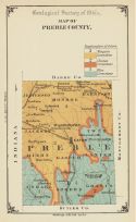
Viewing Options
Main Author:
Geological Survey of Ohio
Title/Description:
Map of Preble County
Publication Info:
Columbus: Geological Survey of Ohio, 1878; Report of the Geological Survey of Ohio, Volume III
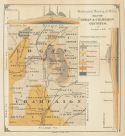
Viewing Options
Main Author:
Hill, Franklin C.
Title/Description:
Map of Logan and Champaign Counties
Publication Info:
Columbus: Geological Survey of Ohio, 1878; Report of the Geological Survey of Ohio, Volume III
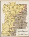
Viewing Options
Title/Description:
Map of Richland, Ashland, Wayne, Knox, Holmes, Coshocton and Licking Counties
Publication Info:
Columbus: Geological Survey of Ohio, 1878; Report of the Geological Survey of Ohio, Volume III
Viewing Options
Main Author:
Orton, Edward
Title/Description:
Map of Franklin County
Publication Info:
Columbus: Geological Survey of Ohio, 1878; Report of the Geological Survey of Ohio, Volume III
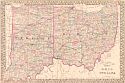
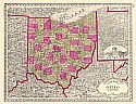
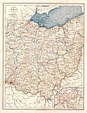
Viewing Options
Main Author:
Mitchell, Samuel Augustus
Title/Description:
County and Township Map of the States of Ohio and Indiana
Publication Info:
Philadelphia: S.A. Mitchell, c.1879
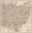
Viewing Options
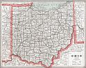
Main Author:
Rand McNally
Title/Description:
Rand McNally & Co.'s New Sectional and Township Map of Ohio
Publication Info:
Chicago: Rand McNally & Co., 1880
Viewing Options
Main Author:
von Steinwehr, A.
Publication Info:
Cincinnati: Von Antwerp, Bragg and Company, 1881; from Eclectic Series, School Geography No. 3
Viewing Options
Main Author:
Rand McNally and Company
Publication Info:
Chicago: Rand McNally and Company, 1881; from New Indexed Business Atlas and Shippers Guide
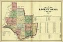
Viewing Options
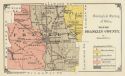
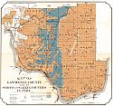
Main Author:
Hardesty, H.H.
Title/Description:
Lawrence County, Ohio
Publication Info:
New York: H.H. Hardesty and Co., 1882
Viewing Options
Main Author:
Rand McNally and Company
Title/Description:
New Sectional and Township Map of Ohio
Publication Info:
Chicago:Rand McNally and Company, 1882
Viewing Options
Main Author:
Tunison, Henry C.
Title/Description:
Tunison's Ohio
Publication Info:
Jacksonville, IL: H.C. Tunison, c.1883
Northern Ohio
Southern Ohio
Main Author:
Hardesty, H.H.
Title/Description:
Map of Northern/Southern Ohio
Publication Info:
New York: H.H. Hardesty & Co., 1883; from Hardesty's Historical and Geographical Encyclopedia
Viewing Options
Main Author:
Watson, Gaylord
Publication Info:
Boston: Perry and Spaulding, 1883; from New Indexed Family Atlas of the United States with Maps of the World
Viewing Options
Main Author:
Van Antwerp, Bragg and Company
Title/Description:
Map of Ohio
Publication Info:
New York: American Book Company, 1883; from The Eclectic Complete Geography
Viewing Options
Main Author:
Rand McNally & Company
Title/Description:
New Sectional and Township Map of Ohio (Southern Ohio)
Publication Info:
Chicago: Rand McNally & Co., 1884; from Rand McNally's Indexed Atlas of the World
Original Source:
From the personal collection of Dr. Gerald Webster; Laramie, Wyoming
Viewing Options
Main Author:
Rand McNally & Company
Title/Description:
New Sectional and Township Map of Ohio (Northern Ohio)
Publication Info:
Chicago: Rand McNally & Co., 1884; from Rand McNally's Indexed Atlas of the World
Original Source:
From the personal collection of Dr. Gerald Webster; Laramie, Wyoming

Viewing Options
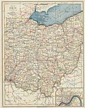
Main Author:
Mitchell, Samuel Augustus
Title/Description:
County and Township Map of the State of Ohio
Publication Info:
Philadelphia: S.A. Mitchell, 1884
Viewing Options
Main Author:
Cram, George F.
Publication Info:
Chicago: Henry S. Stebbins, 1884; from The Unrivaled Family Atlas of the World
Viewing Options
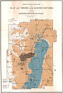
Main Author:
Orton, Edward J.
Title/Description:
Map of Lawrence County and of Scioto and Gallia Counties in Part
Publication Info:
Columbus: G.J. Brand and Company, 1884; from Orton's Geology of Ohio, Volume 5
Viewing Options
Main Author:
Orton, Edward J
Title/Description:
Map of Vinton and Jackson Counties and Gallia County in Part
Publication Info:
Columbus: G.J. Brand and Company, 1884; from Orton's Geology of Ohio, Volume 5
Viewing Options
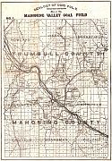
Main Author:
Orton, Edward J.
Title/Description:
Map of the Mahoning Valley Coal Field
Publication Info:
Columbus: G.J. Brand and Company, 1884; from Orton's Geology of Ohio, Volume 5
Viewing Options
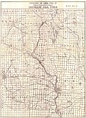
Main Author:
Orton, Edward J.
Title/Description:
Map of the Massilon Coal Field
Publication Info:
Columbus: G.J. Brand and Company, 1884; from Orton's Geology of Ohio, Volume 5
Viewing Options
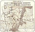
Main Author:
Orton, Edward J.
Title/Description:
Map of Muskingum County and Licking and Perry Counties in Part
Publication Info:
Columbus: G.J. Brand and Company, 1884; from Orton's Geology of Ohio, Volume 5
Viewing Options
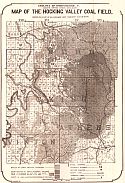
Main Author:
Orton, Edward J.
Title/Description:
Map of the Hocking Valley Coal Field
Publication Info:
Columbus: G.J. Brand and Company, 1884; from Orton's Geology of Ohio, Volume 5
Viewing Options
Main Author:
Orton, Edward J.
Title/Description:
Holmes, Coshocton and Tuscarawas Counties
Publication Info:
Columbus: G.J. Brand and Company, 1884; from Orton's Geology of Ohio, Volume 5
Viewing Options
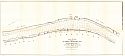
Main Author:
U.S. Army Corps of Engineers
Title/Description:
Ohio River Survey for Ice Harbor at Middleport, Ohio
Publication Info:
Washington: U.S.House of Representatives, 48th Congress, 1st session, Doc. No. 77
Viewing Options
Main Author:
Tunison, Henry C.
Title/Description:
Tunison's Ohio
Publication Info:
Jacksonville, IL: H.C. Tunison, 1885

