Historical Maps of Other Southeastern States

1850 - 1865
Before 1850
1850-1865
1866-1875
1876-1885
1886-1900
After 1900


  Main Author:   Thomas, Cowperthwait and Company
  Title/Description:   A New Map of New York with Its Canals, Roads, and Distances
  Publication Info:   Philadelphia: Thomas, Cowperthwait and Company, 1850
  Date:   1850
  Scale:   1:2,028,000
  Original Source:   Courtesy of Murray Hudson, Halls, Tennessee
Viewing options:


  Main Author:   Chaussegros de Lery
  Title/Description:   Plan of Oswego, 1727
  Publication Info:   Albany: Gavit and Duthie, c.1850; from a manuscript original done at Montreal, July 1727
  Date:   1850
  Scale:   1:3,600
  Original Source:   Courtesy of Murray Hudson, Halls, Tennessee
Viewing options:


  Main Author:   Gavit, John
  Title/Description:   A Map of a Tract of Land in the State of New York Called Macomb's Purchase
  Publication Info:   Albany: Weed, Parsons and Company, 1850; compiled from the official returns under the inspection of the Surveyor General by Charles C. Brodhead; a large tract on the St. Lawrence River of 3,670,715 acres
  Date:   1850
  Scale:   1:633,6000
  Original Source:   Courtesy of Murray Hudson, Halls, Tennessee
Viewing options:


  Main Author:   Gavit, John and John R. Bleeker
  Title/Description:   A Map of the Renselaerwick (Surveyed and Laid Down By a Scale of 100 Chains to an Inch by JNo. R. Bleeker, Surveyor, 1767
  Publication Info:   Albany: Weed, Parsons and Company, 1850; copied from the original by David Vaughn
  Date:   1850
  Scale:   1:158,400
  Original Source:   Courtesy of Murray Hudson, Halls, Tennessee
Viewing options:


  Main Author:   Wigram, John
  Title/Description:   A Map of the Towns of Livingston Germantown and Clermont in the County of Columbia
  Publication Info:   Albany: Weed, Parson and Company, 1850; compiled from the actual surveys in January 1798; copied from the original by David Vaughn and Augustus Tolle
  Date:   1850
  Scale:   1:31,680
  Original Source:   Courtesy of Murray Hudson, Halls, Tennessee
Viewing options:


  Main Author:   Chaussegros de Léry, Gaspard-Joseph
  Title/Description:   Plan of Oswego 1727
  Publication Info:   Albany: Gavit and Duthie, c.1850; from Paris Doc. VII, a manuscript original done at Montreal, July 1727
  Date:   1850
  Scale:   1:3,168
  Original Source:   Courtesy of Murray Hudson, Halls, Tennessee
Viewing options:


  Main Author:   Seaver's Steamship Printing Establishment
  Title/Description:   Northern Route U.S. Mail Line and American Express Line - Routes from Albany to Niagara Falls, Buffalo and Montreal
  Publication Info:   Buffalo: Seaver's Steamship Printing Establishment, c.1850
  Date:   1850
  Scale:   1:225,000
  Original Source:   Courtesy of Murray Hudson, Halls, Tennessee
Viewing options:


  Main Author:   Colton, G.W.
  Title/Description:   Map of the Country Thirty Three Miles Around the City of New York
  Publication Info:   New York: J.H. Colton, 1851
  Date:   1851
  Scale:   1:206,000
  Original Source:   W. S. Hoole Special Collections Library
Viewing options:


  Main Author:   Blodget, Samuel
  Title/Description:   A Prospective View of the Battle fought near Lake George, on the 8th of Sept. 1755, between 2000 English with 250 Mohawks, under the command of Genl. Johnson: & 2500 French & Indians under the command of General Dieskau in which the English were victorious captivating the French Genl. with a number of his men killing 700 & putting the rest to fight
  Publication Info:   Albany: Richard Pease, 1852: Lithographed reproduction of a famous Thomas Jeffery's battle plan; from an engraving in the NY State Library, original map published in London, 1756
  Date:   1852
  Scale:   not indicated
  Original Source:   Courtesy of Murray Hudson, Halls, Tennessee
Viewing options:


  Main Author:   Phelps, Fanning and Company
  Title/Description:   New York
  Publication Info:   New York: Phelps, Fanning and Company, 1853; from The Illustrated Gazetteer of the United States
  Date:   1853
  Scale:   1:4,308,480
  Original Source:   Courtesy of Murray Hudson, Halls, Tennessee
Viewing options:


  Main Author:   Phelps, Fanning and Company
  Title/Description:   Map of the Hudson River and Company
  Publication Info:   New York: Phelps, Fanning and Company, 1853; from The Illustrated Gazetteer of the United States
  Date:   1853
  Scale:   1:633,600
  Original Source:   Courtesy of Murray Hudson, Halls, Tennessee
Viewing options:


  Main Author:   Black, Adam and Charles
  Title/Description:   New York, Vermont, New Hampshire, Rhode Island, Massachusetts, and Connecticut
  Publication Info:   Edinburgh: A and C Adams, 1854; from the General Atlas of the World by Hall and Hughes
  Date:   1854
  Scale:   1:1,584,000
  Original Source:   Courtesy of Adams Antiques, Northport, Alabama
Viewing options:


  Main Author:   Colton, J.H.
  Title/Description:   New York
  Publication Info:   New York: J.H. Colton, 1855
  Date:   1855
  Scale:   1:1,901,000
  Original Source:   Courtesy of Murray Hudson, Halls, Tennessee
Viewing options:


  Main Author:   Colton, J.H.
  Title/Description:   New York
  Publication Info:   New York: J.H. Colton, 1856
  Date:   1856
  Scale:   1:1,901,000
  Original Source:   Courtesy of Murray Hudson, Halls, Tennessee
Viewing options:


  Main Author:   Colton, J.H.
  Title/Description:   New York
  Publication Info:   New York: J.H. Colton, 1856
  Date:   1856
  Scale:   1:1,267,000
  Original Source:   Courtesy of Murray Hudson, Halls, Tennessee
Viewing options:


  Main Author:   Baker, S.F.
  Title/Description:   New York
  Publication Info:   New Orleans: Morse, Gaston and A.B. Griswold, 1857; from The World in Miniature American
  Date:   1857
  Scale:   1:3,611,000
  Original Source:   Courtesy of Murray Hudson, Halls, Tennessee
Viewing options:


  Main Author:   New York Railroad Board of Commisioners
  Title/Description:   Map of the Rail Roads of the State of New York
  Publication Info:   Albany: Railroad Board of Commisioners, 1857
  Date:   1857
  Scale:   1:950,400
  Original Source:   Geological Survey of Alabama
Viewing options:


  Main Author:   Colton, J.H.
  Title/Description:   New York
  Publication Info:   New York: J.H. Colton and Company, c.1858
  Date:   1858
  Scale:   1:1,267,000
  Original Source:   Courtesy of Murray Hudson, Halls, Tennessee
Viewing options:


  Main Author:   Williams, W.
  Title/Description:   
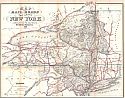
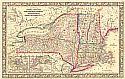
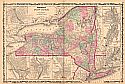
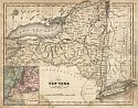
County Map of the State of New York, New Hampshire, Vermont, Massachusetts, Rhode Island, and Connecticut
  Publication Info:   Philadelphia: S. Augustus Mitchell, Jr., c.1860; from Mitchell, Jr.'s New General Atlas
  Date:   1860
  Scale:   1:1,901,000
  Original Source:   Courtesy of Murray Hudson, Halls, Tennessee
Viewing options:


  Main Author:   unknown
  Title/Description:   French Plans of Forts Ontario & Pepperell or Chouaguen 1758
  Publication Info:   Quebec: c.1860; from Mem. sur le Canada published by Quebec Historique Soc, 1838.
  Date:   1860
  Scale:   not indicated
  Original Source:   Courtesy of Murray Hudson, Halls, Tennessee
Viewing options:


  Main Author:   Johnson and Ward
  Title/Description:   Johnson's New York
  Publication Info:   New York: Johnson and Ward, 1861
  Date:   1861
  Scale:   1:1,267,000
  Original Source:   Courtesy of Murray Hudson, Halls, Tennessee
Viewing options:


  Main Author:   Johnson and Browning
  Title/Description:   Johnson's New York
  Publication Info:   New York: Johnson and Browning, 1862; for The New Illustrated Family Atlas
  Date:   1862
  Scale:   1:1,267,000
  Original Source:   University of Alabama Map Library
Viewing options:


  Main Author:   U.S. Coast Survey
  Title/Description:   Preliminary Chart of Hudson River Sheet 3, From Poughkeepsie to Glasco
  Publication Info:   Washington: U.S. Coast Survey, 1862
  Date:   1862
  Scale:   1:40,000
  Original Source:   Courtesy of Murray Hudson, Halls, Tennessee
Viewing options:


  Main Author:   Colton, George W.
  Title/Description:   Colton's Railroad and Township Map of the State of New York with Parts of the Adjoining States and Canada
  Publication Info:   New York: J.H. Colton and Company, 1862
  Date:   1862
  Scale:   1:1,104,000
  Original Source:   Courtesy of Murray Hudson, Halls, Tennessee
Viewing options:


  Main Author:   Johnson and Ward
  Title/Description:   Johnson's New York
  Publication Info:   New York: Johnson and Ward, 1864; from The New Illustrated Family Atlas
  Date:   1864
  Scale:   1:1,267,200
  Original Source:   Courtesy of Murray Hudson, Halls, Tennessee
Viewing options:


  Main Author:   Gibson, John
  Title/Description:   English Plan of the Forts of Ontario & Oswego with part of the River Onondago and Lake Ontario
  Publication Info:   Philadelphia: American, c.1865; from Gentleman's Magazine 1757
  Date:   1865
  Scale:   not indicated
  Original Source:   Courtesy of Murray Hudson, Halls, Tennessee
Viewing options:


  Main Author:   S.N. and D.G. Beers
  Title/Description:   New Topographical Atlas of St. Lawrence County, New York
  Publication Info:   Philadelphia: Stone and Stewart, 1865
  Date:   1865
  Scale:   Various scales
  Original Source:   University of Alabama Map Library


  Main Author:   McNally, Francis
  Title/Description:   New York
  Publication Info:   New York: A.S. Barnes and Burr, 1865; from An Improved System of Geography
  Date:   1865
  Scale:   1:2,534,400
  Original Source:   Courtesy of Murray Hudson, Halls, Tennessee
Viewing options: