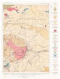
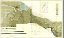
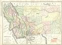
Viewing Options
Main Author:
U.S. Geological Survey
Title/Description:
Geologic Map of the Marysville Mining District, Montana
Publication Info:
Washington: U.S. Department of the Interior, Geological Survey
Original Source:
Geological Survey of Alabama
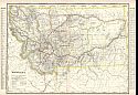
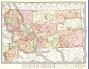
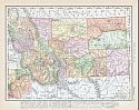
Viewing Options
Main Author:
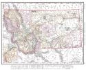
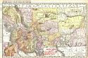
Cram, George F.
Title/Description:
Montana
Publication Info:
Chicago: George F. Cram for A. A. Grant, Toronto, Ont., 1906; from Grant's Bankers and Brokers Railroad System Atlas
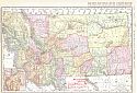
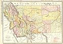
Viewing Options
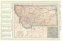
Main Author:
Rand McNally and Company
Title/Description:
Montana
Publication Info:
Chicago: Rand McNally and Company, 1906; from the Commercial Atlas of America
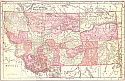
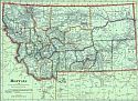
Viewing Options
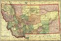
Main Author:
Cram, George F.
Title/Description:
Montana
Publication Info:
Chicago: George F. Cram, 1906; from Cram's Superior Reference Atlas
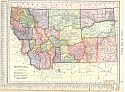
Viewing Options
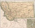
Main Author:
Rand McNally and Company
Title/Description:
Montana
Publication Info:
Chicago: Rand McNally and Company, 1906; from The World and its Peoples
Viewing Options
Main Author:
Poates, L.L.
Title/Description:
Montana
Publication Info:
Boston: Dodd, Mead & Co., c.1907; from Patton and Homan's New Encyclopedic Atlas and Gazetteer
Viewing Options
Main Author:
Cram, George F.
Title/Description:
Map of Montana
Publication Info:
Chicago: George F. Cram, 1907; from Cram's Standard American Atlas
Viewing Options
Main Author:
P.F. Collier and Son
Title/Description:
Montana
Publication Info:
New York: P.F. Collier and Son, 1907; from The New Encyclopedic Atlas and Gazetteer of the World
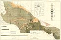
Viewing Options
Main Author:
U.S. Geological Survey
Title/Description:
Geologic Map of the Great Falls Region, Montana
Publication Info:
Washington: Department of the Interior, U.S. Geological Survey, 1907; Bulletin 356 Plate I
Viewing Options
Main Author:
U.S. Geological Survey
Title/Description:
Geologic Map of the Great Falls Region Montana
Publication Info:
Washington: Department of the Interior, U.S. Geological Survey, 1907; Water Supply Paper No. 221 Plate 1
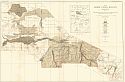
Viewing Options
Main Author:
U.S. Geological Survey
Title/Description:
Map of Great Falls Region of Montana showing Irrigation and Agricultural and Water Resources
Publication Info:
Washington: Department of the Interior, U.S. Geological Survey, 1907; Water Supply Paper No. 221 Plate 7
Viewing Options
Main Author:
Cram, George F.
Title/Description:
Montana
Publication Info:
Chicago: George F. Cram, 1907 from Cram's Ideal Reference Atlas of the World
Viewing Options
Main Author:
Rand McNally & Company
Title/Description:
Montana Railroads
Publication Info:
Chicago: Rand McNally & Co., 1908
Viewing Options
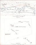
Main Author:
U.S. Geological Survey
Title/Description:
Custer Battlefield, Montana
Publication Info:
Washington: Department of the Interior, U.S. Geological Survey, 1908
Viewing Options
Main Author:
The Crowell Publishing Company
Title/Description:
Map of Montana
Publication Info:
New York: The Crowell Publishing Co., 1908; from The Twentieth Century Peerless Atlas

Viewing Options
Main Author:
U.S. Geological Survey
Title/Description:
Geologic Map and Sections of Lewistown Coal Field, Montana
Publication Info:
Washington: Department of the Interior, U.S. Geological Survey, 1908; Bulletin 390 Plate I
Viewing Options
Main Author:
Hammond, C.S.
Title/Description:
Montana
Publication Info:
New York: C.S. Hammond & Co. 1908; from Hammond's Handy Atlas of the World
Viewing Options
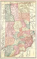
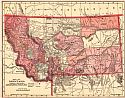
Main Author:
Rand McNally and Company
Title/Description:
Montana
Publication Info:
Chicago: Rand McNally and Company, 1908; from The New Ideal State and County Survey and Atlas
Viewing Options
Main Author:
Rand McNally & Co.
Title/Description:
New Commercial Atlas Map of Montana
Publication Info:
Chicago: Rand McNally & Co., 1909; from Rand McNally & Co.'s Library Atlas of the World

Viewing Options
Main Author:
Patten, William and J.E. Homas
Title/Description:
Montana
Publication Info:
New York: P.F. Collier and Son, 1909; from The New Encyclopedic Atlas and Gazetteer of the World
Viewing Options
Main Author:
Cram, George F.
Title/Description:
Montana
Publication Info:
Chicago: George F. Cram, c.1909; from the Heart of our Country
Viewing Options
Main Author:
Hammond, C.S.
Title/Description:
Montana
Publication Info:
New York: C.S. Hammond and Company, 1909
Viewing Options
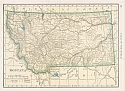
Main Author:
Rand McNally and Company
Title/Description:
Montana
Publication Info:
Chicago: Rand McNally and Company, 1910; from Enlarged Business Atlas and Shippers Guide
Viewing Options
Main Author:
Rand McNally and Company
Title/Description:
Montana
Publication Info:
Chicago: Rand McNally and Company, 1910; from New Ideal State and County Survey

