| |
| Map Example |
 |
| Viewing
options: |
Title |
Author |
Scale |
|
Topographic Map of Part of the Tower Quadrangle |
Clements, J. Morgan |
1:62,500 |
||
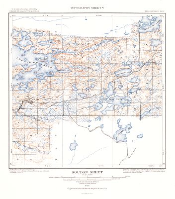
Topographic Map of Part of the Soudan Quadrangle |
Clements, J. Morgan |
1:62,500 |
||
Topographic Map of Part of the Ely Quadrangle |
Clements, J. Morgan |
1:62,500 |
||
Topographic Map of Part of the Basswood Lake and Fall Lake Quadrangles |
Clements, J. Morgan |
1:62,500 |
||
Topographic Map of Part of the Ensign Lake and Snowbank Lake Quadrangles |
Clements, J. Morgan |
1:62,500 |
||
Topographic Map of Part of the Knife Lake Quadrangle |
Clements, J. Morgan |
1:62,500 |
||
Topographic Map of Part of the Gunflint Lake Quadrangle |
Clements, J. Morgan |
1:62,500 |
||
Geologic Map of Part of the Tower Quadrangle, with Structure Sections |
Clements, J. Morgan |
1:62,500 |
||
Geologic Map of Part of the Soudan Quadrangle, with Structure Sections |
Clements, J. Morgan |
1:62,500 |
||
Geologic Map of Part of the Ely Quadrangle, with Structure Sections |
Clements, J. Morgan |
1:62,500 |
||
Geologic Map of Part of the Basswood Lake and Fall Lake Quadrangles, with Structure Sections |
Clements, J. Morgan |
1:62,500 |
||
Geologic Map of Part of the Ensign Lake and Snowbank Lake Quadrangles, with Structure Sections |
Clements, J. Morgan |
1:62,500 |
||
Geologic Map of Part of the Knife Lake Quadrangle, with Structure Sections |
Clements, J. Morgan |
1:62,500 |
||
Geologic Map of Part of the Gunflint Lake Quadrangle, with Structure Sections |
Clements, J. Morgan |
1:62,500 |
||
Detail Map of a Portion of Township 61 and 62N., R.15W., Minnesota |
Clements, J. Morgan |
1:62,500 |
||
Detail Map of a Portion of Township 62 and 63N., R.14W., Minnesota |
Clements, J. Morgan |
1:62,500 |
||
Detail Map of a Portion of Township 62 and 63N., R.13W., Minnesota |
Clements, J. Morgan |
1:62,500 |
||
Detail Map of a Portion of Township 62 and 63N., R.12W., Minnesota |
Clements, J. Morgan |
1:62,500 |
||
Detail Map of a Portion of Township 63N., R.11W., Minnesota |
Clements, J. Morgan |
1:62,500 |
||
Detail Map of Tower and Lee Hills |
Clements, J. Morgan |
1:62,500 |
||
Detail Map of Soudan Hills |
Clements, J. Morgan |
1:62,500 |
||
Detail Map of Point South of Mud Creek Bay, Vermilion Lake, Minnesota |
Clements, J. Morgan |
1:62,500 |
||
Detail Map Showing Actual Exposures in NE1/4 Section 25, T.63N., R.12W., with Structure Sections |
Clements, J. Morgan |
1:62,500 |
|
|
||
|
©
University of Alabama
|
To purchase map reproductions, submit a quote
request.
|
|