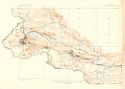
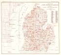
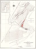
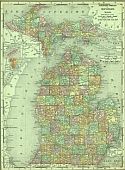
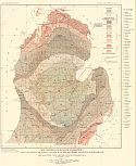
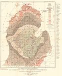
Viewing Options
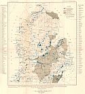
Main Author:
U.S. Geological Survey
Title/Description:
Menominee Special Map, Michigan
Publication Info:
Washington: Department of the Interior, U.S. Geological Survey, 1901
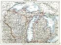
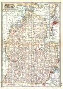
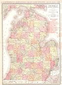
Viewing Options
Main Author:
Johnston, William and Alexander Keith
Title/Description:
Wisconsin, Michigan
Publication Info:
Edinburgh: W. and A.K. Johnston, 1901
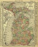
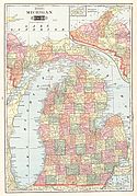
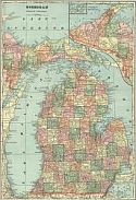
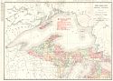
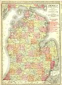
Viewing Options
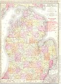
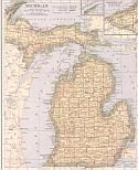
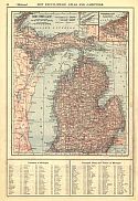
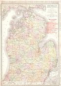
Main Author:
Rand McNally and Co.
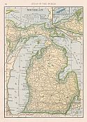
Title/Description:
Michigan
Publication Info:
Chicago: Rand McNally and Co., 1901; from The Universal Atlas of the World
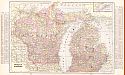
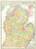
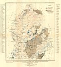
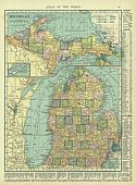
Viewing Options
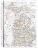
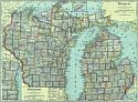
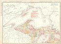
Main Author:
Cram, George F.
Title/Description:
Michigan and Wisconsin
Publication Info:
Chicago: The Fort Dearborn Publishing Co., 1901; from The National Standard Family and Business Atlas of the World
Viewing Options
Main Author:
Tunison, Henry Cuthbert
Title/Description:
Michigan
Publication Info:
New York: H.C. Tunison, 1901; from Tunison's Atlas, Encyclopædia, Gazetteer, and Portfolio of Our Universe, Globe, and Nation
Viewing Options
Main Author:
The Century Company
Title/Description:
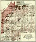
Michigan - Southern Part
Publication Info:
Buffalo: The Matthews-Northrup Co., 1902; from the 1902 edition of The Century Atlas
Original Source:
from the personal collection of Dr. Robert Burkhalter, Santa Fe, New Mexico
Viewing Options
Main Author:
The Century Company
Title/Description:
Michigan - Northern Part
Publication Info:
Buffalo: The Matthew-Northrup Co., 1902; from the 1902 edition of The Century Atlas
Original Source:
From the personal collection of Dr. Robert Burckhalter, Santa Fe, New Mexico
Viewing Options
Main Author:
Rand McNally & Company
Title/Description:
Rand McNally & Co.'s New Business Atlas Map of Michigan [Southern]
Publication Info:
Chicago: Rand McNally & Co., c.1902
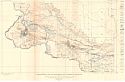
Viewing Options
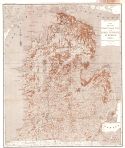
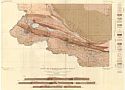
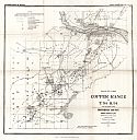
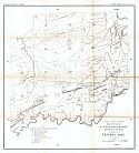
Main Author:
Lane, Alfred C.
Title/Description:
Geological Map of Coal Basin
Publication Info:
Lansing: Geological Survey of Michigan, 1902; Vol VIII, Part II, Plate I
Viewing Options
Main Author:
Cram, George F.
Title/Description:
Michigan
Publication Info:
Chicago: George F. Cram, 1903
Viewing Options
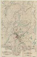
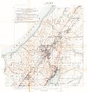
Main Author:
U.S. Geological Survey
Title/Description:
Topographic Map of the Menominee Iron District, Michigan
Publication Info:
Washington: Department of the Interior, U.S. Geological Survey, 1903; Monograph 46 Plate 8
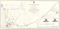
Viewing Options
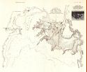
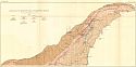
Main Author:
U.S. Army Corps of Engineers
Title/Description:
Map of Marquette Harbor, Michigan
Publication Info:
Washington: U.S.House of Representatives, 58th Congress, 2nd session, Doc. No. 161
Viewing Options
Main Author:
U.S. Army Corps of Engineers
Title/Description:
Map of Gladstone Harbor, Michigan
Publication Info:
Washington: U.S.House of Representatives, 58th Congress, 2nd session, Doc. No. 165, 1903
Viewing Options
Main Author:
Geological Survey of Michigan
Title/Description:
Chart of the Northern Half of Lake Saint Clair and Saint Clair Flats
Publication Info:
Lansing: Geological Survey of Michigan, 1903; Volume IX, Part I, Plate I
Viewing Options
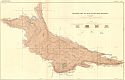
Main Author:
Gregory, W.M.
Title/Description:
Map of the Area About Alabaster Illustrating a report on Gypsum
Publication Info:
Lansing: Geological Survey of Michigan, 1903
Viewing Options
Main Author:
Cram, George F.
Title/Description:
Michigan & Wisconsin
Publication Info:
Philadelphia: The Philadelphia Inquirer,1903; from Pictorial Atlas of the Greater United States and the World
Viewing Options
Main Author:
Rand McNally and Company
Title/Description:
Michigan
Publication Info:
Chicago: Rand McNally and Co., 1905; from Unrivaled Atlas of the World
Viewing Options
Main Author:
Rand McNally and Company
Title/Description:
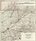
Michigan - Southern Peninsula
Publication Info:
Chicago: Rand McNally and Company, 1905; from Enlarged Business Atlas and Shippers Guide
Viewing Options
Main Author:
Rand McNally and Company
Title/Description:
Michigan - Northern Peninsula
Publication Info:
Chicago: Rand McNally and Company, 1905; from Enlarged Business Atlas and Shippers Guide
Viewing Options
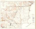
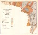
Main Author:
U.S. Geological Survey
Title/Description:
Map showing distribution of flowing-well districts and water works in the southern peninsula of Michigan
Publication Info:
Washington: Department of the Interior, U.S. Geological Survey, 1905; Water Supply Paper No. 183 Plate 1
Viewing Options
Main Author:
U.S. Geological Survey
Title/Description:
Map showing Geological Formations and Conditions of Rock Surface of the Southern Peninsula of Michigan
Publication Info:
Washington: Department of the Interior, U.S. Geological Survey, 1905; Water Supply Paper No. 183 Plate 2

Viewing Options
Main Author:
U.S. Army Corps of Engineers
Title/Description:
Skeleton Map showing Improvements of St. Marys River
Publication Info:
Washington: U.S.House of Representatives, 58th Congress, 3rd session, Doc. No. 215
Viewing Options
Main Author:
Rand McNally and Company
Title/Description:
Michigan, Southern Peninsula
Publication Info:
Chicago: Rand McNally and Company from the Business Atlas and Shippers Guide

Viewing Options
Main Author:
Rand McNally and Company
Title/Description:
Michigan, Northern Peninsula
Publication Info:
Chicago: Rand McNally and Company from the Business Atlas and Shippers Guide
Viewing Options
Main Author:
C.S. Hammond and Company
Title/Description:
Michigan
Publication Info:
New York: C.S. Hammond and Company, 1906; from the Pictorial Atlas of the World
Viewing Options
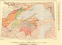
Main Author:
U.S. Geological Survey
Title/Description:
Map showing geological formations and contours of rock surface of the southern peninsula of Michigan
Publication Info:
Washington: Department of the Interior, U.S. Geological Survey, 1906; Water Supply Paper No. 182 Plate 2
Viewing Options
Main Author:
U.S. Geological Survey
Title/Description:
Map showing distribution of flowing-well districts and waterworks in the southern peninsula of Michigan
Publication Info:
Washington: Department of the Interior, U.S. Geological Survey, 1906; Water Supply Paper No. 182 Plate 1
Viewing Options
Main Author:
Rand McNally and Company
Title/Description:
Michigan, Southern Peninsula
Publication Info:
Chicago: Rand McNally and Company, 1906; from the Commercial Atlas of America
Viewing Options
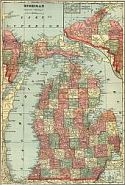
Main Author:
Rand McNally and Company
Title/Description:
Michigan
Publication Info:
Chicago: Rand McNally and Company, 1906; from The World and its Peoples
Viewing Options
Main Author:
Cram, George F.
Title/Description:
Michigan
Publication Info:
Chicago: George F. Cram, 1907; from Cram's Standard American Atlas
Viewing Options
Viewing Options
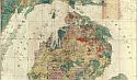
Main Author:
Nellist, John F.
Title/Description:
Surface (Pleistocene) Geology
Publication Info:
Lansing: Geological Survey of Michigan, 1907
Viewing Options
Main Author:
P.F. Collier and Son
Title/Description:
Michigan
Publication Info:
New York: P.F. Collier and Son, 1907; from The New Encyclopedic Atlas and Gazetteer of the World
Viewing Options
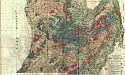
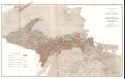
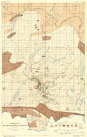
Main Author:
Russell, Israel C.
Title/Description:
Sketch Map Showing Surface Geology of Portions of Menominee, Dickinson, and Iron Counties, Michigan
Publication Info:
Lansing: Geological Survey of Michigan, 1907; Annual Report of 1906, Plate III
Viewing Options
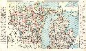
Main Author:
Geological Survey of Michigan
Title/Description:
Map of the Original Swamp Areas of the Lower Peninsula of Michigan
Publication Info:
Lansing: Geological Survey of Michigan, 1907; Annual Report of 1906, Plate XVI
Viewing Options
Main Author:
Davis, Charles A.
Title/Description:
Map of the Original Vegetation of the Upper Peninsula of Michigan
Publication Info:
Lansing: Geological Survey of Michigan, 1907; Annual Report of 1906, Plate XVII
Viewing Options
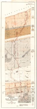
Main Author:
Gordon, W.C.
Title/Description:
Bessemer and the Black River Road
Publication Info:
Lansing: Geological Survey of Michigan, 1907; Annual Report of 1906, Plate XXXII
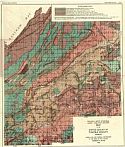
Viewing Options
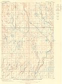
Main Author:
Davis, Charles A.
Title/Description:
Map of the Surface Geology of Tuscola County, Michigan
Publication Info:
Lansing: Geological Survey of Michigan, 1908
Viewing Options
Main Author:
Davis, Charles A.
Title/Description:
Map of Tuscola County, showing places where coal was reported in well records, etc.
Publication Info:
Lansing: Geological Survey of Michigan, 1908
Viewing Options
Main Author:
Davis, Charles A.
Title/Description:
Topographic Map of Tuscola County
Publication Info:
Lansing: Geological Survey of Michigan, 1908
Viewing Options
Main Author:
Hammond, C.S.
Title/Description:
Michigan
Publication Info:
New York: C.S. Hammond & Co. 1908; from Hammond's Handy Atlas of the World
Viewing Options
Main Author:
Rand McNally and Company
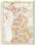
Title/Description:
Michigan
Publication Info:
Chicago: Rand McNally and Company, 1908; from The New Ideal State and County Survey and Atlas
Viewing Options
Main Author:
Patten, William and J.E. Homas
Title/Description:
Michigan
Publication Info:
New York: P.F. Collier and Son, 1909; from The New Encyclopedic Atlas and Gazetteer of the World
Viewing Options
Main Author:
Cram, George F.
Title/Description:
Michigan, Wisconsin
Publication Info:
Chicago: George F. Cram, c.1909; from the Heart of our Country
Viewing Options
Title/Description:
Geologic Map of Iron River District, Michigan
Publication Info:
Lansing: Michigan Geological Survey, 1909
Viewing Options
Main Author:
U.S. Geological Survey
Title/Description:
Geologic Map of Keweenaw Point Copper District, Michigan
Publication Info:
Washington: Department of the Interior, U.S. Geological Survey, 1909; Monograph 52 Plate 28
Viewing Options
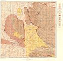
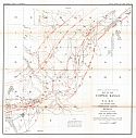
Main Author:
U.S. Geological Survey
Title/Description:
Geologic Map of Menominee Iron District, Michigan
Publication Info:
Washington: Department of the Interior, U.S. Geological Survey, 1909; Monograph 52 Plate 26
Viewing Options
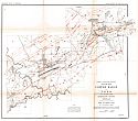
Main Author:
U.S. Geological Survey
Title/Description:
Geologic Map of Iron River District, Michigan
Publication Info:
Washington: Department of the Interior, U.S. Geological Survey, 1909; Monograph 52 Plate 24
Viewing Options
Main Author:
U.S. Geological Survey
Title/Description:
Geologic Map of the Crystal Falls District, including pats of the Felch Mountain and Marquette Districts, Michigan
Publication Info:
Washington: Department of the Interior, U.S. Geological Survey, 1909; Monograph 52 Plate 22
Viewing Options
Main Author:
U.S. Geological Survey
Title/Description:
Map of Perch Lake District, showing Distribution of Outcrops
Publication Info:
Washington: Department of the Interior, U.S. Geological Survey, 1909; Monograph 52 Plate 21
Viewing Options
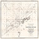
Main Author:
Geological Survey of Michigan
Title/Description:
Keweenaw Copper Range
Publication Info:
Lansing: Geological Survey of Michigan, 1909
Viewing Options
Main Author:
Geological Survey of Michigan
Title/Description:
Geological Map of Isle Royale, Lake Superior, Michigan
Publication Info:
Lansing: Geological Survey of Michigan, 1909
Viewing Options
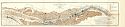
Main Author:
Geological Survey of Michigan
Title/Description:
Map of the Copper Range, T52 R36, Houghton County Michigan
Publication Info:
Lansing: Geological Survey of Michigan, 1909; from Annual report of 1909
Viewing Options
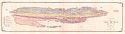
Main Author:
Geological Survey of Michigan
Title/Description:
Map of the Copper Range in T53R35, Houghton County Michigan
Publication Info:
Lansing: Geological Survey of Michigan, 1909; from the Annual Report of 1909
Viewing Options
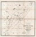
Main Author:
Geological Survey of Michigan
Title/Description:
Map of the Copper Range in T54 R34, Houghton County, Michigan
Publication Info:
Lansing: Geological Survey of Michigan, 1909; from the Annual Report of 1909
Viewing Options
Main Author:
Geological Survey of Michigan
Title/Description:
Calumet Quadrangle (Showing) Principal Horizons of the Keweenawan and limits of the Jacobsville or Eastern Sandstone
Publication Info:
Lansing: Geological Survey of Michigan, 1909; from Annual Report of 1909
Viewing Options
Main Author:
Geological Survey of Michigan
Title/Description:
Map of the Copper Range in T51 R37, Ontonagon County, Michigan
Publication Info:
Lansing: Geological Survey of Michigan, 1909; from the Annual Report of 1909
Viewing Options
Main Author:
Geological Survey of Michigan
Title/Description:
Map of the Copper Range T50 R39, Ontonago County, Michigan
Publication Info:
Lansing: Geological Survey of Michigan, 1909; from the Annual Report of 1909
Viewing Options
Main Author:
Geological Survey of Michigan
Title/Description:
Map of Part of T50 R40 and vicinity, Ontongon County, Michigan including the Victoria Mine
Publication Info:
Lansing: Geological Survey of Michigan, 1909; from the Annual Report of 1909
Viewing Options
Main Author:
Rand McNally and Company
Title/Description:
Michigan
Publication Info:
Chicago: Rand McNally and Company, 1910; from Enlarged Business Atlas and Shippers Guide
Viewing Options
Main Author:
Rand McNally and Company
Title/Description:
Michigan - Northern Peninsula
Publication Info:
Chicago: Rand McNally and Company, 1910; from Enlarged Business Atlas and Shippers Guide
Viewing Options
Main Author:
U.S. Geological Survey
Title/Description:
Geologic Map of Dead River Area, Michigan
Publication Info:
Washington: Department of the Interior, U.S. Geological Survey, 1910; Monograph 52 Plate 20
Viewing Options
Main Author:
U.S. Geological Survey
Title/Description:
Geologic Map and Sections of the Marquette Iron-Bearing District, Michigan
Publication Info:
Washington: Department of the Interior, U.S. Geological Survey, 1910; Monograph 52 Plate 17
Viewing Options
Main Author:
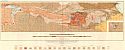
U.S. Geological Survey
Title/Description:
Geologic Map of the Lake Superior Region with Sections
Publication Info:
Washington: Department of the Interior, U.S. Geological Survey, 1910; Monograph 52 Plate 1

Viewing Options
Main Author:
Rand McNally and Company
Title/Description:
Michigan
Publication Info:
Chicago: Rand McNally and Company, 1910; from New Ideal State and County Survey

