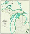
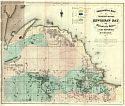
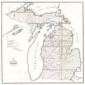
Viewing Options
Main Author:
Noble, Charles (Surveyor General)
Title/Description:
G. Sketch of the Public Surveys in Michigan
Publication Info:
Detroit: Surveyor General's Office, 1850; from the Surveyor General's Office, November 12th 1850
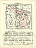
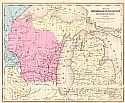
Viewing Options
Main Author:
Goodrich, S.G.
Title/Description:
Michigan
Publication Info:
New York: George Savage, 1850; from A Comprehensive Geography and History Ancient and Modern
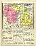
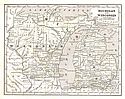
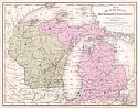
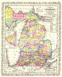
Viewing Options
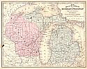
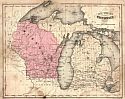
Main Author:
Mitchell, Samuel Augustus
Title/Description:
Michigan and Wisconsin
Publication Info:
Philadelphia: S.A. Mitchell, 1851
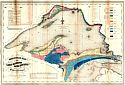
Viewing Options
Main Author:
Foster, J.W. and J.D. Whitney
Title/Description:
Geological Map of the Lake Superior Land District in the State of Michigan
Publication Info:
New York: 1851
Viewing Options
Main Author:
Foster, J.W. and J.D. Whitney
Title/Description:
Geological Map of the District Between Keweenaw Bay and Chocolate River, Lake Superior, Michigan
Publication Info:
New York: 1851
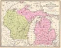
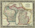
Viewing Options
Main Author:
Morse, Sidney E.
Title/Description:
Michigan and Wisconsin
Publication Info:
New York: Harper and Brothers 1851; from Morse's School Geography
Viewing Options
Main Author:
Young, James H.
Title/Description:
No. 15 Map of the States of Michigan & Wisconsin
Publication Info:
Philadelphia: S.A. Mitchell, 1853; from Mitchell's School and Family Geography
Viewing Options
Main Author:
Phelps, Fanning and Company
Title/Description:
Michigan
Publication Info:
New York: Phelps, Fanning and Company, 1853; from Fanning's Illustrated Gazetteer of the United States
Viewing Options
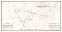
Main Author:
Williams, W.G.
Title/Description:
Extract of a Map of the Delta of the St. Clair
Publication Info:
Washington: Robert Armstrong, Printer, 1853; from Senate Ex. doc. 1. 33rd Congress, 1st Session, Maps and Views to Accompany Message and Document
Viewing Options
Title/Description:
(Lake St. Clair)
Publication Info:
Washington: Robert Armstrong, Printer, 1853; from Senate Ex. doc. 1. 33rd Congress, 1st Session, Maps and Views to Accompany Message and Document
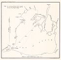
Viewing Options
Main Author:
Macomb, J.N.
Title/Description:
Re Examination of the Outlet of the South Channel of the River St. Clair
Publication Info:
Washington: Robert Armstrong, Printer, 1853; from Senate Ex. doc. 1. 33rd Congress, 1st Session, Maps and Views to Accompany Message and Document
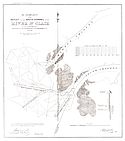
Viewing Options
Main Author:
Bowes, John R.
Title/Description:
Harbor of St. Joseph Michigan
Publication Info:
Washington: Robert Armstrong, Printer, 1853; from Senate Ex. doc. 1. 33rd Congress, 1st Session, Maps and Views to Accompany Message and Document
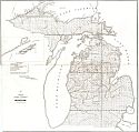
Viewing Options
Main Author:
Chapman, Leander
Title/Description:
Sketch of the Public Surveys in Michigan
Publication Info:
Detroit: Surveyor General's Office, 1853
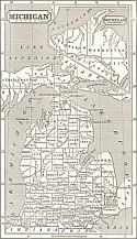
Viewing Options
Main Author:
Surveyor General's Office
Title/Description:
Sketch of the Public Surveys in Michigan
Publication Info:
Detroit: Survey General's Office, 1854
Viewing Options
Main Author:
Surveyor General's Office
Title/Description:
Sketch of the Public Surveys in Michigan
Publication Info:
Detroit: Surveyor General's Office, 1855
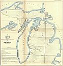
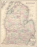
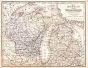
Viewing Options
Main Author:
Mitchell, S. Augustus
Title/Description:
Map of the States of Michigan and Wisconsin
Publication Info:
Philadelphia: Cowperthwait, Desilver and Butler, 1855; from Mitchell's School Atlas
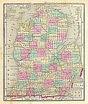
Viewing Options
Main Author:
Desilver, Charles
Title/Description:
A new Map of Michigan with its Canals, Roads and Distances
Publication Info:
Philadelphia: Charles Desilver, c.1856
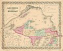
Viewing Options
Main Author:
Colton, Joseph Hutchins
Title/Description:
Lake Superior and the Northern Part of Michigan
Publication Info:
New York: J.H. Colton, c.1857
Viewing Options
Title/Description:
Michigan
Publication Info:
New Orleans: Morse & Gaston and A.B. Grisword, 1857; from The World In Miniature American
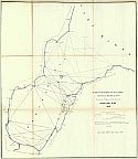
Viewing Options
Main Author:
Meade, George Gordon
Title/Description:
Survey of the N and NW Lakes Showing the Progress of the Survey in Saginaw Bay, 1857
Publication Info:
Washington: Surveyor General's Office, c.1857; 35th Congress, 1st Session Senate Ex. Doc No. 11
Viewing Options
Main Author:
Young, James H.
Title/Description:
No. 15 Map of the States of Michigan & Wisconsin
Publication Info:
Philadelphia: S.A. Mitchell, 1858; from Mitchell's School and Family Geography
Viewing Options
Main Author:
Olney, Jesse
Title/Description:
Map of Michigan, Wisconsin, and Part of Iowa
Publication Info:
New York: Pratt, Oakley, & Co., 1858; from Olney's School Geography
Viewing Options
Main Author:
Colton, G.W.
Title/Description:
Michigan
Publication Info:
New York: J.H. Colton and Company, 1858; from The General Atlas
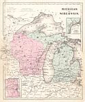
Viewing Options
Main Author:
Mitchell, S. Augustus, Jr.
Title/Description:
County Map of Michigan and Wisconsin
Publication Info:
Philadelphia: S. Augustus Mitchell, Jr., 1861; from Mitchell's New General Atlas
Viewing Options
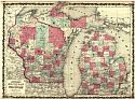
Main Author:
Johnson, A.J.
Title/Description:
Johnson's Michigan and Wisconsin
Publication Info:
New York: Johnson and Ward, 1862; from Johnson's New Illustrated Family Atlas

Viewing Options
Main Author:
Johnson, A.J.
Title/Description:
Johnson's Michigan and Wisconsin
Publication Info:
New York: Johnson and Ward, 1864; from Johnson's New Illustrated Family Atlas
Viewing Options
Main Author:
McNally, Francis
Title/Description:
Michigan and Wisconsin
Publication Info:
New York: A.S. Barnes and Burr, 1865; from An Improved System of Geography
Viewing Options
Main Author:
Colton, J.H.
Title/Description:
Michigan
Publication Info:
New York: Ivison, Phinney, Blakeman and Company, 1865; from American School Quarto Geography
Viewing Options
Main Author:
S. Augustus Mitchell
Title/Description:
Michigan and Wisconsin
Publication Info:
Philadelphia: E.H. Butler and Company, 1870; from Mitchell's New School Atlas

