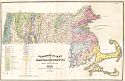
Viewing Options
Main Author:
Hitchcock, Edward
Title/Description:
A Geological Map of Massachusetts
Publication Info:
Amherst: J.S. and C. Adams, 1841; from the Final report on the Geology of Massachusetts, Vol. 1
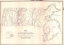
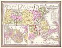
Viewing Options
Main Author:
Hitchcock, Edward
Title/Description:
Map showing the strike and dip of the strata; the axes of elevation and depression; the system of elevation; the course of the diluvial Furrows; and the veins and beds of ore in Massachusetts
Publication Info:
Amherst: J.S. and C. Adams, 1841; from the Final Report on the Geology of Massachusetts, Vol. 2
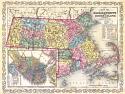
Viewing Options
Main Author:
Morse & Breese
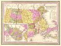
Title/Description:
Massachusetts and Rhode Island
Publication Info:
New York: Morse & Breese, 1842
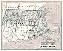
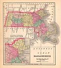
Viewing Options
Main Author:
Mitchell, S. Augustus
Title/Description:
Massachusetts and Rhode Island
Publication Info:
Philadelphia: S. Augustus Mitchell, 1847; from The New Universal Atlas
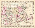
Viewing Options
Main Author:
Mitchell, Samuel Augustus
Title/Description:
Massachusetts and Rhode Island
Publication Info:
Philadelphia: S.A. Mitchell, 1850
Viewing Options
Title/Description:
Massachusetts and Rhode Island
Publication Info:
Worcester: Enos, Dorr & Co., c.1850
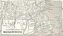
Viewing Options
Title/Description:
Massachusetts
Publication Info:
New York: Phelps, Fanning and Company, 1853; from Fanning's Illustrated Gazetteer of the United States
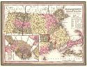
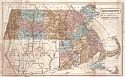
Viewing Options
Main Author:
Thomas, Cowperthwait and Co.
Title/Description:
Map of Massachusetts and Rhode Island
Publication Info:
Philadelphia: Thomas Cowperthwait & Co., 1854
Viewing Options
Main Author:
Desilver, Charles
Title/Description:
Map of Massachusetts and Rhode Island
Publication Info:
Philadelphia: Charles Desilver, c.1856
Viewing Options
Main Author:
Colton, Joseph Hutchins
Title/Description:
Colton's Massachusetts and Rhode Island
Publication Info:
New York: J.H. Colton & Co., 1856
Viewing Options
Title/Description:
Massachusetts
Publication Info:
New Orleans: Morse and Gaston and A.B. Griswold; from The World in Miniature American
Viewing Options
Title/Description:
A Map of the Original Allotments of Land and the Ancient Topography of Watertown
Publication Info:
Boston: New England Historic Genealogical Society, 1860
Viewing Options
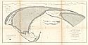
Main Author:
U.S. Coast Survey
Title/Description:
Comparative Map of Cape Cod Harbor Showing Physical Changes
Publication Info:
Washington: U.S. Coast Survey, c.1876; made for the State Commission for the Protection and Preservation of Cape Cod Harbor
Viewing Options
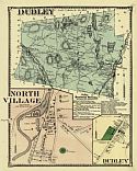
Title/Description:
Dudly, North Village
Publication Info:
New York: F.W. Beers and Co., 1870; from the Atlas of Worcester, Massachusetts and Vicinity
Viewing Options
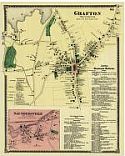
Title/Description:
Grafton, Saundersville
Publication Info:
New York: F.W. Beers and Co., 1870; from the Atlas of Worcester, Massachusetts and Vicinity
Viewing Options
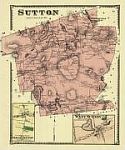
Title/Description:
Sutton, South Sutton and West Sutton
Publication Info:
New York: F.W. Beers and Co., 1870; from the Atlas of Worcester, Massachusetts and Vicinity
Viewing Options
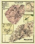
Title/Description:
Auburn, Stoneville, Auburn Centre, Millbury and West Millbury
Publication Info:
New York: F.W. Beers and Co., 1870; from the Atlas of Worcester, Massachusetts and Vicinity
Viewing Options
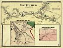
Title/Description:
West Fitchburg, Rockville, South Fitchburg and Westminster
Publication Info:
New York: F.W. Beers and Co., 1870; from the Atlas of Worcester, Massachusetts and Vicinity
Viewing Options
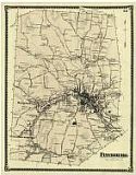
Title/Description:
Fitchburg
Publication Info:
New York: F.W. Beers and Co., 1870; from the Atlas of Worcester, Massachusetts and Vicinity
Viewing Options
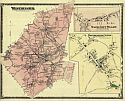
Title/Description:
Westminster, Westminster Centre and Wachusett Village
Publication Info:
New York: F.W. Beers and Co., 1870; from the Atlas of Worcester, Massachusetts and Vicinity
Viewing Options
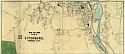
Title/Description:
City of Fitchburg (Southern Part)
Publication Info:
New York: F.W. Beers and Co., 1870; from the Atlas of Worcester, Massachusetts and Vicinity
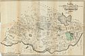
Viewing Options
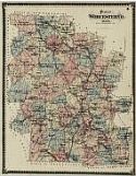
Title/Description:
Plan of Worcester Co., Massachusetts
Publication Info:
New York: F.W. Beers and Co., 1870; from the Atlas of Worcester, Massachusetts and Vicinity

