Historical Maps of Other Southeastern States

Previous Page

  Main Author:    
  Title/Description:   Map of the City of Cambridge
  Publication Info:   Boston: W.A. Greenough & Co., c.1880; published for the Cambridge Directory
  Date:   1880
  Scale:   1:13,000
  Original Source:   Courtesy of Murray Hudson, Halls, Tennessee
Viewing options:


  Main Author:   Hardesty, H.H.
  Title/Description:   Map of Massachusetts
  Publication Info:   New York: H.H. Hardesty & Compay, 1883; from Hardesty's Historical and Geographical Encyclopedia
  Date:   1883
  Scale:   1:633,600
  Original Source:   Courtesy of Murray Hudson, Halls, Tennessee
Viewing options:


  Main Author:    
  Title/Description:   Massachusetts, Rhode Island and Connecticut
  Publication Info:   Philadelphia: O.W. Gray and Son, 1883; from The National Atlas
  Date:   1883
  Scale:   1:570,240
  Original Source:   Courtesy of Murray Hudson, Halls, Tennessee
Viewing options:


  Main Author:    
  Title/Description:   Massachusetts
  Publication Info:   Chicago: Rand McNally and Co., 1884; from Rand McNally Indexed Atlas of the World
  Date:   1884
  Scale:   1:570,000
  Original Source:   From the personal collection of Dr. Gerald Webster
Viewing options:


  Main Author:   Rand McNally & Co.
  Title/Description:   Rand mcNally & Co.'s Massachusetts
  Publication Info:   Chicago: Rand McNally & Co., 1885; with inset maps of Boston and Boston Harbor
  Date:   1885
  Scale:   1:600,000
  Original Source:   Courtesy of Murray Hudson, Halls, Tennessee
Viewing options:


  Main Author:    
  Title/Description:   Railroad and County Map of Massachusetts and Rhode Island
  Publication Info:   New York: A.A. Grant, 1887; from Grant's Standard American Atlas of the World
  Date:   1887
  Scale:   1:633,600
  Original Source:   Courtesy of Murray Hudson, Halls, Tennessee
Viewing options:


  Main Author:    
  Title/Description:   Massachusetts
  Publication Info:   Chicago: Rand McNally and Company, 1889; from the Enlarged Business Atlas and Shippers Guide
  Date:   1889
  Scale:   1:600,000
  Original Source:   Courtesy of Murray Hudson, Halls, Tennessee
Viewing options:


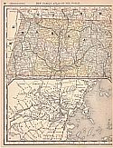
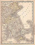
Main Author:   Rand McNally & Co.
Title/Description:   Massachusetts
Publication Info:   Chicago: Rand McNally & Co., 1890; from Rand McNally & Co.'s Family Atlas of the World
Date:   1890
Scale:   1:633,600
Original Source:   University of Alabama Map Library
West
East
Viewing options:
Viewing options:
JPEG or Plugin
JPEG or Plugin


  Main Author:   Walker, George H.
  Title/Description:   Massachusetts Atlas Plate No. 7
  Publication Info:   Boston: George H. Walker, 1891
  Date:   1891
  Scale:   1:63,360
  Original Source:   Courtesy of Murray Hudson, Halls, Tennessee
Viewing options:


  Main Author:    
  Title/Description:   City of Gloucester
  Publication Info:   Boston: George H. Walker & Co., 1891
  Date:   1891
  Scale:   1:4,800
  Original Source:   Courtesy of Murray Hudson, Halls, Tennessee
Viewing options:


  Main Author:   Endicott, Frederic
  Title/Description:   Map of the town of Canton, Massachusetts
  Publication Info:   Copy of an1831 map by Joseph Hodges, published by the author in 1892
  Date:   1892
  Scale:   1:20,000
  Original Source:   Courtesy of Murray Hudson, Halls, Tennessee
Viewing options:


  Main Author:   U.S. Geological Survey
  Title/Description:   Provincetown Harbor
  Publication Info:   Washington, D.C.: U.S. Department of the Interior, U.S. Geological Survey No. 10
  Date:   1893
  Scale:   not indicated
  Original Source:   Courtesy of Murray Hudson, Halls, Tennessee
Viewing options:


  Main Author:    
  Title/Description:   Massachusetts
  Publication Info:  

Chicago: Rand McNally and Company, 1893; from Rand McNally and Company's Enlarged Business Atlas and Shippers Guide

  Date:   1893
  Scale:   1:475,200
  Original Source:   Courtesy of Murray Hudson, Halls, Tennessee
Viewing options:


  Main Author:   Rand McNally and Company
  Title/Description:   Massachusetts
  Publication Info:   Chicago: Rand McNally and Company 1895; From Rand McNally's New General Atlas of the World
  Date:   1895
  Scale:   1:994,752
  Original Source:   Courtesy of Murray Hudson, Halls, Tennessee
Viewing options:


  Main Author:   Cram, George F.
  Title/Description:   Massachusetts and Rhode Island
  Publication Info:   Chicago: George F. Cram, 1898; from Cram's Universal Atlas, Geographical, Astronomical and Historical
  Date:   1898
  Scale:   1:633,600
  Original Source:   Courtesy of Adams Antiques, Northport, Alabama
Viewing options:


  Main Author:   Cram, George F.
  Title/Description:  

Map of the City of Lowell, Massachusetts
Map of the City of Lynn, Massachusetts

  Publication Info:   Chicago: George F. Cram, 1898; from Cram's Universal Atlas, Geographical, Astronomical and Historical
  Date:   1898
  Scale:    
  Original Source:   Courtesy of Adams Antiques, Northport, Alabama
Viewing options:


  Main Author:   Cram, George F.
  Title/Description:  

Map of the City of Worcester, Massachusetts
Map of the City of Springfield, Massachusetts

  Publication Info:   Chicago: George F. Cram, 1898; from Cram's Universal Atlas, Geographical, Astronomical and Historical
  Date:   1898
  Scale:    
  Original Source:   Courtesy of Adams Antiques, Northport, Alabama
Viewing options:


  Main Author:   Rand McNally and Company
  Title/Description:   Rand McNally and Co.'s New Map of Massachusetts
  Publication Info:   Chicago: Rand McNally and Co., 1898
  Date:   1898
  Scale:   1:892,000
  Original Source:   Courtesy of Murray Hudson, Halls, Tennessee
Viewing options:


  Main Author:    
  Title/Description:   Massachusetts
  Publication Info:   New York: Funk & Wagnalls Company, 1898; from A Standard Atlas of the World
  Date:   1898
  Scale:   1:1,267,200
  Original Source:   University of Alabama Map Library
Viewing options:


  Main Author:   Smith, Benjamin E.
  Title/Description:   Massachusetts
  Publication Info:   New York: The Century Company, 1899; from The Century Atlas of the World
  Date:   1899
  Scale:   1: 760,320
  Original Source:   University of Alabama Map Library
Viewing options:


  Main Author:   Smith, Benjamin E.
  Title/Description:   Massachusetts- Eastern Part
  Publication Info:   New York: The Century Company, 1899; from The Century Atlas of the World
  Date:   1899
  Scale:   1: 411,840
  Original Source:   University of Alabama Map Library
Viewing options:


  Main Author:    
  Title/Description:   Massachusetts
  Publication Info:   Chicago: Rand McNally and Company, 1901; from Enlarged Business Atlas and Shippers Guide
  Date:   1901
  Scale:   1:443,520
  Original Source:   Courtesy of Murray Hudson, Halls, Tennessee
Viewing options:


  Main Author:   The Century Company
  Title/Description:   Massachusetts
  Publication Info:   Buffalo: The Matthew-Northrup Co., 1902; from the 1902 edition of the Century Atlas
  Date:   1902
  Scale:   1:768,000
  Original Source:   From the personal collection of Dr. Robert Burckhalter
Viewing options:


  Main Author:   The Century Company
  Title/Description:   Massachusetts - Eastern Part
  Publication Info:   Buffalo: The Matthew-Northrup Co., 1902; from the 1902 edition of the Century Atlas
  Date:   1902
  Scale:   1:411,000
  Original Source:   From the personal collection of Dr. Robert Burckhalter
Viewing options:


  Main Author:    
  Title/Description:   Map of the Territory Bordering the Charles River
  Publication Info:   New York: Bormay & Co., 1902; Locations of the breeding places of mosquitoes from June to Oct., 1902
  Date:   1902
  Scale:   not indicated
  Original Source:   Courtesy of Murray Hudson, Halls, Tennessee
Viewing options:


  Main Author:    
  Title/Description:   Comparison of Depths in Boston Harbor [and] Location and Results of Sundry Borings
  Publication Info:   Boston: Committe on Charles River Dam, 1903; made for Committe on Charles River Dam, Mass. Acts of 1901, Chapter 105
  Date:   1903
  Scale:   1:10,000
  Original Source:   Courtesy of Murray Hudson, Halls, Tennessee
Viewing options:


  Main Author:   The Scarborough Company
  Title/Description:   Scarorough's Topographic Map of Massachusetts
  Publication Info:   Boston: The Scarborough Company, 1903
  Date:   1903
  Scale:   1:205,920
  Original Source:   Courtesy of Murray Hudson, Halls, Tennessee
Viewing options:


  Main Author:   Miller, J. Martin
  Title/Description:   Massachusetts and Rhode Island
  Publication Info:   unknown, 1904; from the Twentieth Century Atlas and Illustrated World
  Date:   1904
  Scale:   1:1,045,440
  Original Source:   Courtesy of Murray Hudson, Halls, Tennessee
Viewing options:


  Main Author:   Walker, George H.
  Title/Description:   Map of Massachusetts
  Publication Info:   Boston: George H. Walker and Company, c. 1905
  Date:   1905
  Scale:   1:444,000
  Original Source:   Courtesy of Murray Hudson, Halls, Tennessee
Viewing options:


  Main Author:   Walker, George H. and Winslow L. Webber
  Title/Description:   City of Gloucester
  Publication Info:   Boston: George H. Walker, 1906
  Date:   1906
  Scale:   1:4,800
  Original Source:   Courtesy of Murray Hudson, Halls, Tennessee
Viewing options:


  Main Author:   Cram, George F.
  Title/Description:   Massachusetts and Rhode Island
  Publication Info:   Chicago: George F. Cram, 1907; from Cram's Standard American Atlas
  Date:   1907
  Scale:   1:570,240
  Original Source:   University of Alabama Map Library
Viewing options:


  Main Author:   Patten, William and J.E. Homas
  Title/Description:   Massachusetts
  Publication Info:   New York: P.F. Collier and Son, 1909; from The New Encyclopedic Atlas and Gazetteer of the World
  Date:   1909
  Scale:   1:
  Original Source:   University of Alabama Map Library
Viewing options:


  Main Author:   Rand McNally and Co.
  Title/Description:   Massachusetts
  Publication Info:   Chicago: Rand McNally and Company, 1912; from The Library Atlas of the World
  Date:   1912
  Scale:   1:443,520
  Original Source:   Courtesy of Murray Hudson, Halls, Tennessee
Viewing options:


  Main Author:   Rand McNally and Company
  Title/Description:   Massachusetts
  Publication Info:   Chicago: Rand McNally and Company, 1913
  Date:   1913
  Scale:   1:982,000
  Original Source:   Courtesy of Murray Hudson, Halls, Tennessee
Viewing options:


  Main Author:    
  Title/Description:   Massachusetts
  Publication Info:   New York: The Century Company, 1913; from the Century Atlas of the World
  Date:   1913
  Scale:   1: 760,320
  Original Source:   University of Alabama Map Library
Viewing options:


  Main Author:    
  Title/Description:   Massachusetts, Eastern Part
  Publication Info:   New York: The Century Company, 1913; from the Century Atlas of the World
  Date:   1913
  Scale:   1: 411,840
  Original Source:   University of Alabama Map Library
Viewing options:


  Main Author:   U.S. Geological Survey
  Title/Description:   Topographical Map of Massachusetts and Rhode Island
  Publication Info:   Washington, D.C.: Department of the Interior, U.S. Geological Survey, 1915
  Date:   1915
  Scale:   1:250,000
  Original Source:   Geological Survey of Alabama
Viewing options:


  Main Author:   U.S. Geological Survey
  Title/Description:   Preliminary Map of Massachusetts and Rhode Island
  Publication Info:   Washington, D.C.: U.S. Department of the Interior, U.S. Geological Survey, 1916; Bulletin No.597, Plate X
  Date:   1916
  Scale:   1:250,000
  Original Source:   Courtesy of Murray Hudson, Halls, Tennessee
Viewing options:
 

  Main Author:   Rand McNally and Company
  Title/Description:   Massachusetts
  Publication Info:   Chicago: Rand McNally and Company
  Date:   1921
  Scale:   1: 443,520
  Original Source:   University of Alabama Map Library
Viewing options:


  Main Author:   Morang, Kenneth E.
  Title/Description:   Cape Cod
  Publication Info:   Cape Cod Chamber of Commerce, 1934
  Date:   1934
  Scale:   1:142,000
  Original Source:   W. S. Hoole Special Collections Library
Viewing options:


  Main Author:    
  Title/Description:   Massachusetts Tourists Map Showing Points of Interest, Camp Grounds, Picnic Sites and Beaches
  Publication Info:   Boston: The Massachusetts Development and Industrial Commission, 1946
  Date:   1946
  Scale:   1:380,160
  Original Source:   W. S. Hoole Special Collections Library
Viewing options:
 

Previous Page