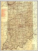
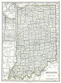
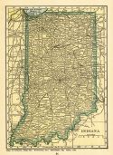
Viewing Options
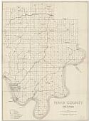
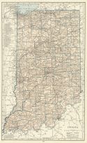
Main Author:
U.S. Geological Survey
Title/Description:
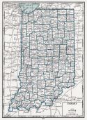
State of Indiana
Publication Info:
Washington: Department of the Interior, U.S. Geological Survey, 1917; compiled 1909-1910, reprinted 1941
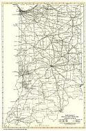
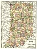
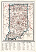
Viewing Options
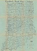
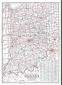
Main Author:
Goodrich Travel and Transport Bureau - B.F.G.R. Company
Title/Description:
Goodrich Road Map of Indiana
Publication Info:
Akron, Ohio: Beck Raymond Commercial Print and Lithograph Company, c.1920
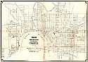
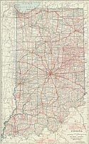
Viewing Options
Main Author:
Ehlers, Jules T.
Title/Description:
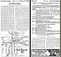
Official Map & Guide to the City of Evansville, Indiana
Publication Info:
Evansville: Geupel Bros., Booksellers and Stationers, 1920
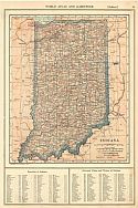
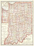
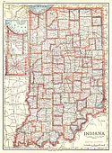
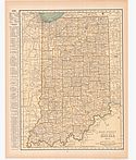
Viewing Options
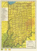
Main Author:
Reynolds, Francis J.
Title/Description:
Indiana
Publication Info:
New York: P.F. Collier and Son Company, 1920; from The New World Atlas and Gazetteer
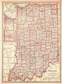
Viewing Options
Main Author:
Cram, George F.
Title/Description:
Indiana
Publication Info:
Chicago: George F. Cram, 1920; from Descriptive Review Showing Development of the State of Pennsylvania
Title/Description:
Official Automobile Bluebook, Vol. 4, 1920, Ohio, Indiana, Kentucky and Lower Michigan
Publication Info:
New York: Automobile Blue Book Publishing Co., 1920
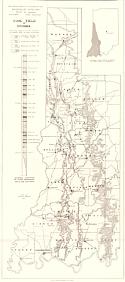
Viewing Options
Main Author:
Reeves, John R.
Title/Description:
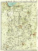
Coal Field of Indiana
Publication Info:
Indiana Department of Conservation, Division of Geology, 1921
Viewing Options
Main Author:
Rand McNally and Company
Title/Description:
Indiana
Publication Info:
Chicago: Rand McNally and Company, 1921; from the Commercial Atlas of America
Viewing Options
Main Author:
Rand McNally and Company
Title/Description:
Indiana- Black and White Mileage Map
Publication Info:
Chicago: Rand McNally and Company, 1921; from the Commercial Atlas of America
Viewing Options
Main Author:
Cram, George F.
Title/Description:
Indiana
Publication Info:
Chicago: George F. Cram Company, 1921; from Cram's Unrivaled Atlas of the World
Viewing Options
Main Author:
National Map Company
Title/Description:
Indiana
Publication Info:
Indianapolis: National Map Company, 1921; from Auto Trails and Commercial Survey of the United States
Viewing Options
Main Author:
National Map Company
Title/Description:
Indiana
Publication Info:
Indianapolis: National Map Company, 1921; from Auto Trails and Commercial Survey of the United States
Viewing Options
Main Author:
The Geographical Publishing Co.
Title/Description:
Indiana
Publication Info:
Chicago: The Geographical Publishing Co., 1922; from New International Atlas of the World
Viewing Options
Main Author:
C.S. Hammond and Company
Title/Description:
Indiana
Publication Info:
New York: C.S. Hammond and Company, 1922; from the New World Looseleaf Atlas
Viewing Options
Main Author:
Cram, George F.
Title/Description:
Indiana
Publication Info:
Chicago: George F. Cram Company, 1923; from Cram's Unrivaled Atlas of the World
Viewing Options
Main Author:
Funk and Wagnalls Company
Title/Description:
Indiana
Publication Info:
New York: Funk and Wagnalls Company, 1923; from Atlas of the World and Gazetteer
Viewing Options
Main Author:
Reynolds, Francis J.
Title/Description:
Indiana
Publication Info:
New York: P.F. Collier and Son Company, 1924; from The New World Atlas and Gazetteer
Viewing Options
Main Author:
Rand McNally and Company
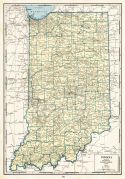
Title/Description:
Indiana
Publication Info:
Chicago: Rand McNally and Company, 1925; from Premier Atlas of the World
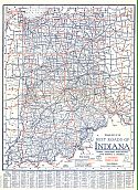
Viewing Options
Main Author:
Clason Map Company
Title/Description:
Best Roads of Indiana
Publication Info:
Chicago: Clason Map Company, c. 1927; from Clason's Touring Atlas

Viewing Options
Main Author:
National Map Company
Title/Description:
Indiana
Publication Info:
Indianapolis: National Map Company, 1930; from Official Paved Road and Commercial Survey of the United States
Viewing Options
Main Author:
Clason Map Company
Title/Description:
Clason's Road Map of Indiana
Publication Info:
Denver: The Clason Map Company, 1930; from Clason's Touring Atlas of the United States and Canada
Viewing Options
Main Author:
C.S. Hammond and Company
Title/Description:
Indiana
Publication Info:
New York: C.S. Hammond and Company, c. 1930; from The New World Loose Leaf Atlas, Sixth Edition
Viewing Options
Main Author:
C.S. Hammond and Company
Title/Description:
Indiana
Publication Info:
New York: C.S. Hammond and Company, c. 1930; from The New World Loose Leaf Atlas, Sixth Edition
Viewing Options
Main Author:
Geographical Publishing Company
Title/Description:
Indiana
Publication Info:
Chicago: Geographical Publishing Company1931; from Commercial Atlas of the World
Viewing Options
Main Author:
Branom, Frederick K. and Lloyd Edwin Smith
Title/Description:
Indiana
Publication Info:
Chicago: Geographical Publishing Company, 1936; from Capper's 1936 Atlas of the World
Viewing Options
Main Author:
Rand McNally and Company
Title/Description:
Standard Map of Indiana
Publication Info:
Chicago: Rand McNally and Company, 1936
Viewing Options
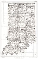
Main Author:
Malott, Clyde A.
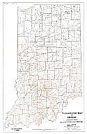
Title/Description:
Topographic Map of Indiana
Publication Info:
State of Indiana, Division of Geology, c.1940
Viewing Options
Main Author:
Geographical Publishing Company
Title/Description:
Indiana
Publication Info:
Chicago: Geographical Publishing Company, 1942; from The New International Atlas of the World, War Edition
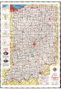
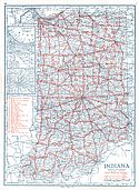
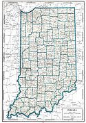
Viewing Options
Main Author:
State Highway Commission
Title/Description:
Indiana Official Highway Map
Publication Info:
Indianapolis: State Highway Commission, 1952
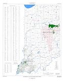
Viewing Options
Main Author:
Keller, Stanley J.
Title/Description:
Map of Indiana Showing Oil, Gas, and Products Pipelines
Publication Info:
Indiana Department of Natural Resources, 1973; mapped on a 1950 U.S.G.S. base
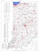
Viewing Options
Main Author:
Carpenter, G.L. and Dan M. Sullivan
Title/Description:
Map Showing Oil, Gas, and Gas Storage Fields in Indiana
Publication Info:
Indiana Department of Natural Resources, 1976
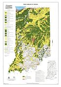
Viewing Options
Main Author:
U.S. Department of Agriculture
Title/Description:
Prime Farmland in Indiana
Publication Info:
Washington: U.S. Department of Agriculture Soil Convervation Service, 1977