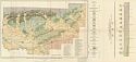
Viewing Options
Main Author:
U.S. Geological Survey
Title/Description:
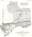
Geologic Map of the Southern, Grubb Cut, Roders, Blue Ridge, Turner, Polk Southard, Wren and Lassiter Mines, Independence County, Arkansas
Publication Info:
Washington: Department of the Interior, U.S. Geological Survey, 1922; Bulletin 734 Plate 17
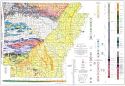
Viewing Options
Main Author:
U.S. Geological Survey
Title/Description:
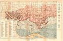
Geologic Map of the Batesville District, Arkansas
Publication Info:
Washington: Department of the Interior, U.S. Geological Survey, 1922; Bulletin 734 Plate 1
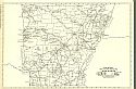
Viewing Options
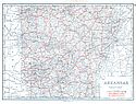
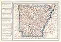
Main Author:
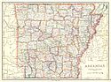
Cram, George F.
Title/Description:
Arkansas
Publication Info:
Chicago: George F. Cram Company, 1923; from Cram's Unrivaled Atlas of the World
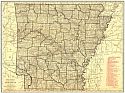
Viewing Options
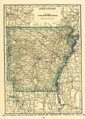
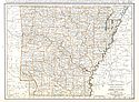
Main Author:
Funk and Wagnalls Company
Title/Description:
Arkansas
Publication Info:
New York: Funk and Wagnalls Company, 1923; from Atlas of the World and Gazetteer
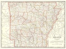
Viewing Options
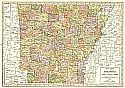
Main Author:
Reynolds, Francis J.
Title/Description:
Arkansas
Publication Info:
New York: P.F. Collier and Son Company, 1924; from The New World Atlas and Gazetteer
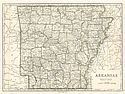
Viewing Options
Main Author:
Rand McNally and Company
Title/Description:
Arkansas
Publication Info:
Chicago: Rand McNally and Company, 1925; from Premier Atlas of the World
Viewing Options
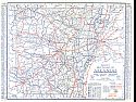
Main Author:
Clason Map Company
Title/Description:
Best Roads in Arkansas
Publication Info:
Chicago: Clason Map Company, c. 1927; from Clason's Touring Atlas
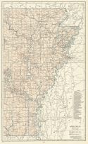
Viewing Options
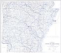
Main Author:
U.S. Department of the Interior, U.S. Geological Survey
Title/Description:
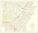
State of Arkansas
Publication Info:
Washington: U.S. Department of the Interior, Geological Survey, 1928
Viewing Options
Main Author:
Arkansas Geological Survey
Title/Description:
Geologic map of the Cretaceous Formations in southwestern Arkansas
Publication Info:
Little Rock: Arkansas Geological Survey, 1929; Bulletin 1, Plate 1
Viewing Options
Main Author:
Arkansas Geological Survey
Title/Description:
Geologic Map of Arkansas
Publication Info:
Washington: U.S. Department of the Interior, Geological Survey, 1929
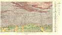
Viewing Options
Main Author:
U.S. Geological Survey
Title/Description:
Geologic Map of DeQueen and Caddo Gap Quadrangles, Arkansas and Oklahoma
Publication Info:
Washington: Department of the Interior, U.S. Geological Survey, 1929; Bulletin 808 Plate 3
Viewing Options
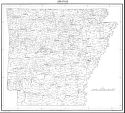
Main Author:
Department of Commerce, Bureau of the Census
Title/Description:
Arkansas, Minor Civil Divisions (for the census of 1930)
Publication Info:
Washington: U.S. Government Printing Office, 1938
Viewing Options
Main Author:
Arkansas Geological Survey
Title/Description:
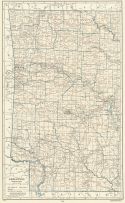
Topographic Map of the Gulf Coastal Plain of Arkansas
Publication Info:
Reprinted on USGS basemap of 1930
Viewing Options
Main Author:
National Map Company
Title/Description:
Arkansas
Publication Info:
Indianapolis: National Map Company, 1930; from Official Paved Road and Commercial Survey of the United States
Viewing Options
Main Author:
Clason Map Company
Title/Description:
Clason's Road Map of Arkansas
Publication Info:
Denver: The Clason Map Company, 1930; from Clason's Touring Atlas of the United States and Canada
Viewing Options
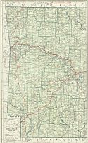
Main Author:
C.S. Hammond and Company
Title/Description:
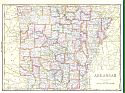
Arkansas (Western Part)
Publication Info:
New York: C.S. Hammond and Company, c. 1930; from The New World Loose Leaf Atlas, Sixth Edition
Viewing Options
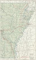
Main Author:
C.S. Hammond and Company
Title/Description:
Arkansas (Eastern Part)
Publication Info:
New York: C.S. Hammond and Company, c. 1930; from The New World Loose Leaf Atlas, Sixth Edition
Viewing Options
Main Author:
C.S. Hammond and Company
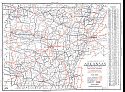
Title/Description:
Arkansas
Publication Info:
New York: C.S. Hammond and Company, c. 1930; from The New World Loose Leaf Atlas, Sixth Edition