Home  |  Help  |  Graphics Tutorial  |  Aerial Photography  |  Historical Maps  |  Contemporary Maps  |  About this site  | 

Historical Maps of Other Southeastern States

Southern
Before 1875
After 1875

Previous Page
.

  Main Author:   Black, Adam and Charles
  Title/Description:   Chili, La Plata or the Argentine Republic and Bolivia
  Publication Info:   Edinburgh: Adam and Charles Black, 1879; from The General Atlas of the World, American Edition
  Date:   1879
  Scale:   1:7,920,000
  Original Source:   Courtesy of Murray Hudson, Halls, Tennessee
Viewing options:


  Main Author:   Rand McNally and Company
  Title/Description:   Southern Portion of South America
  Publication Info:   Chicago: Rand McNally and Company, 1884; from The Indexed Atlas of the World
  Date:   1884
  Scale:   1:12,000,000
  Original Source:   From the personal collection of Dr. Gerald Webster
Viewing options:


  Main Author:   Blackie, Walter Graham
  Title/Description:   La Plata (Argentina), Chili, Paraguay, Uruguay, and Patagonia
  Publication Info:   London: Blackie and Son, 1886; from The Comprehensive Atlas & Geography of the World
  Date:   1886
  Scale:   1:5,702,400
  Original Source:   University of Alabama Map Library
Viewing options:


  Main Author:   Rand McNally and Company
  Title/Description:   Southern Portion of South America
  Publication Info:   Chicago: Rand McNally and Company, 1891; from The Enlarged Business Atlas and Shippers Guide
  Date:   1891
  Scale:   1:12,069,000
  Original Source:   University of Alabama Map Library
Viewing options:


  Main Author:   Rand McNally and Company
  Title/Description:   Map of Argentine Republic, Chile, Paraguay and Uruguay
  Publication Info:   Chicago: Rand McNally and Company, 1892; from The Indexed Atlas of the World
  Date:   1892
  Scale:   1:4,435,200
  Original Source:   Courtesy of Murray Hudson, Halls, Tennessee
Viewing options:


  Main Author:   Bradley, William M.
  Title/Description:   Map of the Republic of Paraguay
  Publication Info:   New York: John E. Potter and Company,1894; from Potter Bradley Atlas of the World
  Date:   1894
  Scale:   1:1,964,000
  Original Source:   University of Alabama Map Library
Viewing options:


  Main Author:   Brewer, H.G.
  Title/Description:   Rio de la Plata and Approaches
  Publication Info:   Washington: Hydrographic Office, Navy Department, 1896
  Date:   1896
  Scale:   1:465,000
  Original Source:   Courtesy of Murray Hudson, Halls, Tennessee
Viewing options:


  Main Author:   Johnston, W. and A.K.
  Title/Description:   Uruguay, Paraguay and North Argentina
  Publication Info:   Edinburgh: W. and A.K. Johnston, [c. 1897]
  Date:   1897
  Scale:   1:8,870,000
  Original Source:   Courtesy of Adams Antiques, Northport, Alabama
Viewing options:


  Main Author:   Johnston, W. and A.K.
  Title/Description:   South Argentina
  Publication Info:   Edinburgh: W. and A.K. Johnston, [c. 1897]
  Date:   1897
  Scale:   1:9,500,000
  Original Source:   Courtesy of Adams Antiques, Northport, Alabama
Viewing options:


  Main Author:   Johnston, W. and A.K.
  Title/Description:   Chile
  Publication Info:   Edinburgh: W. and A.K. Johnston, [c. 1897]
  Date:   1897
  Scale:   1:8,870,000
  Original Source:   Courtesy of Adams Antiques, Northport, Alabama
Viewing options:


  Main Author:   Cram, George F.
  Title/Description:   Chili, Argentine Republic and Uruguay
  Publication Info:   Chicago: George F. Cram, 1898; from The Universal Atlas, Geographical, Astronomical and Historical
  Date:   1898
  Scale:   1:13,612,000
  Original Source:   Courtesy of Adams Antiques, Northport, Alabama
Viewing options:


  Main Author:   Rand McNally and Company
  Title/Description:   Argentine Republic, Chile, Paraguay and Uruguay
  Publication Info:   Chicago: Rand McNally and Company, 1898; from The Indexed Atlas of the World
  Date:   1898
  Scale:   1:4,435,200
  Original Source:   Courtesy of Murray Hudson, Halls, Tennessee
Viewing options:


  Main Author:   Scobel, A.
  Title/Description:   Südamerika, Südliche Hälfte
  Publication Info:   Leipzig: Velhagen and Klasing, 1901; from Andrees Allgemeiner Handaltas
  Date:   1901
  Scale:   1:10,000,000
  Original Source:   University of Alabama Map Library
Viewing options:


  Main Author:   Andrees, Richard
  Title/Description:   Südamerika, Südliche Hälfte
  Publication Info:   Leipzig: Verlag von Velhagen and Klasing; from Allgemeiner Handatlas
  Date:   1904
  Scale:   1:10,000,000
  Original Source:   Courtesy of Murray Hudson, Halls, Tennessee
Viewing options:


  Main Author:   Ramos, M.
  Title/Description:   Mapa de la Republica Argentina
  Publication Info:   Buenos Aires: Department of Agriculture, 1904; from Sketch of the Argentine Republic as a Country for Immigration
  Date:   1904
  Scale:   1:10,000,000
  Original Source:   Geological Survey of Alabama
Viewing options:


  Main Author:   Habenicht, H. and H. Salzmann
  Title/Description:   Süd-Amerika (Southern)
  Publication Info:   Gotha: Justus Perthes, 1905; from Stielers Hand-Atlas
  Date:   1905
  Scale:   1:7,500,000
  Original Source:   Courtesy of Adams Antiques, Northport, Alabama
Viewing options:


  Main Author:   Rand McNally and Company
  Title/Description:   Argentine Republic, Chile, Paraguay, & Uruguay
  Publication Info:   Chicago: Rand McNally and Company, 1905; from Indexed Atlas of the World
  Date:   1905
  Scale:   1:4,435,200
  Original Source:   University of Alabama Map Library
Viewing options:


  Main Author:   Meyer, Joseph
  Title/Description:   Argentinien, Chile, Bolivia, Uruguay und Paraguay
  Publication Info:   Leipzig: Bibliographisches Institut, 1906; from Konverlations - Lexikon
  Date:   1906
  Scale:   1:12,000,000
  Original Source:   Courtesy of Adams Antiques, Northport, Alabama
Viewing options:


  Main Author:   Meyer, Joseph
  Title/Description:   Argentina, Chile, Bolivia, Uruguay och Paraguay
  Publication Info:   Leipzig: Bibliographisches Institut, 1906; from Konveraltions-Lexikon
  Date:   1906
  Scale:   1:12,000,000
  Original Source:   University of Alabama Map Library
Viewing options:


  Main Author:   Rand McNally and Company
  Title/Description:   Chile, Argentine Republic, Paraguay and Uruguay
  Publication Info:   Chicago: Rand McNally and Company, 1906; from The World and its Peoples
  Date:   1906
  Scale:   1:9,187,200
  Original Source:   University of Alabama Map Library
Viewing options:


  Main Author:   Cram, George F.
  Title/Description:   Argentina, Chile and Uruguay
  Publication Info:   Chicago: George F. Cram, 1907; from The Standard American Atlas
  Date:   1907
  Scale:   1:6,652,800
  Original Source:   University of Alabama Map Library
Viewing options:


  Main Author:   Goad, Charles E.
  Title/Description:   Insurance Plan of Valparaiso, Chile
  Publication Info:   London: Charles E. Goad, 1909
  Date:   1909
  Scale:   1:6,000
  Original Source:   Courtesy of Antique Atlas
Viewing options:


  Main Author:   Carmelite House
  Title/Description:   South America: South
  Publication Info:   London: Carmelite House, c.1910; from The Harmsworth Atlas and Gazetteer
  Date:   1910
  Scale:   1:9,400,000
  Original Source:   University of Alabama Map Library
Viewing options:


  Main Author:   C.S. Hammond and Company
  Title/Description:   South America (Southern Part)
  Publication Info:   New York: C.S. Hammond and Company, 1911; from The Modern Atlas of the World
  Date:   1911
  Scale:   1:17,424,000
  Original Source:   Courtesy of Murray Hudson, Halls, Tennessee
Viewing options:


  Main Author:   Martinez, Alberto B.
  Title/Description:   Geographical Map of the Argentine Republic
  Publication Info:   Barcelona: Casa Editorial Sopena, 1912
  Date:   1912
  Scale:   1:5,000,000
  Original Source:   Geological Survey of Alabama
Viewing options:


  Main Author:   Martinez, Albert B.
  Title/Description:   Baedeker of the Argentine Republic
  Publication Info:   Provenza: R. Sopena, 1914
  Date:   1914
  Scale:   various
  Original Source:   University of Alabama Map Library


  Main Author:   Rand McNally and Company
  Title/Description:   Argentine Republic, Chile, Paraguay and Uruguay
  Publication Info:   Chicago: Rand McNally and Company, 1914; from Atlas of Foreign Countries
  Date:   1914
  Scale:   1:4,118,400
  Original Source:   University of Alabama Map Library
Viewing options:


  Main Author:   Rand McNally and Company
  Title/Description:   Chile, Argentine Rep., Paraguay and Uruguay
  Publication Info:   Chicago: Rand McNally and Company, 1916; from The Ideal Atlas of the World
  Date:   1916
  Scale:   1:9,187,200
  Original Source:   Courtesy of Murray Hudson, Halls, Tennessee
Viewing options:


  Main Author:   C.S. Hammond and Company
  Title/Description:   South America (Southern Part)
  Publication Info:   New York: C.S. Hammond and Company, 1917; from The New Universal Atlas of the World
  Date:   1917
  Scale:   1:15,840,000
  Original Source:   Courtesy of Murray Hudson, Halls, Tennessee
Viewing options:


  Main Author:   Bartholomew, J.G.
  Title/Description:   Argentina, Chili, etc.
  Publication Info:   London: The Times, 1920; from The Times Survey Atlas of the World
  Date:   1920
  Scale:   1:10,000,000
  Original Source:   University of Alabama Map Library
Viewing options:


  Main Author:   Philip, George
  Title/Description:   South America: III, South
  Publication Info:   London: George Philip and Son, 1921; from Philip's New Handy General Atlas and Gazateer
  Date:   1921
  Scale:   1:9,300,000
  Original Source:   University of Alabama Map Library
Viewing options:


  Main Author:   C.S. Hammond and Company
  Title/Description:   Western Central Argentina and Central Chile
  Publication Info:   New York: C.S. Hammond and Company, 1922; from the New World Loose Leaf Atlas
  Date:   1922
  Scale:   1:3,801,600
  Original Source:   Courtesy of Murray Hudson, Halls, Tennessee
Viewing options:


  Main Author:   C.S. Hammond and Company
  Title/Description:   Eastern Central Argentina and Uruguay
  Publication Info:   New York: C.S. Hammond and Company, 1922; from the New World Loose Leaf Atlas
  Date:   1922
  Scale:   1:3,801,600
  Original Source:   Courtesy of Murray Hudson, Halls, Tennessee
Viewing options:


  Main Author:   C.S. Hammond and Company
  Title/Description:   South America (Southern Part)
  Publication Info:   New York: C.S. Hammond and Company, 1922; from the New World Loose Leaf Atlas
  Date:   1922
  Scale:   1:10,454,400
  Original Source:   Courtesy of Murray Hudson, Halls, Tennessee
Viewing options:


  Main Author:   Cram, George F.
  Title/Description:   South America (Southern Part)
  Publication Info:   Chicago: George F. Cram Company, 1923; from Cram's Unrivaled Atlas of the World
  Date:   1923
  Scale:   1:11,405,000
  Original Source:   University of Alabama Map Library
Viewing options:


  Main Author:   Meyer, Joseph
  Title/Description:   Peru, Ecuador, Kolumbien u. Venezuela
  Publication Info:   Leipzig: Bibliographisches Institut, 1924; from The Geographischer Hand Atlas, map no. 83
  Date:   1924
  Scale:   1:12,000,000
  Original Source:   University of Alabama Map Library
Viewing options:


  Main Author:   Meyer, Joseph
  Title/Description:   Guayana
  Publication Info:   Leipzig: Bibliographisches Institut, 1924; from The Geographischer Hand Atlas, map no. 84
  Date:   1924
  Scale:   1:10,000,000
  Original Source:   University of Alabama Map Library
Viewing options:


  Main Author:   Meyer, Joseph
  Title/Description:   Argentinien, Chile, Boliva, Urguagy und Paraguay
  Publication Info:   Leipzig: Bibliographisches Institut, 1924; from The Geographischer Hand Atlas, map no. 87
  Date:   1924
  Scale:   1:12,000,000
  Original Source:   University of Alabama Map Library
Viewing options:


  Main Author:   Rand McNally and Company
  Title/Description:   Paraguay
  Publication Info:   Chicago: Rand McNally and Company, 1925; from Premier Atlas of the World
  Date:   1925
  Scale:   1:5,068,800
  Original Source:   University of Alabama Map Library
Viewing options:


  Main Author:   Rand McNally and Company
  Title/Description:   Uruguay
  Publication Info:   Chicago: Rand McNally and Company, 1925; from Premier Atlas of the World
  Date:   1925
  Scale:   1:3,801,600
  Original Source:   University of Alabama Map Library
Viewing options:


  Main Author:   Rand McNally and Company
  Title/Description:   Argentina and Chile
  Publication Info:   Chicago: Rand McNally and Company, 1925; from Premier Atlas of the World
  Date:   1925
  Scale:   1:8,680,320
  Original Source:   University of Alabama Map Library
Viewing options:


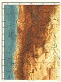
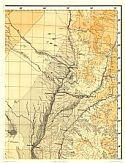
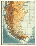
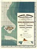
Main Author:   Ministério de Agricultura
Title/Description:   Mapa Hipsometrico de la Republica Argentina y Regiones Limitrofes
Publication Info:   Buenos Aires: Ministério de Agricultura, Dirección General de Minas, Geologia e Hidrologia, 1930
Date:   1930
Scale:   1:2,000,000
Original Source:   Geological Survey of Alabama
Northwest
Northeast
Viewing options:
Viewing options:
JPEG or Plugin
JPEG or Plugin
   
Southwest
Southeast
Viewing options:
Viewing options:
JPEG or Plugin
JPEG or Plugin


  Main Author:   C.S. Hammond and Company
  Title/Description:   West Central Argentina and Central Chile
  Publication Info:   New York: C.S. Hammond and Company, c. 1930; from The New World Loose Leaf Atlas, Sixth Edition
  Date:   1930
  Scale:   1:3,800,000
  Original Source:   University of Alabama Map Library
Viewing options:


  Main Author:   C.S. Hammond and Company
  Title/Description:   East Central Argentina and Uruguay
  Publication Info:   New York: C.S. Hammond and Company, c. 1930; from The New World Loose Leaf Atlas, Sixth Edition
  Date:   1930
  Scale:   1:3,800,000
  Original Source:   University of Alabama Map Library
Viewing options:


  Main Author:   C.S. Hammond and Company
  Title/Description:   South America (Southern Part)
  Publication Info:   New York: C.S. Hammond and Company, c. 1930; from The New World Loose Leaf Atlas, Sixth Edition
  Date:   1930
  Scale:   1:6,653,000
  Original Source:   University of Alabama Map Library
Viewing options:


  Main Author:   Rand McNally and Company
  Title/Description:   Popular Map of Argentina and Chile
  Publication Info:   Chicago: Rand McNally and Company, 1936
  Date:   1936
  Scale:   1:8,680,000
  Original Source:   University of Alabama Map Library
Viewing options:


  Main Author:   Rand McNally and Company
  Title/Description:   Popular Map of Paraguay
  Publication Info:   Chicago: Rand McNally and Company, 1936
  Date:   1936
  Scale:   1:5,005,000
  Original Source:   University of Alabama Map Library
Viewing options:


  Main Author:   Rand McNally and Company
  Title/Description:   Popular Map of Uruguay
  Publication Info:   Chicago: Rand McNally and Company, 1936
  Date:   1936
  Scale:   1:3,802,000
  Original Source:   University of Alabama Map Library
Viewing options:


  Main Author:   U.S. Navy
  Title/Description:   Tic Toc Bay and Port Palcna
  Publication Info:   Washington: Hydrographic Office, U.S. Navy, 1938; 9th Edition, No. 1622
  Date:   1938
  Scale:   Various
  Original Source:   University of Alabama Map Library
Viewing options:


  Main Author:   U.S. Navy
  Title/Description:   Guapiquilan Islands and Quilan Cove
  Publication Info:   Washington: Hydrographic Office, U.S. Navy, 1939; 6th Edition, No. 1747
  Date:   1939
  Scale:   Various
  Original Source:   University of Alabama Map Library
Viewing options:


  Main Author:   Ministério da Agricultura
  Title/Description:   [República Argentina] Mapa geológico de la Patagonia al sur del paralelo 42º y Tierra del Fuego
  Publication Info:   Buenos Aires: Ministério de Agricultura, 1939
  Date:   1939
  Scale:   1:2,000,000
  Original Source:   Geological Survey of Alabama
Viewing options:


  Main Author:   U.S. Navy
  Title/Description:   Plans on the Coast of Chile
  Publication Info:   Washington: Hydrographic Office, U.S. Navy, 1940; 1st Edition, No. 5707
  Date:   1940
  Scale:   Various
  Original Source:   University of Alabama Map Library
Viewing options:


  Main Author:   U.S. Navy
  Title/Description:   Bahia Camarones and Caleta Carolina
  Publication Info:   Washington: Hydrographic Office, U.S. Navy, 1940; 5th Edition, No. 2137
  Date:   1940
  Scale:   1:50,000
  Original Source:   University of Alabama Map Library
Viewing options:


  Main Author:   Geographical Publishing Company
  Title/Description:   Argentina, Chile, Paraguay, and Uruguay
  Publication Info:   Chicago: Geographical Publishing Company, 1942; from The New International Atlas of the World, War Edition
  Date:   1942
  Scale:   1:11,405,000
  Original Source:   University of Alabama Map Library
Viewing options:


  Main Author:   U.S. Navy
  Title/Description:   Anchorages on the Coast of Chile
  Publication Info:   Washington: Hydrographic Office, U.S. Navy, 1942; 9th Edition, No. 1569
  Date:   1942
  Scale:   Various
  Original Source:   University of Alabama Map Library
Viewing options:


  Main Author:   U.S. Navy
  Title/Description:   Pulluce Channel and Port Refuge
  Publication Info:   Washington: Hydrographic Office, U.S. Navy, 1942; 7th Edition, No. 1616
  Date:   1942
  Scale:   1:49,974
  Original Source:   University of Alabama Map Library
Viewing options:


  Main Author:   U.S. Navy
  Title/Description:   Arica Road
  Publication Info:   Washington: Hydrographic Office, U.S. Navy, 1943; 16th Edition, No. 1203
  Date:   1943
  Scale:   1:31,680
  Original Source:   University of Alabama Map Library
Viewing options:


  Main Author:   U.S. Navy
  Title/Description:   Anchorages on the Coast of Chile
  Publication Info:   Washington: Hydrographic Office, U.S. Navy, 1943; 9th Edition, No. 1448
  Date:   1943
  Scale:   Various
  Original Source:   University of Alabama Map Library
Viewing options:


  Main Author:   U.S. Navy
  Title/Description:   Plans on the Coast of Peru
  Publication Info:   Washington: Hydrographic Office, U.S. Navy, 1943; 1st Edition, No. 5703
  Date:   1943
  Scale:   Various
  Original Source:   University of Alabama Map Library
Viewing options:


  Main Author:   U.S. Navy
  Title/Description:   Plans on the Coast of Chile
  Publication Info:   Washington: Hydrographic Office, U.S. Navy, 1943; 1st Edition, No. 5706
  Date:   1943
  Scale:   Various
  Original Source:   University of Alabama Map Library
Viewing options:


  Main Author:   U.S. Navy
  Title/Description:   Island off the Coast of Chile
  Publication Info:   Washington: Hydrographic Office, U.S. Navy, 1944; 1st Edition, No. 1267
  Date:   1944
  Scale:   Various
  Original Source:   University of Alabama Map Library
Viewing options:


  Main Author:   U.S. Navy
  Title/Description:   Bahia Blanca Inner Port, Extension to Cuatreos, and Approaches to Bahia Blanca & Puerto Belgrano
  Publication Info:   Washington: Hydrographic Office, U.S. Navy, 1944; 2nd Edition, No. 5383
  Date:   1944
  Scale:   Various
  Original Source:   University of Alabama Map Library
Viewing options:


  Main Author:   U.S. Navy
  Title/Description:   Conception Bay and San Vicente Bay, Tomé , Penco, and Talcahuano
  Publication Info:   Washington: Hydrographic Office, U.S. Navy, 1944; 2nd Edition, No. 5383
  Date:   1944
  Scale:   Various
  Original Source:   University of Alabama Map Library
Viewing options:


  Main Author:   Ministério da Agricultura
  Title/Description:   Mapa geológico de la región Oeste del meridiano 62º, entre los paralelos 32º y 42º [República Argentina]
  Publication Info:   Buenos Aires: Ministério da Agricultura, 1943
  Date:   1943
  Scale:   1:5,000,000
  Original Source:   Geological Survey of Alabama
Viewing options:


  Main Author:   U.S. Navy
  Title/Description:   Ports in the Guaitecas Islands
  Publication Info:   Washington: Hydrographic Office, U.S. Navy, 1944; 5th Edition, No. 2422
  Date:   1944
  Scale:   Various
  Original Source:   University of Alabama Map Library
Viewing options:


  Main Author:   U.S. Navy
  Title/Description:   Port Quellan and Approaches, Port Quellon (Yauquil), Chiguao Chanel
  Publication Info:   Washington: Hydrographic Office, U.S. Navy, 1944; 2nd Edition, No. 2052
  Date:   1944
  Scale:   Various
  Original Source:   University of Alabama Map Library
Viewing options:


  Main Author:   U.S. Navy
  Title/Description:   Harbors on the Coast of Chile
  Publication Info:   Washington: Hydrographic Office, U.S. Navy, 1944; 19th Edition, No. 1253
  Date:   1944
  Scale:   Various
  Original Source:   University of Alabama Map Library
Viewing options:


  Main Author:   U.S. Navy
  Title/Description:   Puerto San Antonio and Approaches to Puerto San Antonio including Puerto Cartagena
  Publication Info:   Washington: Hydrographic Office, U.S. Navy, 1944; 10th Edition, No. 1485
  Date:   1944
  Scale:   Various
  Original Source:   University of Alabama Map Library
Viewing options:


  Main Author:   U.S. Navy
  Title/Description:   Anchorages on the Coast of Chile
  Publication Info:   Washington: Hydrographic Office, U.S. Navy, 1944; 8th Edition, No. 2075
  Date:   1944
  Scale:   Various
  Original Source:   University of Alabama Map Library
Viewing options:


  Main Author:   U.S. Navy
  Title/Description:   Anchorages on the Coast of Chile
  Publication Info:   Washington: Hydrographic Office, U.S. Navy, 1944; 4th Edition, No. 1678
  Date:   1944
  Scale:   Various
  Original Source:   University of Alabama Map Library
Viewing options:


  Main Author:   U.S. Navy
  Title/Description:   Castro Inlet
  Publication Info:   Washington: Hydrographic Office, U.S. Navy, 1944; 6th Edition, No. 1678
  Date:   1944
  Scale:   Various
  Original Source:   University of Alabama Map Library
Viewing options:
 

Previous Page
.


© University of Alabama
To purchase map reproductions, submit a quote request.
Download MrSID Plugin