Main Author:   Coronelli, Vincenzo Maria
  Title/Description:   La Louisiana, Parte Settentrionalle, Scoperta sotto la Protettione dí Luigi XIV....
  Publication Info:   Venice: 1693
  Date:   1693
  Scale:   1:5,100,000
  Original Source:  

Birmingham Public Library Cartography Collection

Viewing options:


  Main Author:    
  Title/Description:   Gli Stati Uniti Dell' America; Terzo Foglio che comprende Parte Della Virginia e Della Carolina
  Publication Info:   Rome: Preffo la Calcografia Camerale, 1797
  Date:   1797
  Scale:   1:3,420,000
  Original Source:   Courtesy of Murray Hudson, Halls, Tennessee
Viewing options:


  Main Author:   Young, J.H.
  Title/Description:   Western States & Territories
  Publication Info:   Philadelphia: S.A. Mitchell, 1830
  Date:   1830
  Scale:   1:6,336,000
  Original Source:   Courtesy of Murray Hudson, Halls, Tennessee
Viewing options:


  Main Author:   Society for the Diffusion of Useful Knowledge
  Title/Description:   North America Sheet IV: Lake Superior
  Publication Info:   London: Chapman and Hall, 1832
  Date:   1832
  Scale:   1:1,774,000
  Original Source:   Courtesy of Murray Hudson, Halls, Tennessee
Viewing options:


  Main Author:   Society for the Diffusion of Useful Knowledge
  Title/Description:   North America Sheet V: The Northwest and Michigan Territories
  Publication Info:   London: Baldwin & Cradock, 1833
  Date:   1833
  Scale:   1:1,774,000
  Original Source:   Courtesy of Murray Hudson, Halls, Tennessee
Viewing options:


  Main Author:   Huntington, Eleazer
  Title/Description:   Western States
  Publication Info:   Hartford, CT: Eleazer Huntington, 1836; from Jesse Olney's A Practical System of Geography
  Date:   1836
  Scale:   1:4,372,000
  Original Source:   Courtesy of Murray Hudson, Halls, Tennessee
Viewing options:


  Main Author:   Huntington, F.J.
  Title/Description:   The Western States
  Publication Info:   Hartford, CT: F.J. Huntington, 1836
  Date:   1836
  Scale:   1:3,037,000
  Original Source:   Courtesy of Murray Hudson, Halls, Tennessee
Viewing options:


  Main Author:   Olney, Jesse
  Title/Description:   Western States
  Publication Info:   New York: Robinson, Pratt and Company, 1837; from New and Improved School Atlas
  Date:   1837
  Scale:   1:3,041,280
  Original Source:   Courtesy of Murray Hudson, Halls, Tennessee
Viewing options:


  Main Author:   Burr, David
  Title/Description:   Map Illustrating the plan of the Defences (sic) of the Western Frontier
  Publication Info:   Washington: 1838; part of the report by Edmund P. Gaines
  Date:   1838
  Scale:   1:3,485,000
  Original Source:  

Birmingham Public Library Cartography Collection

Viewing options:


  Main Author:   Mitchell, Samuel Augustus
  Title/Description:   No. 9 Map of the Cheif Part of the Western States and Part of Virginia
  Publication Info:   Philadelphia: S.A. Mitchell, 1839; Engraved to Illustrate Mitchell's School and Family Geography
  Date:   1839
  Scale:   1:3,168,000
  Original Source:   Courtesy of Murray Hudson, Halls, Tennessee
Viewing options:


  Main Author:   Owen, D.D.
  Title/Description:   Plate No. 21. Magnetical Chart Exhibiting the Observations Made by J. Locke During the Survey of the Mines of the United States
  Publication Info:   Washington, D.C.: U.S. Department of Interior, Bureau of Mines, c.1884
  Date:   1839
  Scale:   1:950,000
  Original Source:   Courtesy of Murray Hudson, Halls, Tennessee
Viewing options:


  Main Author:   Owen, David Dale
  Title/Description:   Plate No. 3, Geological Section from the Mouth of Rock River through the Blue Mound to the Wisconsin River
  Publication Info:   Baltimore: E. Weber & Co., 1844; in connection with a Geological chart of part of Iowa, Wisconsin, and Illinois N.W. of the Section Line
  Date:   1844
  Scale:   1:760,000
  Original Source:   Courtesy of Murray Hudson, Halls, Tennessee
Viewing options:


  Main Author:   Owen, David Dale
  Title/Description:   Plate No. 2, Geological Chart of Iowa, Wisconsin, and Illinois
  Publication Info:   Baltimore: E. Weber & Co., 1844
  Date:   1844
  Scale:   1:445,000
  Original Source:   Courtesy of Murray Hudson, Halls, Tennessee
Viewing options:


  Main Author:   Society for the Diffusion of Useful Knowledge
  Title/Description:   North America Sheet V Parts of Wisconsin and Michigan
  Publication Info:   London: Charles Knight & Co., 1846
  Date:   1846
  Scale:   1:1,774,000
  Original Source:   Courtesy of Murray Hudson, Halls, Tennessee
Viewing options:


  Main Author:   Society for the Diffusion of Useful Knowledge
  Title/Description:   North America Sheet VIII Ohio, with Parts of Kentucky and Virginia
  Publication Info:   London: Charles Knight & Co., 1846
  Date:   1846
  Scale:   1:1,774,000
  Original Source:   Courtesy of Murray Hudson, Halls, Tennessee
Viewing options:


  Main Author:   Society for the Diffusion of Useful Knowledge
  Title/Description:   North America Sheet IX Parts of Missouri, Illinois and Indiana
  Publication Info:   London: Charles Knight & Co., 1846
  Date:   1846
  Scale:   1:1,774,000
  Original Source:   Courtesy of Murray Hudson, Halls, Tennessee
Viewing options:


  Main Author:   Stiles, Sherman, & Smith
  Title/Description:   Map of the Western States
  Publication Info:   Hartford, CT: Daniel Burgess, 1847; Designed to Accompany Smith's Geography for Schools
  Date:   1847
  Scale:   1:3,551,000
  Original Source:   Courtesy of Murray Hudson, Halls, Tennessee
Viewing options:


  Main Author:   Mitchell, Samuel Augustus
  Title/Description:   No. 14 Map of the Chief Part of the Western States and Part of Virginia
  Publication Info:   Philadelphia: S.A. Mitchell, 1848; Engraved to Illustrate Mitchell's School and Family Geography
  Date:   1848
  Scale:   1:3,168,000
  Original Source:   Courtesy of Murray Hudson, Halls, Tennessee
Viewing options:


  Main Author:   Williams, W.
  Title/Description:   Map of the Western States
  Publication Info:   Philadelphia: Appleton, 1849; Engraved to Accompany Appleton's Hand Book of American Travel
  Date:   1849
  Scale:   1:3,168,000
  Original Source:   Courtesy of Murray Hudson, Halls, Tennessee
Viewing options:


  Main Author:   Society for the Diffusion of Useful Knowledge
  Title/Description:   North America Sheet IV: Lake Surperior
  Publication Info:   London: Edward Stanford, c.1850
  Date:   1850
  Scale:   1:1,774,000
  Original Source:   Courtesy of Murray Hudson, Halls, Tennessee
Viewing options:


  Main Author:   Mitchelll, Samuel Augustus
  Title/Description:   Illinois, Missouri, and Iowa
  Publication Info:   Philadelphia: S.A. Mitchell, 1851
  Date:   1851
  Scale:   1:4,118,000
  Original Source:   Courtesy of Murray Hudson, Halls, Tennessee
Viewing options:


  Main Author:   U.S. Geological Corps
  Title/Description:   Geological Map of Wisconsin, Iowa and Minnesota
  Publication Info:   Washington, DC: U.S. Department of the Treasury, 1851
  Date:   1851
  Scale:   1:1,267,000
  Original Source:   Courtesy of Murray Hudson, Halls, Tennessee
Viewing options:


  Main Author:   Smith, Roswell C.
  Title/Description:   Map No.7, United States (Ohio, Indiana, Kentucky and Tennessee)
  Publication Info:   New York: Daniel Burgess and Company, 1855; from A Concise and Practical System of Geography for Schools, Academies and Families
  Date:   1855
  Scale:   1:4,118,400
  Original Source:   Courtesy of Murray Hudson, Halls, Tennessee
Viewing options:


  Main Author:   Smith, Roswell C.
  Title/Description:   Map No.8, United States (Illinois, Iowa and Missouri)
  Publication Info:   New York: Daniel Burgess and Company, 1855; from A Concise and Practical System of Geography for Schools, Academies and Families
  Date:   1855
  Scale:   1:4,118,400
  Original Source:   Courtesy of Murray Hudson, Halls, Tennessee
Viewing options:


  Main Author:   Smith, Roswell C.
  Title/Description:   Map No.9, United States (Michigan and Wisconsin)
  Publication Info:   New York: Daniel Burgess and Company, 1855; from A Concise and Practical System of Geography for Schools, Academies and Families
  Date:   1855
  Scale:   1:4,118,400
  Original Source:   Courtesy of Murray Hudson, Halls, Tennessee
Viewing options:


  Main Author:   Llyod, H.H. and Company
  Title/Description:   Map of the Central States
  Publication Info:   New York: Warner & Beers, 1865; from H.H. Llyod & Co.'s Atlas of the United States
  Date:   1865
  Scale:   1:3,041,000
  Original Source:   Courtesy of Murray Hudson, Halls, Tennessee
Viewing options:


  Main Author:   McNally, Francis
  Title/Description:   Ohio, Indiana, Kentucky, Tennessee
  Publication Info:   New York: A.S. Barnes and Burr, 1865; from An Improved System of Geography
  Date:   1865
  Scale:   1:4,118,400
  Original Source:   Courtesy of Murray Hudson, Halls, Tennessee
Viewing options:


  Main Author:   McNally, Francis
  Title/Description:   Illinois, Missouri and Iowa
  Publication Info:   New York: A.S. Barnes and Burr, 1865; from An Improved System of Geography
  Date:   1865
  Scale:   1:4,118,400
  Original Source:   Courtesy of Murray Hudson, Halls, Tennessee
Viewing options:


  Main Author:   Wells, Edward
  Title/Description:   Western Division of the United States
  Publication Info:   New York: D. Appleton & Co., 1866; designed to accompany Cornell's High School Geography
  Date:   1866
  Scale:   1:2,978,000
  Original Source:   Courtesy of Murray Hudson, Halls, Tennessee
Viewing options:


  Main Author:   Colton, George W.
  Title/Description:   
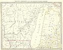
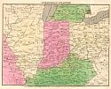
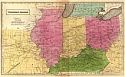
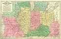
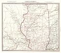
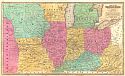
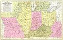
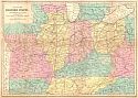
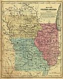
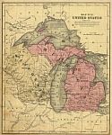
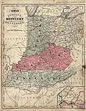
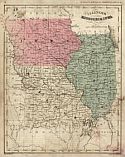
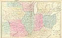
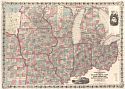
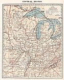
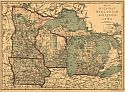
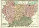
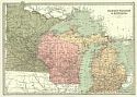
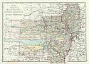
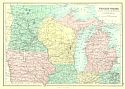
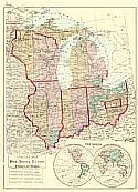
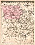
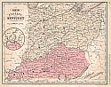
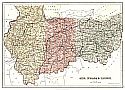
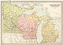
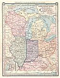
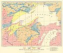
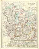
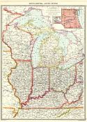
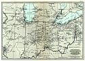
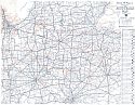
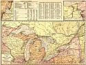
Colton's New Railroad Map of the States of Ohio, Michigan, Indiana, Illinois, Missouri, Wisconsin, Iowa, Minnesota, Nebraska, & Kansas
  Publication Info:   New York: G.W. and C.B. Colton, 1866
  Date:   1866
  Scale:   1:1,647,000
  Original Source:   Courtesy of Murray Hudson, Halls, Tennessee
Viewing options:


  Main Author:   Guyot, A.
  Title/Description:   Central States
  Publication Info:   NewYork: Charles Scribner & Company, 1868; from Guyot's Common-School Geography
  Date:   1868
  Scale:   1:7,286,000
  Original Source:   University of Alabama Map Library
Viewing options:


  Main Author:   Jones, Charles H.
  Title/Description:   Map of Michigan, Wisconsin, Minnesota and Iowa
  Publication Info:  

New York: J. David Williams, 1873; The Peoples Pictorial Atlas

  Date:   1873
  Scale:   1:3,484,800
  Original Source:   Courtesy of Murray Hudson, Halls, Tennessee
Viewing options:


  Main Author:   Bartholomew, John
  Title/Description:   Ohio, Indiana, Illinois and Kentucky
  Publication Info:   Philadelphia: T. Ellwood Zell, 1873; from A Discriptive Hand Atlas of the World
  Date:   1873
  Scale:   1:2,408,000
  Original Source:   University of Alabama Map Library
Viewing options:


  Main Author:   Bartholomew, John
  Title/Description:   Michigan, Wisconsin and Minnesota
  Publication Info:   Philadelphia: T. Ellwood Zell, 1873; from A Discriptive Hand Atlas of the World
  Date:   1873
  Scale:   1:3,000,000
  Original Source:   University of Alabama Map Library
Viewing options:


  Main Author:   Neuman, Louis E.
  Title/Description:   Map of Illinois, Missouri, Kansas, Arkansas, and Indian Territory
  Publication Info:   Jacksonville, IL: H.C. Tunison, 1875
  Date:   1875
  Scale:   1:3,336,000
  Original Source:   Courtesy of Murray Hudson, Halls, Tennessee
Viewing options:


  Main Author:   Bartholomew, John
  Title/Description:   Western States. Michigan, Wisconsin, Minnesota, Iowa, with portion of Illinois & Indiana
  Publication Info:   Edinburgh: A.&C. Black, c.1875
  Date:   1875
  Scale:   1:3,231,000
  Original Source:   Courtesy of Murray Hudson, Halls, Tennessee
Viewing options:


  Main Author:   Hardesty, H.H.
  Title/Description:   Special Map -Ohio, Indiana, Illinois, Wisconsin, and Michigan
  Publication Info:   Chicago: H.H, Hardesty, 1875
  Date:   1875
  Scale:   1:3,928,000
  Original Source:   Courtesy of Murray Hudson, Halls, Tennessee
Viewing options:


  Main Author:   McNally, Francis
  Title/Description:   Illinois, Missouri, and Iowa
  Publication Info:   New York: A.S. Barnes and Company, 1876; from An Improved System of Geography
  Date:   1876
  Scale:   1:4,118,000
  Original Source:   University of Alabama Map Library
Viewing options:


  Main Author:   McNally, Francis
  Title/Description:   Ohio, Indiana, and Kentucky
  Publication Info:   New York: A.S. Barnes and Company, 1876; from An Improved System of Geography
  Date:   1876
  Scale:   1:3,168,000
  Original Source:   University of Alabama Map Library
Viewing options:


  Main Author:   Black, Adam and Charles
  Title/Description:   Ohio, Indiana, & Illinois
  Publication Info:   Edinburgh: Adam and Charles Black, 1879; from Black's General Atlas of the World, American Edition
  Date:   1879
  Scale:   1:2,344,320
  Original Source:   Courtesy of Murray Hudson, Halls, Tennessee
Viewing options:


  Main Author:   Bartholomew, John
  Title/Description:   Michigan, Wisconsin, & Minnesota
  Publication Info:   Philadelphia: T. Elwood Zell, 1881
  Date:   1881
  Scale:   1:3,168,000
  Original Source:   Courtesy of Murray Hudson, Halls, Tennessee
Viewing options:


  Main Author:   Monteith, James
  Title/Description:   North Central States, Eastern Section
  Publication Info:   New York: A.S. Barnes and Company, 1886; from Barnes' Complete Geography
  Date:   1886
  Scale:   1:5,259,000
  Original Source:   University of Alabama Map Library
Viewing options:


  Main Author:   U.S. Department of the Interior, U.S. Geological Survey
  Title/Description:   Geologic Map of Part of the Lake Superior Region Compiled from Official Maps of U.S., Minnesota and Canadian Surveys
  Publication Info:   Washington, D.C.: U.S.G.S., 1890
  Date:   1890
  Scale:   1:2,661,000
  Original Source:   Courtesy of Murray Hudson, Halls, Tennessee
Viewing options:


  Main Author:   Johnston, W. and A.K.
  Title/Description:   NE Central United States
  Publication Info:   Edinburgh: W. and A.K. Johnston, c. 1890
  Date:   1890
  Scale:   1:6,336,000
  Original Source:   Courtesy of Murray Hudson, Halls, Tennessee
Viewing options:


  Main Author:   Bartholomew, John
  Title/Description:   Ohio, Indiana, Illinois and Kentucky
  Publication Info:   London: MacMillan and Company, 1890; from the Library Reference Atlas of the World
  Date:   1890
  Scale:   1: 2,407,680
  Original Source:   Courtesy of Murray Hudson, Halls, Tennessee
Viewing options:


  Main Author:   Johnston, W. and A.K.
  Title/Description:   Illinois, Indiana, Ohio, Kentucky
  Publication Info:   Edinburgh: W. and A.K. Johnston, 1901
  Date:   1901
  Scale:   1:4,992,000
  Original Source:   Courtesy of Adams Antiques, Northport, Alabama
Viewing options:


  Main Author:    
  Title/Description:   Nordöstliche Vereinigte Staaten und Südöstliches Canada
  Publication Info:   Leipzig: Verlag von Velhagen and Klasing; from Andrees Allgemeiner Handatlas
  Date:   1904
  Scale:   1:5,000,000
  Original Source:   Courtesy of Murray Hudson, Halls, Tennessee
Viewing options:


  Main Author:   Rand McNally & Company
  Title/Description:   Coal Production
  Publication Info:   Chicago: Rand McNally & Co., 1906
  Date:   1906
  Scale:   1:21,535,000
  Original Source:   Courtesy of Murray Hudson, Halls, Tennessee
Viewing options:


  Main Author:    
  Title/Description:   North-Central United States
  Publication Info:   London: Carmelite House, c.1910; from The Harmsworth Atlas and Gazetteer
  Date:   1910
  Scale:   1:3,250,000
  Original Source:   University of Alabama Map Library
Viewing options:


  Main Author:    
  Title/Description:   Electric Railways in the Principle Part of the Central States
  Publication Info:   New York: The Century Company, 1913; from the Century Atlas of the World
  Date:   1913
  Scale:   1: 2,471,040
  Original Source:   University of Alabama Map Library
Viewing options:


  Main Author:   Rand McNally
  Title/Description:   Rand McNally Offical 1919 Auto Trails Map, District Number 2
  Publication Info:   Chicago: Rand McNally & Co., 1919; includes Eastern Illinois, Indiana, Southern Michigan, and Western Ohio
  Date:   1919
  Scale:   1:760,000
  Original Source:   Courtesy of Murray Hudson, Halls, Tennessee
Viewing options:
 

  Main Author:   Rand McNally and Company
  Title/Description:   The Great Lakes and Vicinity
  Publication Info:   Chicago: Rand McNally and Company; from the Commerical Atlas of America
  Date:   1921
  Scale:   1:823,680
  Original Source:   University of Alabama Map Library
Viewing options: