Main Author:   Ogilby, John
  Title/Description:   Yucatan Conventus Iuridici Hispania Novae
  Publication Info:   London: 1671
  Date:   1671
  Scale:   1:6,336,000
  Original Source:   Birmingham Public Library Cartography Collection
Viewing options:


  Main Author:   Senex, John (info)
  Title/Description:   A New Map of the Isthmus of Darien in America
  Publication Info:   [London: 1719]
  Date:   1719
  Scale:   1:2,850,000
  Original Source:   Birmingham Public Library Cartography Collection
Viewing options:


  Main Author:   Senex, John (info)
  Title/Description:   A Draft of the Golden and Adjacent Islands with part of the Isthmus of Darien as it was taken by Capt. Ienefer where ye Scots West-India Company were settled
  Publication Info:   London: 1721
  Date:   1721
  Scale:   1:60,000
  Original Source:   Birmingham Public Library Cartography Collection
Viewing options:


  Main Author:   Moll, Herman (info)
  Title/Description:   The Scots Settlement in America called New Caledonia
  Publication Info:   [London: 1732?]
  Date:   1732
  Scale:   1:92,150
  Original Source:   W. S. Hoole Special Collections Library
Viewing options:


  Main Author:   Bellin, Jacques Nicolas (info)
  Title/Description:   Carte des Provinces de Tabasco, Chiapa. Verapaz, Guatemala, Honduras et Yucatan
  Publication Info:   Paris: 1754
  Date:   1754
  Scale:   1:5,069,000
  Original Source:   Courtesy of Murray Hudson, Halls, Tennessee
Viewing options:


  Main Author:   Buchon, Jean Alexandre
  Title/Description:   Carte Géographique, Statistique et Historique de Guatemala
  Publication Info:   Paris: J.A. Buchon, 1825
  Date:   1825
  Scale:   1:5,500,000
  Original Source:   Courtesy of Murray Hudson, Halls, Tennessee
Viewing options:


  Main Author:   Rapkin, John
  Title/Description:   Central America
  Publication Info:   London: John Tallis and Company, c.1850
  Date:   1850
  Scale:   1:3,800,000
  Original Source:   Courtesy of Murray Hudson, Halls, Tennessee
Viewing options:


  Main Author:   Squier, Ephraim George
  Title/Description:   Map of the river of San Juan de Nicaragua with several insets
  Publication Info:   Washington: 1850; from House Executive Document No. 75, 31st Congress, 1st Session 1850
  Date:   1850
  Scale:   varies
  Original Source:   Courtesy of Antique Atlas
Viewing options:


  Main Author:   Society for the Diffusion of Useful Knowledge
  Title/Description:   Yucatan, Belize, Guatemala, Salvador, Honduras, Nicaragua and the Southern States of Mexico
  Publication Info:   London: Charles Knight, 1852; from the General Atlas
  Date:   1852
  Scale:   1:7,920,000
  Original Source:   Courtesy of Murray Hudson, Halls, Tennessee
Viewing options:


  Main Author:   Lisbourne, Lionel
  Title/Description:   Atlantic and Pacific Junction: Topographic Map of a Portion of the Isthmus of Darien in Site of Proposed Inter-Oceanic Navigation
  Publication Info:   Washington: U.S. Senate, 1854
  Date:   1854
  Scale:   1:460,000
  Original Source:   Courtesy of Murray Hudson, Halls, Tennessee
Viewing options:


  Main Author:   Colton, J.H.  
  Title/Description:   Central America
  Publication Info:   New York: J.H. Colton and Company, 1855
  Date:   1855
  Scale:   1:5,385,000
  Original Source:   Birmingham Public Library Cartography Collection
Viewing options:


  Main Author:   Bauza, Don Felipe
  Title/Description:   Central America West Coast
  Publication Info:   London: Hydrographical Office, 1855
  Date:   1855
  Scale:   1:2,890,000
  Original Source:   Courtesy of Murray Hudson, Halls, Tennessee
Viewing options:


  Main Author:   Malte-Brun, Victor
  Title/Description:   Amerique Centrale
  Publication Info:   Paris: Gustave Barba, 1856; from Geographie Universelle
  Date:   1856
  Scale:   1:6,336,000
  Original Source:   University of Alabama Map Library
Viewing options:


  Main Author:   Hazzard, J.L.
  Title/Description:   A New Map of Central America
  Publication Info:   Philadelphia: Charles Desilver, [1857]; from A New Universal Atlas of 1857.
  Date:   1857
  Scale:   1:3,900,000
  Original Source:   Courtesy of Adams Antiques, Northport, Alabama
Viewing options:


  Main Author:   MacNab, John
  Title/Description:   Central America
  Publication Info:   Edinburgh: A. Fullerton and Company, [1862]
  Date:   1862
  Scale:   1:3,300,000
  Original Source:   W. S. Hoole Special Collections Library
Viewing options:


  Main Author:   Johnson and Ward
  Title/Description:   Johnson's Central America
  Publication Info:   New York: Johnson and Ward, 1864; from The New Illustrated Family Atlas
  Date:   1864
  Scale:   Various
  Original Source:   Courtesy of Murray Hudson, Halls, Tennessee
Viewing options:


  Main Author:  
  Title/Description:   Map and Vertical Section of the Proposed Honduras Interoceanic Railroad
  Publication Info:   Washington: U.S. Senate Document No. 62, 30th Congress, First Session, Report from the Secretary of the Navy by Rear-Admiral Chas H. Davis, 1866
  Date:   1866
  Scale:   1:500,000
  Original Source:   Geological Survey of Alabama
Viewing options:


  Main Author:  
  Title/Description:   Map and Profile of the Route of Construction of a Ship Canal from the Atlantic to the Pacific Across the Isthmus in the State of Nicaragua
  Publication Info:   Washington: U.S. Senate Document No. 62, 30th Congress, First Session, Report from the Secretary of the Navy by Rear-Admiral Chas H. Davis, 1866
  Date:   1866
  Scale:   1:304,000
  Original Source:   Geological Survey of Alabama
Viewing options:


  Main Author:  
  Title/Description:   Map of the Isthmus Between Chagres and Panama (1845 Map Reprinted in 1866)
  Publication Info:   Washington: U.S. Senate Document No. 62, 30th Congress, First Session, Report from the Secretary of the Navy by Rear-Admiral Chas H. Davis, 1866
  Date:   1866
  Scale:   1:100,000
  Original Source:   Geological Survey of Alabama
Viewing options:


  Main Author:  
  Title/Description:   Panama Railroad (1849 Map Reprinted in 1866)
  Publication Info:   Washington: U.S. Senate Document No. 62, 30th Congress, First Session, Report from the Secretary of the Navy by Rear-Admiral Chas H. Davis, 1866
  Date:   1866
  Scale:   1:120,000
  Original Source:   Geological Survey of Alabama
Viewing options:


  Main Author:  
  Title/Description:   Map and Profile of the Route of Construction of a Ship Canal Between the Pacific and Atlantic Oceans
  Publication Info:   Washington: U.S. Senate Document No. 62, 30th Congress, First Session, Report from the Secretary of the Navy by Rear-Admiral Chas H. Davis, 1866
  Date:   1866
  Scale:   N/A
  Original Source:   Geological Survey of Alabama
Viewing options:


  Main Author:  
  Title/Description:   Isthmus of Darien (1854 Map Reprinted in 1866)
  Publication Info:   Washington: U.S. Senate Document No. 62, 30th Congress, First Session, Report from the Secretary of the Navy by Rear-Admiral Chas H. Davis, 1866
  Date:   1866
  Scale:   N/A
  Original Source:   Geological Survey of Alabama
Viewing options:


  Main Author:  
  Title/Description:   Map of Part of the Isthmus of Darien (1866 Reprint of an Earlier Map)
  Publication Info:   Washington: U.S. Senate Document No. 62, 30th Congress, First Session, Report from the Secretary of the Navy by Rear-Admiral Chas H. Davis, 1866
  Date:   1866
  Scale:   1:275,000
  Original Source:   Geological Survey of Alabama
Viewing options:


  Main Author:  
  Title/Description:   General Sketch of the Survey for an Interoceanic Ship Canal Near the Isthmus of Darien
  Publication Info:   Washington: U.S. Senate Document No. 62, 30th Congress, First Session, Report from the Secretary of the Navy by Rear-Admiral Chas H. Davis, 1866
  Date:   1866
  Scale:   1:96,000
  Original Source:   Geological Survey of Alabama
Viewing options:


  Main Author:   Johnson, Alvin Jewett
  Title/Description:   Johnson's Central America
  Publication Info:   [New York]: Johnson and Ward, [1867]
  Date:   1867
  Scale:    
  Original Source:   W. S. Hoole Special Collections Library
Viewing options:


  Main Author:    
  Title/Description:   Central America
  Publication Info:   Philadelphia: J.B. Lippincott and Company ,1869; from an atlas to accompany Chamber's Encyclopedia
  Date:   1869
  Scale:   1:6,336,000
  Original Source:   Courtesy of Murray Hudson, Halls, Tennessee
Viewing options:


  Main Author:   Chesley, J.A.
  Title/Description:   Navy Bay (Puerto de Naos)
  Publication Info:   Washington: Government Printing Office, c.1874; as surveyed by Lieut. J.A. Chesley U.S.N. from U.S. Steamer "Kansas"
  Date:   1874
  Scale:   1:20,000
  Original Source:   Courtesy of Murray Hudson, Halls, Tennessee
Viewing options:


Main Author:   Jones, Charles H. and Theodore F. Hamilton
Title/Description:   
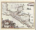
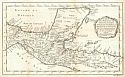
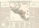
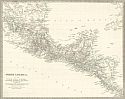
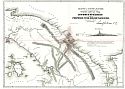
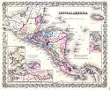
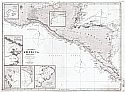
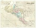
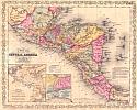
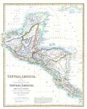
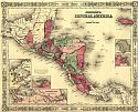
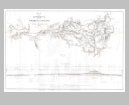
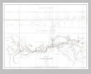
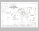
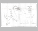
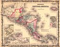
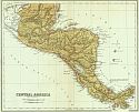
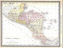
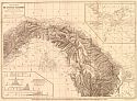
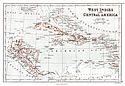
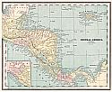
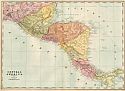
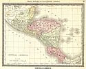
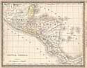
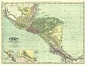
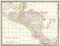
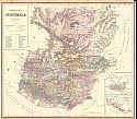
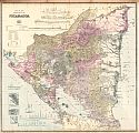
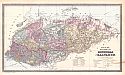
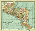
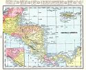
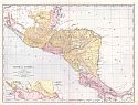
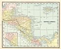
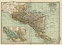
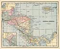
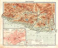
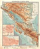
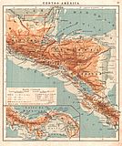
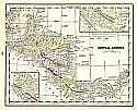
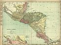
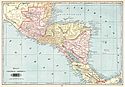
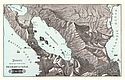
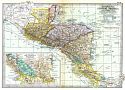
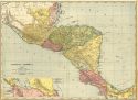
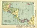
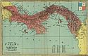
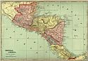
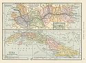
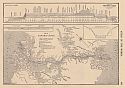
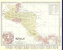
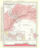
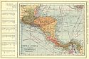
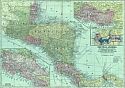
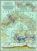
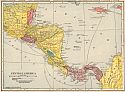
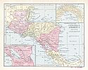
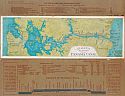
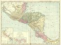
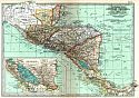
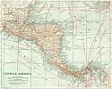
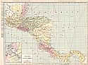
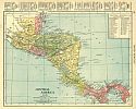
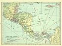
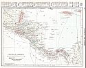
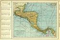
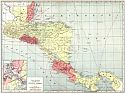
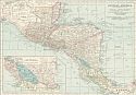
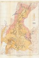
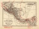
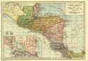
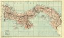
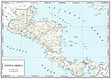
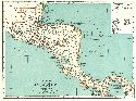
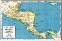
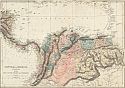
Central America, comprising Mexico, Guatemala, Honduras, San Salvador, Nicaragua and Colombia
Publication Info:   Chicago: H.H. Hardesty, 1875; from The Historical Atlas of the World Illustrated
Date:   1875
Scale:   1:5,702,400
Original Source:   Courtesy of Murray Hudson, Halls, Tennessee
 
North
Viewing options:
 
South
Viewing options:


  Main Author:   Rand McNally and Company
  Title/Description:   Central America
  Publication Info:   Chicago, Rand McNally and Company, 1881; from New Indexed Business Atlas and Shippers Guide
  Date:   1881
  Scale:   1:5,068,800
  Original Source:   University of Alabama Map Library
Viewing options:


  Main Author:   Hardesty, H.H.
  Title/Description:   Map of Central America
  Publication Info:   New York: H.H. Hardesty and Company, 1883; from The Historical and Geographical Encyclopedia
  Date:   1883
  Scale:   1:4,752,000
  Original Source:   Courtesy of Murray Hudson, Halls, Tennessee
Viewing options:


  Main Author:   Rand McNally and Company
  Title/Description:   Central America
  Publication Info:   Chicago: Rand McNally and Company, 1884; from The Indexed Atlas of the World
  Date:   1884
  Scale:   1:6,360,000
  Original Source:   From the personal collection of Dr. Gerald Webster
Viewing options:


  Main Author:   Wyse, Lucien N.B.
  Title/Description:   Carte Generale De L'Isthme Columbien
  Publication Info:   New York: Science, 1886; Map of Central America, Showing the Interoceanic Routes Recommended by the French Commission Under Commander L.N.B. Wyse
  Date:   1886
  Scale:   1:500,000
  Original Source:   Courtesy of Murray Hudson, Halls, Tennessee
Viewing options:


  Main Author:   Butler, George
  Title/Description:   West Indies and Central America
  Publication Info:   London: Longmans, Green, and Company, 1886; from the Public Schools Atlas of Modern Geography
  Date:   1886
  Scale:   1:15,684,400
  Original Source:   University of Alabama Map Library
Viewing options:


  Main Author:   Cram, George
  Title/Description:   Central America
  Publication Info:   Chicago: George F. Cram, 1887; from The Unrivaled Atlas of the World
  Date:   1887
  Scale:   1:6,336,000
  Original Source:   University of Alabama Map Library
Viewing options:


  Main Author:   Cram, George F.
  Title/Description:   Central America
  Publication Info:   Chicago: George F. Cram, 1887; from The Bankers and Brokers Railroad Atlas
  Date:   1887
  Scale:   1:3,294,720
  Original Source:   Courtesy of Murray Hudson, Halls, Tennessee
Viewing options:


  Main Author:   Rand McNally and Company
  Title/Description:   Central America
  Publication Info:   Chicago: Rand McNally and Company, 1889; from The Enlarged Business Atlas and Shippers Guide
  Date:   1889
  Scale:   1:4,878,720
  Original Source:   Courtesy of Murray Hudson, Halls, Tennessee
Viewing options:


  Main Author:   Rand McNally and Company
  Title/Description:   Central America
  Publication Info:   Chicago: Rand McNally and Company, 1890; from The Family Atlas of the World
  Date:   1890
  Scale:   1:5,069,000
  Original Source:   University of Alabama Map Library
Viewing options:


  Main Author:   Cram, George F.
  Title/Description:   Central America
  Publication Info:   Rochester: W.H. Stewart, c. 1890; from Cram's Unrivaled Atlas of the World
  Date:   1890
  Scale:   1:6,336,000
  Original Source:   Courtesy of Murray Hudson, Halls, Tennessee
Viewing options:


  Main Author:   Rand McNally and Company
  Title/Description:   Map of Central America
  Publication Info:   Chicago: Rand McNally and Company, 1892; from The Indexed Atlas of the World
  Date:   1892
  Scale:   1:2,534,400
  Original Source:   Courtesy of Murray Hudson, Halls, Tennessee
Viewing options:


  Main Author:   Fisk and Company
  Title/Description:   Central America Comprising Guatemala, Honduras San Salvador, Nicaragua and Costa Rica
  Publication Info:   New York: Hunt and Eaton, c.1893; from The Columbian Atlas of the World We Live In
  Date:   1893
  Scale:   1:4,752,000
  Original Source:   Courtesy of Murray Hudson, Halls, Tennessee
Viewing options:


  Main Author:   Rand McNally and Company
  Title/Description:   Central America
  Publication Info:   Chicago: Rand McNally and Company, 1893; from The Universal Atlas of the World
  Date:   1893
  Scale:   1:4,993,000
  Original Source:   University of Alabama Map Library
Viewing options:


  Main Author:   Bradley, William M.
  Title/Description:   Commercial Map of Guatemala
  Publication Info:   New York: John E. Potter and Company,1894; from Potter Bradley Atlas of the World
  Date:   1894
  Scale:   1:1,125,000
  Original Source:   University of Alabama Map Library
Viewing options:


  Main Author:   Bradley, William M.
  Title/Description:   Map of the Republic of Nicaragua
  Publication Info:   New York: John E. Potter and Company,1894; from Potter Bradley Atlas of the World
  Date:   1894
  Scale:   1:1,125,000
  Original Source:   University of Alabama Map Library
Viewing options:


  Main Author:   Bradley, William M.
  Title/Description:   Map of the Republics of Honduras and Salvador
  Publication Info:   New York: John E. Potter and Company,1894; from Potter Bradley Atlas of the World
  Date:   1894
  Scale:   1:1,774,000
  Original Source:   University of Alabama Map Library
Viewing options:


  Main Author:   Bradley, William M.
  Title/Description:   Map of the Republic of Costa Rica
  Publication Info:   New York: John E. Potter and Company,1894; from Potter Bradley Atlas of the World
  Date:   1894
  Scale:   1:6,333,000
  Original Source:   University of Alabama Map Library
Viewing options:


  Main Author:   Rand McNally and Company
  Title/Description:   Central America
  Publication Info:   Chicago: Rand McNally and Company, 1894; from Rand McNally and Company's Encyclopedia and Gazetteer
  Date:   1894
  Scale:   4,752,000
  Original Source:   University of Alabama Map Library
Viewing options:


  Main Author:   Cram, George F.
  Title/Description:   Birds Eye View of the Maritime Canal of Nicaragua
  Publication Info:   Chicago: George F. Cram, 1896
  Date:   1896
  Scale:   not indicated
  Original Source:   Courtesy of Murray Hudson, Halls, Tennessee
Viewing options:


  Main Author:   Smith, H.S.
  Title/Description:   Central America
  Publication Info:   Philadelphia: Historical Publishing Company, 1896; from The Historical Atlas
  Date:   1896
  Scale:   1:4,435,200
  Original Source:  

University of Alabama Map Library

Viewing options:


  Main Author:   Cram, George F.
  Title/Description:   Central America
  Publication Info:   Chicago: George F. Cram, 1898; from The Universal Atlas, Geographical, Astronomical and Historical
  Date:   1898
  Scale:   1:6,246,000
  Original Source:   Courtesy of Adams Antiques, Northport, Alabama
Viewing options:


  Main Author:   Rand McNally and Company
  Title/Description:   Central America
  Publication Info:   Chicago: Rand McNally and Company, c. 1898; from Indexed Atlas of the World
  Date:   1898
  Scale:   1:2,534,400
  Original Source:   Amelia Gayle Gorgas Library
Viewing options:


  Main Author:   Cram, George F.
  Title/Description:   Central America
  Publication Info:   Chicago: George F. Cram, 1899
  Date:   1899
  Scale:   1:6,116,000
  Original Source:   Courtesy of Murray Hudson, Halls, Tennessee
Viewing options:


  Main Author:   Smith, Benjamin E.
  Title/Description:   Central America
  Publication Info:   New York: The Century Company, 1899; from The Century Atlas of the World
  Date:   1899
  Scale:   1:4,435,200
  Original Source:   University of Alabama Map Library
Viewing options:


  Main Author:   Servoss, R.D.
  Title/Description:   Central America
  Publication Info:   New York: The Snow-Church Surety Company, 1900; from The Legal and Banking Year Book
  Date:   1900
  Scale:   1:7,920,000
  Original Source:   Courtesy of Murray Hudson, Halls, Tennessee
Viewing options:


  Main Author:  
  Title/Description:   Salvador
  Publication Info:   Barcelona: Editorial FTD, 1900; from Atlas Universal 4 Especial de la America Central
  Date:   1900
  Scale:   1:1,000,000
  Original Source:   University of Alabama Map Library
Viewing options:


  Main Author:  
  Title/Description:   Nicaragua y Costa Rica
  Publication Info:   Barcelona: Editorial FTD, 1900; from Atlas Universal 4 Especial de la America Central
  Date:   1900
  Scale:   1:2,400,000
  Original Source:   University of Alabama Map Library
Viewing options:


  Main Author:  
  Title/Description:   Centro America
  Publication Info:   Barcelona: Editorial FTD, 1900; from Atlas Universal 4 Especial de la America Central
  Date:   1900
  Scale:   1:5,000,000
  Original Source:   University of Alabama Map Library
Viewing options:


  Main Author:   Cram, George F.
  Title/Description:   Central America
  Publication Info:   Chicago: The Fort Dearborn Publishing Company, 1901; from The National Standard Family and Business Atlas of the World
  Date:   1901
  Scale:   1:3,104,640
  Original Source:   Courtesy of Murray Hudson, Halls, Tennessee
Viewing options:


  Main Author:   Rand McNally and Company
  Title/Description:   Central America
  Publication Info:   Chicago: Rand McNally and Company, 1901; from The Enlarged Business Atlas and Shippers Guide
  Date:   1901
  Scale:   1:2,471,040
  Original Source:   Courtesy of Murray Hudson, Halls, Tennessee
Viewing options:


  Main Author:   Tunison, Henry Cuthbert
  Title/Description:   Central America
  Publication Info:   New York: H.C. Tunison, 1901; from Tunison's Atlas, Encyclopædia, Gazetteer, and Portfolio of Our Universe, Globe, and Nation
  Date:   1901
  Scale:   1:3,326,400
  Original Source:   University of Alabama Map Library
Viewing options:


  Main Author:   Tunison, Henry Cuthbert
  Title/Description:   Birds-Eye View of the Nicaragua Canal
  Publication Info:   New York: H.C. Tunison, 1901; from Tunison's Atlas, Encyclopædia, Gazetteer, and Portfolio of Our Universe, Globe, and Nation
  Date:   1901
  Scale:   Oblique
  Original Source:   University of Alabama Map Library
Viewing options:


  Main Author:   The Century Company
  Title/Description:   Central America
  Publication Info:   Buffalo: The Matthews-Northrup, Company, 1902; from the 1902 edition of The Century Atlas.
  Date:   1902
  Scale:   1:4,435,000
  Original Source:   From the personal collection of Dr. Robert Burckhalter
Viewing options:


  Main Author:    
  Title/Description:   Panama Canal
  Publication Info:   Washington: E.J. Beverstock, 1903
  Date:   1903
  Scale:    
  Original Source:   Geological Survey of Alabama
Viewing options:


  Main Author:   Cram, George F.
  Title/Description:   Central America
  Publication Info:   Philadelphia: The Philadelphia Inquirer, 1903; from Pictorial Atlas of the Greater United States and the World
  Date:   1903
  Scale:   1:3,168,000
  Original Source:   University of Alabama Map Library
Viewing options:


  Main Author:   Harden, Oliver B.
  Title/Description:   Map Showing Location of Panama Canal
  Publication Info:   Washington: National Geographic Society, 1905
  Date:   1905
  Scale:   1:100,000
  Original Source:   Geological Survey of Alabama
Viewing options:


  Main Author:   Rand McNally and Company
  Title/Description:   Central America
  Publication Info:   Chicago: Rand McNally and Company, 1905; from Indexed Atlas of the World
  Date:   1905
  Scale:   1:2,471,040
  Original Source:   University of Alabama Map Library
Viewing options:


  Main Author:   Rand McNally and Company
  Title/Description:   Profile of Panama Canal
  Publication Info:   Chicago: Rand McNally and Company, 1905; from Indexed Atlas of the World
  Date:   1905
  Scale:   1:633,600
  Original Source:   University of Alabama Map Library
Viewing options:


  Main Author:   C.S. Hammond and Company
  Title/Description:   Central America
  Publication Info:   New York: C.S. Hammond and Company, 1906; from The Pictorial Atlas of the World
  Date:   1906
  Scale:   1:8,236,800
  Original Source:   Courtesy of Murray Hudson, Halls, Tennessee
Viewing options:


  Main Author:   C.S. Hammond and Company
  Title/Description:   Panama
  Publication Info:   New York: C.S. Hammond and Company, 1906; from The Pictorial Atlas of the World
  Date:   1906
  Scale:   1:3,484,800
  Original Source:   Courtesy of Murray Hudson, Halls, Tennessee
Viewing options:


  Main Author:   Cram, George F.
  Title/Description:   Republic of Panama
  Publication Info:   Chicago: George F. Cram, 1907; from The Standard American Atlas
  Date:   1907
  Scale:   1:1,584,000
  Original Source:   University of Alabama Map Library
Viewing options:


  Main Author:   Cram, George F.
  Title/Description:   Central America
  Publication Info:   Chicago: George F. Cram, 1907; from The Standard American Atlas
  Date:   1907
  Scale:   1:3,294,720
  Original Source:   University of Alabama Map Library
Viewing options:


  Main Author:   Hammond, C.S.
  Title/Description:   United States Canal Zone and Cuba
  Publication Info:   New York: C.S. Hammond & Co., 1908; from Hammond's Handy Atlas of the World
  Date:   1908
  Scale:   Various
  Original Source:   Courtesy of Murray Hudson, Halls, Tennessee
Viewing options:


  Main Author:   Hammond, C.S.
  Title/Description:   Panama Canal
  Publication Info:   New York: C.S. Hammond & Co., 1908; from Hammond's Handy Atlas of the World
  Date:   1908
  Scale:   1:452,570
  Original Source:   Courtesy of Murray Hudson, Halls, Tennessee
Viewing options:


  Main Author:   Rand McNally and Company
  Title/Description:   Central America
  Publication Info:   Chicago, Rand McNally and Company, 1908; from The New Ideal State and County Survey and Atlas
  Date:   1908
  Scale:   1:5,575,680
  Original Source:   University of Alabama Map Library
Viewing options:


  Main Author:   Rand McNally and Company
  Title/Description:   Isthmus of Panama, Showing Panama Canal
  Publication Info:   Chicago, Rand McNally and Company, 1908; from The New Ideal State and County Survey and Atlas
  Date:   1908
  Scale:   1:633,600
  Original Source:   University of Alabama Map Library
Viewing options:


  Main Author:   Patten, William and J.E. Homas
  Title/Description:   Central America
  Publication Info:   New York: P.F. Collier and Son, 1909; from The New Encyclopedic Atlas and Gazetteer of the World
  Date:   1909
  Scale:   1:6,842,880
  Original Source:   University of Alabama Map Library
Viewing options:


  Main Author:   Patten, William and J.E. Homas
  Title/Description:   Map of Panama Canal
  Publication Info:   New York: P.F. Collier and Son, 1909; from The New Encyclopedic Atlas and Gazetteer of the World
  Date:   1909
  Scale:   1:380,160
  Original Source:   University of Alabama Map Library
Viewing options:


  Main Author:   Cram, George F.
  Title/Description:   Central America
  Publication Info:   Chicago: George F. Cram, 1909; from The Heart of Our Country
  Date:   1909
  Scale:   1:3,484,500
  Original Source:   Courtesy of Murray Hudson, Halls, Tennessee
Viewing options:


  Main Author:   Cram, George F.
  Title/Description:   The Republic of Panama and the U.S. Isthmian Canal Zone
  Publication Info:   Chicago: George F. Cram, 1909; from The Heart of Our Country
  Date:   1909
  Scale:   1:1,584,000
  Original Source:   Courtesy of Murray Hudson, Halls, Tennessee
Viewing options:


  Main Author:   C.S. Hammond and Company
  Title/Description:   Map of Panama Canal
  Publication Info:   New York: C.S. Hammond and Company, 1910; from The New Reference Atlas of the World
  Date:   1910
  Scale:   1:175,000
  Original Source:   University of Alabama Map Library
Viewing options:


  Main Author:   Rand McNally and Company
  Title/Description:   Isthmus of Panama (Showing Panama Canal)
  Publication Info:   Chicago: Rand McNally and Company, 1911; from The Indexed Atlas
  Date:   1911
  Scale:   1:633,600
  Original Source:   Courtesy of Murray Hudson, Halls, Tennessee
Viewing options:


  Main Author:   C.S. Hammond and Company
  Title/Description:   Central America
  Publication Info:   New York: C.S. Hammond and Company, 1911; from The Modern Atlas of the World
  Date:   1911
  Scale:   1:7,920,000
  Original Source:   Courtesy of Murray Hudson, Halls, Tennessee
Viewing options:


  Main Author:   Ravenstein, E.G.
  Title/Description:   Central America
  Publication Info:   Chicago: The Reilly and Britton Company, 1911; from The New Census Atlas of the World
  Date:   1911
  Scale:   1:6,969,600
  Original Source:   University of Alabama Map Library
Viewing options:


  Main Author:   Gray, C.P.
  Title/Description:   AeroView of the Panama Canal
  Publication Info:   New York: C.P. Gray, 1912
  Date:   1912
  Scale:   1:250,000
  Original Source:   Courtesy of Murray Hudson, Halls, Tennessee
Viewing options:


  Main Author:   Rand McNally and Company
  Title/Description:   Central America
  Publication Info:   Chicago: Rand McNally and Company, 1912; from The Commercial Atlas of America
  Date:   1912
  Scale:   1:2,471,040
  Original Source:   Courtesy of Murray Hudson, Halls, Tennessee
Viewing options:


  Main Author:   The Century Company
  Title/Description:   Central America
  Publication Info:   New York: The Century Company, 1913; from The Century Atlas of the World
  Date:   1913
  Scale:   1:4,435,200
  Original Source:   University of Alabama Map Library
Viewing options:


  Main Author:   The Century Company
  Title/Description:   Panama Canal Zone
  Publication Info:   New York: The Century Company, 1913; from The Century Atlas of the World
  Date:   1913
  Scale:   Various
  Original Source:   University of Alabama Map Library
Viewing options:


  Main Author:   Reynolds, Francis J.
  Title/Description:   Central America
  Publication Info:   New York: P.F. Collier and Son, 1914; from the New Encyclopedic Atlas and Gazetteer of the World
  Date:   1914
  Scale:   1:6,969,600
  Original Source:   Courtesy of Murray Hudson, Halls, Tennessee
Viewing options:


  Main Author:   Reynolds, Francis J.
  Title/Description:   Isthmian Canal Commision map showing Isthmus with completed canal
  Publication Info:   New York: P.F. Collier and Son, 1914; from the New Encyclopedic Atlas and Gazetteer of the World
  Date:   1914
  Scale:   1:316,800
  Original Source:   Courtesy of Murray Hudson, Halls, Tennessee
Viewing options:


  Main Author:   Rand McNally and Company
  Title/Description:   Panama
  Publication Info:   Chicago: Rand McNally and Company, 1914; from Atlas of Foreign Countries
  Date:   1914
  Scale:   1:1,045,440
  Original Source:   University of Alabama Map Library
Viewing options:


  Main Author:   Rand McNally and Company
  Title/Description:   Standard Map of Central America
  Publication Info:   Chicago: Rand McNally and Company, 1915; from The Commercial Atlas of America
  Date:   1915
  Scale:   1:2,648,000
  Original Source:   Courtesy of Murray Hudson, Halls, Tennessee
Viewing options:


  Main Author:   Dubois, William
  Title/Description:   The Panama Canal
  Publication Info:   Chicago: George F. Cram, c.1915
  Date:   1915
  Scale:   1:467,000
  Original Source:   Courtesy of Murray Hudson, Halls, Tennessee
Viewing options:


  Main Author:   Rand McNally and Company
  Title/Description:   Isthmus of Panama
  Publication Info:   Chicago: Rand McNally and Company, 1915; from Library Atlas of the World
  Date:   1915
  Scale:   1:633,600
  Original Source:   Courtesy of Murray Hudson, Halls, Tennessee
Viewing options:


  Main Author:   Rand McNally and Company
  Title/Description:   Central America
  Publication Info:   Chicago: Rand McNally and Company, 1916; from The Ideal Atlas of the World
  Date:   1916
  Scale:   1:5,575,680
  Original Source:   Courtesy of Murray Hudson, Halls, Tennessee
Viewing options:


  Main Author:   C.S. Hammond and Company
  Title/Description:   Central America
  Publication Info:   New York: C.S. Hammond and Company, 1917; from The New Universal Atlas of the World
  Date:   1917
  Scale:   1:7,920,000
  Original Source:   Courtesy of Murray Hudson, Halls, Tennessee
Viewing options:


  Main Author:   C.S. Hammond and Company
  Title/Description:   Central America
  Publication Info:   New York: C.S. Hammond and Company, 1918; from Hammonds Pictorial Atlas of the World
  Date:   1918
  Scale:   1:7,920,000
  Original Source:   University of Alabama Map Library
Viewing options:


  Main Author:   Reynolds, Francis J.
  Title/Description:   Central America
  Publication Info:   New York: P.F. Collier and Son Company, 1920; from The New World Atlas and Gazetteer
  Date:   1920
  Scale:   1:8,553,600
  Original Source:   Courtesy of Murray Hudson, Halls, Tennessee
Viewing options:


  Main Author:   Reynolds, Francis J.
  Title/Description:   Panama Canal Zone
  Publication Info:   New York: P.F. Collier and Son Company, 1920; from The New World Atlas and Gazetteer
  Date:   1920
  Scale:   1:506,880
  Original Source:   Courtesy of Murray Hudson, Halls, Tennessee
Viewing options:


  Main Author:   Cram, George F.
  Title/Description:   Panama Canal
  Publication Info:   Chicago: James R. Gray and Company, 1920; from Cram's Unrivaled Atlas of the World
  Date:   1920
  Scale:   1:253,440
  Original Source:   Courtesy of Murray Hudson, Halls, Tennessee
Viewing options:


  Main Author:   Rand McNally and Company
  Title/Description:   Panama
  Publication Info:   Chicago: Rand McNally and Company; from The Commercial Atlas of America
  Date:   1921
  Scale:   1:1,045,440
  Original Source:   University of Alabama Map Library
Viewing options:


  Main Author:   Rand McNally and Company
  Title/Description:   Central America
  Publication Info:   Chicago: Rand McNally and Company; from The Commercial Atlas of America
  Date:   1921
  Scale:   1:2,648,448
  Original Source:   University of Alabama Map Library
Viewing options:


  Main Author:   C.S. Hammond and Company
  Title/Description:   Central America
  Publication Info:   New York: C.S. Hammond and Company, 1922; from the New World Loose Leaf Atlas
  Date:   1922
  Scale:   1:4,435,200
  Original Source:   Courtesy of Murray Hudson, Halls, Tennessee
Viewing options:


  Main Author:   C.S. Hammond and Company
  Title/Description:   Panama
  Publication Info:   New York: C.S. Hammond and Company, 1922; from the New World Loose Leaf Atlas
  Date:   1922
  Scale:   1:1,457,280
  Original Source:   Courtesy of Murray Hudson, Halls, Tennessee
Viewing options:


  Main Author:   C.S. Hammond and Company
  Title/Description:   Map of the United States Canal Zone
  Publication Info:   New York: C.S. Hammond and Company, 1922; from the New World Loose Leaf Atlas
  Date:   1922
  Scale:   1:190,080
  Original Source:   Courtesy of Murray Hudson, Halls, Tennessee
Viewing options:


  Main Author:   Funk and Wagnalls Company
  Title/Description:   Central America
  Publication Info:   New York: Funk and Wagnalls Company, 1923; from Atlas of the World and Gazetteer
  Date:   1923
  Scale:   1:12,672,000
  Original Source:   University of Alabama Map Library
Viewing options:


  Main Author:   Reynolds, Francis J.
  Title/Description:   Central America
  Publication Info:   New York: P.F. Collier and Son Company, 1924; from The New World Atlas and Gazetteer
  Date:   1924
  Scale:   1:6,969,600
  Original Source:   University of Alabama Map Library
Viewing options:


  Main Author:   Reynolds, Francis J.
  Title/Description:   Map Showing Isthmus with Completed Canal
  Publication Info:   New York: P.F. Collier and Son Company, 1924; from The New World Atlas and Gazetteer
  Date:   1924
  Scale:   1:380,160
  Original Source:   University of Alabama Map Library
Viewing options:


  Main Author:   Villegas, Sabas A.
  Title/Description:   Mapa de la Republica de Panama
  Publication Info:   New York: American Geographical Society, 1925
  Date:   1925
  Scale:   1:500,000
  Original Source:   University of Alabama Map Library
Viewing options:


  Main Author:   Rand McNally and Company
  Title/Description:   Central America
  Publication Info:   Chicago: Rand McNally and Company, 1925; from Premier Atlas of the World
  Date:   1925
  Scale:   1:5,575,680
  Original Source:   University of Alabama Map Library
Viewing options:


  Main Author:   Rand McNally and Company
  Title/Description:   Central Zone (Panama)
  Publication Info:   Chicago: Rand McNally and Company, 1925; from Premier Atlas of the World
  Date:   1925
  Scale:   1:538,560
  Original Source:   University of Alabama Map Library
Viewing options:


  Main Author:   U.S. Geological Survey
  Title/Description:   General Geologic Map of the Proposed Madden Reservoir near Alhajuela, Canal Zone
  Publication Info:   Washington: Department of the Interior, U.S. Geological Survey, 1930; Bulletin 821 Plate 5
  Date:   1930
  Scale:   1:40,000
  Original Source:   Geological Survey of Alabama
Viewing options:


  Main Author:   U.S. Geological Survey
  Title/Description:   Geologic Map and Sections of Area in the vicinity of Dam Sites 1 and 5, Canal Zone
  Publication Info:   Washington: Department of the Interior, U.S. Geological Survey, 1930; Bulletin 821 Plate 6
  Date:   1930
  Scale:   1:10,000
  Original Source:   Geological Survey of Alabama
Viewing options:


  Main Author:   C.S. Hammond and Company
  Title/Description:   Airways Map of Central America
  Publication Info:   New York: C.S. Hammond and Company, c. 1930; from The New World Loose Leaf Atlas, Sixth Edition
  Date:   1930
  Scale:   1:12,672,000
  Original Source:   University of Alabama Map Library
Viewing options:


  Main Author:   C.S. Hammond and Company
  Title/Description:   Central America
  Publication Info:   New York: C.S. Hammond and Company, c. 1930; from The New World Loose Leaf Atlas, Sixth Edition
  Date:   1930
  Scale:   1:4,435,000
  Original Source:   University of Alabama Map Library
Viewing options:


  Main Author:   C.S. Hammond and Company
  Title/Description:   Panama
  Publication Info:   New York: C.S. Hammond and Company, c. 1930; from The New World Loose Leaf Atlas, Sixth Edition
  Date:   1930
  Scale:   1:1,457,000
  Original Source:   University of Alabama Map Library
Viewing options:


  Main Author:   C.S. Hammond and Company
  Title/Description:   Map of the United States Canal Zone Showing the Completed Panama Canal
  Publication Info:   New York: C.S. Hammond and Company, c. 1930; from The New World Loose Leaf Atlas, Sixth Edition
  Date:   1930
  Scale:   1:125,000
  Original Source:   University of Alabama Map Library
Viewing options:


  Main Author:   Geographical Publishing Company
  Title/Description:   Central America
  Publication Info:   Chicago: Geographical Publishing Company, 1931; from Commercial Atlas of the World
  Date:   1931
  Scale:   1:3,484,800
  Original Source:   University of Alabama Map Library
Viewing options:


  Main Author:   Rand McNally and Company
  Title/Description:   Popular Map of Central America
  Publication Info:   Chicago: Rand McNally and Company, 1936
  Date:   1936
  Scale:   1:5,576,000
  Original Source:   University of Alabama Map Library
Viewing options:


  Main Author:   Geographical Publishing Company
  Title/Description:   Central America
  Publication Info:   Chicago: Geographical Publishing Company, 1942; from The New International Atlas of the World, War Edition
  Date:   1942
  Scale:   1:9,821,000
  Original Source:   University of Alabama Map Library
Viewing options:


  Main Author:   Instituto Geographico de Costa Rica
  Title/Description:   Mapa de Costa Rica
  Publication Info:   San Jose: Instituto Geographico de Costa Rica, 1956
  Date:   1956
  Scale:   1:750,000
  Original Source:   Geological Survey of Alabama
Viewing options:


  Main Author:   Instituto Geográfico Nacional
  Title/Description:   Mapa General República de Honduras
  Publication Info:   Tegucigalpa: El Instituto Geográfico Nacional, 1976
  Date:   1976
  Scale:   1:1,000,000
  Original Source:   Birmingham Public Library Cartography Collection
Viewing options:


© University of Alabama
To purchase map reproductions, submit a quote request.
Download MrSID Plugin