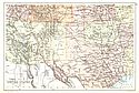
Viewing Options
Main Author:
Buchon, J.A.
Title/Description:
Carte Geographique, Statistique at Historique du Territoire D'Arkansas
Publication Info:
Paris: J.A. Buchon, c.1822
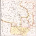
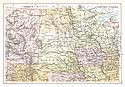
Viewing Options
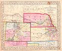
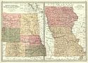
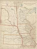
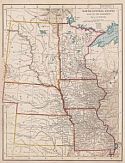
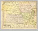
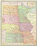
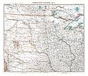
Main Author:
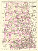
Gamble, William H.
Title/Description:
Map of Kansas, Nebraska, and Colorado. Showing Also the Eastern Portion of Idaho
Publication Info:
Philadelphia: S.A. Mitchell, Jr., c.1861

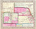
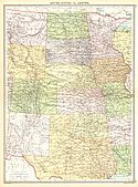
Viewing Options
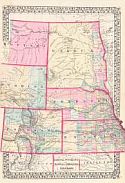
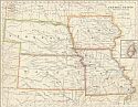
Main Author:
Johnson, A.J.
Title/Description:
Johnson's Nebraska, Dakota, Colorado and Kansas
Publication Info:
New York: Johnson and Ward, 1862; from Johnson's New Illustrated Family Atlas
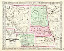
Viewing Options
Main Author:
Johnson, Alvin J.
Title/Description:
Johnson's Nebraska, Dekota, Colorado, Idaho & Kansas
Publication Info:
New York: Johnson and Ward, 1863
Viewing Options
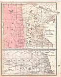
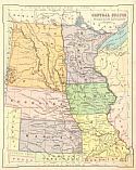
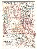
Main Author:
Colton, J.H.
Title/Description:
Minnesota, Nebraska and Kansas
Publication Info:
New York: Ivison, Phinney, Blakeman and Company, 1865; from American School Quarto Georgraphy
Viewing Options
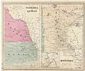
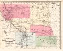
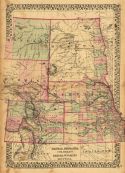
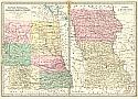
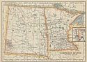
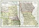
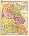
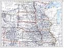
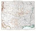
Main Author:
Gamble, William H.
Title/Description:
Map of Kansas, Nebraska, and Colorado. Showing Also the Southern Potion of Dacotah
Publication Info:
Philadelphia: S.A. Mitchell, Jr., c.1867
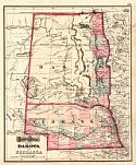
Viewing Options
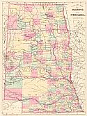
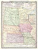
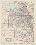
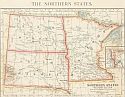
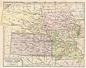
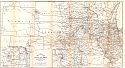
Main Author:
Mitchell, Samuel Augustus, Jr.
Title/Description:
County Map of Dakota, Wyoming, Kansas, Nebraska, and Colorado
Publication Info:
Philadelphia: S.A. Mitchell, Jr., 1870
Viewing Options
Main Author:
McNally, Francis
Title/Description:
Nebraska, Kansas, Dakota, Colorado and Montana
Publication Info:
New York: A.S. Barnes and Company, c.1870
Viewing Options
Main Author:
S. Augustus Mitchell
Title/Description:
Minnesota and Dakota, Nebraska
Publication Info:
Philadelphia: E.H. Butler and Company, 1870; from Mitchell's New School Atlas
Viewing Options
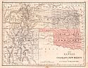
Main Author:
S. Augustus Mitchell
Title/Description:
Kansas, Colorado, New Mexico and Indian Territory
Publication Info:
Philadelphia: E.H. Butler and Company, 1870; from Mitchell's New School Atlas
Viewing Options
Main Author:
Hayden, F.V.
Title/Description:
Map of Nebraska and Dakota
Publication Info:
Washington: U.S. House of Representatives, 42nd Congress, 1st Sess., Ex. Do. No. 19, 1872; from Final Report of the U.S. Geological Survey of Nebraska
Viewing Options
Title/Description:
Dakota and Nebraska
Publication Info:
Philadelphia: Stedman, Brown and Lyon, 1873; from Gray's Atlas of the World, Accompanied by Descriptions Geographical, Historical, Scientific and Statistical
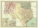
Viewing Options
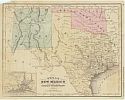
Main Author:
Bartholomew, John
Title/Description:
Texas, New Mexico and Indian Territory
Publication Info:
Philadelphia: T. Ellwood Zell, 1873; from A Discriptive Hand Atlas of the World
Viewing Options
Main Author:
Bartholomew, John
Title/Description:
Kansas, Nebraska, Colorado, Dakota, Wyoming and part of Montana: Iowa and Missouri
Publication Info:
Philadelphia: T. Ellwood Zell, 1873; from A Discriptive Hand Atlas of the World
Viewing Options
Main Author:
McNally, Francis
Title/Description:
Texas, New Mexico and Indian Territory
Publication Info:
Chicago: A.S. Barnes and Company, 1873; from An Improved System of Geography
Viewing Options
Main Author:
Mitchell, S. Augustus
Title/Description:
County Map of Kansas, Nebraska, Colorado, Dakota, Wyoming, Montana
Publication Info:
Philadelphia: S. A. Mitchell,1873; from Mitchell's New General Atlas
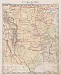
Viewing Options
Title/Description:
United States, Western Part
Publication Info:
New York: Scribner, Armstrong and Company, c. 1874; from Guyot's Intermediate Geography
Viewing Options
Main Author:
von Steinwehr, A., D.G. Brinton
Title/Description:
North Central States West of the Mississippi
Publication Info:
Cincinatti: Van Antwerp, Bragg and Company, 1877; from An Intermediate Geography with Lessons in Map Drawing
Viewing Options
Main Author:
Swinton, William
Title/Description:
Central States Western Division
Publication Info:
New York: Ivison, Blakeman, Taylor & Co., 1881
Viewing Options
Main Author:
Bartholomew, John
Title/Description:
Kansas, Nebraska, Colorado, Dakota, Wyoming, and Part of Montana, with Manitoba - Iowa & Missouri
Publication Info:
Philadelphia: T. Ellwood Zell, Davis & Co., 1881
Viewing Options
Main Author:
Bradley & Co.
Title/Description:
County Map of Dakota and Nebraska
Publication Info:
Philadelphia: Bradley & Co., 1881; small map from an encyclopedia
Viewing Options
Main Author:
von Steinwehr, A.
Title/Description:
North-Central States
Publication Info:
Cincinnati: Von Antwerp, Bragg and Company, 1881; from Eclectic Series, School Geography No. 3
Viewing Options
Title/Description:
Northern States, Western Section
Publication Info:
Cincinnati: Von Antwerp, Bragg and Company, 1883; from The Eclectic Complete Geography
Viewing Options
Main Author:
Ivison, Blakeman, Taylor and Company
Title/Description:
Central States - Western Division
Publication Info:
New York: Ivison, Blakeman, Taylor and Company,1883; from Handy Atlas of the World
Viewing Options
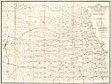
Main Author:
Monteith, James
Title/Description:
North Central States Western Section
Publication Info:
New York: Ivison, Blakeman, Taylor & Co., 1886
Viewing Options
Main Author:
Johnson, Alvin J.
Title/Description:
Map of North and South Dakota and Nebraska
Publication Info:
New York: A.J. Johnson & Co., 1889; Drawn and Engraved on Copper-Plate Expressly for Johnson's Cyclopedia
Viewing Options
Main Author:
U.S. Department of Agriculture
Title/Description:
Map Accompanying Reports of the Artesian Wells Investigation
Publication Info:
Washington: U.S. Department of Agriculture, 1890
Viewing Options
Main Author:
Bartholomew, John
Title/Description:
1. Kansas, Nebraska, Colorado, Dakota, Wyoming and Part of Montana 2. Iowa and Missouri
Publication Info:
London: MacMillan and Co., 1890; from The Library Reference Atlas of the World
Scale:
1. 1:6,336,000
2. 1:3,168,000
Viewing Options
Main Author:
Colton, J.H.
Title/Description:
United States, Section No. 11 (Nebraska, Kansas and Indian Territory)
Publication Info:
New York: Sheldon and Company, 1890; from Colton's Common School Geography
Viewing Options
Main Author:
Colton, J.H.
Title/Description:
United States, Section No. 12 (Dakota and Minnesota)
Publication Info:
New York: Sheldon and Company, 1890; from Colton's Common School Geography
Viewing Options
Main Author:
Appleton, D.
Title/Description:
Central and North Central States - Western Division
Publication Info:
New York: D. Appleton and Company, c. 1891; from Appleton's Standard Higher Geography
Viewing Options
Main Author:
Swinton, William
Title/Description:
Nebraska, Dakota, Wyoming, E. Montana
Publication Info:
New York: Ivison, Blakeman and Company, 1892; from A Complete Course in Geography
Viewing Options
Main Author:
Swinton, William
Title/Description:
Texas, Kansas, S. Nebraska, Colorado, New Mexico, Indian Territory
Publication Info:
New York: Ivison, Blakeman and Company, 1892; from A Complete Course in Geography
Viewing Options
Title/Description:
Central States, Western Division
Publication Info:
New York: University Publishing Company, 1892; from Manual of Geography
Original Source:
Geological Survey of Alabama
Viewing Options
Title/Description:
The Central States
Publication Info:
New York: American Book Company, 1896; from the Eclectic Complete Geography
Viewing Options
Main Author:
Frye, Alexis Everett
Title/Description:
Central States, Western Section
Publication Info:
Boston: Ginn and Company, 1896; from Frye's Complete Geography
Viewing Options
Title/Description:
Northern States, Western Section
Publication Info:
New York: American Book Company, 1896; from the Eclectic Complete Geography
Viewing Options
Main Author:
Matthews - Northrup Company
Title/Description:
Central States Western Section Plate H.
Publication Info:
New York: American Book Co., 1897
Viewing Options
Main Author:
Johnston, William and Alexander Keith
Title/Description:
United States (N.W. Central)
Publication Info:
Edinburgh: W. and A.K. Johnston, 1897
Viewing Options
Title/Description:
Central States, Western Division
Publication Info:
New York: University Publishing Company, 1901; from Maury's Manual of Geography
Viewing Options
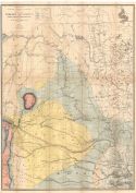
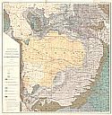
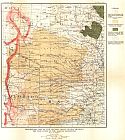
Main Author:
Darton, N.H.
Title/Description:
Preliminary Geologic Map of the Central Great Plains
Publication Info:
Washington: Department of the Interior, U.S. Geological Survey, 1904; Professional Paper No. 32 Pl. XXXV
Viewing Options
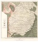
Main Author:
Darton, N.H.
Title/Description:
Preliminary Map Showing Present State of Knowledge relating to Groundwaters in the Central Great Plains
Publication Info:
Washington: Department of the Interior, U.S. Geological Survey, 1904; Professional Paper No. 32 Pl. LXIX
Viewing Options
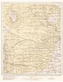
Main Author:
Darton, N.H.
Title/Description:
Preliminary Map of the Central Great Plains Showing the Structure of the Dakota Sandstone
Publication Info:
Washington: U.S. Deparment of the Interior, Geological Survey, 1904
Viewing Options
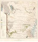
Main Author:
Darton, N.H.
Title/Description:
Preliminary Map of the Central Great Plains Showing Altitude of head of Water in Dakota and Associated Sandstones
Publication Info:
Washington: U.S. Deparment of the Interior, Geological Survey, 1904
Viewing Options
Main Author:
Darton, N.H.
Title/Description:
Preliminary Map of the Central Great Plains Showing the Economic Geology
Publication Info:
Washington: U.S. Deparment of the Interior, Geological Survey, 1904
Viewing Options
Main Author:
Habenicht, H.
Title/Description:
Vereinigte Staaten
Publication Info:
Gotha: Justus Perthes, 1905; from Stielers Hand-Atlas
Viewing Options
Main Author:
Habenicht, H.
Title/Description:
Vereinigte Staaten
Publication Info:
Gotha: Justus Perthes, 1905; from Stielers Hand-Atlas
Viewing Options
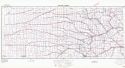
Main Author:
The International Text Book Company
Title/Description:
Railway Mail Service
Publication Info:
Scranton: International Correspondence, Schools, 1908
Viewing Options
Main Author:
The International Text Book Company
Title/Description:
Railway Mail Service
Publication Info:
Scranton: International Correspondence, Schools, 1908
Viewing Options
Main Author:
Bartholomew, J.G.
Title/Description:
United States. Section 3
Publication Info:
New York: Thomas Nelson and Sons, 1908; from The Globe Hand Atlas
Viewing Options
Main Author:
Bartholomew, J.G.
Title/Description:
United States. Section 4
Publication Info:
New York: Thomas Nelson and Sons, 1908; from The Globe Hand Atlas
Viewing Options
Main Author:
U.S. Geological Survey
Title/Description:
Preliminary Map of the Central Great Plains, showing the Structure of the Dakota Sandstone
Publication Info:
Washington: Department of the Interior, U.S. Geological Survey, 1918; Bulletin 691 Plate I
Viewing Options
Main Author:
Philip, George
Title/Description:
United States: IV. Central
Publication Info:
London: George Philip and Son, 1921, from Philip's New Handy General Atlas and Gazetteer
Viewing Options
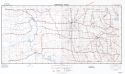
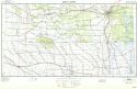
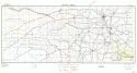
Main Author:
Corps of Engineers, U.S. Army
Title/Description:
Aberdeen
Publication Info:
Washington: Corps of Engineers, U.S. Army, 1940
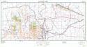
Viewing Options
Main Author:
Corps of Engineers, U.S. Army
Title/Description:
Cheyenne
Publication Info:
Washington: Corps of Engineers, U.S. Army, 1940
Viewing Options
Main Author:
Corps of Engineers, U.S. Army
Publication Info:
Washington: Corps of Engineers, U.S. Army, 1940
Viewing Options
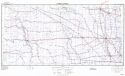
Main Author:
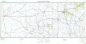
Corps of Engineers, U.S. Army
Title/Description:
Lincoln
Publication Info:
Washington: Corps of Engineers, U.S. Army, 1940
Viewing Options
Main Author:
Corps of Engineers, U.S. Army
Publication Info:
Washington: Corps of Engineers, U.S. Army, 1940
Viewing Options
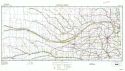
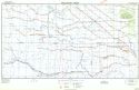
Main Author:
Corps of Engineers, U.S. Army
Title/Description:
Salina
Publication Info:
Washington: Corps of Engineers, U.S. Army, 1940
Viewing Options
Main Author:
Corps of Engineers, U.S. Army
Title/Description:
Sioux City
Publication Info:
Washington: Corps of Engineers, U.S. Army, 1940
Viewing Options
Main Author:
Corps of Engineers, U.S. Army
Publication Info:
Washington: Corps of Engineers, U.S. Army, 1940
Viewing Options
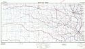
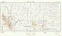
Main Author:
Corps of Engineers, U.S. Army
Title/Description:
Wichita
Publication Info:
Washington: Corps of Engineers, U.S. Army, 1940
Viewing Options
Main Author:
Corps of Engineers, U.S. Army
Title/Description:
Williston
Publication Info:
Washington: Corps of Engineers, U.S. Army, 1940
Viewing Options
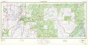
Main Author:
Corps of Engineers, U.S. Army
Title/Description:
Oklahoma City
Publication Info:
Washington: Corps of Engineers, U.S. Army, 1940
Viewing Options
Main Author:
Corps of Engineers, U.S. Army
Title/Description:
Rapid City
Publication Info:
Washington: Corps of Engineers, U.S. Army, 1940

