1851 - 1900
Before 1800
1800-1850
1851-1900
After 1900

Previous Page
Next Page

  Main Author:   Butler, Samuel
  Title/Description:   Hispania Antiqua
  Publication Info:   Philadelphia: Blanchard and Lea, 1851
  Date:   1851
  Scale:   1:5,385,600
  Original Source:   Courtesy of Murray Hudson, Halls, Tennessee
Viewing options:


  Main Author:   Morse, Sidney E.
  Title/Description:   France, Spain and Portugal
  Publication Info:   New York: Harper and Brothers, 1851; from Morse's School Geography
  Date:   1851
  Scale:   1:7,600,000
  Original Source:   University of Alabama Map Library
Viewing options:


  Main Author:   Meyer, Joseph
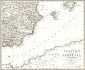
  Title/Description:   Spanien und Portugal
  Publication Info:   Hildburghausen: Bibliographschen Intiituts zu Hildurghausen, 1852; from Meyer's Zeitung Atlas
  Date:   1852
  Scale:   1:4,635,300
  Original Source:   Antique Atlas
Viewing options:


  Main Author:   Society for the Diffusion of Useful Knowledge
  Title/Description:   Ancient Spain and Portugal
  Publication Info:   London: Charles Knight, 1852; from the General Atlas
  Date:   1852
  Scale:   1:3,421,440
  Original Source:   Courtesy of Murray Hudson, Halls, Tennessee
Viewing options:


  Main Author:   Society for the Diffusion of Useful Knowledge
  Title/Description:   Spain and Portugal
  Publication Info:   London: Charles Knight, 1852; from the General Atlas
  Date:   1852
  Scale:   1:3,421,440
  Original Source:   Courtesy of Murray Hudson, Halls, Tennessee
Viewing options:


  Main Author:   Society for the Diffusion of Useful Knowledge
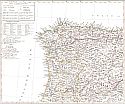
  Title/Description:   Spain I (Northwest)
  Publication Info:   London: Charles Knight, 1852; from the General Atlas
  Date:   1852
  Scale:   1:1,774,080
  Original Source:   Courtesy of Murray Hudson, Halls, Tennessee
Viewing options:


  Main Author:   Society for the Diffusion of Useful Knowledge
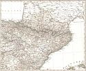
  Title/Description:   Spain II (Northeast)
  Publication Info:   London: Charles Knight, 1852; from the General Atlas
  Date:   1852
  Scale:   1:1,774,080
  Original Source:   Courtesy of Murray Hudson, Halls, Tennessee
Viewing options:


  Main Author:   Society for the Diffusion of Useful Knowledge
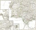
  Title/Description:   Spain III (Southern)
  Publication Info:   London: Charles Knight, 1852; from the General Atlas
  Date:   1852
  Scale:   1:1,774,080
  Original Source:   Courtesy of Murray Hudson, Halls, Tennessee
Viewing options:


  Main Author:   Society for the Diffusion of Useful Knowledge
  Title/Description:   Portugal
  Publication Info:   London: Charles Knight, 1852; from the General Atlas
  Date:   1852
  Scale:   1:1,774,080
  Original Source:   Courtesy of Murray Hudson, Halls, Tennessee
Viewing options:


  Main Author:   Society for the Diffusion of Useful Knowledge
  Title/Description:   Oporto
  Publication Info:   London: Charles Knight, 1852; from the General Atlas
  Date:   1852
  Scale:   1:79,200
  Original Source:   Courtesy of Murray Hudson, Halls, Tennessee
Viewing options:


  Main Author:   Society for the Diffusion of Useful Knowledge
  Title/Description:   Lisbon
  Publication Info:   London: Charles Knight, 1852; from the General Atlas
  Date:   1852
  Scale:   1:14,400
  Original Source:   Courtesy of Murray Hudson, Halls, Tennessee
Viewing options:


  Main Author:   Society for the Diffusion of Useful Knowledge
  Title/Description:   Madrid
  Publication Info:   London: Charles Knight, 1852; from the General Atlas
  Date:   1852
  Scale:   1:11,880
  Original Source:   Courtesy of Murray Hudson, Halls, Tennessee
Viewing options:


  Main Author:   Dufour, A.H. and T. Duvotenay
  Title/Description:   España Romana
  Publication Info:   Madrid: Gaspar y Roig, 1852; from El Globo, Atlas Historico Universal de Geografica
  Date:   1852
  Scale:   1:4,928,000
  Original Source:   University of Alabama Map Library
Viewing options:


  Main Author:   Dufour, A.H. and T. Duvotenay
  Title/Description:   España en la Invasión de los Barbaros
  Publication Info:   Madrid: Gaspar y Roig, 1852; from El Globo, Atlas Historico Universal de Geografica
  Date:   1852
  Scale:   1:4,928,000
  Original Source:   University of Alabama Map Library
Viewing options:


  Main Author:   Dufour, A.H. and T. Duvotenay
  Title/Description:   España Arabe
  Publication Info:   Madrid: Gaspar y Roig, 1852; from El Globo, Atlas Historico Universal de Geografica
  Date:   1852
  Scale:   1:4,928,000
  Original Source:   University of Alabama Map Library
Viewing options:


  Main Author:   Dufour, A.H. and T. Duvotenay
  Title/Description:   España y Portugal
  Publication Info:   Madrid: Gaspar y Roig, 1852; from El Globo, Atlas Historico Universal de Geografica
  Date:   1852
  Scale:   1:5,544,000
  Original Source:   University of Alabama Map Library
Viewing options:


  Main Author:   Black, Adam and Charles
  Title/Description:   Spain and Portugal
  Publication Info:   Edinburgh: A and C Adams, 1854; from the General Atlas of the World by Hall and Hughes
  Date:   1854
  Scale:   1:2,534,000
  Original Source:   Courtesy of Adams Antiques, Northport, Alabama
Viewing options:


  Main Author:   Sydow, E. von
  Title/Description:   Spanien und Portugal
  Publication Info:   Gotha: Justus Perthes, 1855; from E. von Sydow's Schul-Atlas in Acht und Dreissig Karten
  Date:   1855
  Scale:   1:6,336,000
  Original Source:   University of Alabama Map Library
Viewing options:


  Main Author:    
  Title/Description:   Spain and Portugal
  Publication Info:   Philadelphia: Charles Desilver, 1856
  Date:   1856
  Scale:   1:3,000,000
  Original Source:   Courtesy of Adams Antiques, Northport, Alabama
Viewing options:


  Main Author:   Colton, Joseph Hutchins
  Title/Description:   Spain and Portugal
  Publication Info:   New York: J.H. Colton & Co., c.1856
  Date:   1856
  Scale:   1:3,168,000
  Original Source:   Courtesy of Murray Hudson, Halls, Tennessee
Viewing options:


  Main Author:   Stieler, Adolf
  Title/Description:   Spanien und Portugal
  Publication Info:   Gotha: Justus Perthes, 1856; from Stieler's Hand-Atlas
  Date:   1856
  Scale:   1: 3,686,968
  Original Source:   University of Alabama Map Library
Viewing options:


  Main Author:   Dussieux, Louis
  Title/Description:   Hispania
  Publication Info:   Paris: J. Lecoffre et Comp., [1856]; from Atlas General de Geographie
  Date:   1856
  Scale:   1:5,068,800
  Original Source:   University of Alabama Map Library
Viewing options:


  Main Author:   Dussieux, Louis
  Title/Description:   Carte Physique et Politique de L'Espagne et du Portugal
  Publication Info:   Paris: J. Lecoffre et Comp., [1856]; from Atlas General de Geographie
  Date:   1856
  Scale:   1:3,991,680
  Original Source:   University of Alabama Map Library
Viewing options:


  Main Author:   Hughes, William, Edited by George Long
  Title/Description:   Hispania
  Publication Info:   Philadelphia: Blanchard and Lea, 1856; from the An Atlas of Classical Geography
  Date:   1856
  Scale:   1;4,752,000
  Original Source:   Courtesy of Murray Hudson, Halls, Tennessee
Viewing options:


  Main Author:   Bibliographisches Institut
  Title/Description:   Spanien und Portugal
  Publication Info:   Hildburghausen: Bibliographisches Institut, 1850-1860; from Atlas der Geographie
  Date:   1856
  Scale:   1:4,731,217
  Original Source:   University of Alabama Map Library
Viewing options:


  Main Author:   Bibliographisches Institut
  Title/Description:   Portugal und die Azoren
  Publication Info:   Hildburghausen: Bibliographisches Institut, 1850-1860; from Atlas der Geographie
  Date:   1856
  Scale:   1:2,534,400
  Original Source:   University of Alabama Map Library
Viewing options:


  Main Author:   Andriveau-Gujon, J.
  Title/Description:   Espagne et Portugal
  Publication Info:   Paris: J. Andriveau-Goujon, 1857
  Date:   1857
  Scale:   1:2,075,000
  Original Source:   Courtesy of Adams Antiques, Northport, Alabama
Viewing options:


  Main Author:   Morse, Charles W.
  Title/Description:   Spain and Portugal
  Publication Info:   New York: Samuel N. Gaston, 1857; from Morse and Gaston's Diamond Atlas, Eastern Hemisphere
  Date:   1857
  Scale:   1:6,970,000
  Original Source:   University of Alabama Map Library
Viewing options:


  Main Author:   Thiers, Adolphe, Auguste Delfour, Thunot Duvotenay
  Title/Description:   Plan de la bataille navale du Ferrol
  Publication Info:   Paris: Paulin, Lheureux et Cie.,1859; from Atlas de L'Histoire du Consulat et de L'Empire
  Date:   1859
  Scale:  
  Original Source:   University of Alabama Map Library
Viewing options:


  Main Author:   Thiers, Adolphe, Auguste Delfour, Thunot Duvotenay
  Title/Description:   Plan de la bataille de Trafalgar
  Publication Info:   Paris: Paulin, Lheureux et Cie.,1859; from Atlas de L'Histoire du Consulat et de L'Empire
  Date:   1859
  Scale:  
  Original Source:   University of Alabama Map Library
Viewing options:


  Main Author:   Thiers, Adolphe, Auguste Delfour, Thunot Duvotenay
  Title/Description:   Carte générale d'Espagne et de Portugal
  Publication Info:   Paris: Paulin, Lheureux et Cie.,1859; from Atlas de L'Histoire du Consulat et de L'Empire
  Date:   1859
  Scale:   1:2,609,000
  Original Source:   University of Alabama Map Library
Viewing options:


  Main Author:   Thiers, Adolphe, Auguste Delfour, Thunot Duvotenay
  Title/Description:   Carte des environs de Baylen
  Publication Info:   Paris: Paulin, Lheureux et Cie.,1859; from Atlas de L'Histoire du Consulat et de L'Empire
  Date:   1859
  Scale:   1:590,000
  Original Source:   University of Alabama Map Library
Viewing options:


  Main Author:   Thiers, Adolphe, Auguste Delfour, Thunot Duvotenay
  Title/Description:   Plan de Saragosse et de ses environs
  Publication Info:   Paris: Paulin, Lheureux et Cie.,1859; from Atlas de L'Histoire du Consulat et de L'Empire
  Date:   1859
  Scale:   1:39,000
  Original Source:   University of Alabama Map Library
Viewing options:


  Main Author:   Thiers, Adolphe, Auguste Delfour, Thunot Duvotenay
  Title/Description:   Plan du champ de bataille de Talavera
  Publication Info:   Paris: Paulin, Lheureux et Cie.,1859; from Atlas de L'Histoire du Consulat et de L'Empire
  Date:   1859
  Scale:   1:35,000
  Original Source:   University of Alabama Map Library
Viewing options:


  Main Author:   Thiers, Adolphe, Auguste Delfour, Thunot Duvotenay
  Title/Description:   Plans des principales places fortes d'Espagne
  Publication Info:   Paris: Paulin, Lheureux et Cie.,1859; from Atlas de L'Histoire du Consulat et de L'Empire
  Date:   1859
  Scale:   various
  Original Source:   University of Alabama Map Library
Viewing options:


  Main Author:   Thiers, Adolphe, Auguste Delfour, Thunot Duvotenay
  Title/Description:   Carte de la partie du Portugal comprise entre le Douro, l'Oréan et la Guadiana
  Publication Info:   Paris: Paulin, Lheureux et Cie.,1859; from Atlas de L'Histoire du Consulat et de L'Empire
  Date:   1859
  Scale:   1:1,181,000
  Original Source:   University of Alabama Map Library
Viewing options:


  Main Author:   Thiers, Adolphe, Auguste Delfour, Thunot Duvotenay
  Title/Description:   Plan de la baie d'Algésiras
  Publication Info:   Paris: Paulin, Lheureux et Cie.,1859; from Atlas de L'Histoire du Consulat et de L'Empire
  Date:   1859
  Scale:   1:46,800
  Original Source:   University of Alabama Map Library
Viewing options:


  Main Author:   Weller, Edward
  Title/Description:   Spain and Portugal
  Publication Info:   London: Longman and Company, c.1861
  Date:   1861
  Scale:   1:4,435,200
  Original Source:   Courtesy of Murray Hudson, Halls, Tennessee
Viewing options:


  Main Author:   Vuillemin, A and Malte-Brun
  Title/Description:   Espagne Ancienne
  Publication Info:   Paris: Frune, 1861; from Atlas Universal de Géographie Ancienne et Moderne
  Date:   1861
  Scale:   1:3,145,000
  Original Source:   Courtesy of Adams Antiques, Northport, Alabama
Viewing options:


  Main Author:   Vuillemin, A and Malte-Brun
  Title/Description:   Espagne & Portugal
  Publication Info:   Paris: Frune, 1861; from Atlas Universal de Géographie Ancienne et Moderne
  Date:   1861
  Scale:   1:3,145,000
  Original Source:   Courtesy of Adams Antiques, Northport, Alabama
Viewing options:


  Main Author:   Bohn, Henry G.
  Title/Description:   Spain
  Publication Info:   London: Henry G. Bohn, 1862; from A Pictorial Hand-Book of Modern Geography
  Date:   1862
  Scale:   1:14,400,000
  Original Source:   University of Alabama Map Library
Viewing options:


  Main Author:   Bohn, Henry G.
  Title/Description:   Portugal
  Publication Info:   London: Henry G. Bohn, 1862; from A Pictorial Hand-Book of Modern Geography
  Date:   1862
  Scale:   1:5,200,000
  Original Source:   University of Alabama Map Library
Viewing options:


  Main Author:   Weller, Edward
  Title/Description:   Spain and Portugal
  Publication Info:   London: Cassell, Peter and Galpin c.1862; from Cassell's Complete Atlas
  Date:   1862
  Scale:   1:2,977,920
  Original Source:   Courtesy of Murray Hudson, Halls, Tennessee
Viewing options:


Main Author:   Weller, Edward
Title/Description:   Spain and Portugal
Publication Info:   London: Cassell, Peter and Galpin c.1862; from Cassell's Complete Atlas
Date:   1862
Scale:   1:1,584,000
Original Source:   Courtesy of Murray Hudson, Halls, Tennessee
North West Sheet
North East Sheet
Viewing options:
Viewing options:
JPEG or Plugin
JPEG or Plugin
   
South West Sheet
South East Sheet
Viewing options:
Viewing options:
JPEG or Plugin
JPEG or Plugin


  Main Author:   Johnson, Alvin J.
  Title/Description:   Johnson's Spain and Portugal
  Publication Info:   New York: Johnson and Ward, 1863
  Date:   1863
  Scale:   1:3,168,000
  Original Source:   Courtesy of Murray Hudson, Halls, Tennessee
Viewing options:


  Main Author:   Dufour, Adalphe and Thunot Duvotenay
  Title/Description:   Plan de la Bair D' Algesiras
  Publication Info:   Paris: Lheureux et cie, 1864; from Atlas de l'Histoire du Consulat et de l'Empire
  Date:   1864
  Scale:   1:47,000
  Original Source:   Adams Antique
Viewing options:


  Main Author:   Dufour, Adalphe and Thunot Duvotenay
  Title/Description:   Plan de la Bataille de Trafalgar
  Publication Info:   Paris: Lheureux et cie, 1864; from Atlas de l'Histoire du Consulat et de l'Empire
  Date:   1864
  Scale:   Various
  Original Source:   Adams Antiques
Viewing options:


  Main Author:   Dufour, Adalphe and Thunot Duvotenay
  Title/Description:   Carte Generale D'Spagne et de Portugal
  Publication Info:   Paris: Lheureux et cie, 1864; from Atlas de l'Histoire du Consulat et de l'Empire
  Date:   1864
  Scale:   1:2,500,000
  Original Source:   Adams Antiques
Viewing options:


  Main Author:   Dufour, Adalphe and Thunot Duvotenay
  Title/Description:   Carte des environs de Baylen
  Publication Info:   Paris: Lheureux et cie, 1864; from Atlas de l'Histoire du Consulat et de l'Empire
  Date:   1864
  Scale:   1:590,000
  Original Source:   Adams Antiques
Viewing options:


  Main Author:   Dufour, Adalphe and Thunot Duvotenay
  Title/Description:   Plan de Saragosse et de ses environs
  Publication Info:   Paris: Lheureux et cie, 1864; from Atlas de l'Histoire du Consulat et de l'Empire
  Date:   1864
  Scale:   1:39,000
  Original Source:   Adams Antiques
Viewing options:


  Main Author:   Dufour, Adalphe and Thunot Duvotenay
  Title/Description:   Plan du champ de Bataille de Talavera
  Publication Info:   Paris: Lheureux et cie, 1864; from Atlas de l'Histoire du Consulat et de l'Empire
  Date:   1864
  Scale:   1:31,200
  Original Source:   Adams Antiques
Viewing options:


  Main Author:   Dufour, Adalphe and Thunot Duvotenay
  Title/Description:   Plans des Principales Places Fortes D' Espagne
  Publication Info:   Paris: Lheureux et cie, 1864; from Atlas de l'Histoire du Consulat et de l'Empire
  Date:   1864
  Scale:   Various
  Original Source:   Adams Antiques
Viewing options:


  Main Author:   Dufour, Adalphe and Thunot Duvotenay
  Title/Description:   Carte de ala Partie Du Portugal Comprise entre Le Douro, L'Ocean et la Guadian
  Publication Info:   Paris: Lheureux et cie, 1864; from Atlas de l'Histoire du Consulat et de l'Empire
  Date:   1864
  Scale:   1:1,165,000
  Original Source:   Adams Antiques
Viewing options:


  Main Author:   McNally, Francis
  Title/Description:   France, Spain and Portugal
  Publication Info:   New York: A.S. Barnes and Burr, 1865; from An Improved System of Geography
  Date:   1865
  Scale:   1:7,603,200
  Original Source:   Courtesy of Murray Hudson, Halls, Tennessee
Viewing options:


  Main Author:   Hughes, William
  Title/Description:   Hispania
  Publication Info:   New York: Sheldon and Company, 1867; from An Atlas of Classical Geography
  Date:   1867
  Scale:   1: 4,435,000
  Original Source:   University of Alabama Map Library
Viewing options:


  Main Author:    
  Title/Description:   Spain and Portugal
  Publication Info:   Philadelphia: J.B. Lippincott and Co. ,1869; from Atlas to accompany Chambers Encyclopedia
  Date:   1869
  Scale:   1:4,752,000
  Original Source:   Courtesy of Murray Hudson, Halls, Tennessee
Viewing options:


  Main Author:   Bartholomew, John
  Title/Description:   Spain and Portugal
  Publication Info:   Edinburgh: William Collins, Sons and Company, 1870; from The Advanced Atlas
  Date:   1870
  Scale:   1: 4,308,000
  Original Source:   University of Alabama Map Library
Viewing options:


  Main Author:   Stieler, Adolf
  Title/Description:   Spanien und Portugal
  Publication Info:   Gotha: Justus Perthus, 1870; from Hand - Atlas
  Date:   1870
  Scale:   1:3,700,000
  Original Source:   Courtesy of Murray Hudson, Halls, Tennessee
Viewing options:


Main Author:   Stieler, Adolf
Title/Description:   Spanien und Portugal in IV Blattern
Publication Info:   Gotha: Justus Perthus, 1870; from Hand - Atlas
Date:   1870
Scale:   1:1,850,000
Original Source:   Courtesy of Murray Hudson, Halls, Tennessee
Northwest
Northeast
Viewing options:
Viewing options:
JPEG or Plugin
JPEG or Plugin
   
Southwest
Southeast
Viewing options:
Viewing options:
JPEG or Plugin
JPEG or Plugin


  Main Author:   Amthor, Ed. & Wilhelm Issleib
  Title/Description:   Portugal & Spanien
  Publication Info:   Fort Wayne: Siemon Bro & Co., 1870; from Volks-Atlas über alle Theile der Erde für Schule und Haus
  Date:   1870
  Scale:   1:6,120,576
  Original Source:   University of Alabama Map Library
Viewing options:


  Main Author:   Delamarche, Felix
  Title/Description:   Carte Physique et Politique de L'Espagne et du Portugal
  Publication Info:   Paris: c. 1872; from the Atlas Grosselin - Delamarche
  Date:   1872
  Scale:   1:3,800,000
  Original Source:   Courtesy of Murray Hudson, Halls, Tennessee
Viewing options:


  Main Author:   Delamarche, Felix
  Title/Description:   Espagne Ancienne
  Publication Info:   Paris: c. 1872; from the Atlas Grosselin - Delamarche
  Date:   1872
  Scale:   1:3,674,880
  Original Source:   Courtesy of Murray Hudson, Halls, Tennessee
Viewing options:


  Main Author:   H. Lange
  Title/Description:   Spainen und Portugal
  Publication Info:   Braunschweig: Druck und Verlag von George Westermann, 1872; from Dr. H. Lange's Neuer Volksschul - Atlas uber alle Theile der Erde
  Date:   1872
  Scale:   1:6,075,000
  Original Source:   University of Alabama Map Library
Viewing options:


  Main Author:   Jones, Charles H.
  Title/Description:   Spain and Portugal
  Publication Info:  

New York: J. David Williams, 1873; The Peoples Pictorial Atlas

  Date:   1873
  Scale:   1:2,724,480
  Original Source:   Courtesy of Murray Hudson, Halls, Tennessee
Viewing options:


  Main Author:   Bartholomew, John
  Title/Description:   Spain and Portugal
  Publication Info:   Philadelphia: T. Ellwood Zell, 1873; from A Discriptive Hand Atlas of the World
  Date:   1873
  Scale:   1:3,168,000
  Original Source:   University of Alabama Map Library
Viewing options:


  Main Author:   Drioux and Leroy
  Title/Description:   Carte Physique et Politique de L'Espagne et du Portugal
  Publication Info:   Paris: Librairie Classique d'Eugene Belin, 1873; from Atlas Universel et Classique de Geographie
  Date:   1873
  Scale:   1:3,674,800
  Original Source:   Courtesy of Adams Antiques, Northport, Alabama
Viewing options:


  Main Author:   Jones, Charles H. and Theodore F. Hamilton
  Title/Description:   Spain and Portugal
  Publication Info:   Chicago: H.H. Hardesty, 1875; from Historical Atlas of the World Illustrated
  Date:   1875
  Scale:   1:2,977,920
  Original Source:   Courtesy of Murray Hudson, Halls, Tennessee
Viewing options:


  Main Author:   McNally, Francis
  Title/Description:   France, Spain, and Portugal
  Publication Info:   New York: A.S. Barnes and Company, 1876; from An Improved System of Geography
  Date:   1876
  Scale:   1:7,920,000
  Original Source:   University of Alabama Map Library
Viewing options:


  Main Author:   Gray, Ormando W.
  Title/Description:   Spain and Portugal
  Publication Info:   Philadelphia; O.W. Gray and Son, 1876
  Date:   1876
  Scale:   1:3,168,000
  Original Source:   Courtesy of Murray Hudson, Halls, Tennessee
Viewing options:


  Main Author:    
  Title/Description:   Carte Physique et Militaire de la Peninsula
  Publication Info:   Paris: Furne, Jouvet et Compagnie, 1878; from Atlas de Geographie Militaire
  Date:   1878
  Scale:   1:2,685,000
  Original Source:   Adams Antiques
Viewing options:


  Main Author:    
  Title/Description:   Carte des Chemis de Fer de L'Espagne, Portugal
  Publication Info:   Paris: Grandremy and Henon, [1879]
  Date:   1879
  Scale:    
  Original Source:   University of Alabama Map Library
Viewing options:


  Main Author:   Black, Adam and Charles
  Title/Description:   Spain & Portugal
  Publication Info:   Edinburgh: Adam and Charles Black, 1879; from Black's General Atlas of the World, American Edition
  Date:   1879
  Scale:   1:2,534,400
  Original Source:   Courtesy of Murray Hudson, Halls, Tennessee
Viewing options:


  Main Author:   Hughes, W.
  Title/Description:   Spain & Portugal
  Publication Info:   London: George Philip & Son, [c. 1880]
  Date:   1880
  Scale:   1:2,200,000
  Original Source:   Courtesy of Adams Antiques, Northport, Alabama
Viewing options:


  Main Author:   Spruner, Karl and Theodor Menke
  Title/Description:   Iberische Halbinsel zur Zeit des Reichs der Westgothen 531-711 n. Ch.
  Publication Info:   Gotha: Justus Perthes, 1880; from Hand-Atlas für die Geschichte des Mittelatters und die Neueren Zeit
  Date:   1880
  Scale:   1:5,000,000
  Original Source:   University of Alabama Map Library
Viewing options:


  Main Author:   Spruner, Karl and Theodor Menke
  Title/Description:   Iberische Halbinsel von der Ankunft der Araber bis zum Untergange der Omaijaden 711 bis 1028 n. Ch.
  Publication Info:   Gotha: Justus Perthes, 1880; from Hand-Atlas für die Geschichte des Mittelatters und die Neueren Zeit
  Date:   1880
  Scale:   1:3,700,000
  Original Source:   University of Alabama Map Library
Viewing options:


  Main Author:   Spruner, Karl and Theodor Menke
  Title/Description:   Iberische Halbinsel zur Zeit der Herrschaft der Almoraviden und der Almohaden 1086 (1094) bis 1257.
  Publication Info:   Gotha: Justus Perthes, 1880; from Hand-Atlas für die Geschichte des Mittelatters und die Neueren Zeit
  Date:   1880
  Scale:   1:3,700,000
  Original Source:   University of Alabama Map Library
Viewing options:


  Main Author:   Spruner, Karl and Theodor Menke
  Title/Description:   Iberische Habinsel von 1257 bis zur Vereinigung von Castilien u. Aragon 1479, und zum Fall des Königreichs Granada 1492.
  Publication Info:   Gotha: Justus Perthes, 1880; from Hand-Atlas für die Geschichte des Mittelatters und die Neueren Zeit
  Date:   1880
  Scale:   1:3,700,000
  Original Source:   University of Alabama Map Library
Viewing options:


  Main Author:   Spruner, Karl and Theodor Menke
  Title/Description:   Iberische Halbinsel nach ihrer kirchlichen Eintheilung seit der Maurischen Zeit
  Publication Info:   Gotha: Justus Perthes, 1880; from Hand-Atlas für die Geschichte des Mittelatters und die Neueren Zeit
  Date:   1880
  Scale:   1:3,700,000
  Original Source:   University of Alabama Map Library
Viewing options:


  Main Author:   Spruner, Karl and Theodor Menke
  Title/Description:   Iberische Halbinsel seit dem Anfange des XVITEN Jahrhunderts
  Publication Info:   Gotha: Justus Perthes, 1880; from Hand-Atlas für die Geschichte des Mittelatters und die Neueren Zeit
  Date:   1880
  Scale:   1:3,700,000
  Original Source:   University of Alabama Map Library
Viewing options:


  Main Author:   Andree, Richard
  Title/Description:   Spanien und Portugal
  Publication Info:   Leipzig: Verlag von Velhagen and Klasing, 1881; from Allgemeiner Hand atlas
  Date:   1881
  Scale:   1: 3,000,000
  Original Source:   Courtesy of Murray Hudson, Halls, Tennessee
Viewing options:


  Main Author:   Stieler, Adolf
  Title/Description:   Spanien und Portugal
  Publication Info:   Gotha: Justus Perthes, c.1881; from Adolf Stieler's Hand Atlas
  Date:   1881
  Scale:   1:3,700,000
  Original Source:   Courtesy of Murray Hudson, Halls, Tennessee
Viewing options:


Northwest
Viewing options:
 
Northeast
Viewing options:
     
 
Southwest
Viewing options:
 
Southeast
Viewing options:
  Main Author:   Stieler, Adolf 
  Title/Description:   Spanien und Portugal in 4 Blättern
  Publication Info:   Gotha: Justus Perthes, c.1881; from Adolf Stieler's Hand Atlas
  Date:   1881
  Scale:   1:1,500,000
  Original Source:   Courtesy of Murray Hudson, Halls, Tennessee


  Main Author:   Tunison, H.C.
  Title/Description:   Spain and Portugal
  Publication Info:   Jacksonville, IL: H.C. Tunison, 1882; from Tunison's Peerless Universal Atlas of the World
  Date:   1882
  Scale:   1: 4,152,306
  Original Source:   Courtesy of Murray Hudson, Halls, Tennessee
Viewing options:


  Main Author:   Johnston, W. and A.K.
  Title/Description:   Spain and Portugal
  Publication Info:   Edinburgh: W. and A.K. Johnston, 1882; from The World An Atlas
  Date:   1882
  Scale:   1:3,800,000
  Original Source:   University of Alabama Map Library
Viewing options:


  Main Author:    
  Title/Description:   Spain & Portugal
  Publication Info:   Chicago: Rand McNally and Co., 1884; from Rand McNally Indexed Atlas of the World
  Date:   1884
  Scale:   1:3,168,000
  Original Source:   From the personal collection of Dr. Gerald Webster
Viewing options:


  Main Author:    
  Title/Description:   Railway and Statistical Map of Spain and Portugal
  Publication Info:   London: Letts, Son and Company, 1884; from Lett's Complete Popular Atlas
  Date:   1884
  Scale:   1:3,484,800
  Original Source:   Courtesy of Murray Hudson, Halls, Tennessee
Viewing options:


  Main Author:    
  Title/Description:   City of Madrid
  Publication Info:   London: Letts, Son and Company, 1884; from Lett's Complete Popular Atlas
  Date:   1884
  Scale:   1:4,874
  Original Source:   Courtesy of Murray Hudson, Halls, Tennessee
Viewing options:


  Main Author:   Meissas, Achille et Auguste Michelot
  Title/Description:   Espagne et Portugal
  Publication Info:   Paris: Librairie Hachette et Cie., 1884; from Petit Atlas Universel de Geographie
  Date:   1884
  Scale:   1:5,000,000
  Original Source:   University of Alabama Map Library
Viewing options:


  Main Author:   Tunison, Henry Cuthbert
  Title/Description:   Spain and Portugal
  Publication Info:   Jacksonville, IL: H.C. Tunison, 1885
  Date:   1885
  Scale:   1:2,217,600
  Original Source:   Courtesy of Murray Hudson, Halls, Tennessee
Viewing options:


  Main Author:   Monteith, James
  Title/Description:   Spain and Portugal
  Publication Info:   New York: A.S. Barnes and Company, 1885; from Monteith's Independent Course Comprehensive Geography
  Date:   1885
  Scale:   1:8,870,000
  Original Source:   University of Alabama Map Library
Viewing options:


  Main Author:   Gray, Frank A.
  Title/Description:   Gray's New Map of Spain and Portugal
  Publication Info:   Philadelphia: O. W. Gray and Son, 1886; from Gray's National Atlas of 1886
  Date:   1886
  Scale:   1:3,750,000
  Original Source:   University of Alabama Map Library
Viewing options:


  Main Author:   Johnston, Keith
  Title/Description:   Iberia vel Hispania
  Publication Info:   Boston: Ginn and Company, 1886; from Ginn and Company's Classical Atlas
  Date:   1886
  Scale:   1:4,500,000
  Original Source:   Courtesy of Murray Hudson, Halls, Tennessee
Viewing options:


  Main Author:   Butler, George
  Title/Description:   Spain and Portugal
  Publication Info:   London: Longmans, Green, and Company, 1886; from the Public Schools Atlas of Modern Geography
  Date:   1886
  Scale:   1:3,861,000
  Original Source:   University of Alabama Map Library
Viewing options:


  Main Author:   Blackie, Walter Graham
  Title/Description:   Spain and Portugal
  Publication Info:   London: Blackie and Son, 1886; from The Comprehensive Atlas & Geography of the World
  Date:   1886
  Scale:   1:2,597,760
  Original Source:   University of Alabama Map Library
Viewing options:


  Main Author:   Andree, Richard
  Title/Description:   Hispanien
  Publication Info:   Leipzig: Verlag von Velhagen and Klasing, 1886; from Droysens Allgemeiner Historischer Handatlas
  Date:   1886
  Scale:   1:6,000,000
  Original Source:   University of Alabama Map Library
Viewing options:


  Main Author:   Andree, Richard
  Title/Description:   Karten zur Spanischen Geschichte
  Publication Info:   Leipzig: Verlag von Velhagen and Klasing, 1886; from Droysens Allgemeiner Historischer Handatlas
  Date:   1886
  Scale:   1:12,000,000
  Original Source:   University of Alabama Map Library
Viewing options:


  Main Author:   Andree, Richard
  Title/Description:   Spanien zur Zeit der Omejjaden
  Publication Info:   Leipzig: Verlag von Velhagen and Klasing, 1886; from Droysens Allgemeiner Historischer Handatlas
  Date:   1886
  Scale:   1:6,000,000
  Original Source:   University of Alabama Map Library
Viewing options:


  Main Author:   Andree, Richard
  Title/Description:   Spanien seit dem XVI Jahrhundert
  Publication Info:   Leipzig: Verlag von Velhagen and Klasing, 1886; from Droysens Allgemeiner Historischer Handatlas
  Date:   1886
  Scale:   1:6,000,000
  Original Source:   University of Alabama Map Library
Viewing options:


  Main Author:   Philip, George and Son
  Title/Description:   Spain and Portugal
  Publication Info:   London: Geore Philip and Son, 1886; from Philips' Elementary Atlas and Geography
  Date:   1886
  Scale:   1:6,969,600
  Original Source:   University of Alabama Map Library
Viewing options:


  Main Author:   Cram, George F.
  Title/Description:   Spain & Portugal
  Publication Info:   Boston: George V. Jones & Co., 1887; Engraved for Gaskell's Atlas of the World
  Date:   1887
  Scale:   1:4,435,000
  Original Source:   Courtesy of Murray Hudson, Halls, Tennessee
Viewing options:


  Main Author:   Mitchell Jr., S. Augustus
  Title/Description:   Spain and Portugal
  Publication Info:   Philadelphia: Bradley and Bro., 1887
  Date:   1887
  Scale:   1: 3,168,000
  Original Source:   Courtesy of Murray Hudson, Halls, Tennessee
Viewing options:


  Main Author:    
  Title/Description:   Spain and Portugal
  Publication Info:   New York: A.A. Grant, 1887; from Grant's Standard American Atlas of the World
  Date:   1887
  Scale:   1:3,484,800
  Original Source:   Courtesy of Murray Hudson, Halls, Tennessee
Viewing options:


  Main Author:   Bradley, William M.
  Title/Description:   Spain and Portugal
  Publication Info:   Philadelphia: William M. Bradley and Brother, 1888; from Bradley's Atlas of the World
  Date:   1888
  Scale:   1:2,091,000
  Original Source:   Courtesy of Murray Hudson, Halls, Tennessee
Viewing options:


  Main Author:    
  Title/Description:   Spain and Portugal
  Publication Info:   London: Longmans, Green and Company, 1889; from Longmans New Atlas, Political and Physical
  Date:   1889
  Scale:   1:4,000,000
  Original Source:   University of Alabama Map Library
Viewing options:


Main Author:   Rand McNally & Co.
Title/Description:   Spain and Portugal
Publication Info:   Chicago: Rand McNally & Co., 1890; from Rand McNally & Co.'s Family Atlas of the World
Date:   1890
Scale:   1:3,168,000
Original Source:   University of Alabama Map Library
West
East
Viewing options:
Viewing options:
JPEG or Plugin
JPEG or Plugin


  Main Author:    
  Title/Description:   Espagne et Portugal
  Publication Info:   Paris: Librerie Hachette et Cie, c. 1980; from Atlas de Geographie Moderne
  Date:   1890
  Scale:   1: 3,500,000
  Original Source:   University of Alabama Map Library
Viewing options:


  Main Author:   Bartholomew, John
  Title/Description:   Spain and Portugal
  Publication Info:   London: MacMillan and Company, 1890; from the Library Reference Atlas of the World
  Date:   1890
  Scale:   1: 3,168,000
  Original Source:   Courtesy of Murray Hudson, Halls, Tennessee
Viewing options:


  Main Author:   Cram, George F.
  Title/Description:   Spain and Portugal
  Publication Info:   Rochester: W.H. Stewart, c. 1890; from Cram's Unrivaled Atlas of the World
  Date:   1890
  Scale:   1:3,484,800
  Original Source:   Courtesy of Murray Hudson, Halls, Tennessee
Viewing options:


  Main Author:   Rand McNally and Company
  Title/Description:   Spain and Portugal
  Publication Info:   Chicago: Rand McNally and Company, 1891; from The Enlarged Business Atlas and Shippers Guide
  Date:   1891
  Scale:   1:3,001,000
  Original Source:   University of Alabama Map Library
Viewing options:


  Main Author:   Stieler, Adolf
  Title/Description:   Spanien und Portugal
  Publication Info:   Gotha: Justus Perthes, 1891; from his Hand Atlas of 1891
  Date:   1891
  Scale:   1:3,700,000
  Original Source:   Courtesy of Adams Antiques, Northport, Alabama
Viewing options:


Viewing options:
 
Viewing options:
     
 
Viewing options:
 
Viewing options:
  Main Author:   Stieler, Adolf
  Title/Description:   Spanische Halbinsel
  Publication Info:   Gotha: Justus Perthes, 1891; from his Hand Atlas of 1891
  Date:   1891
  Scale:   1:1,500,000
  Original Source:   Courtesy of Adams Antiques, Northport, Alabama


  Main Author:   Bartholomew, J.
  Title/Description:   Spain and Portugal
  Publication Info:   New York: Thomas Nelson and Sons, 1891; from The Popular Hand Atlas of the World
  Date:   1891
  Scale:   1:4,435,200
  Original Source:   University of Alabama Map Library
Viewing options:


  Main Author:   Fisk & Company
  Title/Description:   Spain and Portugal
  Publication Info:   New York: Hunt & Eaton, 1892; from The Columbian Atlas of the World We Live In
  Date:   1892
  Scale:   1:4,000,000
  Original Source:   Courtesy of Murray Hudson, Halls, Tennessee
Viewing options:


  Main Author:    
  Title/Description:   Map of Spain and Portugal
  Publication Info:   Chicago: Rand McNally and Company, 1892; from Indexed Atlas of the World
  Date:   1892
  Scale:   1: 1,900,800
  Original Source:   Courtesy of Murray Hudson, Halls, Tennessee
Viewing options:


  Main Author:   Cram, George F.
  Title/Description:   Spain and Portugal
  Publication Info:   Waterbury, Conn: P.J. Bolan, 1892; from The Columbian World's Fair Atlas
  Date:   1892
  Scale:   1:4,435,000
  Original Source:   University of Alabama Map Library
Viewing options:


  Main Author:    
  Title/Description:   Spain and Portugal
  Publication Info:  

Chicago: Rand McNally and Company, 1893; from Rand McNally and Company's Enlarged Business Atlas and Shippers Guide

  Date:   1893
  Scale:   1:3,168,000
  Original Source:   Courtesy of Murray Hudson, Halls, Tennessee
Viewing options:


  Main Author:   Cram, George F.
  Title/Description:   Spain and Portugal
  Publication Info:   Chicago: John F. Waite; from the International Office and Family Atlas of the World
  Date:   1893
  Scale:   1:3,484,800
  Original Source:   Courtesy of Murray Hudson, Halls, Tennessee
Viewing options:


  Main Author:   Kiepert, Henry
  Title/Description:   Hispania Mauretania et Africa
  Publication Info:   New York: Leach, Shewell and Sanborn, c. 1894; Atlas Antiquus- Twelve Maps of the Ancient World, 11th ed.
  Date:   1894
  Scale:   1:5,000,000
  Original Source:   University of Alabama Map Library
Viewing options:


  Main Author:   Bradley, William M.
  Title/Description:   Spain and Portugal
  Publication Info:   New York: John E. Potter and Company,1894; from Potter Bradley Atlas of the World
  Date:   1894
  Scale:   1:2,091,000
  Original Source:   University of Alabama Map Library
Viewing options:


  Main Author:   Rand McNally and Company
  Title/Description:   Spain and Portugal
  Publication Info:   Chicago: Rand McNally and Company, 1894; from Rand McNally and Company's Encyclopedia and Gazetteer
  Date:   1894
  Scale:   4,752,000
  Original Source:   University of Alabama Map Library
Viewing options:


  Main Author:   Wagner, Hermann and E. von Sydow
  Title/Description:   Spanische Halbinsel
  Publication Info:   Gotha: Justus Perthes, 1895; from Sydow-Wagner's Methodischer Schul-Atlas
  Date:   1895
  Scale:   1:5,000,000
  Original Source:   University of Alabama Map Library
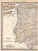
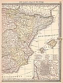
Viewing options:


  Main Author:   Gardiner, Samual Rawson
  Title/Description:   Battle of Trafalgar, 21st October, 1805
  Publication Info:   London: Longmans, Green, and Company, 1895; from A School Atlas of British History
  Date:   1895
  Scale:   -
  Original Source:   University of Alabama Map Library
Viewing options:


  Main Author:   Gardiner, Samuel Rawson
  Title/Description:   Spain and Portugal to Illustrate the Peninsular War
  Publication Info:   London: Longmans, Green and Company, 1895; from A School Atlas of British History
  Date:   1895
  Scale:   1:6,970,000
  Original Source:   University of Alabama Map Library
Viewing options:


  Main Author:    
  Title/Description:   Spain and Portugal
  Publication Info:   Edinburgh: W. and A.K. Johnston, [c. 1897]
  Date:   1897
  Scale:   1:5,000,000
  Original Source:   Courtesy of Adams Antiques, Northport, Alabama
Viewing options:


  Main Author:    
  Title/Description:   Balearic Islands, Andorra, Environs of Madrid, Cadiz, Gibraltar, Lisbon and Canary Islands
  Publication Info:   Edinburgh: W. and A.K. Johnston, [c. 1897]
  Date:   1897
  Scale:   Various scales
  Original Source:   Courtesy of Adams Antiques, Northport, Alabama
Viewing options:


  Main Author:    
  Title/Description:   Espagne et Portugal
  Publication Info:   Gotha: Justus Perthes, 1897; from Atlas-Général
  Date:   1897
  Scale:   1: 5,000,000
  Original Source:   University of Alabama Map Library
Viewing options:


  Main Author:   Cram, George F.
  Title/Description:   Spain & Portugal
  Publication Info:   Chicago: George F. Cram, 1898; from Cram's Universal Atlas, Geographical, Astronomical and Historical
  Date:   1898
  Scale:   1:3,485,000
  Original Source:   Courtesy of Adams Antiques, Northport, Alabama
Viewing options:


  Main Author:   Diercke, C. and E. Gaebler
  Title/Description:   Pyrenäen-Halbinsel
  Publication Info:   Braunschweig: George Westermann, 1898; from Diercke, Schul-Atlas für höhere lehranstalten
  Date:   1898
  Scale:   1:4,500,000
  Original Source:   University of Alabama Map Library
Viewing options:


  Main Author:   Cram, George F.
  Title/Description:   Madrid (Spain)
  Publication Info:   Chicago: George F. Cram, 1898; from Cram's Universal Atlas, Geographical, Astronomical and Historical
  Date:   1898
  Scale:    
  Original Source:   Courtesy of Adams Antiques, Northport, Alabama
Viewing options:


  Main Author:   Kiepert, Henry
  Title/Description:   Hispania Mauretania et Africa
  Publication Info:   Chicago: Rand McNally and Company, 1898; from Atlas Antiquus, Twelve Maps of the Ancient World
  Date:   1898
  Scale:   1:5,000,000
  Original Source:   University of Alabama Map Library
Viewing options:


  Main Author:    
  Title/Description:   Spain and Portugal
  Publication Info:   Chicago: Rand McNally and Company, 1898; from the Indexed Atlas of the World
  Date:   1898
  Scale:   1:1,900,800
  Original Source:   Courtesy of Murray Hudson, Halls, Tennessee
Viewing options:


  Main Author:   Smith, Benjamin E.
  Title/Description:   Spain, Portugal, and Andorra
  Publication Info:   New York: The Century Company, 1899; from The Century Atlas of the World
  Date:   1899
  Scale:   1: 3,548,160
  Original Source:   University of Alabama Map Library
Viewing options:


  Main Author:   The Times London
  Title/Description:   Spain and Portugal
  Publication Info:   The Times London, 1899
  Date:   1899
  Scale:   1:3,000,000
  Original Source:   University of Alabama Map Library
Viewing options:


  Main Author:  
  Title/Description:   Peninsula Iberia
  Publication Info:   Barcelona: Editorial FTD, 1900; from Atlas Universal 4 Especial de la America Central
  Date:   1900
  Scale:   1:5,000,000
  Original Source:   University of Alabama Map Library
Viewing options:


Previous Page
Next Page


© University of Alabama
To purchase map reproductions, submit a quote request.
Download MrSID Plugin