1826 - 1835
Before 1750
1750-1825
1826-1835
1836-1850
1851-1875
1876-1885
1886-1895
1896-1905
After 1905

Previous Page
Next Page

  Main Author:   Perrot, A.M. and J. Aupick
  Title/Description:   Nouvel Atlas Royaume De France
  Publication Info:   Paris: L. Duprat-Duverger, 1827
  Date:   1827
  Scale:   1:468,000
  Original Source:   Courtesy of Adams Antiques, Northport, Alabama


  Main Author:   Malt-Brun, M.
  Title/Description:   France
  Publication Info:   Philadelphia: John Grigg, 1828; from A New General Atlas, Exhibiting thr Five Great Divisions of the Globe
  Date:   1828
  Scale:   1:4,752,000
  Original Source:   Courtesy of Murray Hudson, Halls, Tennessee
Viewing options:


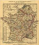
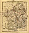
Main Author:   Arrowsmith, A.
Titles/Descriptions:   "France and the Netherlands" and "Gallia"
Publication Info:   London: A. Arrowsmith, 1828; from a Comparative Atlas of Ancient and Modern Geography
Date:   1828
Scale:   1: 4,118,400
Original Source:   University of Alabama Map Library
Modern
Ancient
Viewing options:
Viewing options:
JPEG or Plugin
JPEG or Plugin


  Main Author:    
  Title/Description:   France Divided Into Its Provinces and Departments
  Publication Info:   London: c.1829
  Date:   1829
  Scale:   1:5,830,000
  Original Source:   Courtesy of Murray Hudson, Halls, Tennessee
Viewing options:


  Main Author:   Society for the Diffusion of Useful Knowledge
  Title/Description:   France I
  Publication Info:   London: Baldwin & Cradock, 1830; published under the superintendence of the Society for the Diffusion of Useful Knowledge
  Date:   1830
  Scale:   1:1,901,000
  Original Source:   Courtesy of Murray Hudson, Halls, Tennessee
Viewing options:


  Main Author:   Society for the Diffusion of Useful Knowledge
  Title/Description:   France II
  Publication Info:   London: Baldwin & Cradock, 1830; published under the superintendence of the Society for the Diffusion of Useful Knowledge
  Date:   1830
  Scale:   1:1,901,000
  Original Source:   Courtesy of Murray Hudson, Halls, Tennessee
Viewing options:


  Main Author:    
  Title/Description:   France Divided Into Departments
  Publication Info:   Boston: Samuel Walker, c.1830; from a Malte-Bran Geography
  Date:   1830
  Scale:   1:6,336,000
  Original Source:   Courtesy of Murray Hudson, Halls, Tennessee
Viewing options:


  Main Author:   Butler, Samuel
  Title/Description:   France in Provinces
  Publication Info:   London: Rees, Orme, Brown, Green and Longman, c. 1830; from An Atlas of Modern Geography
  Date:   1830
  Scale:   1: 5,595,324
  Original Source:   University of Alabama Map Library
Viewing options:


  Main Author:   Butler, Samuel
  Title/Description:   France in Departments
  Publication Info:   London: Rees, Orme, Brown, Green and Longman, c. 1830; from An Atlas of Modern Geography
  Date:   1830
  Scale:   1: 5,456,654
  Original Source:   University of Alabama Map Library
Viewing options:


  Main Author:   Hall, Sidney
  Title/Description:   France
  Publication Info:   London: Longman, Rees, Orme, Brown and Green, 1830
  Date:   1830
  Scale:   1:2,534,400
  Original Source:   Courtesy of Murray Hudson, Halls, Tennessee
Viewing options:


  Main Author:   Society for the Diffusion of Useful Knowledge
  Title/Description:   Ancient France or Gallia Tranalpina
  Publication Info:   London: Baldwin and Gradock, 1831
  Date:   1831
  Scale:   1:3,485,000
  Original Source:   University of Alabama Map Library
Viewing options:


  Main Author:   Society for the Diffusion of Useful Knowledge
  Title/Description:   France in Provinces
  Publication Info:   London: Baldwin & Cradock, 1831; published under the superintendence of the Society for the Diffusion of Useful Knowledge
  Date:   1831
  Scale:   1:3,485,000
  Original Source:   Courtesy of Murray Hudson, Halls, Tennessee
Viewing options:


  Main Author:   Society for the Diffusion of Useful Knowledge
  Title/Description:   France II
  Publication Info:   London: Baldwin & Cradock, 1831; published under the superintendence of the Society for the Diffusion of Useful Knowledge
  Date:   1831
  Scale:   1:1,901,000
  Original Source:   Courtesy of Murray Hudson, Halls, Tennessee
Viewing options:


  Main Author:   Heck, J. G.
  Title/Description:   La France
  Publication Info:   Paris, 1832
  Date:   1832
  Scale:    
  Original Source:   Antique Atlas
Viewing options:


  Main Author:   Stieler, Adolf
  Title/Description:   Der Nordostliche Theil Von Frankreich
  Publication Info:   Gotha: Justus Perthes, 1832; No. 14b, from Stieler's Hand-Atlas
  Date:   1832
  Scale:   1:1,862,000
  Original Source:   Courtesy of Murray Hudson, Halls, Tennessee
Viewing options:


  Main Author:    
  Title/Description:   France
  Publication Info:   Philadelphia: Carey & Lea, 1832; from Carey & Lea's Family Cabinet Atlas, First American Edition
  Date:   1832
  Scale:   1:12,335,000
  Original Source:   Courtesy of Murray Hudson, Halls, Tennessee
Viewing options:


  Main Author:   Delamarche, Felix
  Title/Description:   Royaume de France, Divise en ses 32 Provinces Avant 1790
  Publication Info:   Paris: 1833; from the Atlas de la Geographie Ancienne, du Moyen Age et Modern
  Date:   1833
  Scale:   1:3,829,000
  Original Source:   University of Alabama Map Library
Viewing options:


  Main Author:   Lesage, A
  Title/Description:   Formation Graduelle Du Territoire Français, ordre et nature de ses divers agrandissements
  Publication Info:   Paris: Leclere, 1833; from Atlas Historique, Généalogique, Chronologique et Géographique
  Date:   1833
  Scale:   1:6,117,500
  Original Source:   University of Alabama Map Library
Viewing options:


  Main Author:   Lesage, A
  Title/Description:   La France en 1812 et 1814. Anciennes Provinces. Departemens. Chef lieux. Lieux de batailles de son histoire.
  Publication Info:   Paris: Leclere, 1833; from Atlas Historique, Généalogique, Chronologique et Géographique
  Date:   1833
  Scale:   1:6,117,500
  Original Source:   University of Alabama Map Library
Viewing options:


  Main Author:   Delamarche, Félix
  Title/Description:   Galla Antiquae
  Publication Info:   Paris: Félix, Delamarche, 1834; No.26 from Atlas De La Géographie Ancienne, du moyen âge, et modern, Adopté Par Le Conseil Royal
  Date:   1834
  Scale:   1:4,400,000
  Original Source:   Courtesy of Adams Antiques, Northport, Alabama
Viewing options:


  Main Author:   Delamarche, Félix
  Title/Description:   Royaume de France divisé en ses 32 Provinces avant 1790
  Publication Info:   Paris: Félix, Delamarche, 1834; No.8 from Atlas De La Géographie Ancienne, du moyen âge, et modern, Adopté Par Le Conseil Royal
  Date:   1834
  Scale:   1:3,800,000
  Original Source:   Courtesy of Adams Antiques, Northport, Alabama
Viewing options:


  Main Author:   Delamarche, Félix
  Title/Description:   Royaume de France divise en 86 Départements
  Publication Info:   Paris: Félix, Delamarche, 1834; No.9 from Atlas De La Géographie Ancienne, du moyen âge, et modern, Adopté Par Le Conseil Royal
  Date:   1834
  Scale:   1:3,837,000
  Original Source:   Courtesy of Adams Antiques, Northport, Alabama
Viewing options:


  Main Author:   Malte-Brun, Conrad
  Title/Description:   France Divided into Departments
  Publication Info:   Boston: Samuel Walker, 1834; from A System of Universal Geography
  Date:   1834
  Scale:   1:6,336,000
  Original Source:   University of Alabama Map Library
Viewing options:


  Main Author:   Bradford, Thomas Gamaliel
  Title/Description:   France
  Publication Info:   Boston: American Stationers Company, 1835; From A Comprehensive Atlas, Geographical, Historical, and Commercial
  Date:   1835
  Scale:   1:4,844,036
  Original Source:   Courtesy of Murray Hudson, Halls, Tennessee
Viewing options:
 

Previous Page
Next Page


© University of Alabama
To purchase map reproductions, submit a quote request.
Download MrSID Plugin