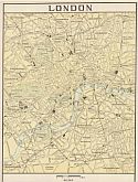
Main Author:
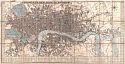
Overton, Henry
Title/Description:
A New and Correct Map Thirty Miles Around London
Publication Info:
London: c.1650
Date:
1650
Scale:
1:158,400
Original Source:
Courtesy of
Murray Hudson
, Halls, Tennessee
Viewing options:
JPEG
or
Plugin
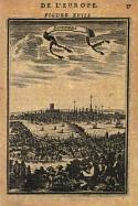
Main Author:
Mallet, Alain Manesson (
info
)
Title/Description:
Londres
Publication Info:
Paris: 1683
Date:
1683
Scale:
Original Source:
Antique Atlas
Viewing options:
JPEG
or
Plugin
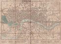
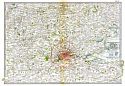
Main Author:
Laurie & Whittle
Title/Description:
A New and Accurate Plan of London, Westminster and Borough of Southwark
Publication Info:
London: Laurie & Whittle, 1798
Date:
1798
Scale:
1:15,000
Original Source:
Courtesy of
Murray Hudson
, Halls, Tennessee
Viewing options:
JPEG
or
Plugin
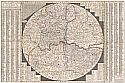
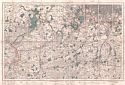
Main Author:
Unknown
Title/Description:
[Southeast England Centering on London]
Publication Info:
Vienna: c.1825
Date:
1825
Scale:
1:576,000
Original Source:
Courtesy of
Murray Hudson
, Halls, Tennessee
Viewing options:
JPEG
or
Plugin
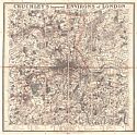
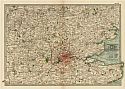
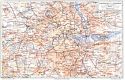
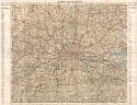
Main Author:
Cruchley, George Frederick
Title/Description:
Cruchley's New and Improved Map of the Environs of London
Publication Info:
London: G.F. Cruchley Mapsellers, 1827
Date:
1827
Scale:
1:85,000
Original Source:
W. S. Hoole Special Collections Library
Viewing options:
JPEG
or
Plugin
Main Author:
Cruchley, George Frederick
Title/Description:
Cruchley's New Plan of London, showing all the new and intend improvements to the present time
Publication Info:
London: G.F. Cruchley Mapsellers, 1833
Date:
1833
Scale:
1:70,000
Original Source:
W. S. Hoole Special Collections Library
Viewing options:
JPEG
or
Plugin
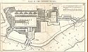
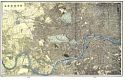
Main Author:
Graham, C.B.
Title/Description:
Plan of the London Docks
Publication Info:
Washington: U.S. Senate, 30th Congress, 2nd Session, 1848
Date:
1848
Scale:
1:6,600
Original Source:
Courtesy of
Murray Hudson
, Halls, Tennessee
Viewing options:
JPEG
or
Plugin
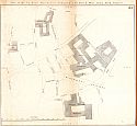
Main Author:
Graham, C.B.
Title/Description:
Plan of the UpTown Warehouses belonging to the East and West India Dock Company
Publication Info:
Washington: U.S. Senate, 30th Congress, 2nd Session, 1848
Date:
1848
Scale:
1:1,800
Original Source:
Courtesy of
Murray Hudson
, Halls, Tennessee
Viewing options:
JPEG
or
Plugin
Main Author:
Graham, C.B.
Title/Description:
River Thames with Docks from Blackwell to the Tower
Publication Info:
Washington: U.S. Senate, 30th Congress, 2nd Session, 1848
Date:
1848
Scale:
1:6,000
Original Source:
Courtesy of
Murray Hudson
, Halls, Tennessee
Viewing options:
JPEG
or
Plugin
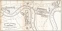
Main Author:
Graham, C.B.
Title/Description:
Plan of the East and West India docks, 13th April, 1841
Publication Info:
Washington: U.S. Senate, 30th Congress, 2nd Session, 1848
Date:
1848
Scale:
1:1,500
Original Source:
Courtesy of
Murray Hudson
, Halls, Tennessee
Viewing options:
JPEG
or
Plugin
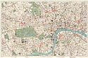
Main Author:
Bibliographisches Institut
Title/Description:
Gegend von London
Publication Info:
Hildburghausen: Bibliographisches Institut, 1850-1860; from
Atlas der Geographie
Date:
1857
Scale:
1:95,040
Original Source:
University of Alabama Map Library
Viewing options:
JPEG
or
Plugin
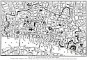
Main Author:
Weller, Edward
Title/Description:
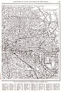
The "Landmarks" of London
Publication Info:
London: Weekly Dispatch, 1860; from
The Dispatch Atlas
Date:
1860
Scale:
not indicated
Original Source:
Courtesy of
Murray Hudson
, Halls, Tennessee
Viewing options:
JPEG
or
Plugin
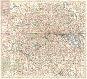
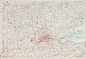
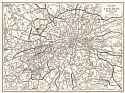
Main Author:
Gray, Ormando
Title/Description:
The Environs of London - The Environs of Paris
Publication Info:
Philadelphia: O.W. Gray & Son, 1873
Date:
1873
Scale:
not indicated
Original Source:
Courtesy of
Murray Hudson
, Halls, Tennessee
Viewing options:
JPEG
or
Plugin
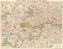
Main Author:
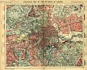
Title/Description:
Geological Map of the Environs of London
Publication Info:
London: Letts, Son and Company, 1884; from
Lett's Complete Popular Atlas
Date:
1884
Scale:
1:105,000
Original Source:
Courtesy of
Murray Hudson
, Halls, Tennessee
Viewing options:
JPEG
or
Plugin
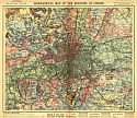
Main Author:
Title/Description:
Orographical Map of the Environs of London
Publication Info:
London: Letts, Son and Company, 1884; from
Lett's Complete Popular Atlas
Date:
1884
Scale:
1:105,000
Original Source:
Courtesy of
Murray Hudson
, Halls, Tennessee
Viewing options:
JPEG
or
Plugin
Main Author:
Cram, George F.
Title/Description:
London (England)
Publication Info:
Chicago: George F. Cram, 1898; from Cram's
Universal Atlas, Geographical, Astronomical and Historical
Date:
1898
Scale:
Original Source:
Courtesy of
Adams Antiques
, Northport, Alabama
Viewing options:
JPEG
or
Plugin
Main Author:
Smith, Benjamin E.
Title/Description:
Vicinity of London
Publication Info:
New York: The Century Company, 1899; from
The Century Atlas of the World
Date:
1899
Scale:
1: 570,240
Original Source:
University of Alabama Map Library
Viewing options:
JPEG
or
Plugin
Main Author:
Cram, George F.
Title/Description:
London
Publication Info:
Chicago: George F. Cram, 1901; From
Cram's Atlas of the World Ancient and Modern
Date:
1901
Scale:
33,000
Original Source:
Courtesy of
Murray Hudson
, Halls, Tennessee
Viewing options:
JPEG
or
Plugin
Main Author:
The Century Company
Title/Description:
London and Vicinity
Publication Info:
Buffalo: The Matthew-Northrup Co., 1902; from the 1902 edition of
The Century Atlas
.
Date:
1902
Scale:
1:570,000
Original Source:
From the personal collection of Dr. Robert Burckhalter
Viewing options:
JPEG
or
Plugin
Main Author:
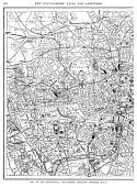
Stanford, Edward
Title/Description:
Ordnance Map of the S.W. Environs of London
Publication Info:
London: Edward Stanford, c.1904
Date:
1904
Scale:
1:63,360
Original Source:
Courtesy of
Murray Hudson
, Halls, Tennessee
Viewing options:
JPEG
or
Plugin
Main Author:
Title/Description:
Umgebung von London
Publication Info:
Leipzig: Bibliographisches Institut, 1906; from
Meyers Konveraltions - Lexikon
Date:
1906
Scale:
1:100,000
Original Source:
Courtesy of
Adams Antiques
, Northport, Alabama
Viewing options:
JPEG
or
Plugin
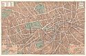
Main Author:
Title/Description:
London Innere Stadt
Publication Info:
Leipzig: Bibliographisches Institut, 1906; from
Meyers Konveraltions - Lexikon
Date:
1906
Scale:
1:35,000
Original Source:
Courtesy of
Adams Antiques
, Northport, Alabama
Viewing options:
JPEG
or
Plugin
Main Author:
Baedeker, Karl
Title/Description:
London and Its Environs
Publication Info:
Leipsig: Karl Baedeker, 1908
Date:
1908
Scale:
Various
Original Source:
University of Alabama Map Library
Proceed to Atlas:
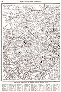
Main Author:
Patten, William and J.E. Homas
Title/Description:
Map of the Municipality of London, England (Western Half)
Publication Info:
New York: P.F. Collier and Son, 1909; from
The New Encyclopedic Atlas and Gazetteer of the World
Date:
1909
Scale:
1: 63,360
Original Source:
University of Alabama Map Library
Viewing options:
JPEG
or
Plugin
Main Author:
Patten, William and J.E. Homas
Title/Description:
The City of London, Bailiwick of the Lord Mayor
Publication Info:
New York: P.F. Collier and Son, 1909; from
The New Encyclopedic Atlas and Gazetteer of the World
Date:
1909
Scale:
Not Available
Original Source:
University of Alabama Map Library
Viewing options:
JPEG
or
Plugin
Main Author:
Title/Description:
London, Edinburgh, Dublin
Publication Info:
London: Carmelite House, c.1910; from
The Harmsworth Atlas and Gazetteer
Date:
1910
Scale:
1:42,000
Original Source:
University of Alabama Map Library
Viewing options:
JPEG
or
Plugin
Main Author:
Title/Description:
Vicinity of London
Publication Info:
New York: The Century Company, 1913; from the
Century Atlas of the World
Date:
1913
Scale:
1: 570,240
Original Source:
University of Alabama Map Library
Viewing options:
JPEG
or
Plugin
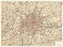
Main Author:
Bartholomew John
Title/Description:
Bartholomew's One Inch to the Mile Map of London
Publication Info:
London: John Bartholomew & Son, c.1920
Date:
1920
Scale:
1:63,360
Original Source:
Courtesy of
Murray Hudson
, Halls, Tennessee
Viewing options:
JPEG
or
Plugin
Main Author:
Bacon, George W.
Title/Description:
Bacon's Gem Map of London and Suburbs
Publication Info:
London: George W. Bacon & Co., c.1920
Date:
1920
Scale:
1:40,000
Original Source:
Courtesy of
Murray Hudson
, Halls, Tennessee
Viewing options:
JPEG
or
Plugin
Main Author:
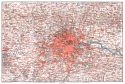
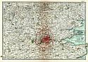
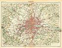
Gross, Alexander
Title/Description:
30 Miles Round London
Publication Info:
London: Geographia, c.1920; including Golf Links
Date:
1920
Scale:
1:142,500
Original Source:
Courtesy of
Murray Hudson
, Halls, Tennessee
Viewing options:
JPEG
or
Plugin
Main Author:
Bartholomew, J.G.
Title/Description:
London
Publication Info:
London: The Times, 1920; from
The Times Survey Atlas of the World
Date:
1920
Scale:
1:126,720
Original Source:
University of Alabama Map Library
Viewing options:
JPEG
or
Plugin
Main Author:
C.S. Hammond and Company
Title/Description:
Environs of London
Publication Info:
New York: C.S. Hammond and Company, 1922; from
the New World Loose Leaf Atlas
Date:
1922
Scale:
1:570,240
Original Source:
Courtesy of
Murray Hudson
, Halls, Tennessee
Viewing options:
JPEG
or
Plugin
Main Author:
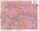
Title/Description:
The Pictorial Plan of London
Publication Info:
London: Geographica, 1923
Date:
1923
Scale:
Original Source:
Courtesy of
Murray Hudson
, Halls, Tennessee
Viewing options:
JPEG
or
Plugin
Main Author:
Reynolds, Francis J.
Title/Description:
Map of the Municipality of London, England (Western Half)
Publication Info:
New York: P.F. Collier and Son Company, 1924; from
The New World Atlas and Gazetteer
Date:
1924
Scale:
1:32,000
Original Source:
University of Alabama Map Library
Viewing options:
JPEG
or
Plugin
Main Author:
Reynolds, Francis J.
Title/Description:
Map of the Municipality of London, England (Eastern Half)
Publication Info:
New York: P.F. Collier and Son Company, 1924; from
The New World Atlas and Gazetteer
Date:
1924
Scale:
1:32,000
Original Source:
University of Alabama Map Library
Viewing options:
JPEG
or
Plugin
Main Author:
Title/Description:
Vest Pocket Street Plan of Central London
Publication Info:
London: Geographica, 1928
Date:
1928
Scale:
1:15,000
Original Source:
Courtesy of
Murray Hudson
, Halls, Tennessee
Viewing options:
JPEG
or
Plugin
Main Author:
The Times Company
Title/Description:
The Times Road Map of London
Publication Info:
London: The Times Company, 1930
Date:
1930
Scale:
1:80,000
Original Source:
Courtesy of
Murray Hudson
, Halls, Tennessee
Viewing options:
JPEG
or
Plugin
Main Author:
Bacon, George W.
Title/Description:
Bacon's "Midget" Map of Central and West London
Publication Info:
London: G.W. Bacon and Co, c.1930
Date:
1930
Scale:
1:21,120
Original Source:
Courtesy of
Murray Hudson
, Halls, Tennessee
Viewing options:
JPEG
or
Plugin
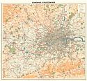
Main Author:
Philip, George
Title/Description:
London's Countryside
Publication Info:
London: George Philip and Son, Ltd., c.1930
Date:
1930
Scale:
1:80,000
Original Source:
Courtesy of
Murray Hudson
, Halls, Tennessee
Viewing options:
JPEG
or
Plugin
Main Author:
Title/Description:
Map of 20 Miles Round London
Publication Info:
London: Geographica, 1940
Date:
1940
Scale:
1:47,520
Original Source:
Courtesy of
Murray Hudson
, Halls, Tennessee
Viewing options:
JPEG
or
Plugin
© University of Alabama
To purchase map reproductions, submit a
quote request
.