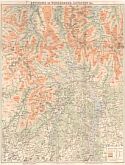
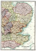
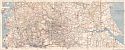
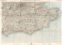
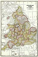
After 1875
Before 1800
1800-1875
After 1875

Previous Page

  Main Author:   Black, Adam and Charles
  Title/Description:   England and Wales
  Publication Info:   Edinburgh: Adam and Charles Black, 1879; from Black's General Atlas of the World, American Edition
  Date:   1879
  Scale:   1:950,400
  Original Source:   Courtesy of Murray Hudson, Halls, Tennessee
Viewing options:


  Main Author:   Mitchell, S. Augustus
  Title/Description:   County Map of England and Wales
  Publication Info:   Philadelphia: S. Augustus Mitchell, 1880; from Mitchell's New General Atlas
  Date:   1880
  Scale:   1: 2,424,846
  Original Source:   Courtesy of Murray Hudson, Halls, Tennessee
Viewing options:


  Main Author:    
  Title/Description:   Map of Cook's Tours in Scottland & England
  Publication Info:   New York: Thomas Cook & Son, 1881
  Date:   1881
  Scale:   1:2,534,000
  Original Source:   Courtesy of Murray Hudson, Halls, Tennessee
Viewing options:


  Main Author:   Stieler, Adolf
  Title/Description:   Grossbritannien
  Publication Info:   Gotha: Justus Perthes, c.1881; from Adolf Stieler's Hand Atlas
  Date:   1881
  Scale:   1:1,500,000
  Original Source:   Courtesy of Murray Hudson, Halls, Tennessee
Viewing options:


  Main Author:   Tunison, H.C.
  Title/Description:   England and Wales
  Publication Info:   Jacksonville, IL: H.C. Tunison, 1882; from Tunison's Peerless Universal Atlas of the World
  Date:   1882
  Scale:   1: 2,480,856
  Original Source:   Courtesy of Murray Hudson, Halls, Tennessee
Viewing options:


  Main Author:   Bartholomew, J.
  Title/Description:   England and Wales
  Publication Info:   Edinburgh: Blackie and Son, [c. 1884]
  Date:   1884
  Scale:   1:2,200,000
  Original Source:   Courtesy of Adams Antiques, Northport, Alabama
Viewing options:


  Main Author:    
  Title/Description:   England & Wales
  Publication Info:   Chicago: Rand McNally and Co., 1884; from Rand McNally Indexed Atlas of the World
  Date:   1884
  Scale:   1:1,584,000
  Original Source:   From the personal collection of Dr. Gerald Webster
Viewing options:


  Main Author:    
  Title/Description:   Railroad and County Map of England and Wales
  Publication Info:   London: Letts, Son and Company, 1884; from Lett's Complete Popular Atlas
  Date:   1884
  Scale:   1:1,774,080
  Original Source:   Courtesy of Murray Hudson, Halls, Tennessee
Viewing options:


  Main Author:    
  Title/Description:   Geological Map of England and Wales
  Publication Info:   London: Letts, Son and Company, 1884; from Lett's Complete Popular Atlas
  Date:   1884
  Scale:   1:1,774,080
  Original Source:   Courtesy of Murray Hudson, Halls, Tennessee
Viewing options:


Main Author:    
Title/Description:   Watershed Map of England and Wales
Publication Info:   London: Letts, Son and Company, 1884; from Lett's Complete Popular Atlas
Date:   1884
Scale:   1:760,320
Original Source:   Courtesy of Murray Hudson, Halls, Tennessee
Viewing options:
 
Viewing options:
JPEG or Plugin
 
JPEG or Plugin
     
 
Viewing options:
 
Viewing options:
JPEG or Plugin
 
JPEG or Plugin
     
 
Viewing options:
 
Viewing options:
JPEG or Plugin
 
JPEG or Plugin


  Main Author:    
  Title/Description:   Plan of Liverpool
  Publication Info:   London: Letts, Son and Company, 1884; from Lett's Complete Popular Atlas
  Date:   1884
  Scale:   1:14,400
  Original Source:   Courtesy of Murray Hudson, Halls, Tennessee
Viewing options:


  Main Author:   Tunison, Henry Cuthbert
  Title/Description:   England and Wales
  Publication Info:   Jacksonville, IL: H.C. Tunison, 1885
  Date:   1885
  Scale:   1:1,900,000
  Original Source:   Courtesy of Murray Hudson, Halls, Tennessee
Viewing options:


  Main Author:   Stanford, Edward
  Title/Description:   Map of England and Wales
  Publication Info:   London: Edward Stanford, c.1885
  Date:   1885
  Scale:   1:1,013,760
  Original Source:   Courtesy of Murray Hudson, Halls, Tennessee
Viewing options:


  Main Author:   Cram, George
  Title/Description:   England and Wales
  Publication Info:   Chicago: George F. Cram, 1887; from Cram's Unrivaled Atlas of the World
  Date:   1887
  Scale:   1:2,534,000
  Original Source:   University of Alabama Map Library
Viewing options:


  Main Author:   Mitchell, S. Augustus
  Title/Description:   County Map of England, and Wales
  Publication Info:   Philadelphia: William M. Bradley & Bro., 1888; from Mitchell's New General Atlas
  Date:   1887
  Scale:   1: 2,407,680
  Original Source:   Courtesy of Murray Hudson, Halls, Tennessee
Viewing options:


  Main Author:    
  Title/Description:   England and Wales
  Publication Info:   New York: A.A. Grant, 1887; from Grant's Standard American Atlas of the World
  Date:   1887
  Scale:   1:1,900,800
  Original Source:   Courtesy of Murray Hudson, Halls, Tennessee
Viewing options:


  Main Author:    
  Title/Description:   England and Wales, Physical Features
  Publication Info:   London: Longmans, Green and Company, 1889; from Longmans New Atlas, Political and Physical
  Date:   1889
  Scale:   1:2,000,000
  Original Source:   University of Alabama Map Library
Viewing options:


  Main Author:    
  Title/Description:   England and Wales
  Publication Info:   London: Longmans, Green and Company, 1889; from Longmans New Atlas, Political and Physical
  Date:   1889
  Scale:   1: 2,000,000
  Original Source:   University of Alabama Map Library
Viewing options:


  Main Author:    
  Title/Description:   British Isles, Geological
  Publication Info:   London: Longmans, Green and Company, 1889; from Longmans New Atlas, Political and Physical
  Date:   1889
  Scale:   1:4,000,000
  Original Source:   University of Alabama Map Library
Viewing options:


  Main Author:    
  Title/Description:   British Isles, Population Density
  Publication Info:   London: Longmans, Green and Company, 1889; from Longmans New Atlas, Political and Physical
  Date:   1889
  Scale:   1:4,000,000
  Original Source:   University of Alabama Map Library
Viewing options:


  Main Author:   Caster, George C.
  Title/Description:   Map of Seventy Miles Round Peterborough
  Publication Info:   Peterborough: George C. Caster, c.1890; from the New Ordnance Survey Showing Roads, Railways, and County Boundaries
  Date:   1890
  Scale:   1:316,800
  Original Source:   Courtesy of Murray Hudson, Halls, Tennessee
Viewing options:


  Main Author:   Bartholomew, John
  Title/Description:   Map of Windermere, Coniston & Grasmere
  Publication Info:   London: W.H. Smith & Son, c.1890
  Date:   1890
  Scale:   1:63,360
  Original Source:   Courtesy of Murray Hudson, Halls, Tennessee
Viewing options:


Main Author:   Rand McNally & Co.
Title/Description:   England and Wales
Publication Info:   Chicago: Rand McNally & Co., 1890; from Rand McNally & Co.'s Family Atlas of the World
Date:   1890
Scale:   1:1,584,000
Original Source:   University of Alabama Map Library
 
North
Viewing options:
 
South
Viewing options:


  Main Author:   Johnston, W. and A.K.
  Title/Description:   Motoring and Touring Map of England
  Publication Info:   Edinburgh: W. and A.K. Johnston Ltd, c.1890
  Date:   1890
  Scale:   1:633,600
  Original Source:   Courtesy of Murray Hudson, Halls, Tennessee
Viewing options:


  Main Author:   Bartholomew, John
  Title/Description:   England and Wales
  Publication Info:   London: MacMillan and Company, 1890; from the Library Reference Atlas of the World
  Date:   1890
  Scale:   1: 1,774,080
  Original Source:   Courtesy of Murray Hudson, Halls, Tennessee
Viewing options:


  Main Author:   Bartholomew, John
  Title/Description:   England and Wales (Section 1)
  Publication Info:   London: MacMillan and Company, 1890; from the Library Reference Atlas of the World
  Date:   1890
  Scale:   1: 633,600
  Original Source:   Courtesy of Murray Hudson, Halls, Tennessee
Viewing options:


  Main Author:   Bartholomew, John
  Title/Description:   England and Wales (Section 2)
  Publication Info:   London: MacMillan and Company, 1890; from the Library Reference Atlas of the World
  Date:   1890
  Scale:   1: 633,600
  Original Source:   Courtesy of Murray Hudson, Halls, Tennessee
Viewing options:


  Main Author:   Bartholomew, John
  Title/Description:   England and Wales (Section 3)
  Publication Info:   London: MacMillan and Company, 1890; from the Library Reference Atlas of the World
  Date:   1890
  Scale:   1: 633,600
  Original Source:   Courtesy of Murray Hudson, Halls, Tennessee
Viewing options:


  Main Author:   Bartholomew, John
  Title/Description:   England and Wales (Section 4)
  Publication Info:   London: MacMillan and Company, 1890; from the Library Reference Atlas of the World
  Date:   1890
  Scale:   1: 633,600
  Original Source:   Courtesy of Murray Hudson, Halls, Tennessee
Viewing options:


  Main Author:   Bartholomew, John
  Title/Description:   England and Wales (Section 5)
  Publication Info:   London: MacMillan and Company, 1890; from the Library Reference Atlas of the World
  Date:   1890
  Scale:   1: 633,600
  Original Source:   Courtesy of Murray Hudson, Halls, Tennessee
Viewing options:


  Main Author:   Bartholomew, John
  Title/Description:   England and Wales (Section 6)
  Publication Info:   London: MacMillan and Company, 1890; from the Library Reference Atlas of the World
  Date:   1890
  Scale:   1: 633,600
  Original Source:   Courtesy of Murray Hudson, Halls, Tennessee
Viewing options:


  Main Author:   Mast, Crowell, and Kirkpatrick
  Title/Description:   England & Wales
  Publication Info:   New York: Mat, Crowell, and Kirkpatrick, 1893; from Popular Atlas
  Date:   1893
  Scale:   1:2,534,000
  Original Source:   Courtesy of Murray Hudson, Halls, Tennessee
Viewing options:


  Main Author:    
  Title/Description:   England and Wales
  Publication Info:  

Chicago: Rand McNally and Company, 1893; from Rand McNally and Company's Enlarged Business Atlas and Shippers Guide

  Date:   1893
  Scale:   1:1,584,000
  Original Source:   Courtesy of Murray Hudson, Halls, Tennessee
Viewing options:


  Main Author:   Bartholomew, John
  Title/Description:   "The Hub" Cycling Map of England and Wales
  Publication Info:   London: George Newnes Ltd., c.1897
  Date:   1897
  Scale:   1:825,000
  Original Source:   Courtesy of Murray Hudson, Halls, Tennessee
Viewing options:


  Main Author:   Bartholomew, J.G.
  Title/Description:   Brighton
  Publication Info:   Edinburg: John Batholomew and Company, 1898; from The Royal Atlas of England and Wales
  Date:   1898
  Scale:   1:253,000
  Original Source:   University of Alabama Map Library
Viewing options:


  Main Author:   Bartholomew, J.G.
  Title/Description:   Canterbury
  Publication Info:   Edinburg: John Batholomew and Company, 1898; from The Royal Atlas of England and Wales
  Date:   1898
  Scale:   1:253,000
  Original Source:   University of Alabama Map Library
Viewing options:


  Main Author:   Bartholomew, J.G.
  Title/Description:   Exeter
  Publication Info:   Edinburg: John Batholomew and Company, 1898; from The Royal Atlas of England and Wales
  Date:   1898
  Scale:   1:253,000
  Original Source:   University of Alabama Map Library
Viewing options:


  Main Author:   Bartholomew, J.G.
  Title/Description:   Hull
  Publication Info:   Edinburg: John Batholomew and Company, 1898; from The Royal Atlas of England and Wales
  Date:   1898
  Scale:   1:253,000
  Original Source:   University of Alabama Map Library
Viewing options:


  Main Author:   Bartholomew, J.G.
  Title/Description:   Liverpool
  Publication Info:   Edinburg: John Batholomew and Company, 1898; from The Royal Atlas of England and Wales
  Date:   1898
  Scale:   1:253,000
  Original Source:   University of Alabama Map Library
Viewing options:


  Main Author:   Bartholomew, J.G.
  Title/Description:   Middlesex
  Publication Info:   Edinburg: John Batholomew and Company, 1898; from The Royal Atlas of England and Wales
  Date:   1898
  Scale:   1:253,000
  Original Source:   University of Alabama Map Library
Viewing options:


  Main Author:   Bartholomew, J.G.
  Title/Description:   Norwich
  Publication Info:   Edinburg: John Batholomew and Company, 1898; from The Royal Atlas of England and Wales
  Date:   1898
  Scale:   1:253,000
  Original Source:   University of Alabama Map Library
Viewing options:


  Main Author:   Bartholomew, J.G.
  Title/Description:   Peterborough
  Publication Info:   Edinburg: John Batholomew and Company, 1898; from The Royal Atlas of England and Wales
  Date:   1898
  Scale:   1:253,000
  Original Source:   University of Alabama Map Library
Viewing options:


  Main Author:   Bartholomew, J.G.
  Title/Description:   Plymouth
  Publication Info:   Edinburg: John Batholomew and Company, 1898; from The Royal Atlas of England and Wales
  Date:   1898
  Scale:   1:253,000
  Original Source:   University of Alabama Map Library
Viewing options:


  Main Author:   Bartholomew, J.G.
  Title/Description:   Southampton
  Publication Info:   Edinburg: John Batholomew and Company, 1898; from The Royal Atlas of England and Wales
  Date:   1898
  Scale:   1:253,000
  Original Source:   University of Alabama Map Library
Viewing options:


  Main Author:   Bartholomew, J.G.
  Title/Description:   York
  Publication Info:   Edinburg: John Batholomew and Company, 1898; from The Royal Atlas of England and Wales
  Date:   1898
  Scale:   1:253,000
  Original Source:   University of Alabama Map Library
Viewing options:


  Main Author:   Bartholomew, J.G.
  Title/Description:   Land Surface Features
  Publication Info:   Edinburg: John Batholomew and Company, 1898; from The Royal Atlas of England and Wales
  Date:   1898
  Scale:   1:1,996,000
  Original Source:   University of Alabama Map Library
Viewing options:


  Main Author:   Cram, George F.
  Title/Description:   England & Wales
  Publication Info:   Chicago: George F. Cram, 1898; from Cram's Universal Atlas, Geographical, Astronomical and Historical
  Date:   1898
  Scale:   1:1,901,000
  Original Source:   Courtesy of Adams Antiques, Northport, Alabama
Viewing options:


  Main Author:    
  Title/Description:   England and Wales
  Publication Info:   Philadelphia: Mast, Crowell, & Kirkpatrick, 1898; from Peerless Atlas of the World
  Date:   1898
  Scale:   1:2,534,400
  Original Source:   University of Alabama Map Library
Viewing options:


  Main Author:   Smith, Benjamin E.
  Title/Description:   England and Wales- Southern Part
  Publication Info:   New York: The Century Company, 1899; from The Century Atlas of the World
  Date:   1899
  Scale:   1: 1,393,920
  Original Source:   University of Alabama Map Library
Viewing options:


  Main Author:   Smith, Benjamin E.
  Title/Description:   England and Wales- Northern Part
  Publication Info:   New York: The Century Company, 1899; from The Century Atlas of the World
  Date:   1899
  Scale:   1: 1,393,920
  Original Source:   University of Alabama Map Library
Viewing options:


  Main Author:   Cram, George F.
  Title/Description:   England and Wales
  Publication Info:   Chicago: The Fort DearbornPublishing Company, 1901; from The National Standard Family and Business Atlas of the World
  Date:   1901
  Scale:   1:2,471,040
  Original Source:   Courtesy of Murray Hudson, Halls, Tennessee
Viewing options:


  Main Author:   Murray, John
  Title/Description:   Britannia
  Publication Info:   London: Oxford University Press, 1904; from Murray's Small Classical Atlas
  Date:   1904
  Scale:   1:1,900,000
  Original Source:   University of Alabama Map Library
Viewing options:


  Main Author:    
  Title/Description:   England und Wales, Südliche Hälfte
  Publication Info:   Leipzig: Verlag von Velhagen and Klasing; from Andrees Allgemeiner Handatlas
  Date:   1904
  Scale:   1:1,000,000
  Original Source:   Courtesy of Murray Hudson, Halls, Tennessee
Viewing options:


  Main Author:    
  Title/Description:   England und Wales, Nördliche Hälfte
  Publication Info:   Leipzig: Verlag von Velhagen and Klasing; from Andrees Allgemeiner Handatlas
  Date:   1904
  Scale:   1:1,000,000
  Original Source:   Courtesy of Murray Hudson, Halls, Tennessee
Viewing options:


  Main Author:    
  Title/Description:   England and Wales
  Publication Info:   Leipzig: Bibliographisches Institut, 1906; from Meyers Konveraltions - Lexikon
  Date:   1906
  Scale:   1:2,500,000
  Original Source:   Courtesy of Adams Antiques, Northport, Alabama
Viewing options:


  Main Author:    
  Title/Description:   Geologische Karte von England und Wales
  Publication Info:   Leipzig: Bibliographisches Institut, 1906; from Meyers Konveraltions-Lexikon
  Date:   1906
  Scale:   1:2,500,000
  Original Source:   University of Alabama Map Library
Viewing options:


  Main Author:   Cram, George F.
  Title/Description:   England and Wales
  Publication Info:   Chicago: George F. Cram, 1907; from Cram's Standard American Atlas
  Date:   1907
  Scale:   1:1,584,000
  Original Source:   University of Alabama Map Library
Viewing options:


  Main Author:   Patten, William and J.E. Homas
  Title/Description:   England and Wales
  Publication Info:   New York: P.F. Collier and Son, 1909; from The New Encyclopedic Atlas and Gazetteer of the World
  Date:   1909
  Scale:   Various
  Original Source:   University of Alabama Map Library
Viewing options:


  Main Author:   Rand McNally & Company
  Title/Description:   England and Wales
  Publication Info:   Chicago: Rand McNally & co., 1910
  Date:   1910
  Scale:   1:2,598,000
  Original Source:   Courtesy of Murray Hudson, Halls, Tennessee
Viewing options:


  Main Author:   Rand, McNally & Co.
  Title/Description:   England and Wales
  Publication Info:   Chicago: Rand McNally & Co., 1910; Atlas of the World
  Date:   1910
  Scale:   1:2,597,760
  Original Source:   Courtesy of Murray Hudson, Halls, Tennessee
Viewing options:


  Main Author:   Philip, George
  Title/Description:   Philip's Cycling Map of the District South-East of London
  Publication Info:   London: George Philip & Son, c.1910; from Philip's Unrivalled Series of Cycling Maps
  Date:   1910
  Scale:   1:200,000
  Original Source:   Courtesy of Murray Hudson, Halls, Tennessee
Viewing options:


  Main Author:   Bacon, George W.
  Title/Description:   Road Map of England and Wales
  Publication Info:   London: G.W. Bacon and Co., c.1910
  Date:   1910
  Scale:   1:824,000
  Original Source:   Courtesy of Murray Hudson, Halls, Tennessee
Viewing options:


  Main Author:    
  Title/Description:   The North of England and South Scotland: Railway System
  Publication Info:   London: Carmelite House, c.1910; from The Harmsworth Atlas and Gazetteer
  Date:   1910
  Scale:   1:1,140,480
  Original Source:   University of Alabama Map Library
Viewing options:


  Main Author:    
  Title/Description:   The South of England: Railway System
  Publication Info:   London: Carmelite House, c.1910; from The Harmsworth Atlas and Gazetteer
  Date:   1910
  Scale:   1:1,140,480
  Original Source:   University of Alabama Map Library
Viewing options:


  Main Author:    
  Title/Description:   The Home Counties and the East of England
  Publication Info:   London: Carmelite House, c.1910; from The Harmsworth Atlas and Gazetteer
  Date:   1910
  Scale:   1:887,000
  Original Source:   University of Alabama Map Library
Viewing options:


  Main Author:    
  Title/Description:   The West of England and Wales
  Publication Info:   London: Carmelite House, c.1910; from The Harmsworth Atlas and Gazetteer
  Date:   1910
  Scale:   1:887,000
  Original Source:   University of Alabama Map Library
Viewing options:


  Main Author:    
  Title/Description:   Northern England
  Publication Info:   London: Carmelite House, c.1910; from The Harmsworth Atlas and Gazetteer
  Date:   1910
  Scale:   1:887,000
  Original Source:   University of Alabama Map Library
Viewing options:


  Main Author:    
  Title/Description:   England and Wales, Northern Part
  Publication Info:   New York: The Century Company, 1913; from the Century Atlas of the World
  Date:   1913
  Scale:   1: 1,393,920
  Original Source:   University of Alabama Map Library
Viewing options:


  Main Author:    
  Title/Description:   England and Wales, Southern Part
  Publication Info:   New York: The Century Company, 1913; from the Century Atlas of the World
  Date:   1913
  Scale:   1: 1,393,920
  Original Source:   University of Alabama Map Library
Viewing options:


  Main Author:   Michelin Tyre Co. Ltd.
  Title/Description:   Michelin Map of the British Isles - No. 16 Birmingham - Cambridge
  Publication Info:   London: Michelin Tyre Co. Ltd., c.1918
  Date:   1918
  Scale:   1:200,000
  Original Source:   Courtesy of Murray Hudson, Halls, Tennessee
Viewing options:


  Main Author:   Michelin Tyre Co. Ltd.
  Title/Description:   Michelin Map of the British Isles - No. 11 Manchester - York
  Publication Info:   London: Michelin Tyre Co. Ltd., c.1918
  Date:   1918
  Scale:   1:200,000
  Original Source:   Courtesy of Murray Hudson, Halls, Tennessee
Viewing options:


  Main Author:   Michelin Tyre Co. Ltd.
  Title/Description:   Michelin Map of the British Isles - No. 6 Mersey - Humber
  Publication Info:   London: Michelin Tyre Co. Ltd., c.1920
  Date:   1920
  Scale:   1:200,000
  Original Source:   Courtesy of Murray Hudson, Halls, Tennessee
Viewing options:


  Main Author:   Stanford, Edward
  Title/Description:   Stanford's Chart of the Thames Estuary
  Publication Info:   London: Edward Stanford, 1920; from Stanford's Geographical Establishment
  Date:   1920
  Scale:   1:150,000
  Original Source:   Courtesy of Murray Hudson, Halls, Tennessee
Viewing options:


  Main Author:   Bartholomew, John
  Title/Description:   Bartholomew's Road Map of England and Wales
  Publication Info:   Edinburgh: The Geographical Institute; Sheet No.10, Devon and Cornwall
  Date:   1920
  Scale:   1:253,440
  Original Source:   Courtesy of Murray Hudson, Halls, Tennessee
Viewing options:


  Main Author:   Bartholomew, John
  Title/Description:   Bartholomew's Road Map of England and Wales
  Publication Info:   Edinburgh: The Geographical Institute, 1920; Sheet No.12, Surrey, Sussex, and Kent
  Date:   1920
  Scale:   1:253,440
  Original Source:   Courtesy of Murray Hudson, Halls, Tennessee
Viewing options:


  Main Author:   Johnston, W. and A.K.
  Title/Description:   Map of England, Sheet No.4
  Publication Info:   Edinburgh: W. and A.K. Johnston, 1920
  Date:   1920
  Scale:   1:190,080
  Original Source:   Courtesy of Murray Hudson, Halls, Tennessee
Viewing options:


  Main Author:   Philip, George
  Title/Description:   Philip's Ten-Sheet Road Map of England and Wales, Sheet No.9
  Publication Info:   London: George Philip and Son, Ltd., c.1920
  Date:   1920
  Scale:   1:200,000
  Original Source:   Courtesy of Murray Hudson, Halls, Tennessee
Viewing options:


  Main Author:    
  Title/Description:   30 Miles Round Manchester
  Publication Info:   London: "Geographia" Ltd., c.1920; from "Geographia" Sheet No.5 of 19
  Date:   1920
  Scale:   1:126,720
  Original Source:   Courtesy of Murray Hudson, Halls, Tennessee
Viewing options:


  Main Author:   The Geographical Publishing Company
  Title/Description:   England and Wales
  Publication Info:   Chicago: The Geographical Publishing Company, 1922; from the New International Atlas of the World
  Date:   1922
  Scale:   1:2,534,400
  Original Source:   Courtesy of Murray Hudson, Halls, Tennessee
Viewing options:


  Main Author:   Bibliographisches Institut
  Title/Description:   England und Wales
  Publication Info:   Leipzig: Bibliographisches Institut, 1924; from Meyers Geographischer Handatlas, map no. 36
  Date:   1924
  Scale:   1:2,500,000
  Original Source:   University of Alabama Map Library
Viewing options:


  Main Author:   Ordnance Survey Office
  Title/Description:   Ordnance Survey Map of Roman Britain
  Publication Info:   Southampton: Jack, Brigadier E.M., 1928; Second Edition
  Date:   1928
  Scale:   1:1,000,000
  Original Source:   Courtesy of Murray Hudson, Halls, Tennessee
Viewing options:
 

Previous Page