|
|
| N - Z |
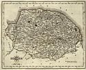
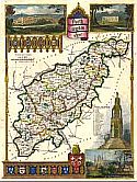
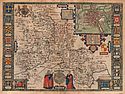
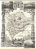
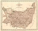
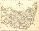
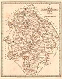
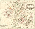
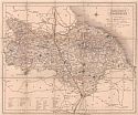
| Norfolk
|
 |
|
||||||||||||||||||||||||
|
 |
|
||||||||||||||||||||||||
|
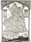
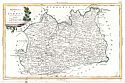
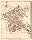
| Northamptonshire
|
 |
|
||||||||||||||||||||||||
|
 |
|
||||||||||||||||||||||||
|
 |
|
||||||||||||||||||||||||
|
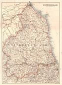
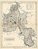
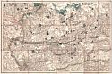
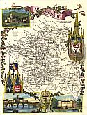
| Northumberland
|
 |
|
||||||||||||||||||||||||
|
 |
|
||||||||||||||||||||||||
|
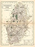
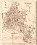
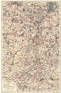
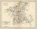
| Nottinghamshire
|
 |
|
||||||||||||||||||||||||
|
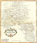
| Oxfordshire
|
 |
|
||||||||||||||||||||||||
|
 |
|
||||||||||||||||||||||||
|
 |
|
||||||||||||||||||||||||
|
 |
|
||||||||||||||||||||||||
|
 |
|
||||||||||||||||||||||||
|
 |
|
||||||||||||||||||||||||
|
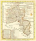
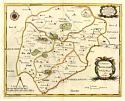
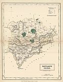
| Rutlandshire
|
 |
|
||||||||||||||||||||||||
|
 |
|
||||||||||||||||||||||||
|
 |
|
||||||||||||||||||||||||
|
 |
|
||||||||||||||||||||||||
|
New October 2013!!! |
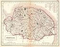
| Shropshire
|
 |
|
||||||||||||||||||||||||
|
 |
|
||||||||||||||||||||||||
|
| Somersetshire
|
 |
|
||||||||||||||||||||||||
|
 |
|
||||||||||||||||||||||||
|
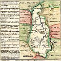
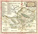
| Southwales
|
 |
|
||||||||||||||||||||||||
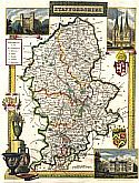
|
| Staffordshire
|
 |
|
||||||||||||||||||||||||
|
 |
|
||||||||||||||||||||||||
|
| Suffolk
|
 |
|
||||||||||||||||||||||||
|
 |
|
||||||||||||||||||||||||
|
 |
|
||||||||||||||||||||||||
|
 |
|
||||||||||||||||||||||||
|
| Surrey
|
 |
|
||||||||||||||||||||||||
|
 |
|
||||||||||||||||||||||||
|
 |
|
||||||||||||||||||||||||
|
 |
|
||||||||||||||||||||||||
|
| Sussex
|
 |
|
||||||||||||||||||||||||
|
 |
|
||||||||||||||||||||||||
|
 |
|
||||||||||||||||||||||||
|
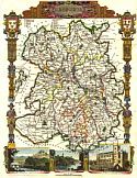
| Warwickshire |
 |
|
||||||||||||||||||||||||
|
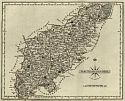
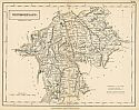
| Westmoreland |
 |
|
||||||||||||||||||||||||
|
 |
|
||||||||||||||||||||||||
|
 |
|
||||||||||||||||||||||||
|
 |
|
||||||||||||||||||||||||
|
New October 2013!!! |
 |
|
||||||||||||||||||||||||
|
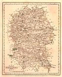
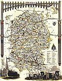
| Wiltshire
|
 |
|
||||||||||||||||||||||||
|
 |
|
||||||||||||||||||||||||
|
| Worchestershire
|
 |
|
||||||||||||||||||||||||
|
 |
|
||||||||||||||||||||||||
|
 |
|
||||||||||||||||||||||||
|
 |
|
||||||||||||||||||||||||
|
New October 2013!!! |
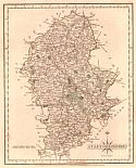
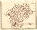
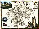
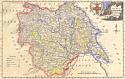
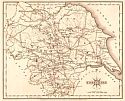
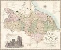
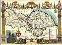
| Yorkshire
|
 |
|
||||||||||||||||||||||||
|
 |
|
||||||||||||||||||||||||
|
 |
|
||||||||||||||||||||||||
|
 |
|
||||||||||||||||||||||||
|
 |
|
||||||||||||||||||||||||
|
|
|
||
|
©
University of Alabama
|
To purchase map reproductions, submit a quote
request.
|
|