Use the menu to the right to browse our collection of out-of-print editions of U.S.G.S. Quadrangles. Please keep in mind that map coverage varies and may not be complete for all counties.
Out-of-Print Quadrangles
Main Author
Alabama Highway Dept.
Alabama Highway Dept.
Alabama Highway Dept.
Alabama Highway Dept.
Alabama Highway Dept.
Alabama Highway Dept.
Alabama Highway Dept.
Alabama Highway Dept.
Alabama Highway Dept.
Location
Russell County
Russell County
Russell County
Russell County
Russell County
Russell County
Russell County
Russell County
Russell County
Publication Information
Montgomery: ASHD
Montgomery: ASHD
Montgomery: ASHD
Montgomery: ASHD
Montgomery: ASHD
Montgomery: ASHD
Montgomery: ASHD
Montgomery: ASHD
Montgomery: ASHD
Date
2011
1994
1985
1975
1964
1954
1950
1938
1937
Scale
1:125,000
1:125,000
1:125,000
1:125,000
1:125,000
1:125,000
1:125,000
1:125,000
1:125,000
Viewing Options
Main Author:
LaTourrette, John
Title/Description:
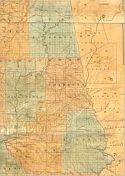
An Accurate Map of the State of Alabama and West Florida [Sheet 11: Chambers, Macon, Randolph, Russell, Tallapoosa]
Publication Info:
New York: Colton & Co., 1837
Title/Description:
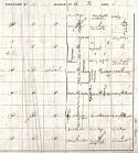
Russell County Landowners Map
Publication Info:
Unknown
Viewing Options
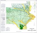
Main Author:
U.S. Department of Agriculture
Title/Description:
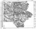
Russell County soil survey map
Publication Info:
Washington: U.S. Department of Agriculture
Viewing Options
Main Author:
U.S. Department of Agriculture
Title/Description:
Russell County soil survey map
Publication Info:
Washington: U.S. Department of Agriculture
Viewing Options
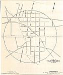
Main Author:
Alabama State Planning Commission
Title/Description:
Town of Hurstboro, Alabama
Publication Info:
Montgomery: Alabama State Planning Commission, 1944
Viewing Options
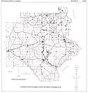
Main Author:
Scott, John C.
Title/Description:
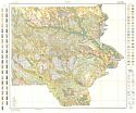
Geologic Map of Russell County, Alabama
Publication Info:
Geological Survey of Alabama, Special Map 24
Viewing Options
Main Author:
Peace, R.R., Jr.
Title/Description:
Location of Wells in Russell County and Areas of Artesian Flow
Publication Info:
Tuscaloosa: Geological Survey of Alabama, 1964; from Bulletin 75, Plate 1
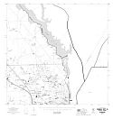
Phenix City North
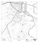
Phenix City North
Main Author:
State of Alabama Highway Department
Title/Description:
Phenix City (2 maps)
Publication Info:
Montgomery: State of Alabama Highway Department, 1975
Viewing Options
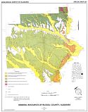
Main Author:
Dean, Lewis S.
Title/Description:
Mineral Resources of Russell County, Alabama
Publication Info:
Geological Survey of Alabama, Special Map 227