Viewing Options
Title/Description:
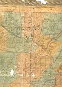
Decatur, Ala.
Publication Info:
New York: C.P. Gray, c. 1930
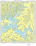
Viewing Options
Main Author:
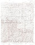
U.S. Geological Survey
Title/Description:
Danville Quadrangle (Preliminary Edition)
Publication Info:
Washington, D.C.: Department of the Interior, U.S. Geological Survey, c.1935
Viewing Options
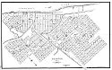
Main Author:
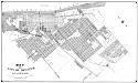
McClusky, H.G.
Title/Description:
Map of City of Decatur, Alabama
Publication Info:
[Decatur]: The Author, 1941
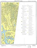
Viewing Options
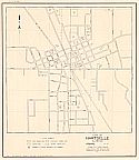
Main Author:
Alabama State Planning Commission
Title/Description:
City of Hartselle, Alabama
Publication Info:
Montgomery: Alabama State Planning Commission, 1941
Viewing Options
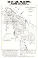
Main Author:
McKlusky, H.G.
Title/Description:
Decatur, Alabama
Publication Info:
Decatur Chamber of Commerce, c. 1948
Viewing Options
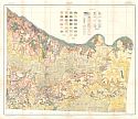
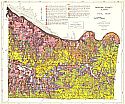
Main Author:
Brackeen, L.G.
Title/Description:
Soil Map Morgan County, Alabama
Publication Info:
Alabama Department of Agriculture, 1952
Finley Island
Decatur

Mason Ridge
Valhermoso Springs
Lacey Springs
Stoups Crossroads
Hartselle
Somerville
Center Grove
Newsome Sinks

McKendry
Falkville
Eva
Lawrence Cove
Hulaco
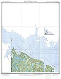
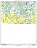
Main Author:
U.S. Department of Agriculture
Title/Description:
Soil Maps of Morgan County, Alabama
Publication Info:
Washington, D.C.: U.S. Department of Agriculture,
Soil Conservation Service, 1956
Viewing Options
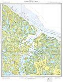
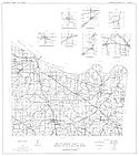
Main Author:
Dodson, Chester L. and Wiley F. Harris, Jr.
Title/Description:
Map of Morgan County, Ala., Showing Location of Wells and Springs
Publication Info:
Tuscaloosa: Geological Survey of Alabama, 1961; from Information Series 24, Plate 1
Viewing Options
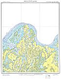
Main Author:
Dodson, Chester L., and Wiley F. Harris, Jr.
Title/Description:
Geologic Map of Morgan County, Alabama
Publication Info:
Geological Surgey of Alabama, Special Map 23
Viewing Options
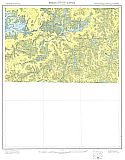
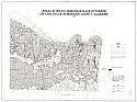
Main Author:
U.S. Department of the Interior, U.S. Geological Survey
Title/Description:
Areas in which sinkholes have occurred or can occur in Morgan County, Alabama
Publication Info:
United States Department of the Interior, U.S. Geological Survey, 1977
Viewing Options
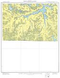
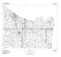
Main Author:
U.S. Geological Survey
Title/Description:
Morgan County
Publication Info:
Washington, D.C.: Department of the Interior, U.S. Geological Survey, 1974; advance sheet for eventually unpublished map series
Viewing Options
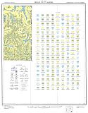
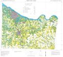
Main Author:
U.S. Department of Agriculture, Soil Conservation Service
Title/Description:
Soil Interpretive Map of Important Farmlands for Morgan County, Alabama
Publication Info:
U.S.D.A., Soil Conservation Service, c1980
Viewing Options
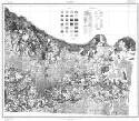
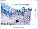
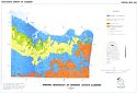
Main Author:
Rheams, Karen F.
Title/Description:
Mineral Resources of Morgan County, Alabama
Publication Info:
Geological Survey of Alabama, Special Map 242