Use the menu to the right to browse our collection of out-of-print editions of U.S.G.S. Quadrangles. Please keep in mind that map coverage varies and may not be complete for all counties.
Out-of-Print Quadrangles
Main Author
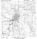
Alabama Highway Dept.
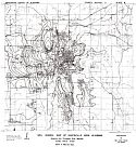
Alabama Highway Dept.
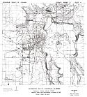
Alabama Highway Dept.
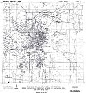
Alabama Highway Dept.
Alabama Highway Dept.
Alabama Highway Dept.
Alabama Highway Dept.
Alabama Highway Dept.
Alabama Highway Dept.
Location
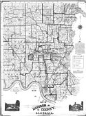
Madison County
Madison County
Madison County
Madison County
Madison County
Madison County
Madison County
Madison County
Madison County
Publication Information
Montgomery: ASHD
Montgomery: ASHD
Montgomery: ASHD
Montgomery: ASHD
Montgomery: ASHD
Montgomery: ASHD
Montgomery: ASHD
Montgomery: ASHD
Montgomery: ASHD
Date
2006
1996
1986
1976
1965
1959
1948
1938
1937
Scale
1:125,000
1:125,000
1:125,000
1:125,000
1:125,000
1:125,000
1:125,000
1:125,000
1:125,000
Viewing Options
Main Author:
LaTourrette, John
Title/Description:
An Accurate Map of the State of Alabama and West Florida [Sheet 3: Blount, Jackson, Limestone, Madison, Marshall, Morgan]
Publication Info:
New York: Colton & Co., 1837
Viewing Options
Viewing Options
Viewing Options
Viewing Options
Main Author:
Hartley and Drayton
Title/Description:
City of Huntsville, Madison County, Alabama
Publication Info:
Louisville: Hartley and Drayton, 1861; photographic reproduction of original held by the National Archives
Viewing Options
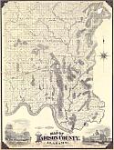
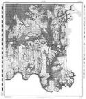
Main Author:
Mayhew, James H.
Title/Description:
Map of Madison County, Alabama
Publication Info:
Cincinnati: Strobridge and Co., 1875
Viewing Options
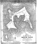
Main Author:
Mayhew, James H.
Title/Description:
Map of the Plateau of Monte Sano, Madison Co., Ala. (Photocopy)
Publication Info:
North Alabama Improvement Co., 1889
Viewing Options
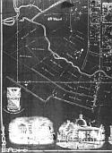
Main Author:
Burgolt, Paul
Title/Description:
Map of the Country in the Vicinity of Huntsville, Ala occupied as a Military Encampment by a portion of the Fourth Army Corps and other U.S. Troops in the Autumn of 1898
Publication Info:
Copy of a map held by the National Archives, Washington, D.C.
Viewing Options
Title/Description:
Map of Madison County, Alabama
Publication Info:
Unknown publisher, 1909
Viewing Options
Main Author:
U.S. Department of Agriculture
Title/Description:
Madison County soil survey map
Publication Info:
Washington: U.S. Department of Agriculture
Viewing Options
Main Author:
U.S. Department of Agriculture
Title/Description:
Madison County soil survey map
Publication Info:
Washington: U.S. Department of Agriculture
Viewing Options
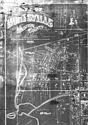
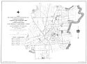
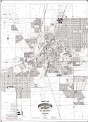
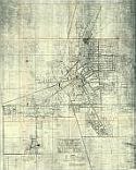
Title/Description:
City of Huntsville, Madison County, Alabama
Publication Info:
Huntsville: G.W. Jones and Sons, 1929
Viewing Options
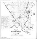
Title/Description:
Map of Madison County, Alabama Showing Original Boundary
Publication Info:
Huntsville, Ala: G.W. Jones & Sons, Engineers, 1932
Viewing Options
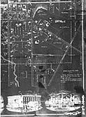
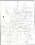
Main Author:
Alabama State Planning Commission
Title/Description:
City of Huntsville
Publication Info:
Montgomery: Alabama State Planning Commission, 1941
Viewing Options
Viewing Options
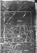
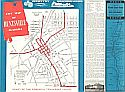
Title/Description:
City Map of Huntsville, Alabama
Publication Info:
Unknown Publisher, c.1950
Viewing Options
Title/Description:
City of Huntsville, Alabama Proposed Natural Gas System
Publication Info:
Birmingham: J.W. Goodwin Engineering Co., Inc.; blue print copy
Viewing Options
Main Author:
Brackeen, L.G.
Title/Description:
Soil Map Madison County , Alabama
Publication Info:
Alabama Department of Agriculture, 1952
Viewing Options
Main Author:
Geological Survey of Alabama
Title/Description:
Map Showing Wells and Springs in Huntsville Area, Alabama
Publication Info:
Tuscaloosa: Geological Survey of Alabama, 1952; Count Report 3, Plate 8
Viewing Options
Main Author:
Geological Survey of Alabama
Title/Description:
Map Showing Location of Test Wells in Huntsville Area, Alabama
Publication Info:
Tuscaloosa: Geological Survey of Alabama, 1952; County Report 3, Plate 7
Viewing Options
Main Author:
Geological Survey of Alabama
Title/Description:
Soil Isopach Map of Huntsville Area Alabama
Publication Info:
Tuscaloosa: Geological Survey of Alabama, 1952; County Report 3, Plate 6
Viewing Options
Main Author:
Geological Survey of Alabama
Title/Description:
Piezometric Map of Huntsville, Alabama
Publication Info:
Tuscaloosa: Geological Survey of Alabama, 1952; County Report 3, Plate 4
Viewing Options
Main Author:
Geological Survey of Alabama
Title/Description:
Structure Map of Huntsville Area, Alabama
Publication Info:
Tuscaloosa: Geological Survey of Alabama, 1952; County Report 3, Plate 2
Viewing Options
Main Author:
Geological Survey of Alabama
Title/Description:
Piezometric Map of Huntsville, Alabama
Publication Info:
Tuscaloosa: Geological Survey of Alabama, 1953; County Report 3, Plate 5
Viewing Options
Main Author:
Geological Survey of Alabama
Title/Description:
Structure Map of Madison County, Alabama, Showing Configuration of the Contact between the Chattanooga Shale and Fort Payne Chert
Publication Info:
Tuscaloosa: Geological Survey of Alabama, 1954; County Report 3, Plate 3
Viewing Options
Main Author:
Geological Survey of Alabama
Title/Description:
Map Showing Wells and Springs in Madison County, Alabama
Publication Info:
United States Geological Survey, 1954; County Report 3, Plate 9
Main Author:
U.S. Department of Agriculture
Title/Description:
Soil Survey, Madison County, Alabama
Publication Info:
Washington: U.S. Department of Agriculture, Soil Conservation Servicde, 1958
Viewing Options
Main Author:
Sanford, Jr., T.H., G.T. Malmberg and L.R. West
Title/Description:
Geology of the Huntsville Quadrangle, Alabama
Publication Info:
Washington, D.C.: Department of the Interior, U.S. Geological Survey, 1961
Viewing Options
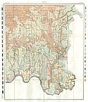
Main Author:
Malmberg, Glenn T. and T.H. Sanford, Jr.
Title/Description:
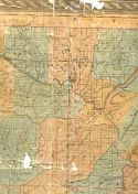
Geologic Map of Madison County, Alabama
Publication Info:
Geological Survey of Alabama, Special Map 25
Sheet 5
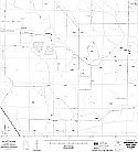
Sheet 6
Sheet 7
Sheet 4
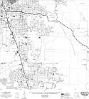
Sheet 1
Sheet 8
Sheet 3
Sheet 2
Sheet 9
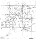
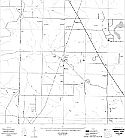
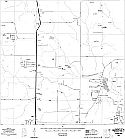
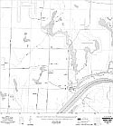
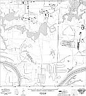
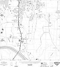
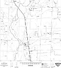
Main Author:
State of Alabama Highway Department
Title/Description:
Huntsville (13 maps)
Publication Info:
Montgomery: State of Alabama Highway Department, 1975
Sheet 12
Sheet 11
Sheet 10
Sheet 13
Viewing Options
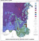
Main Author:
Chaffin, Herbert S. Jr.
Title/Description:
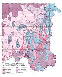
Mineral Resources Map of Madison County, Alabama
Publication Info:
Tuscaloosa: Geological Survey of Alabama, Special Map 155
Viewing Options
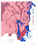
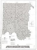
Main Author:
U.S. Department of the Interior, U.S. Geological Survey
Title/Description:
Areas in which sinkholes have occurred or can occur in Madison County, Alabama
Publication Info:
Washington: United States Department of the Interior, U.S. Geological Survey, 1977
Viewing Options
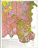
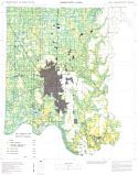
Main Author:
U.S. Department of Agriculture, Soil Conservation Service
Title/Description:
Soil Interpretive Map of Important Farmlands for Madison County, Alabama
Publication Info:
Washington: U.S. Department of Agriculture, Soil Conservation Service, 1980