Use the menu to the right to browse our collection of out-of-print editions of U.S.G.S. Quadrangles. Please keep in mind that map coverage varies and may not be complete for all counties.
Out-of-Print Quadrangles
Main Author
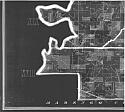
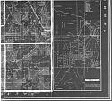
Alabama Highway Dept.
Alabama Highway Dept.
Alabama Highway Dept.
Alabama Highway Dept.
Alabama Highway Dept.
Alabama Highway Dept.
Alabama Highway Dept.
Alabama Highway Dept.
Location
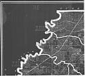
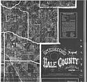
Hale County
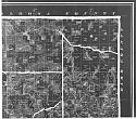
Hale County
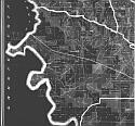
Hale County
Hale County
Hale County
Hale County
Hale County
Hale County
Publication Information
Montgomery: ASHD
Montgomery: ASHD
Montgomery: ASHD
Montgomery: ASHD
Montgomery: ASHD
Montgomery: ASHD
Montgomery: ASHD
Montgomery: ASHD
Date
2012
2003
1994
1986
1976
1949
1938
1937
Scale
1:125,000
1:125,000
1:125,000
1:125,000
1:125,000
1:125,000
1:125,000
1:125,000
Viewing Options
Viewing Options
Viewing Options
Viewing Options
Viewing Options
Viewing Options
Main Author:
Snedecor, V. Gayle
Title/Description:
Snedecor's Map of Hale County, Alabama, 1870
Publication Info:
Boston: Walling and Gray, 1870; photographic reproduction of original
Viewing Options
Publication Info:
Photocopy of a hand drawn map of lots in Erie, Alabama, dated 1909
Viewing Options
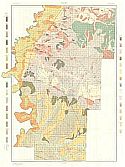
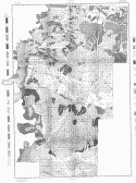
Main Author:
U.S. Department of Agriculture
Title/Description:
Hale County soil survey map
Publication Info:
Washington: U.S. Department of Agriculture, 1909
Viewing Options
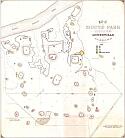
Main Author:
Jones, Walter B.
Title/Description:
Map of Mound Park situated near Moundville, Alabama
Publication Info:
Huntsville: G.W. Jones and Sons, 1930; hand drawn additions to a blueprinted basemap
Viewing Options
Main Author:
U.S. Department of Agriculture
Title/Description:
Hale County soil survey map
Publication Info:
Washington: U.S. Department of Agriculture, 1931
Viewing Options
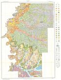
Main Author:
U.S. Department of Agriculture
Title/Description:
Soil Map of Hale County, Alabama
Publication Info:
Washington: U.S. Department of Agriculture, 1935
Viewing Options
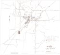
Main Author:
Moundville Town Planning Commission
Title/Description:
Town of Moundville Alabama Land Use Map
Publication Info:
Montgomery: Alabama State Planning and Industrial Development Board1955
Viewing Options
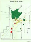
Main Author:
Tuscaloosa Area Council of Local Governments
Title/Description:
Moundville Existing Land Use
Publication Info:
Tuscaloosa Area Council of Local Government, 1970
Viewing Options
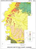
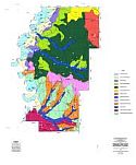
Main Author:
Sanford, Thomas H.
Title/Description:
Geologic Map of Hale County, Alabama
Publication Info:
Tuscaloosa: Geological Survey of Alabama, Special Map 136
Viewing Options
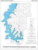
Main Author:
Davis, Marvin E.
Title/Description:
Availability of Ground Water Hale County, Alabama
Publication Info:
Tuscaloosa: Geological Survey of Alabama, 1975; Map 136 Plate 2
Viewing Options
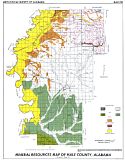
Main Author:
Tolson, Janyth S.
Title/Description:
Mineral Resources Map of Hale County, Alabama
Publication Info:
Tuscaloosa: Geological Survey of Alabama, Special Map 178
Viewing Options
Main Author:
U.S. Department of Agriculture
Title/Description:
General Soil Map
Publication Info:
Washington: U.S. Department of Agriculture, Natural Resources Conservation Service, 2000

