Use the menu to the right to browse our collection of out-of-print editions of U.S.G.S. Quadrangles. Please keep in mind that map coverage varies and may not be complete for all counties.
Out-of-Print Quadrangles
Main Author
Alabama Highway Dept.
Alabama Highway Dept.
Alabama Highway Dept.
Alabama Highway Dept.
Alabama Highway Dept.
Alabama Highway Dept.
Alabama Highway Dept.
Alabama Highway Dept.
Alabama Highway Dept.
Alabama Highway Dept.
Location
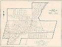
Etowah County
Etowah County
Etowah County
Etowah County
Etowah County
Etowah County
Etowah County
Etowah County
Etowah County
Etowah County
Publication Information
Montgomery: ASHD
Montgomery: ASHD
Montgomery: ASHD
Montgomery: ASHD
Montgomery: ASHD
Montgomery: ASHD
Montgomery: ASHD
Montgomery: ASHD
Montgomery: ASHD
Montgomery: ASHD
Date
2008
1999
1992
1982
1970
1965
1960
1949
1938
1937
Scale
1:125,000
1:125,000
1:125,000
1:125,000
1:125,000
1:125,000
1:125,000
1:125,000
1:125,000
1:125,000
Viewing Options
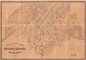
Title/Description:
Tallman's Map of Etowah County, Alabama
Publication Info:
Cincinatti: Krebs Lithographing Co., 1877
Viewing Options
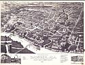
Title/Description:
Perspective Map of the City of Gadsden, Alabama
Viewing Options
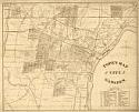
Title/Description:
Pope's Map of Gadsden
Publication Info:
New York: Phot-Gravure Co., c.1888

Viewing Options
Main Author:
Hill and Campbell
Title/Description:
Gadsden
Publication Info:
Gadsden: Hill and Campbell, 1910
Viewing Options
Main Author:
Hill and Campbell
Title/Description:
West Point Addition to the City of Gadsden, Ala.
Publication Info:
Gadsden: Hill and Campbell, 1910
Viewing Options
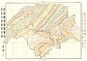
Main Author:
U.S. Department of Agriculture
Title/Description:
Etowah County soil survey map
Publication Info:
Washington: U.S. Department of Agriculture, 1913
Viewing Options
Main Author:
U.S. Department of Agriculture
Title/Description:
Etowah County soil survey map
Publication Info:
Washington: U.S. Department of Agriculture, 1913
Viewing Options
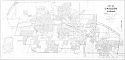
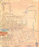
Title/Description:
Sketch of the Greater Gadsden District Showing Railroad Facilities and the Location of some of the Leading Manufacturing Plants
Publication Info:
Gadsden: Capen, 1929
Viewing Options
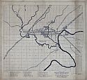
Main Author:
Works Progress Administration
Title/Description:
Map of the City of Gadsden, Alabama
Publication Info:
Works Progress Administration, 1938
Viewing Options
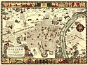
Title/Description:
A Pictorial Map of Gadsden, Alabama with Scenes of Today and Yesterday
Publication Info:
Gadsden: The Women's Club and the City Commission, 1939

Viewing Options
Viewing Options
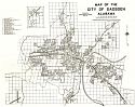
Title/Description:
City of Gadsden, Alabama
Publication Info:
Montgomery: Alabama State Planning Commission, 1940
Viewing Options
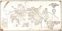
Main Author:
Alabama State Planning Commission
Title/Description:
City of Attalla, Alabama
Publication Info:
Montgomery: Alabama State Planning Commission, 1940
Viewing Options
Viewing Options
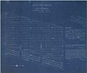
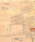
Main Author:
Brazel, G.M.
Title/Description:
Tenements, Dwight Manufacturing Company, Gadsden, Alabama
Publication Info:
Blueprint dated Nov. 2, 1942
Viewing Options
Main Author:
Gadsden Chamber of Commerce
Title/Description:
Map of the City of Gadsden
Publication Info:
Gadsden Chamber of Commerce, 1951
Viewing Options
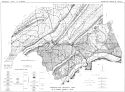
Main Author:
Causey, L.V.
Title/Description:
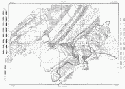
Generalized Geologic Map of Etowah County, Alabama
Publication Info:
Tuscaloosa: Geological Survey of Alabama Information Series 25, Plate 1
Viewing Options
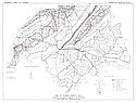
Main Author:
Causey, Lawson V.
Title/Description:
Map of Etowah County, Ala., Showing Location of Wells and Springs and Area of Artesian Flow
Publication Info:
Tuscaloosa: Geological Survey of Alabama, 1961; from Information Series 25, Plate 2
Viewing Options
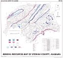
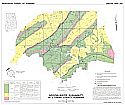
Main Author:
Neathery, T.L., Clarke, O.M. Jr., Szabo, M.W.
Title/Description:
Mineral Resources Map of Etowah County, Alabama
Publication Info:
Tuscaloosa: Geological Survey of Alabama, Special Map 86
Viewing Options
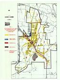
Title/Description:
Glencoe, Alabama, Existing Land Use
Publication Info:
Anniston: East Alabama Regional Planning and Development Commission, 1974
Sheet 1
Sheet 2
Sheet 3
Sheet 4
Sheet 5
Sheet 6
Sheet 7
Sheet 8
Sheet 9
Sheet 10
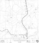
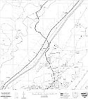
Main Author:
State of Alabama Highway Department
Title/Description:
Gadsden (10 maps)
Publication Info:
Montgomery: State of Alabama Highway Department, 1976
Viewing Options
Main Author:
United States Geological Survey
Title/Description:
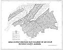
Areas in which sinkholes have occurred or can occur in Etowah County, Alabama
Publication Info:
Washington: Department of the Interior, U.S. Geological Survey, 1977
Viewing Options
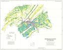
Main Author:
U.S. Department of Agriculture
Title/Description:
Soil Interpretive Map of Important Farmlands for Etowah County, Alabama
Publication Info:
Washington: U.S. Department of Agriculture, Soil Conservation Service, 1979
Viewing Options
Main Author:
Baker, Robert M. and Steven D. Mann
Title/Description:
Availability of Ground Water in Etowah County, Alabama
Publication Info:
Tuscaloosa: Geological Survey of Alabama, 1995; Special Map 243

