Use the menu to the right to browse our collection of out-of-print editions of U.S.G.S. Quadrangles. Please keep in mind that map coverage varies and may not be complete for all counties.
Out-of-Print Quadrangles
Main Author
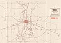
Alabama Highway Dept.
Alabama Highway Dept.
Alabama Highway Dept.
Alabama Highway Dept.
Alabama Highway Dept.
Alabama Highway Dept.
Alabama Highway Dept.
Alabama Highway Dept.
Location
Chambers County
Chambers County
Chambers County
Chambers County
Chambers County
Chambers County
Chambers County
Chambers County
Publication Information
Montgomery: ASHD
Montgomery: ASHD
Montgomery: ASHD
Montgomery: ASHD
Montgomery: ASHD
Montgomery: ASHD
Montgomery: ASHD
Montgomery: ASHD
Date
2009
2001
1992
1985
1973
1978
1938
1937
Scale
1:125,000
1:125,000
1:125,000
1:125,000
1:125,000
1:125,000
1:125,000
1:125,000
Viewing Options
Main Author:
LaTourrette, John
Title/Description:
An Accurate Map of the State of Alabama and West Florida [Sheet 11: Chambers, Macon, Randolph, Russell, Tallapoosa]
Publication Info:
New York: Colton & Co., 1837
Viewing Options
Main Author:
U.S. Department of Agriculture
Title/Description:
Chambers County soil survey map
Publication Info:
Washington: U.S. Department of Agriculture, 1909
Viewing Options
Main Author:
U.S. Department of Agriculture
Title/Description:
Chambers County soil survey map
Publication Info:
Washington: U.S. Department of Agriculture, 1909

Viewing Options
Main Author:
Western Railway of Alabama
Title/Description:
(Western Railway of Alabama Right of Way through the Town of Cusseta)
Publication Info:
Atlanta: Western Railway of Alabama, c. 1925
Original Source:
Heart of Dixie Railroad Museum
Viewing Options
Viewing Options
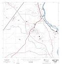
Main Author:
State of Alabama Highway Department
Title/Description:
Lanett (2 maps)
Publication Info:
Montgomery: State of Alabama Highway Department, 1970
Viewing Options
Main Author:
Black, H.R., and Hall, D.M.
Title/Description:
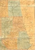
Map | Chambers County State of Alabama Exhibiting the Locations of Creek Reservation Under the Treaty of March 14, 1832
Publication Info:
S.N., 1974; Redrawn from John James Albert's 1832 map
Viewing Options
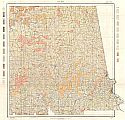
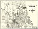
Main Author:
Chandler, Robert V. and Lines, Gregory C.
Title/Description:
Water Availability, Chambers County, Alabama
Publication Info:
Tuscaloosa: Geological Survey of Alabama, 1975; Map 133
Viewing Options
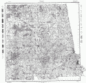
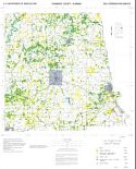
Main Author:
U.S. Department of Agriculture, Soil Conservation Service
Title/Description:
Soil Interpretive Map of Important Farmlands for Chambers County, Alabama
Publication Info:
Washington: Department of Agriculture, 1980
Viewing Options
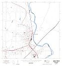
Main Author:
Office of State Planning and Federal Programs
Title/Description:
Lafayette, Alabama
Publication Info:
Montgomery: Office of State Planning and Federal Programs, 1980; from Development Potentials Along the U.S. Highway 431 Corridor
Viewing Options
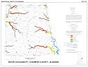
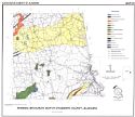
Main Author:
Wade, George D.
Title/Description:
Mineral Resources of Chambers County, Alabama
Publication Info:
Tuscaloosa: Geological Survey of Alabama, Special Map 165

