Use the menu to the right to browse our collection of out-of-print editions of U.S.G.S. Quadrangles. Please keep in mind that map coverage varies and may not be complete for all counties.
Out-of-Print Quadrangles
Main Author
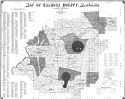
Alabama Highway Dept.
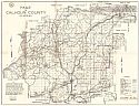
Alabama Highway Dept.
Alabama Highway Dept.
Alabama Highway Dept.
Alabama Highway Dept.
Alabama Highway Dept.
Alabama Highway Dept.
Alabama Highway Dept.
Alabama Highway Dept.
Location
Calhoun County
Calhoun County
Calhoun County
Calhoun County
Calhoun County
Calhoun County
Calhoun County
Calhoun County
Calhoun County
Publication Information
Montgomery: ASHD
Montgomery: ASHD
Montgomery: ASHD
Montgomery: ASHD
Montgomery: ASHD
Montgomery: ASHD
Montgomery: ASHD
Montgomery: ASHD
Montgomery: ASHD
Date
2014
2005
1996
1988
1977
1965
1959
1948
1937
Scale
1:125,000
1:125,000
1:125,000
1:125,000
1:125,000
1:125,000
1:125,000
1:125,000
1:125,000
Viewing Options
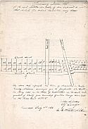
Main Author:
Lindsey, Johyn
Title/Description:
Survey of the town of Alexandria
Publication Info:
unpublished hand written document
Viewing Options
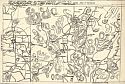
Main Author:
Stephen, Walter W.
Title/Description:
Part of Northern Area of Present Calhoun County, Alabama
Publication Info:
Hand Drawn (traced) by Water W. Stephen from an original map of c.1865
Viewing Options
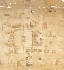
Title/Description:
Diagram of Jacksonville, Alabama (hand drawn map)
Publication Info:
Montgomery: Unknown publisher, c.1875
Viewing Options
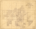
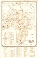
Main Author:
Anniston Land Company
Title/Description:
Map of the City of Anniston
Publication Info:
Boston: Heliotype Printing Co., 1890
Viewing Options
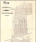
Main Author:
Piedmont Land and Improvement Company
Title/Description:
Map of Piedmont, Alabama
Viewing Options
Main Author:
The Forbes Co.
Title/Description:
Map of Tredegar, Alabama
Publication Info:
Boston: The Forbes Co., 1890; photocopy of original
Viewing Options
Main Author:
U.S. Department of Agriculture
Title/Description:
Calhoun County soil survey map
Publication Info:
Washington: U.S. Department of Agriculture, 1908
Viewing Options
Main Author:
U.S. Department of Agriculture
Title/Description:
Calhoun County soil survey map
Publication Info:
Washington: U.S. Department of Agriculture, 1908
Viewing Options
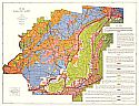
Main Author:
Deese, S.W. and M.A.
Title/Description:
Map of Calhoun County, Alabama
Publication Info:
Atlanta: The Hudgins Co., 1910
Viewing Options
Main Author:
Ward, George W.
Title/Description:
Map of Calhoun County, Alabama
Publication Info:
Montgomery: George W. Ward, 1930
Viewing Options
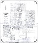
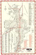
Main Author:
Totten, Robert
Title/Description:
Totten's Official Street Map of Anniston, Alabama
Publication Info:
Unknown
Viewing Options
Main Author:
Anniston Chamber of Commerce
Title/Description:
Totten's Official Map of Anniston, Alabama
Publication Info:
Anniston: Anniston Chamber of Commerce, 1948
Viewing Options
Main Author:
Brackeen, L.G.
Title/Description:
Soil Map Calhoun County, Alabama
Publication Info:
Tuscaloosa: Alabama Department of Agriculture, 1952
Viewing Options
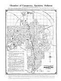
Main Author:
Anniston Chamber of Commerce
Title/Description:
Anniston, Alabama
Publication Info:
Anniston: Chamber of Commerce, c.1954
Viewing Options
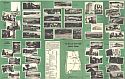
Main Author:
Anniston Chamber of Commerce
Title/Description:
City Map and Street Guide, Anniston, Alabama
Publication Info:
Anniston Chamber of Commerce, c.1954
Viewing Options
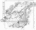
Main Author:
Warman, James C., Lawson V. Causey, James H. Burks and Helmat W. Ziemand
Title/Description:
Map Showing Location of Wells and Springs in Calhoun County, Alabama
Publication Info:
Tuscaloosa: Geological Survey of Alabama, 1960; from Information Series 17, Plate 1
Viewing Options
Main Author:
Warman, J.C., and Causey, L.V.
Title/Description:
Geologic Map of Calhoun County, Alabama
Publication Info:
Tuscaloosa: Geological Survey of Alabama, Special Map 17
Viewing Options
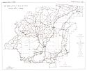
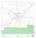
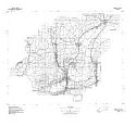
Main Author:
State of Alabama Highway Department
Title/Description:
Piedmont
Publication Info:
Montgomery: State of Alabama Highway Department, 1970
Viewing Options
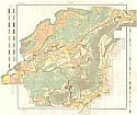
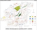
Main Author:
Neathery, Thornton L., Clarke, Otis M. Jr., Smith, W. Everett, Szabo, Michael W., and White, Doss H.
Title/Description:
Mineral Resources Map of Calhoun County, Alabama
Publication Info:
Tuscaloosa: Geological Survey of Alabama, Special Map 116
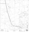
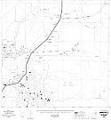
Sheet 1
Sheet 2
Sheet 3
Sheet 4
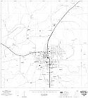
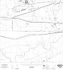
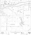
Main Author:
State of Alabama Highway Department
Title/Description:
Anniston (8 maps) Sheets 1-4
Publication Info:
Montgomery: State of Alabama Highway Department, 1976
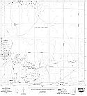
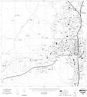
Sheet 5
Sheet 6
Sheet 7
Sheet 8
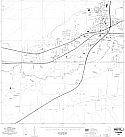
Main Author:
State of Alabama Highway Department
Title/Description:
Anniston (8 maps) Sheets 5-8
Publication Info:
Montgomery: State of Alabama Highway Department, 1976
Viewing Options
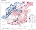
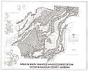
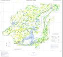
Main Author:
U.S. Geological Survey
Title/Description:
Areas in which sinkholes have occured or can occur in Calhoun County, Alabama
Publication Info:
Washington: Department of the Interior, U.S. Geological Survey, 1977
Viewing Options
Main Author:
U.S. Geological Survey
Title/Description:
Calhoun County
Publication Info:
Washington: Department of the Interior, U.S. Geological Survey, 1974; advance sheet for eventually unpublished map series
Viewing Options
Main Author:
U.S. Department of Agriculture, Soil Conservation Service
Title/Description:
Soil Interpretive Map of Important Farmlands for Calhoun County, Alabama
Publication Info:
Washington: U.S. Department of Agriculture, 1980

