Use the menu to the right to browse our collection of out-of-print editions of U.S.G.S. Quadrangles. Please keep in mind that map coverage varies and may not be complete for all counties.
Out-of-Print Quadrangles
Main Author
Alabama Highway Dept.
Alabama Highway Dept.
Alabama Highway Dept.
Alabama Highway Dept.
Alabama Highway Dept.
Alabama Highway Dept.
Alabama Highway Dept.
Alabama Highway Dept.
Alabama Highway Dept.
Location
Autauga County
Autauga County
Autauga County
Autauga County
Autauga County
Autauga County
Autauga County
Autauga County
Autauga County
Publication Information
Montgomery: ASHD
Montgomery: ASHD
Montgomery: ASHD
Montgomery: ASHD
Montgomery: ASHD
Montgomery: ASHD
Montgomery: ASHD
Montgomery: ASHD
Montgomery: ASHD
Date
2011
2001
1992
1985
1975
1965
1948
1938
1937
Scale
1:125,000
1:125,000
1:125,000
1:125,000
1:125,000
1:125,000
1:125,000
1:125,000
1:125,000
Viewing Options
Title/Description:
Pickett Range, Autaugaville
Publication Info:
Hand drawn map from the Pickett Papers
Viewing Options
Main Author:
LaTourrette, John
Title/Description:
An Accurate Map of the State of Alabama and West Florida [Sheet 12: Autauga, Bibb, Coosa, Montgomery, Shelby, Talladega]
Publication Info:
New York: Colton & Co., 1837
Viewing Options
Main Author:
LaTourrette, John
Title/Description:
An Accurate Map of the State of Alabama and West Florida [Sheet 16: Autauga, Bibb, Dallas, Jefferson, Perry, Shelby]
Publication Info:
New York: Colton & Co., 1837
Viewing Options
Main Author:
LaTourette, John
Title/Description:
An Accurate Map of the State of Alabama and West Florida [Sheet 19: Autauga, Butler, Dallas, Lowndes, Perry, Wilcox]
Publication Info:
New York: Colton & Co., 1837

Viewing Options
Main Author:
Faust, F.C., Engineer
Title/Description:
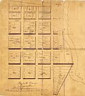
Map of Prattville, Alabama
Publication Info:
Blueprint copy of map dated Jan. 1, 1891
Viewing Options
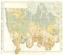
Main Author:
U.S. Department of Agriculture
Title/Description:
Autauga County soil survey map
Publication Info:
Washington: U.S. Department of Agriculture, 1906
Viewing Options
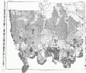
Main Author:
U.S. Department of Agriculture
Title/Description:
Autauga County soil survey map
Publication Info:
Washington: U.S. Department of Agriculture, 1906
Viewing Options
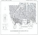
Title/Description:
Map of Autauga County, Alabama
Publication Info:
Birmingham: Bethel W. Whitson, c.1930
Viewing Options
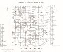
Main Author:
Works Progress Administration
Title/Description:
Autauga County Property Ownership Maps
Publication Info:
Montgomery: Alabama State Highway Department, 1936
Viewing Options
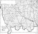
Main Author:
Scott, John C. and Newton, John G.
Title/Description:
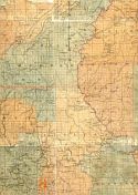
Geologic Reconnaissance map of Autauga County, Alabama
Publication Info:
Tuscaloosa: Geological Survey of Alabama, 1960: Information Series 21 Plate 2
Viewing Options
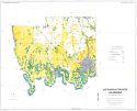
Title/Description:
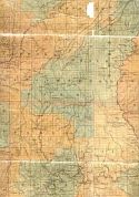
Soil Interpretive Map of Important Farmlands for Autauga County, Alabama
Publication Info:
Washington: U.S. Department of Agriculture, Soil Conservation Service, c.1979
Viewing Options
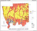
Main Author:
Tew, Berry H.
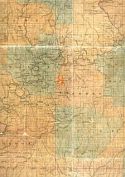
Title/Description:
Mineral Resources of Autauga County, Alabama
Publication Info:
Tuscaloosa: Geological Survey of Alabama, Special Map 211

