1875 - 1900


Before 1875
1875-1900
After 1900

Previous Page
Next Page

  Main Author:   Walling, Henry F.
  Title/Description:   Counties of Quebec, Montmorency, Portneuf, Lislet, Montmagny, Bellechasse, Dorchester, Levis and Lotbiniere - Province of Quebec
  Publication Info:   Montreal: 1875; from Tackabury's Atlas of the Dominion of Canada
  Date:   1875
  Scale:   1:380,000
  Original Source:   University of Alabama Map Library
Viewing options:


  Main Author:   Walling, Henry F.
  Title/Description:   Map of the Western Part of the Province of Quebec, Canada
  Publication Info:   Montreal: 1875; from Tackabury's Atlas of the Dominion of Canada
  Date:   1875
  Scale:   1:887,000
  Original Source:   University of Alabama Map Library
Viewing options:


  Main Author:   Walling, Henry F.
  Title/Description:   Map of the Eastern Part of the Province of Quebec, Canada
  Publication Info:   Montreal: 1875; from Tackabury's Atlas of the Dominion of Canada
  Date:   1875
  Scale:   1:887,000
  Original Source:   University of Alabama Map Library
Viewing options:


  Main Author:   Walling, Henry F.
  Title/Description:   Map of the Central Part of the Province of Quebec, Canada
  Publication Info:   Montreal: 1875; from Tackabury's Atlas of the Dominion of Canada
  Date:   1875
  Scale:   1:887,000
  Original Source:   University of Alabama Map Library
Viewing options:


  Main Author:   James R. Osgood and Company
  Title/Description:   Montreal
  Publication Info:   Boston: James R. Osgood and Company, 1875; from The Maritime Provinces: A Handbook for Travelers
  Date:   1875
  Scale:   1:65,000
  Original Source:   University of Alabama Map Library
Viewing options:


  Main Author:   James R. Osgood and Company
  Title/Description:   Quebec
  Publication Info:   Boston: James R. Osgood and Company, 1875; from The Maritime Provinces: A Handbook for Travelers
  Date:   1875
  Scale:   1:65,000
  Original Source:   University of Alabama Map Library
Viewing options:


  Main Author:   James R. Osgood and Company
  Title/Description:   Map of the Saguenay River, Map of that Part of the River St. Lawrence Traversed by the Saguenay River
  Publication Info:   Boston: James R. Osgood and Company, 1875; from The Maritime Provinces: A Handbook for Travelers
  Date:   1875
  Scale:   1:various
  Original Source:   University of Alabama Map Library
Viewing options:


  Main Author:   Walling, Henry F.
  Title/Description:   County of Pontiac - Province of Quebec
  Publication Info:   Montreal: 1875; from Tackabury's Atlas of the Dominion of Canada
  Date:   1875
  Scale:   1:380,000
  Original Source:   University of Alabama Map Library
Viewing options:


  Main Author:   Walling, H.F.
  Title/Description:   County Gaspe and parts of Bonaventure and Rimouski, Province of Quebec
  Publication Info:   Montreal: G. N. Tackabury; from Tackabury's Atlas of the Dominion of Canada
  Date:   1875
  Scale:   1:380,160
  Original Source:   University of Alabama Map Library
Viewing options:


  Main Author:   Walling, H.F.
  Title/Description:   Plan of the City of Quebec
  Publication Info:   Montreal: G. N. Tackabury; from Tackabury's Atlas of the Dominion of Canada
  Date:   1875
  Scale:   1:10,800
  Original Source:   University of Alabama Map Library
Viewing options:


  Main Author:   Walling, H.F.
  Title/Description:   Counties of Charlevoix and Kmaouraska, Province of Quebec
  Publication Info:   Montreal: G. N. Tackabury; from Tackabury's Atlas of the Dominion of Canada
  Date:   1875
  Scale:   1:380,160
  Original Source:   University of Alabama Map Library
Viewing options:


  Main Author:   Walling, H.F.
  Title/Description:   Map of the Province of Brunswick
  Publication Info:   Montreal: G. N. Tackabury; from Tackabury's Atlas of the Dominion of Canada
  Date:   1875
  Scale:   1:1,267,200
  Original Source:   University of Alabama Map Library
Viewing options:


  Main Author:   Walling, H.F.
  Title/Description:   County of Chicoutimi and part of Saguenay, Province of Quebec
  Publication Info:   Montreal: G. N. Tackabury; from Tackabury's Atlas of the Dominion of Canada
  Date:   1875
  Scale:   1:380,160
  Original Source:   University of Alabama Map Library
Viewing options:


  Main Author:   Walling, H.F.
  Title/Description:   Counties of Wolfe and Compton, Province of Quebec
  Publication Info:   Montreal: G. N. Tackabury; from Tackabury's Atlas of the Dominion of Canada
  Date:   1875
  Scale:   1:380,160
  Original Source:   University of Alabama Map Library
Viewing options:


  Main Author:   Walling, H.F.
  Title/Description:   County of Ottowa, Province of Quebec
  Publication Info:   Montreal: G. N. Tackabury; from Tackabury's Atlas of the Dominion of Canada
  Date:   1875
  Scale:   1:380,160
  Original Source:   University of Alabama Map Library
Viewing options:


  Main Author:   Walling, H.F.
  Title/Description:   Counties of Beauce and Megantic, Province of Quebec
  Publication Info:   Montreal: G. N. Tackabury; from Tackabury's Atlas of the Dominion of Canada
  Date:   1875
  Scale:   1:380,160
  Original Source:   University of Alabama Map Library
Viewing options:


  Main Author:   Mitchell, S. Augustus
  Title/Description:   Quebec in Counties
  Publication Info:   Philadelphia: S. Augustus Mitchell, 1880; from The New General Atlas
  Date:   1880
  Scale:   1:2,024,607
  Original Source:   Courtesy of Murray Hudson, Halls, Tennessee
Viewing options:


  Main Author:   Rand McNally and Company
  Title/Description:   Quebec
  Publication Info:   Chicago, Rand McNally and Company, 1881; from New Indexed Business Atlas and Shippers Guide
  Date:   1881
  Scale:   1:1,837,440
  Original Source:   University of Alabama Map Library
Viewing options:


  Main Author:   Hardesty, H.H.
  Title/Description:   Map of Quebec
  Publication Info:   New York: H.H. Hardesty and Company, 1883; from The Historical and Geographical Encyclopedia
  Date:   1883
  Scale:   1:1,901,000
  Original Source:   Courtesy of Murray Hudson, Halls, Tennessee
Viewing options:


  Main Author:   Bartholomew, John
  Title/Description:   Province of Quebec
  Publication Info:   London: George Philip and Son, 1883; from The Atlas of the British Empire Throughout the World
  Date:   1883
  Scale:   1:2,535,000
  Original Source:   University of Alabama Map Library
Viewing options:


  Main Author:   Rand McNally and Company
  Title/Description:   Quebec
  Publication Info:   Chicago: Rand McNally and Company, 1884; from The Indexed Atlas of the World
  Date:   1884
  Scale:   1:1,900,000
  Original Source:   From the personal collection of Dr. Gerald Webster
Viewing options:


  Main Author:   Hardesty, H.H.
  Title/Description:   Map of Quebec
  Publication Info:   New York: H.H. Hardesty and Company, 1884; from The Historical and Geographical Encyclopedia
  Date:   1884
  Scale:   1:1,869,120
  Original Source:   Courtesy of Murray Hudson, Halls, Tennessee
Viewing options:


Main Author:   Ells, R.W.
Title/Description:   (Geology of the Southern Shore of the St. Lawrence River)
Publication Info:   Ottawa: Geological Survey of Canada, 1884
Date:   1884
Scale:   1:253,440
Original Source:   Geological Survey of Alabama
Sheet 1
Sheet 2
Sheet 3
Viewing options:
Viewing options:
Viewing options:
JPEG or Plugin
JPEG or Plugin
JPEG or Plugin
     
Sheet 4
Sheet 5
Sheet 6
Viewing options:
Viewing options:
Viewing options:
JPEG or Plugin
JPEG or Plugin
JPEG or Plugin


  Main Author:   Mitchell, S. Augustus
  Title/Description:   Map of Quebec in Counties
  Publication Info:   Philadelphia: William M. Bradley and Brother, 1884; from The Atlas of the World
  Date:   1884
  Scale:   1:2,027,520
  Original Source:   Courtesy of Murray Hudson, Halls, Tennessee
Viewing options:


  Main Author:   Cram, George F.
  Title/Description:   Quebec
  Publication Info:   Chicago: George F. Cram, 1886; from Cram's Unrivaled Family Atlas of the World
  Date:   1886
  Scale:   1:2,217,600
  Original Source:   Courtesy of Murray Hudson, Halls, Tennessee
Viewing options:


  Main Author:   Cram, George F.
  Title/Description:   Quebec
  Publication Info:   Chicago: George F. Cram, 1887
  Date:   1887
  Scale:   1:2,218,000
  Original Source:   Courtesy of Murray Hudson, Halls, Tennessee
Viewing options:


  Main Author:   Mitchell, S. Augustus
  Title/Description:   Map of Quebec in Counties
  Publication Info:   Philadelphia: William M. Bradley and Brother., 1888; from The New General Atlas
  Date:   1887
  Scale:   1:1,900,800
  Original Source:   Courtesy of Murray Hudson, Halls, Tennessee
Viewing options:


  Main Author:   Grant, A.A.
  Title/Description:   Quebec
  Publication Info:   New York: A.A. Grant, 1887; from The Standard American Atlas of the World
  Date:   1887
  Scale:   1:1,267,200
  Original Source:   Courtesy of Murray Hudson, Halls, Tennessee
Viewing options:


  Main Author:   Cram, George F.
  Title/Description:   Quebec
  Publication Info:   Chicago: George F. Cram, 1887; from The Bankers and Brokers Railroad Atlas
  Date:   1887
  Scale:   1:1,393,920
  Original Source:   Courtesy of Murray Hudson, Halls, Tennessee
Viewing options:


  Main Author:   Cram, George F.
  Title/Description:   Quebec
  Publication Info:   Chicago: George F. Cram, 1889
  Date:   1889
  Scale:   1:2,219,000
  Original Source:   Courtesy of Murray Hudson, Halls, Tennessee
Viewing options:


  Main Author:   Rand McNally and Company
  Title/Description:   Quebec
  Publication Info:   Chicago: Rand McNally and Company, 1889; from The Enlarged Business Atlas and Shippers Guide
  Date:   1889
  Scale:   1:1,900,800
  Original Source:   Courtesy of Murray Hudson, Halls, Tennessee
Viewing options:


  Main Author:   Mast, Crowell and Kirkpatrick
  Title/Description:   Quebec
  Publication Info:   Springfield, Ohio: Mast, Crowell and Kirkpatrick, 1889; from Peerless Atlas of the World
  Date:   1889
  Scale:   1:2,281,000
  Original Source:   University of Alabama Map Library
Viewing options:


Main Author:   Rand McNally and Company
Title/Description:   Quebec
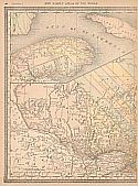
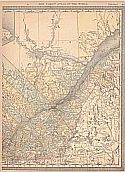
Publication Info:   Chicago: Rand McNally and Company, 1890; from The Family Atlas of the World
Date:   1890
Scale:   1:1,901,000
Original Source:   University of Alabama Map Library
West
East
Viewing options:
Viewing options:
JPEG or Plugin
JPEG or Plugin


  Main Author:   Bartholomew, John
  Title/Description:   Province of Quebec
  Publication Info:   London: MacMillan and Company, 1890; from The Library Reference Atlas of the World
  Date:   1890
  Scale:   1:158,400
  Original Source:   Courtesy of Murray Hudson, Halls, Tennessee
Viewing options:


  Main Author:   Walker, Henry B.
  Title/Description:   Quebec
  Publication Info:   Philadelphia: H.B. Walker, 1890; from Walker's International Atlas
  Date:   1890
  Scale:   1:1,393,920
  Original Source:   University of Alabama Map Library
Viewing options:


  Main Author:   Geological and Natural History Survey of Canada
  Title/Description:   Plan of the Asbestus Areas in the Townships of Thetford, Coleraine, Wolfetown, and Ireland
  Publication Info:   Ottawa: Geological and Natural History Survey of Canada, 1890
  Date:   1890
  Scale:   1:31,680
  Original Source:   Geological Survey of Alabama
Viewing options:


  Main Author:   Geological Survey of Canada
  Title/Description:   Province of Quebec (Eastern Township Map), North-East Quarter Sheet
  Publication Info:   Ottawa: Geological Survey of Canada, 1890
  Date:   1890
  Scale:   1:253,400
  Original Source:   Geological Survey of Alabama
Viewing options:


  Main Author:   Rand McNally and Company
  Title/Description:   Quebec
  Publication Info:   Chicago: Rand McNally and Company, 1891; from The Enlarged Business Atlas and Shippers Guide
  Date:   1891
  Scale:   1:1,864,000
  Original Source:   University of Alabama Map Library
Viewing options:


  Main Author:   Rand McNally and Company
  Title/Description:   Map of Quebec
  Publication Info:   Chicago: Rand McNally and Company, 1892; from The Indexed Atlas of the World
  Date:   1892
  Scale:   1:1,203,840
  Original Source:   Courtesy of Murray Hudson, Halls, Tennessee
Viewing options:


  Main Author:   Fisk and Company
  Title/Description:   Canada East
  Publication Info:   New York: Hunt and Eaton, c.1893
  Date:   1893
  Scale:   1:5,386,000
  Original Source:   Courtesy of Murray Hudson, Halls, Tennessee
Viewing options:


  Main Author:   Fisk and Company
  Title/Description:   Quebec
  Publication Info:   New York: Hunt and Eaton, c.1893; from The Columbian Atlas of the World We Live In
  Date:   1893
  Scale:   1:15,840
  Original Source:   Courtesy of Murray Hudson, Halls, Tennessee
Viewing options:


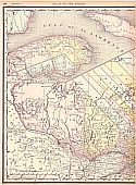
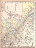
Main Author:   Rand McNally and Company
Title/Description:   Quebec
Publication Info:   Chicago: Rand McNally and Company, 1893; from The Universal Atlas of the World
Date:   1893
Scale:   1:1,872,700
Original Source:   University of Alabama Map Library
West
East
Viewing options:
Viewing options:
JPEG or Plugin
JPEG or Plugin


  Main Author:   Mast, Crowell and Kirkpatrick
  Title/Description:   Quebec
  Publication Info:   New York: Mast Crowell and Kirkpatrick, 1893; from The Popular Atlas
  Date:   1893
  Scale:   1:2,217,600
  Original Source:   Courtesy of Murray Hudson, Halls, Tennessee
Viewing options:


  Main Author:   Rand McNally and Company
  Title/Description:   Quebec
  Publication Info:  

Chicago: Rand McNally and Company, 1893; from The Enlarged Business Atlas and Shippers Guide

  Date:   1893
  Scale:   1:1,204,000
  Original Source:   Courtesy of Murray Hudson, Halls, Tennessee
Viewing options:


  Main Author:   Cram, George F.
  Title/Description:   Quebec
  Publication Info:   Chicago: John F. Waite; from the International Office and Family Atlas of the World
  Date:   1893
  Scale:   1:2,217,600
  Original Source:   Courtesy of Murray Hudson, Halls, Tennessee
Viewing options:


  Main Author:   Mast, Crowell and Kirkpatrick
  Title/Description:   Quebec
  Publication Info:   Springfield, Ohio: Mast, Crowell and Kirkpatrick1894; from Peoples Atlas of the World
  Date:   1894
  Scale:   1:2,344,320
  Original Source:   University of Alabama Map Library
Viewing options:


  Main Author:   Rand McNally and Company
  Title/Description:   Quebec
  Publication Info:   Chicago: Rand McNally and Company, 1894; from Rand McNally and Company's Encyclopedia and Gazetteer
  Date:   1894
  Scale:   3,484,800
  Original Source:   University of Alabama Map Library
Viewing options:


  Main Author:   Rand McNally and Company
  Title/Description:   Quebec
  Publication Info:   Chicago: Rand McNally and Company 1895; from The New General Atlas of the World
  Date:   1895
  Scale:   1:2,471,040
  Original Source:   Courtesy of Murray Hudson, Halls, Tennessee
Viewing options:


  Main Author:   Walker, H.B.
  Title/Description:   Quebec
  Publication Info:   Chicago: H.B. Walker, 1895; from The International Atlas
  Date:   1895
  Scale:   1:1,267,200
  Original Source:   Courtesy of Murray Hudson, Halls, Tennessee
Viewing options:


  Main Author:   Gardiner, Samuel Rawson
  Title/Description:   Seige of Quebec, 1759
  Publication Info:   London: Longmans, Green and Company, 1895; from A School Atlas of British History
  Date:   1895
  Scale:   1:120,000
  Original Source:   University of Alabama Map Library
Viewing options:


  Main Author:   Johnson, A.J.
  Title/Description:   Map of New Brunswick and Quebec of the Dominion of Canada
  Publication Info:   New York: A.J. Johnson, 1896; from The Universal Cyclopedia
  Date:   1896
  Scale:   1:3,800,000
  Original Source:   University of Alabama Map Library
Viewing options:


  Main Author:   D. Appleton and Company
  Title/Description:   City of Quebec
  Publication Info:   New York: D. Appleton and Company, 1896; from Appleton's General Guide to the United States and Canada
  Date:   1896
  Scale:   1:31,680
  Original Source:   Courtesy of Murray Hudson, Halls, Tennessee
Viewing options:


  Main Author:   Rand McNally and Company
  Title/Description:   Quebec
  Publication Info:   Chicago: Rand McNally and Company, 1896; from Enlarged Business Atlas
  Date:   1896
  Scale:   1:1,203,840
  Original Source:   University of Alabama Map Library
Viewing options:


  Main Author:   Geological Survey of Canada
  Title/Description:   Province of Quebec, Montreal Sheet (Eastern Township Map)
  Publication Info:   Ottawa: Geological Survey of Canada, 1896
  Date:   1896
  Scale:   1:253,440
  Original Source:   Geological Survey of Alabama
Viewing options:


  Main Author:   Cram, George F.
  Title/Description:   Map of the City of Quebec
  Publication Info:   Chicago: George F. Cram, 1898; from The Universal Atlas, Geographical, Astronomical and Historical
  Date:   1898
  Scale:   not indicated
  Original Source:   Courtesy of Adams Antiques, Northport, Alabama
Viewing options:


  Main Author:   Cram, George F.
  Title/Description:   Quebec
  Publication Info:   Chicago: George F. Cram, 1898; from The Universal Atlas, Geographical, Astronomical and Historical
  Date:   1898
  Scale:   1:2,217,600
  Original Source:   Courtesy of Adams Antiques, Northport, Alabama
Viewing options:


  Main Author:   Cram, George F.
  Title/Description:   Quebec
  Publication Info:   Chicago: George F. Cram, 1898
  Date:   1898
  Scale:   1:2,219,000
  Original Source:   Courtesy of Murray Hudson, Halls, Tennessee
Viewing options:


  Main Author:   Rand McNally and Company
  Title/Description:   Quebec
  Publication Info:   Chicago: Rand McNally and Company, 1898; from The Indexed Atlas of the World
  Date:   1898
  Scale:   1:1,267,200
  Original Source:   Courtesy of Murray Hudson, Halls, Tennessee
Viewing options:


  Main Author:   Smith, Benjamin E.
  Title/Description:   Quebec
  Publication Info:   New York: The Century Company, 1899; from The Century Atlas of the World
  Date:   1899
  Scale:   1:8,236,800
  Original Source:   University of Alabama Map Library
Viewing options:


  Main Author:   Cram, George F.
  Title/Description:   Quebec
  Publication Info:   Chicago: George F. Cram, 1899; from The Standard American Railway Atlas
  Date:   1899
  Scale:   1:1,330,560
  Original Source:   Courtesy of Murray Hudson, Halls, Tennessee
Viewing options:


  Main Author:   Meissas, Achille et Auguste Michelot
  Title/Description:   Quebec
  Publication Info:   New York: The Bradstreet Company, 1899; from Bradstreet's Pocket Atlas of the United States
  Date:   1899
  Scale:   1:5,700,000
  Original Source:   University of Alabama Map Library
Viewing options:


  Main Author:   Geological Survey of Canada
  Title/Description:   Province of Quebec, Three Rivers Sheet, Eastern Townships Map
  Publication Info:   Ottawa: Geological Survey of Canada, 1899
  Date:   1899
  Scale:   1:253,440
  Original Source:   Geological Survey of Alabama
Viewing options:


  Main Author:   Rand McNally and Company.
  Title/Description:   Quebec Railroads
  Publication Info:   Chicago: Rand McNally and Company, 1900; from The Enlarged Business Atlas and Shipper's Guide
  Date:   1900
  Scale:   1:1,203,840
  Original Source:   Courtesy of Murray Hudson, Halls, Tennessee
Viewing options:
 

Previous Page
Next Page


© University of Alabama
To purchase map reproductions, submit a quote request.
Download MrSID Plugin