Home  |  Help  |  Graphics Tutorial  |  Aerial Photography  |  Historical Maps  |  Contemporary Maps  |  About this site  | 

1885 - 1900


Before 1885
1885-1900
After 1900

Previous Page
Next Page

  Main Author:   Cram, George F.
  Title/Description:   Ontario
  Publication Info:   Chicago: George F. Cram, 1886; from Cram's Unrivaled Family Atlas of the World
  Date:   1886
  Scale:   1:2,217,600
  Original Source:   Courtesy of Murray Hudson, Halls, Tennessee
Viewing options:


  Main Author:   Blackie, Walter Graham
  Title/Description:   Canada: The Province of Ontario, and Part of Quebec
  Publication Info:   London: Blackie and Son, 1886; from The Comprehensive Atlas & Geography of the World
  Date:   1886
  Scale:   1:2,090,880
  Original Source:   University of Alabama Map Library
Viewing options:


  Main Author:   Cram, George F.
  Title/Description:   Railroad and County Map of Ontario
  Publication Info:   Chicago: George F. Cram, 1887; from The Standard American Atlas of the World
  Date:   1887
  Scale:   1:1,267,000
  Original Source:   University of Alabama Map Library
Viewing options:


  Main Author:   Cram, George F.
  Title/Description:   Part of Canada
  Publication Info:   Chicago: George F. Cram, 1887; from Gaskell's Atlas of the World
  Date:   1887
  Scale:   1:3,295,000
  Original Source:   Courtesy of Murray Hudson, Halls, Tennessee
Viewing options:


  Main Author:   Cram, George F.
  Title/Description:   Ontario
  Publication Info:   Chicago: George F. Cram, 1887
  Date:   1887
  Scale:   1:2,218,000
  Original Source:   Courtesy of Murray Hudson, Halls, Tennessee
Viewing options:


  Main Author:   Mitchell, S. Augustus
  Title/Description:   Map of Ontario in Counties
  Publication Info:   Philadelphia: William M. Bradley and Brother, 1888; from The New General Atlas
  Date:   1887
  Scale:   1:2,534,400
  Original Source:   Courtesy of Murray Hudson, Halls, Tennessee
Viewing options:


  Main Author:   Grant, A.A.
  Title/Description:   Railroad and County Map of Ontario
  Publication Info:   New York: A.A. Grant, 1887; from The Standard American Atlas of the World
  Date:   1887
  Scale:   1:1,267,200
  Original Source:   Courtesy of Murray Hudson, Halls, Tennessee
Viewing options:


  Main Author:   Cram, George F.
  Title/Description:   Railroad and County Map of Ontario
  Publication Info:   Chicago: George F. Cram, 1887; from The Bankers and Brokers Railroad Atlas
  Date:   1887
  Scale:   1:1,267,200
  Original Source:   Courtesy of Murray Hudson, Halls, Tennessee
Viewing options:
 

  Main Author:   Cram, George F.
  Title/Description:   Northwestern Part of Ontario
  Publication Info:   Chicago: George F. Cram, 1887; from The Bankers and Brokers Railroad Atlas
  Date:   1887
  Scale:   1:1,851,200
  Original Source:   Courtesy of Murray Hudson, Halls, Tennessee
Viewing options:


  Main Author:   Cram, George F.
  Title/Description:   Railroad and County Map of Ontario
  Publication Info:   Chicago: George F. Cram, 1887; from The Bankers and Brokers Railroad Atlas
  Date:   1887
  Scale:   1:1,267,200
  Original Source:   Courtesy of Murray Hudson, Halls, Tennessee
Viewing options:


  Main Author:   Cram, George F.
  Title/Description:   Ontario
  Publication Info:   Chicago: George F. Cram, 1889
  Date:   1889
  Scale:   1:2,218,000
  Original Source:   Courtesy of Murray Hudson, Halls, Tennessee
Viewing options:


  Main Author:   Mast, Crowell and Kirkpatrick
  Title/Description:   Ontario
  Publication Info:   Philadelphia: Mast, Crowell and Kirkpatrick, 1889; from The Peerless Atlas of the World
  Date:   1889
  Scale:   1:2,217,000
  Original Source:   University of Alabama Map Library
Viewing options:


  Main Author:   Rand McNally and Company
  Title/Description:   Ontario (Map 1)
  Publication Info:   Chicago: Rand McNally and Company, 1889; from The Enlarged Business Atlas and Shippers Guide
  Date:   1889
  Scale:   1:1,140,480
  Original Source:   Courtesy of Murray Hudson, Halls, Tennessee
Viewing options:


  Main Author:   Rand McNally and Company
  Title/Description:   Ontario (Map 2)
  Publication Info:   Chicago: Rand McNally and Company, 1889; from The Enlarged Business Atlas and Shippers Guide
  Date:   1889
  Scale:   1:1,140,480
  Original Source:   Courtesy of Murray Hudson, Halls, Tennessee
Viewing options:


Main Author:   Rand McNally and Company
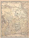
Title/Description:   Western Ontario
Publication Info:   Chicago: Rand McNally and Company, 1890; from The Family Atlas of the World
Date:   1890
Scale:   1:1,140,480
Original Source:   University of Alabama Map Library
 
North
Viewing options:
 
South
Viewing options:


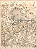
Main Author:   Rand McNally and Company
Title/Description:   Eastern Ontario
Publication Info:   Chicago: Rand McNally and Company, 1890; from The Family Atlas of the World
Date:   1890
Scale:   1:1,140,480
Original Source:   University of Alabama Map Library
West
East
Viewing options:
Viewing options:
JPEG or Plugin
JPEG or Plugin


  Main Author:   Walker, Henry B.
  Title/Description:   Ontario
  Publication Info:   Philadelphia: H.B. Walker1890; from Walker's International Atlas
  Date:   1890
  Scale:   1:1,267,200
  Original Source:   University of Alabama Map Library
Viewing options:


  Main Author:   Rand McNally and Company
  Title/Description:   Ontario No.2
  Publication Info:   Chicago: Rand McNally and Company, 1891; from The Enlarged Business Atlas and Shippers Guide
  Date:   1891
  Scale:   1:1,140,000
  Original Source:   University of Alabama Map Library
Viewing options:


  Main Author:   Rand McNally and Company
  Title/Description:   Ontario No.1
  Publication Info:   Chicago: Rand McNally and Company, 1891; from The Enlarged Business Atlas and Shippers Guide
  Date:   1891
  Scale:   1:1,118,000
  Original Source:   University of Alabama Map Library
Viewing options:


  Main Author:   Bartholomew, J.
  Title/Description:   Province of Ontario
  Publication Info:   New York: Thomas Nelson and Sons, 1891; from The Popular Hand Atlas of the World
  Date:   1891
  Scale:   1:2,661,120
  Original Source:   University of Alabama Map Library
Viewing options:


  Main Author:   Fisk and Company
  Title/Description:   Ottawa
  Publication Info:   New York: Hunt and Eaton, 1892; from The Columbian Atlas of the World We Live In
  Date:   1892
  Scale:   1:18,000
  Original Source:   Courtesy of Murray Hudson, Halls, Tennessee
Viewing options:


  Main Author:   Rand McNally and Company
  Title/Description:   Map of Ontario
  Publication Info:   Chicago: Rand McNally and Company, 1892; from The Indexed Atlas of the World
  Date:   1892
  Scale:   1:584,000
  Original Source:   Courtesy of Murray Hudson, Halls, Tennessee
Viewing options:


  Main Author:   Mast, Crowell and Kirkpatrick
  Title/Description:   Ontario
  Publication Info:   New York: Mast, Crowell and Kirkpatrick, 1893; from The Popular Atlas
  Date:   1893
  Scale:   1:2,217,600
  Original Source:   Courtesy of Murray Hudson, Halls, Tennessee
Viewing options:


  Main Author:   Rand McNally and Company
  Title/Description:   Ontario
  Publication Info:  

Chicago: Rand McNally and Company, 1893; from The Enlarged Business Atlas and Shippers Guide

  Date:   1893
  Scale:   1:1,584,000
  Original Source:   Courtesy of Murray Hudson, Halls, Tennessee
Viewing options:


  Main Author:   Cram, George F.
  Title/Description:   Ontario
  Publication Info:   Chicago: John F. Waite; from the International Office and Family Atlas of the World
  Date:   1893
  Scale:   1:2,407,680
  Original Source:   Courtesy of Murray Hudson, Halls, Tennessee
Viewing options:


  Main Author:   Fisk and Company
  Title/Description:   Ontario
  Publication Info:   New York: Hunt and Eaton, c.1893; from The Columbian Atlas of the World We Live In
  Date:   1893
  Scale:   1:2,661,120
  Original Source:   Courtesy of Murray Hudson, Halls, Tennessee
Viewing options:


  Main Author:   Mast, Crowell and Kirkpatrick
  Title/Description:   Ontario
  Publication Info:   Springfield, Ohio: Mast, Crowell and Kirkpatrick1894; from Peoples Atlas of the World
  Date:   1894
  Scale:   1:2,344,320
  Original Source:   University of Alabama Map Library
Viewing options:


  Main Author:   Rand McNally and Company
  Title/Description:   Ontario
  Publication Info:   Chicago: Rand McNally and Company, 1894; from Rand McNally and Company's Encyclopedia and Gazetteer
  Date:   1894
  Scale:   2,977,920
  Original Source:   University of Alabama Map Library
Viewing options:


  Main Author:   Rand McNally and Company
  Title/Description:   Ontario
  Publication Info:   Chicago: Rand McNally and Company 1895; from The New General Atlas of the World
  Date:   1895
  Scale:   1:2,280,960
  Original Source:   Courtesy of Murray Hudson, Halls, Tennessee
Viewing options:


  Main Author:   Walker, H.B.
  Title/Description:   Ontario
  Publication Info:   Chicago: H.B. Walker, 1895; from The International Atlas
  Date:   1895
  Scale:   1:1,267,200
  Original Source:   Courtesy of Murray Hudson, Halls, Tennessee
Viewing options:


  Main Author:   Rand McNally and Company
  Title/Description:   Ontario
  Publication Info:   Chicago: Rand McNally and Company, 1896; from Enlarged Business Atlas
  Date:   1896
  Scale:   1:1,520,640
  Original Source:   University of Alabama Map Library
Viewing options:


  Main Author:   Geological Survey of Canada
  Title/Description:   Province of Ontario, Thunder Bay District, Lake Shebandowan Sheet
  Publication Info:   Ottawa: Geological Survey of Canada, 1896
  Date:   1896
  Scale:   1:253,440
  Original Source:   Geological Survey of Alabama
Viewing options:


  Main Author:   Geological Survey of Canada
  Title/Description:   Provinces of Ontario and Quebec, Nipissing District Ont. and Pontiac County Que., Lake Nipissing District
  Publication Info:   Ottawa: Geological Survey of Canada, 1897
  Date:   1897
  Scale:   1:253,440
  Original Source:   Geological Survey of Alabama
Viewing options:


  Main Author:   Geological Survey of Canada
  Title/Description:   Provinces of Ontario and Quebec, Nipissing District Ont. and Pontiac County Que., Lake Temiscaming Sheet
  Publication Info:   Ottawa: Geological Survey of Canada, 1897
  Date:   1897
  Scale:   1:253,440
  Original Source:   Geological Survey of Alabama
Viewing options:


  Main Author:   Geological Survey of Canada
  Title/Description:   Province of Ontario, Thunder Bay and Rainy River Districts, Sein River Sheet
  Publication Info:   Ottawa: Geological Survey of Canada, 1897
  Date:   1897
  Scale:   1:253,440
  Original Source:   Geological Survey of Alabama
Viewing options:


  Main Author:   Province of Ontario, Bureau of Mines
  Title/Description:   Map of Parts of the Countries of Hastings and Renfrew
  Publication Info:   Toronto, Province of Ontario, Bureau of Mines, 1897
  Date:   1897
  Scale:   1:158,400
  Original Source:   Geological Survey of Alabama
Viewing options:


  Main Author:   Province of Ontario, Bureau of Mines
  Title/Description:   Map of Base and Meridian Lines in Rainy River District, 1897
  Publication Info:   Toronto, Province of Ontario, Bureau of Mines, 1897
  Date:   1897
  Scale:   1:250,000
  Original Source:   Geological Survey of Alabama
Viewing options:


  Main Author:   Province of Ontario, Bureau of Mines
  Title/Description:   Map of Abitibi River and the Nipissing-Algoma Line, 1898
  Publication Info:   Toronto, Province of Ontario, Bureau of Mines, 1898
  Date:   1898
  Scale:   1:500,000
  Original Source:   Geological Survey of Alabama
Viewing options:


  Main Author:   Cram, George F.
  Title/Description:   Ontario
  Publication Info:   Chicago: George F. Cram, 1898; from The Universal Atlas, Geographical, Astronomical and Historical
  Date:   1898
  Scale:   1:2,217,000
  Original Source:   Courtesy of Adams Antiques, Northport, Alabama
Viewing options:


  Main Author:   Mast, Crowell and Kirkpatrick
  Title/Description:   Map of Ontario
  Publication Info:   Philadelphia: Mast, Crowell and Kirkpatrick, 1898; from The Peerless Atlas of the World
  Date:   1898
  Scale:   1:2,851,200
  Original Source:   University of Alabama Map Library
Viewing options:


  Main Author:   Rand McNally and Company
  Title/Description:   Ontario
  Publication Info:   Chicago: Rand McNally and Company, 1898; from The Indexed Atlas of the World
  Date:   1898
  Scale:   1:1,584,000
  Original Source:   Courtesy of Murray Hudson, Halls, Tennessee
Viewing options:


  Main Author:   Province of Ontario, Bureau of Mines
  Title/Description:   Map of the Western Part of the Michipicoton Mining District, District of Algoma, Ontario
  Publication Info:   Toronto, Province of Ontario, Bureau of Mines, 1899
  Date:   1899
  Scale:   1:250,000
  Original Source:   Geological Survey of Alabama
Viewing options:


  Main Author:   Smith, Benjamin E.
  Title/Description:   Ontario
  Publication Info:   New York: The Century Company, 1899; from The Century Atlas of the World
  Date:   1899
  Scale:   1:2,217,600
  Original Source:   University of Alabama Map Library
Viewing options:


  Main Author:   Cram, George F.
  Title/Description:   North-Western Part of Ontario
  Publication Info:   Chicago: George F. Cram, 1899; from The Standard American Railway Atlas
  Date:   1899
  Scale:   1:2,851,200
  Original Source:   Courtesy of Murray Hudson, Halls, Tennessee
Viewing options:


  Main Author:   Cram, George F.
  Title/Description:   Ontario
  Publication Info:   Chicago: George F. Cram, 1899; from The Standard American Railway Atlas
  Date:   1899
  Scale:   1:1,267,200
  Original Source:   Courtesy of Murray Hudson, Halls, Tennessee
Viewing options:


  Main Author:   Meissas, Achille et Auguste Michelot
  Title/Description:   Ontario
  Publication Info:   New York: The Bradstreet Company, 1899; from Bradstreet's Pocket Atlas of the United States
  Date:   1899
  Scale:   1:6,336,000
  Original Source:   University of Alabama Map Library
Viewing options:


  Main Author:   Rand McNally and Company.
  Title/Description:   Ontario Railroads
  Publication Info:   Chicago: Rand McNally and Company, 1900; from The Enlarged Business Atlas and Shipper's Guide
  Date:   1900
  Scale:   1:1,140,480
  Original Source:   Courtesy of Murray Hudson, Halls, Tennessee
Viewing options:


  Main Author:   Geological Survey of Canada
  Title/Description:   Map Showing the Occurences of Iron Ores and Other Minerals in Portions of the Countries of Frontnac, Lanark, Renfrew, and Leeds
  Publication Info:   Ottawa: Geological Survey of Canada, 1900
  Date:   1900
  Scale:   1:125,000
  Original Source:   Geological Survey of Alabama
Viewing options:


  Main Author:   Province of Ontario, Bureau of Mines
  Title/Description:   Map of Sudbury Mining District Showing Location of Mines and Mining Properties
  Publication Info:   Toronto, Province of Ontario, Bureau of Mines, 1900
  Date:   1900
  Scale:   1:125,000
  Original Source:   Geological Survey of Alabama
Viewing options:


  Main Author:   Province of Ontario, Bureau of Mines
  Title/Description:   Map of Parts of the Districts of Algoma and Nipissing Showing the Upper Basins of the Moose, Ottawa, and Nipissing Rivers
  Publication Info:   Toronto, Province of Ontario, Bureau of Mines, 1900
  Date:   1900
  Scale:   1:500,000
  Original Source:   Geological Survey of Alabama
Viewing options:


Previous Page
Next Page


© University of Alabama
To purchase map reproductions, submit a quote request.
Download MrSID Plugin