Before 1865


Before 1865
1865-1880
1881-1890
1891-1900
1901-1910
After 1910

Next Page

  Main Author:   Moll, Herman
  Title/Description:   A New Map of New Found Land, New Scotland, The Isles of Breton, Anticofte, St. Johns &c. Together with Fishing Banks
  Publication Info:   London: Hermon Moll, c.1720
  Date:   1720
  Scale:   1:4,879,000
  Original Source:   Courtesy of Murray Hudson, Halls, Tennessee
Viewing options:


  Main Author:   Gilles, Robert de Vaugondy
  Title/Description:   Part of North America containing Canada, the Northern Parts of New England and New York with Nova Scotia and Newfoundland
  Publication Info:   London: c.1796
  Date:   1796
  Scale:   1:9,573,000
  Original Source:   Courtesy of Murray Hudson, Halls, Tennessee
Viewing options:


  Main Author:   Walker, J.
  Title/Description:   A Sketch of the Battle of La Fourche or Chateauguay, Oct. 26, 1813
  Publication Info:   London: W. Faden, 1815
  Date:   1815
  Scale:   1:28,800
  Original Source:   Courtesy of Murray Hudson, Halls, Tennessee
Viewing options:


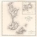
Main Author:   Perrot, A.M. and J. Aupick
Title/Description:   Iles Saint Pierre et Miquelon
Publication Info:   Paris: L. Duprat-Duverger, 1827; No. 90 from Carte Des Colonies Françaises in Nouvel Atlas Du Royaume De France
Date:   1827
Scale:   1:147,000
Original Source:   Courtesy of Adams Antiques, Northport, Alabama
Map
Description
Viewing options:
Viewing options:
JPEG or Plugin
JPEG or Plugin


  Main Author:   Society for the Diffusion of Useful Knowledge
  Title/Description:   North America, Sheet II, Lower Canada and New Brunswick with Part of New York, Vermont and Maine
  Publication Info:   London: Baldwin and Gradock, 1832
  Date:   1832
  Scale:   1:1,837,000
  Original Source:   Courtesy of Murray Hudson, Halls, Tennessee
Viewing options:


  Main Author:   Society for the Diffusion of Useful Knowledge
  Title/Description:   North America, Sheet I, Nova Scotia with part of New Brunswick and Lower Canada
  Publication Info:   London: Baldwin and Gradock, 1832
  Date:   1832
  Scale:   1:1,711,000
  Original Source:   Courtesy of Murray Hudson, Halls, Tennessee
Viewing options:


  Main Author:   Greenleaf, J.
  Title/Description:   Newfoundland, Nova Scotia and New Brunswick
  Publication Info:   Brattleboro, VT: J. Greenleaf, 1840
  Date:   1840
  Scale:   1:1,457,000
  Original Source:   Courtesy of Murray Hudson, Halls, Tennessee
Viewing options:


  Main Author:   Hall, Sidney
  Title/Description:   Canada, New Brunswick and Nova Scotia
  Publication Info:   London: Longman, Orme, and Company, c.1840
  Date:   1840
  Scale:   1:5,069,000
  Original Source:   Courtesy of Murray Hudson, Halls, Tennessee
Viewing options:


  Main Author:   Morse, Sidney, E. and Samuel Breese
  Title/Description:   Nova Scotia, New Brunswick, etc.
  Publication Info:   New York: Morse and Breese, 1843
  Date:   1843
  Scale:   1:2,154,000
  Original Source:   Courtesy of Murray Hudson, Halls, Tennessee
Viewing options:


  Main Author:   Society for the Diffusion of Useful Knowledge
  Title/Description:   North America Sheet I Nova-Scotia with Part of New Brunswick and Lower Canada
  Publication Info:   London: Charles Knight and Company, 1846
  Date:   1846
  Scale:   1:1,774,000
  Original Source:   Courtesy of Murray Hudson, Halls, Tennessee
Viewing options:


  Main Author:   Morse, Sidney E.
  Title/Description:   New Brunswick, Nova Scotia and Newfoundland
  Publication Info:   New York: Harper and Brothers, 1851; from Morse's School Geography
  Date:   1851
  Scale:   1:9,500,000
  Original Source:   University of Alabama Map Library
Viewing options:


  Main Author:   Society for the Diffusion of Useful Knowledge
  Title/Description:   Nova Scotia with part of New Brunswick and Lower Canada
  Publication Info:   London: Charles Knight, 1852; from the General Atlas
  Date:   1852
  Scale:   1:1,774,080
  Original Source:   Courtesy of Murray Hudson, Halls, Tennessee
Viewing options:


  Main Author:   Colton, J.H.
  Title/Description:   New Brunswick, Nova Scotia, Newfoundland, and Prince Edward Island
  Publication Info:   New York: J.H. Colton and Company, 1856
  Date:   1856
  Scale:   1:3,168,000
  Original Source:   Courtesy of Murray Hudson, Halls, Tennessee
Viewing options:


  Main Author:   Gaston, Samuel N. and Charles W. Morse
  Title/Description:   Nova Scotia and New Brunswick
  Publication Info:   New York: Samuel N. Gaston, 1857
  Date:   1857
  Scale:   1:5,385,000
  Original Source:   University of Alabama Map Library
Viewing options:


  Main Author:   Bartholomew, J.
  Title/Description:   Canada, New Brunswick, Nova Scotia &c.
  Publication Info:   Montreal: B. Dawson and Son, 1859
  Date:   1859
  Scale:   1:2,408,000
  Original Source:   Courtesy of Murray Hudson, Halls, Tennessee
Viewing options:


  Main Author:   Society of the Diffusion of Useful Knowledge
  Title/Description:   North America, Sheet 1, Nova Scotia with Part of New Brunswick and East Canada
  Publication Info:   London: Edward Stanford, c.1860
  Date:   1860
  Scale:   1:1,774,000
  Original Source:   Courtesy of Murray Hudson, Halls, Tennessee
Viewing options:


  Main Author:   Lieber, Oscar M.
  Title/Description:   Sketch showing the Geology of the Coast of Labrador
  Publication Info:   Washington: U.S. Coast Survey, 1860
  Date:   1860
  Scale:   various scales
  Original Source:   Courtesy of Murray Hudson, Halls, Tennessee
Viewing options:


  Main Author:   Ettling, T.
  Title/Description:   Lower Canada, New Brunswick, Nova Scotia
  Publication Info:   London: 1861; from The Weekly Dispatch Atlas
  Date:   1861
  Scale:   1:3,485,000
  Original Source:   Courtesy of Murray Hudson, Halls, Tennessee
Viewing options:


  Main Author:   Mitchell, S. Augustus, Jr.
  Title/Description:  

County Map of Nova Scotia, New Brunswick, Cape Breton Island and Prince Edward's Island

  Publication Info:   Philadelphia: S. Augustus Mitchell, Jr. 1861; from The New General Atlas
  Date:   1861
  Scale:   1:2,851,200
  Original Source:   Courtesy of Murray Hudson, Halls, Tennessee
Viewing options:


  Main Author:   Colton, G.W. and C.B.
  Title/Description:   Colton's Dominion of Canada No. 3. The Provinces of New Brunswick and Nova Scotia and Prince Edward Island
  Publication Info:   New York: G.W. and C.B. Colton, 1862
  Date:   1862
  Scale:   1:1,584,000
  Original Source:   Courtesy of Murray Hudson, Halls, Tennessee
Viewing options:


  Main Author:   Johnson, A.J.
  Title/Description:   Johnson's New Brunswick, Nova Scotia, Newfoundland and Prince Edward Island
  Publication Info:   New York: Johnson and Ward, 1862
  Date:   1862
  Scale:   1:3,295,000
  Original Source:   Courtesy of Murray Hudson, Halls, Tennessee
Viewing options:


  Main Author:   Bayfield, Captain H.W.
  Title/Description:   Sydney Harbour
  Publication Info:   London: Hydrographic Office of the Admiralty, 1863
  Date:   1863
  Scale:   1:32,000
  Original Source:   Courtesy of Murray Hudson, Halls, Tennessee
Viewing options:


  Main Author:   Johnson and Ward
  Title/Description:   Johnson's New Brunswick, Nova Scotia, Newfoundland and Prince Edward Island
  Publication Info:   New York: Johnson and Ward, 1864; from The New Illustrated Family Atlas
  Date:   1864
  Scale:   1:3,168,000
  Original Source:   Courtesy of Murray Hudson, Halls, Tennessee
Viewing options:
 

Next Page


© University of Alabama
To purchase map reproductions, submit a quote request.
Download MrSID Plugin