1875 - 1900


Before 1875
1875-1900
After 1900

Previous Page
Next Page

  Main Author:   Jones, Charles H. and Theodore F. Hamilton
  Title/Description:   Map of Canada, Ontario, and Quebec
  Publication Info:   Chicago: H.H. Hardesty, 1875; from The Historical Atlas of the World Illustrated
  Date:   1875
  Scale:   1:3,484,800
  Original Source:   Courtesy of Murray Hudson, Halls, Tennessee
Viewing options:


  Main Author:   Mitchell, S. Augustus
  Title/Description:   Map of the British Provinces
  Publication Info:   Philadelphia: J.H. Butler and Company, 1875; from A System of Modern Geography
  Date:   1875
  Scale:   1:9,504,000
  Original Source:   Courtesy of Murray Hudson, Halls, Tennessee
Viewing options:


  Main Author:   McNally, Francis
  Title/Description:   Canada, New Brunswick, Nova Scotia, andc.
  Publication Info:   New York: A.S. Barnes and Company, 1876; from An Improved System of Geography
  Date:   1876
  Scale:   1:7,920,000
  Original Source:   University of Alabama Map Library
Viewing options:


  Main Author:   von Stienwehr, A. , D.G. Brinton
  Title/Description:   Dominion of Canada, Western Part and Eastern Part
  Publication Info:   Cincinnati,van Antwerp, Bragg and Co; from An Intermediate Geography with Lessons in Map Drawing
  Date:   1877
  Scale:   not indicated
  Original Source:   Courtesy of Murray Hudson, Halls, Tennessee
Viewing options:


  Main Author:   Hughes, W.
  Title/Description:   Dominion of Canada
  Publication Info:   London: George Philip and Son, [c. 1880]
  Date:   1880
  Scale:   1:6,970,000
  Original Source:   Courtesy of Adams Antiques, Northport, Alabama
Viewing options:


  Main Author:   von Steinwehr, A.
  Title/Description:   Map of the Dominion of Canada
  Publication Info:   Cincinnati: Van Antwerp, Bragg and Company, 1881; from Eclectic Series, School Geography No. 3
  Date:   1881
  Scale:   1:44,352,000
  Original Source:   Courtesy of Murray Hudson, Halls, Tennessee
Viewing options:


  Main Author:   Bartholomew, John
  Title/Description:   Dominion of Canada and Northern United States
  Publication Info:   Philadelphia: T. Ellwood Zell, Davis and Company, 1881
  Date:   1881
  Scale:   1:5,069,000
  Original Source:   Courtesy of Murray Hudson, Halls, Tennessee
Viewing options:


  Main Author:   Rand McNally and Company
  Title/Description:   British America
  Publication Info:   Chicago, Rand McNally and Company, 1881; from New Indexed Business Atlas and Shippers Guide
  Date:   1881
  Scale:   1:12,672,000
  Original Source:   University of Alabama Map Library
Viewing options:


  Main Author:   Tunison, H.C.
  Title/Description:   Canada
  Publication Info:   Jacksonville, IL: H.C. Tunison, 1882; from The Peerless Universal Atlas of the World
  Date:   1882
  Scale:   1:1,877,033
  Original Source:   Courtesy of Murray Hudson, Halls, Tennessee
Viewing options:


  Main Author:   McNally, Francis
  Title/Description:   Ontario, Quebec, New Brunswick, Nova Scotia, etc.
  Publication Info:   Chicago: A.S. Barnes and Company, 1882; from McNally's System of Geography
  Date:   1882
  Scale:   1:7,920,000
  Original Source:   Courtesy of Murray Hudson, Halls, Tennessee
Viewing options:


  Main Author:    
  Title/Description:   Canada
  Publication Info:   New York: Phillips and Hunt, 1882; from The Peoples Cyclopedia
  Date:   1882
  Scale:   1:5,385,600
  Original Source:   Courtesy of Murray Hudson, Halls, Tennessee
Viewing options:


  Main Author:   Johnston, W. and A.K.
  Title/Description:   Eastern Part of the Dominion of Canada
  Publication Info:   Edinburgh: W. and A.K. Johnston, 1882; from The World An Atlas
  Date:   1882
  Scale:   1:6,336,000
  Original Source:   University of Alabama Map Library
Viewing options:


  Main Author:   Geological and Natural History Survey of Canada
  Title/Description:   Map of the Dominion of Canada, Geologically Colored from the Surveys Made by the Geological Corps, 1842 to 1882 (East Sheet)
  Publication Info:   Ottawa: Geological and Natural History Survey of Canada, 1882
  Date:   1882
  Scale:   1:2,850,000
  Original Source:   Geological Survey of Alabama
Viewing options:


  Main Author:   Geological and Natural History Survey of Canada
  Title/Description:   Map of the Dominion of Canada, Geologically Colored from the Surveys Made by the Geological Corps, 1842 to 1882 (West Sheet)
  Publication Info:   Ottawa: Geological and Natural History Survey of Canada, 1882
  Date:   1882
  Scale:   1:2,850,000
  Original Source:   Geological Survey of Alabama
Viewing options:


  Main Author:   Hardesty, H.H.
  Title/Description:   British America
  Publication Info:   New York: H.H. Hardesty and Company, 1883; from The Historical and Geographical Encyclopedia
  Date:   1883
  Scale:   1:12,672,000
  Original Source:   Courtesy of Murray Hudson, Halls, Tennessee
Viewing options:


  Main Author:   Bartholomew, John
  Title/Description:   Dominion of Canada
  Publication Info:   London: George Philip and Son, 1883; from The Atlas of the British Empire Throughout the World
  Date:   1883
  Scale:   1:19,000,000
  Original Source:   University of Alabama Map Library
Viewing options:


  Main Author:    
  Title/Description:   British Canada
  Publication Info:   Cincinnati: Van Antwerp, Bragg and Company, 1883; from The Eclectic Complete Geography
  Date:   1883
  Scale:   1:4,285,000
  Original Source:   Courtesy of Murray Hudson, Halls, Tennessee
Viewing options:


  Main Author:   Watson, Gaylord
  Title/Description:   British America
  Publication Info:   Boston: Perry and Spaulding, 1883; from New Indexed Family Atlas of the United States with Maps of the World
  Date:   1883
  Scale:   1:12,672,000
  Original Source:   University of Alabama Map Library
Viewing options:


  Main Author:   Bartholomew, J.
  Title/Description:   Dominion of Canada
  Publication Info:   Edinburgh: Blackie and Son, [c. 1884]
  Date:   1884
  Scale:   1:19,000,000
  Original Source:   Courtesy of Adams Antiques, Northport, Alabama
Viewing options:


  Main Author:   Rand McNally and Company
  Title/Description:   British America
  Publication Info:   Chicago: Rand McNally and Company, 1884; from The Indexed Atlas of the World
  Date:   1884
  Scale:   1:12,672,000
  Original Source:   From the personal collection of Dr. Gerald Webster
Viewing options:


  Main Author:   Hardesty, H.H.
  Title/Description:   Map of British America
  Publication Info:   New York: H.H. Hardesty and Company, 1884; from The Historical and Geographical Encyclopedia
  Date:   1884
  Scale:   1:12,355,200
  Original Source:   Courtesy of Murray Hudson, Halls, Tennessee
Viewing options:


  Main Author:    
  Title/Description:   Map of the British Provinces of North America
  Publication Info:   Philadelphia: Cowperthwait and Company, 1884; from Warren's Common-School Geography
  Date:   1884
  Scale:   1:9,504,000
  Original Source:   Courtesy of Murray Hudson, Halls, Tennessee
Viewing options:


  Main Author:   Cram, George F.
  Title/Description:   Canada
  Publication Info:   Chicago: Henry S. Stebbing, 1885; from Cram's Unrivaled Family Atlas of the World
  Date:   1885
  Scale:   1:17,424,000
  Original Source:   Courtesy of Murray Hudson, Halls, Tennessee
Viewing options:


  Main Author:   Monteith, James
  Title/Description:   Dominion of Canada, Eastern and Western Part
  Publication Info:   New York: A.S. Barnes and Company, 1886; from A Complete Geography
  Date:   1886
  Scale:   1:12,285,000
  Original Source:   University of Alabama Map Library
Viewing options:


  Main Author:   Gray, O. W.
  Title/Description:   Provinces of Ontario and Quebec, Dominion of Canada
  Publication Info:   Philadelphia: Stedman and Brown, 1886; from the National Atlas
  Date:   1886
  Scale:   1:1,584,000
  Original Source:   Courtesy of Murray Hudson, Halls, Tennessee
Viewing options:


  Main Author:   Butler, George
  Title/Description:   The Dominion of Canada
  Publication Info:   London: Longmans, Green, and Company, 1886; from the Public Schools Atlas of Modern Geography
  Date:   1886
  Scale:   1:9,042,500
  Original Source:   University of Alabama Map Library
Viewing options:


  Main Author:   Blackie, Walter Graham
  Title/Description:   British North America. The Dominion of Canada
  Publication Info:   London: Blackie and Son, 1886; from The Comprehensive Atlas & Geography of the World
  Date:   1886
  Scale:   1:11,721,600
  Original Source:   University of Alabama Map Library
Viewing options:


  Main Author:   Philip, George and Son
  Title/Description:   Dominion of Canada
  Publication Info:   London: George Philip and Son, 1886; from Philips' Elementary Atlas and Geography
  Date:   1886
  Scale:   1:30,400,000
  Original Source:   University of Alabama Map Library
Viewing options:


  Main Author:   Cram, George F.
  Title/Description:   Dominion of Canada
  Publication Info:   Chicago: George F. Cram, 1887
  Date:   1887
  Scale:   1:14,256,000
  Original Source:   Courtesy of Murray Hudson, Halls, Tennessee
Viewing options:


  Main Author:   Cram, George Franklin
  Title/Description:   Dominion of Canada
  Publication Info:   Boston: George V. Jones and Company, 1887; from Gaskell's Atlas of the World
  Date:   1887
  Scale:   1:14,890,000
  Original Source:   Courtesy of Murray Hudson, Halls, Tennessee
Viewing options:


Main Author:   Bradley, William M.
Title/Description:   Dominion of Canada (Eastern Sheet) Comprising New Brunswick, Nova Scotia, Prince Edward Island and Cape Breton Island with Newfoundland
Publication Info:   Philadelphia: William M. Bradley and Brother, 1888; from Bradley's Atlas of the World
Date:   1888
Scale:   1:2,065,500
Original Source:   Courtesy of Murray Hudson, Halls, Tennessee
West
East
Viewing options:
Viewing options:
JPEG or Plugin
JPEG or Plugin


  Main Author:   Adam and Charles Black
  Title/Description:   Dominion of Canada
  Publication Info:   Edinburgh: A. and C. Black, 1889; from The Scribner-Black Atlas of the World
  Date:   1889
  Scale:   1:13,939,000
  Original Source:   University of Alabama Map Library
Viewing options:


  Main Author:   Johnson, Alvin J.
  Title/Description:   Map of Ontartio, of the Dominion of Canada - Map of New Brunswick and Quebec, of the Dominion of Canada
  Publication Info:   New York: A.J. Johnson, 1889;from Cyclopaedia
  Date:   1889
  Scale:   various scales
  Original Source:   Courtesy of Murray Hudson, Halls, Tennessee
Viewing options:


  Main Author:   Longmans, Green and Company
  Title/Description:   The Canadian North West
  Publication Info:   London: Longmans, Green and Company, 1889; from The New Atlas, Political and Physical
  Date:   1889
  Scale:   1:8,000,000
  Original Source:   University of Alabama Map Library
Viewing options:


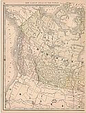
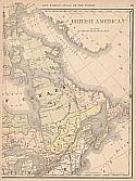
  Main Author:   Rand McNally and Company
  Title/Description:   British America
  Publication Info:   Chicago: Rand McNally and Company, 1889; from The Enlarged Business Atlas and Shippers Guide
  Date:   1889
  Scale:   1:12,355,200
  Original Source:   Courtesy of Murray Hudson, Halls, Tennessee
Viewing options:


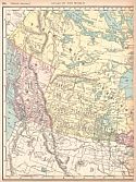
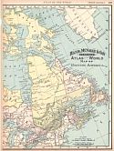
Main Author:   Rand McNally and Company
Title/Description:   British America
Publication Info:   Chicago: Rand McNally and Company, 1890; from The Family Atlas of the World
Date:   1890
Scale:   1:12,038,000
Original Source:   University of Alabama Map Library
West
East
Viewing options:
Viewing options:
JPEG or Plugin
JPEG or Plugin


  Main Author:   Librerie Hachette et Cie
  Title/Description:   Puissance du Canada
  Publication Info:   Paris: Librerie Hachette et Cie, c. 1980; from Atlas de Geographie Moderne
  Date:   1890
  Scale:   1:15,000,000
  Original Source:   University of Alabama Map Library
Viewing options:


  Main Author:   Bartholomew, John
  Title/Description:   Dominion of Canada
  Publication Info:   London: MacMillan and Company, 1890; from The Library Reference Atlas of the World
  Date:   1890
  Scale:   1:13,622,400
  Original Source:   Courtesy of Murray Hudson, Halls, Tennessee
Viewing options:


  Main Author:   Bartholomew, John
  Title/Description:   Eastern Provinces of Canada and Northern United States
  Publication Info:   London: MacMillan and Company, 1890; from The Library Reference Atlas of the World
  Date:   1890
  Scale:   1:5,068,800
  Original Source:   Courtesy of Murray Hudson, Halls, Tennessee
Viewing options:


  Main Author:   Bartholomew, John
  Title/Description:   Western Provinces, British Columbia and North-West Territory
  Publication Info:   London: MacMillan and Company, 1890; from The Library Reference Atlas of the World
  Date:   1890
  Scale:   1:7,920,000
  Original Source:   Courtesy of Murray Hudson, Halls, Tennessee
Viewing options:


  Main Author:   Stieler, Adolf
  Title/Description:   West-Canada
  Publication Info:   Gotha: Justus Perthes, 1891; from The Hand Atlas of 1891
  Date:   1891
  Scale:   1:7,500,000
  Original Source:   Courtesy of Adams Antiques, Northport, Alabama
Viewing options:


  Main Author:   Bartholomew, J.
  Title/Description:   Dominion of Canada
  Publication Info:   New York: Thomas Nelson and Sons, 1891; from The Popular Hand Atlas of the World
  Date:   1891
  Scale:   1:13,939,200
  Original Source:   University of Alabama Map Library
Viewing options:


Main Author:   Rand McNally and Company
Title/Description:   Map of British America
Publication Info:   Chicago: Rand McNally and Company, 1893; from The Universal Atlas of the World
Date:   1893
Scale:   1:11,365,000
Original Source:   University of Alabama Map Library
West
East
Viewing options:
Viewing options:
JPEG or Plugin
JPEG or Plugin


  Main Author:   Rand McNally and Company
  Title/Description:   British America
  Publication Info:  

Chicago: Rand McNally and Company, 1893; from The Enlarged Business Atlas and Shippers Guide

  Date:   1893
  Scale:   1:12,672,000
  Original Source:   Courtesy of Murray Hudson, Halls, Tennessee
Viewing options:


  Main Author:   Rand McNally and Company
  Title/Description:   British Columbia
  Publication Info:  

Chicago: Rand McNally and Company, 1893; from The Enlarged Business Atlas and Shippers Guide

  Date:   1893
  Scale:   1:2,408,000
  Original Source:   Courtesy of Murray Hudson, Halls, Tennessee
Viewing options:


  Main Author:   Cram, George F.
  Title/Description:   Dominion of Canada
  Publication Info:   Chicago: John F. Waite; from the International Office and Family Atlas of the World
  Date:   1893
  Scale:   1:14,256,000
  Original Source:   Courtesy of Murray Hudson, Halls, Tennessee
Viewing options:


  Main Author:   Bradley, William M.
  Title/Description:   Dominion of Canada (Western Sheet)
  Publication Info:   New York: John E. Potter and Company,1894; from Potter Bradley Atlas of the World
  Date:   1894
  Scale:   1:2,065,500
  Original Source:   University of Alabama Map Library
Viewing options:


  Main Author:   Bradley, William M.
  Title/Description:   Dominion of Canada (Eastern Sheet)
  Publication Info:   New York: John E. Potter and Company,1894; from Potter Bradley Atlas of the World
  Date:   1894
  Scale:   1:2,065,500
  Original Source:   University of Alabama Map Library
Viewing options:


  Main Author:   Rand McNally and Company
  Title/Description:   British North America
  Publication Info:   Chicago: Rand McNally and Company 1895; from The New General Atlas of the World
  Date:   1895
  Scale:   1:18,374,400
  Original Source:   Courtesy of Murray Hudson, Halls, Tennessee
Viewing options:


  Main Author:   American Book Company
  Title/Description:   British America
  Publication Info:   New York: American Book Company, 1896; from The Eclectic Complete Geography
  Date:   1896
  Scale:   1:20,000,000
  Original Source:   Courtesy of Murray Hudson, Halls, Tennessee
Viewing options:


  Main Author:   Rand McNally and Company
  Title/Description:   British America
  Publication Info:   Chicago: Rand McNally and Company, 1896; from Enlarged Business Atlas
  Date:   1896
  Scale:   1:10,137,600
  Original Source:   University of Alabama Map Library
Viewing options:


  Main Author:   Cram, George F.
  Title/Description:   Dominion of Canada
  Publication Info:   Chicago: George F. Cram, 1898; from The Universal Atlas, Geographical, Astronomical and Historical
  Date:   1898
  Scale:   1:14,678,000
  Original Source:   Courtesy of Adams Antiques, Northport, Alabama
Viewing options:


  Main Author:   Mast, Crowell and Kirkpatrick
  Title/Description:   Map of Manitoba, British Columbia and the Northwest Territories
  Publication Info:   Philadelphia: Mast, Crowell and Kirkpatrick, 1898; from The Peerless Atlas of the World
  Date:   1898
  Scale:   1:10,454,400
  Original Source:   University of Alabama Map Library
Viewing options:


  Main Author:   Rand McNally and Company
  Title/Description:   British America
  Publication Info:   Chicago: Rand McNally and Company, 1898; from The Indexed Atlas of the World
  Date:   1898
  Scale:   1:11,400,000
  Original Source:   Courtesy of Murray Hudson, Halls, Tennessee
Viewing options:


  Main Author:   Smith, Benjamin E.
  Title/Description:   Dominion of Canada and Newfoundland
  Publication Info:   New York: The Century Company, 1899; from The Century Atlas of the World
  Date:   1899
  Scale:   1:15,523,200
  Original Source:   University of Alabama Map Library
Viewing options:


  Main Author:   The Times London
  Title/Description:   British North America
  Publication Info:   The Times London, 1899
  Date:   1899
  Scale:   1:12,500,000
  Original Source:   University of Alabama Map Library
Viewing options:


  Main Author:   The Times London
  Title/Description:   Canada, Eastern
  Publication Info:   The Times London, 1899
  Date:   1899
  Scale:   1:5,000,000
  Original Source:   University of Alabama Map Library
Viewing options:


  Main Author:   The Times London
  Title/Description:   Canada, Western
  Publication Info:   The Times London, 1899
  Date:   1899
  Scale:   1:5,000,000
  Original Source:   University of Alabama Map Library
Viewing options:


Previous Page
Next Page


© University of Alabama
To purchase map reproductions, submit a quote request.
Download MrSID Plugin