Main Author:   U.S. Coast Survey
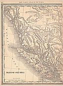
  Title/Description:   North West Coast of America, Sheet I, Cape Flattery to Dixon Entrance
  Publication Info:   Washington: U.S. Coast Survey, 1868
  Date:   1868
  Scale:   1:1,200,000
  Original Source:   Courtesy of Murray Hudson, Halls, Tennessee
Viewing options:


  Main Author:   Geological Survey of Canada
  Title/Description:   Map of a Portion of British Columbia Showing the Coal Fields of Comox Nanaimo and Cowtich on Vancouver and Adjacent Islands
  Publication Info:   Ottawa: Canada Department of Mines and Resources, 1876
  Date:   1876
  Scale:   1:250,000
  Original Source:   Geological Survey of Alabama
Viewing options:


  Main Author:   Hardesty, H.H.
  Title/Description:   Map of British Columbia
  Publication Info:   New York: H.H. Hardesty and Company, 1883; from The Historical and Geographical Encyclopedia
  Date:   1883
  Scale:   1:2,534,000
  Original Source:   Courtesy of Murray Hudson, Halls, Tennessee
Viewing options:


  Main Author:   Bartholomew, John
  Title/Description:   British Columbia
  Publication Info:   London: George Philip and Son, 1883; from The Atlas of the British Empire Throughout the World
  Date:   1883
  Scale:   1:7,603,000
  Original Source:   University of Alabama Map Library
Viewing options:


  Main Author:   Tolmie, W.F. and G.M. Dawson
  Title/Description:   Map Showing the Distribution of the Indian Tribes in British Columbia
  Publication Info:   Ottawa: Geological and Natural History Survey of Canada, 1883
  Date:   1883
  Scale:   1:1,742,000
  Original Source:   Geological Survey of Alabama
Viewing options:


  Main Author:   Hardesty, H.H.
  Title/Description:   British Columbia
  Publication Info:   New York: H.H. Hardesty and Company, 1884; from The Historical and Geographical Encyclopedia
  Date:   1884
  Scale:   1:1,520,640
  Original Source:   Courtesy of Murray Hudson, Halls, Tennessee
Viewing options:


  Main Author:   Cram, George F.
  Title/Description:   British Columbia
  Publication Info:   Chicago: George F. Cram, 1887; from The Bankers and Brokers Railroad Atlas
  Date:   1887
  Scale:   1:3,168,000
  Original Source:   Courtesy of Murray Hudson, Halls, Tennessee
Viewing options:


  Main Author:   Cram, George F.
  Title/Description:   British Columbia
  Publication Info:   Chicago: George F. Cram, 1888; from The Standard American Atlas
  Date:   1888
  Scale:   1:3,168,000
  Original Source:   Courtesy of Murray Hudson, Halls, Tennessee
Viewing options:


  Main Author:   Rand McNally and Company
  Title/Description:   British Columbia
  Publication Info:   Chicago: Rand McNally and Company, 1889; from The Enlarged Business Atlas and Shippers Guide
  Date:   1889
  Scale:   1:2,407,680
  Original Source:   Courtesy of Murray Hudson, Halls, Tennessee
Viewing options:


  Main Author:   Johnston, W. and A.K.
  Title/Description:   British Columbia
  Publication Info:   Edinburgh: W. and A.K. Johnston, c.1890
  Date:   1890
  Scale:   1:6,000,000
  Original Source:   Courtesy of Murray Hudson, Halls, Tennessee
Viewing options:


Main Author:   Rand McNally and Company
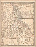
Title/Description:   British Columbia
Publication Info:   Chicago: Rand McNally and Company, 1890; from The Family Atlas of the World
Date:   1890
Scale:   1:2,408,000
Original Source:   University of Alabama Map Library
West
East
Viewing options:
Viewing options:
JPEG or Plugin
JPEG or Plugin


  Main Author:   Walker, Henry B.
  Title/Description:   British Columbia
  Publication Info:   Philadelphia: H.B. Walker1890; from Walker's International Atlas
  Date:   1890
  Scale:   1:3,168,000
  Original Source:   University of Alabama Map Library
Viewing options:


  Main Author:   Rand McNally and Company
  Title/Description:   British Columbia
  Publication Info:   Chicago: Rand McNally and Company, 1891; from The Enlarged Business Atlas and Shippers Guide
  Date:   1891
  Scale:   1:2,407,680
  Original Source:   University of Alabama Map Library
Viewing options:


  Main Author:   Rand McNally and Company
  Title/Description:   British Columbia
  Publication Info:   Chicago: Rand McNally and Company 1895; from The New General Atlas of the World
  Date:   1895
  Scale:   1:3,643,200
  Original Source:   Courtesy of Murray Hudson, Halls, Tennessee
Viewing options:


  Main Author:   Walker, H.B.
  Title/Description:   British Columbia
  Publication Info:   Chicago: H.B. Walker, 1895; from The International Atlas
  Date:   1895
  Scale:   1:3,168,000
  Original Source:   Courtesy of Murray Hudson, Halls, Tennessee
Viewing options:


  Main Author:   Walker, H.B.
  Title/Description:   Official Map of the City of Vancouver, British Columbia
  Publication Info:   Chicago: H.B. Walker, 1895; from The International Atlas
  Date:   1895
  Scale:   1:35,200
  Original Source:   Courtesy of Murray Hudson, Halls, Tennessee
Viewing options:


  Main Author:   Walker, H.B.
  Title/Description:   Official Map of the City of New Westminster, British Columbia
  Publication Info:   Chicago: H.B. Walker, 1895; from The International Atlas
  Date:   1895
  Scale:   1:14,250
  Original Source:   Courtesy of Murray Hudson, Halls, Tennessee
Viewing options:


  Main Author:   Walker, H.B.
  Title/Description:   Official Map of the City of Victoria, British Columbia
  Publication Info:   Chicago: H.B. Walker, 1895; from The International Atlas
  Date:   1895
  Scale:   not indicated
  Original Source:   Courtesy of Murray Hudson, Halls, Tennessee
Viewing options:


  Main Author:   Geological Survey of Canada
  Title/Description:   Placer Mines of Antler Creek
  Publication Info:   Ottawa: Geological Survey of Canada, 1895
  Date:   1895
  Scale:   1:9,500
  Original Source:   Geological Survey of Alabama
Viewing options:


  Main Author:   Geological Survey of Canada
  Title/Description:   Quartz Veins and Placer Diggings in the Vicinity of Grouse Creek, Cariboo District, B.C.
  Publication Info:   Ottawa: Geological Survey of Canada, 1895
  Date:   1895
  Scale:   1:19,500
  Original Source:   Geological Survey of Alabama
Viewing options:


  Main Author:   Geological Survey of Canada
  Title/Description:   Placer Mines of Cunningham Creek, Cariboo District, B.C.
  Publication Info:   Ottawa: Geological Survey of Canada, 1895
  Date:   1895
  Scale:   1:19,500
  Original Source:   Geological Survey of Alabama
Viewing options:


  Main Author:   Geological Survey of Canada
  Title/Description:   Quartz Veins and Placer Mines of Little Snowshoe and Keithley Creeks, Cariboo District, B.C.
  Publication Info:   Ottawa: Geological Survey of Canada, 1895
  Date:   1895
  Scale:   1:25,344
  Original Source:   Geological Survey of Alabama
Viewing options:


  Main Author:   Geological Survey of Canada
  Title/Description:   Veins and Placer Mines of Sugar Creek, Hardscrabble, Slouch Creek, Nelson Creek, Willow River, and Dragon Creek, Cariboo District, B.C.
  Publication Info:   Ottawa: Geological Survey of Canada, 1895
  Date:   1895
  Scale:   1:25,344
  Original Source:   Geological Survey of Alabama
Viewing options:


  Main Author:   Geological Survey of Canada
  Title/Description:   Placer Mines of Harvey Creek, Cariboo District, B.C.
  Publication Info:   Ottawa: Geological Survey of Canada, 1895
  Date:   1895
  Scale:   1:14,000
  Original Source:   Geological Survey of Alabama
Viewing options:


  Main Author:   Geological Survey of Canada
  Title/Description:   Map of Placer Mines and Quartz Locations in the Vicinity of Williams Creek, Cariboo District, B.C.
  Publication Info:   Ottawa: Geological Survey of Canada, 1895
  Date:   1895
  Scale:   1:7,800
  Original Source:   Geological Survey of Alabama
Viewing options:


  Main Author:   Geological Survey of Canada
  Title/Description:   British Columbia, Kamloops Sheet, Geologically Coloured
  Publication Info:   Ottawa: Geological Survey of Canada, 1895
  Date:   1895
  Scale:   1:253,440
  Original Source:   Geological Survey of Alabama
Viewing options:


  Main Author:   Geological Survey of Canada
  Title/Description:   Map of the Finlay and Omerica Rivers, British Columbia
  Publication Info:   Ottawa: Geological Survey of Canada, 1895
  Date:   1895
  Scale:   1:500,000
  Original Source:   Geological Survey of Alabama
Viewing options:


  Main Author:   Geological Survey of Canada
  Title/Description:   British Columbia, Kamloops Sheet, Topography, Economic Minerals and Glacial Striae
  Publication Info:   Ottawa: Geological Survey of Canada, 1895
  Date:   1895
  Scale:   1:243,440
  Original Source:   Geological Survey of Alabama
Viewing options:


  Main Author:   Geological Survey of Canada
  Title/Description:   Map of Placer Mines and Quartz Locations in the Vicinity of Lightning Creek, Cariboo District, B.C.
  Publication Info:   Ottawa: Geological Survey of Canada, 1895
  Date:   1895
  Scale:   1:10,800
  Original Source:   Geological Survey of Alabama
Viewing options:


  Main Author:   Rand McNally and Company
  Title/Description:   British Columbia
  Publication Info:   Chicago: Rand McNally and Company, 1896; from Enlarged Business Atlas
  Date:   1896
  Scale:   1:2,407,680
  Original Source:   University of Alabama Map Library
Viewing options:


  Main Author:   Cram, George F.
  Title/Description:   British Columbia
  Publication Info:   Chicago: George F. Cram, 1898; from The Universal Atlas, Geographical, Astronomical and Historical
  Date:   1898
  Scale:   1:5,386,000
  Original Source:   Courtesy of Adams Antiques, Northport, Alabama
Viewing options:


  Main Author:   Dawson, George M.
  Title/Description:   British Columbia, Shuswap Sheet
  Publication Info:   Ottawa: Geological Survey of Canada, 1898
  Date:   1898
  Scale:   1:253,440
  Original Source:   Geological Survey of Alabama
Viewing options:


  Main Author:   Rand McNally and Company
  Title/Description:   British Columbia
  Publication Info:   Chicago: Rand McNally and Company, 1898; from The Indexed Atlas of the World
  Date:   1898
  Scale:   1:2,400,000
  Original Source:   Courtesy of Murray Hudson, Halls, Tennessee
Viewing options:


  Main Author:   Dawson, George M.
  Title/Description:   British Columbia, Shuswap Sheet, Economic Minerals and Glacial Striae
  Publication Info:   Ottawa: Geological Survey of Canada, 1899
  Date:   1899
  Scale:   1:253,440
  Original Source:   Geological Survey of Alabama
Viewing options:


  Main Author:   Cram, George F.
  Title/Description:   British Columbia
  Publication Info:   Chicago: George F. Cram, 1899; from Cram's Standard American Railway System Atlas
  Date:   1899
  Scale:   1:2,407,680
  Original Source:   Courtesy of Murray Hudson, Halls, Tennessee
Viewing options:


  Main Author:   Meissas, Achille et Auguste Michelot
  Title/Description:   British Columbia
  Publication Info:   New York: The Bradstreet Company, 1899; from Bradstreet's Pocket Atlas of the United States
  Date:   1899
  Scale:   1:15,840,000
  Original Source:   University of Alabama Map Library
Viewing options:


  Main Author:   W. and A.K. Johnston
  Title/Description:   British Columbia
  Publication Info:   Edinburgh: W. and A.K. Johnston, [c. 1901]
  Date:   1901
  Scale:   1:7,286,000
  Original Source:   Courtesy of Adams Antiques, Northport, Alabama
Viewing options:


  Main Author:   Rand McNally and Company
  Title/Description:   Rand McNally and Company's New Map of British Columbia
  Publication Info:   Chicago: Rand McNally and Company, c.1901; from The Atlas of the World
  Date:   1901
  Scale:   1:3,612,000
  Original Source:   Courtesy of Murray Hudson, Halls, Tennessee
Viewing options:


  Main Author:   Cram, George F.
  Title/Description:   British Columbia
  Publication Info:   Chicago: The Fort Dearborn Publishing Company, 1901; from The National Standard Family and Business Atlas of the World
  Date:   1901
  Scale:   1:5,575,680
  Original Source:   Courtesy of Murray Hudson, Halls, Tennessee
Viewing options:


  Main Author:   Rand McNally and Company
  Title/Description:   British Columbia
  Publication Info:   Chicago: Rand McNally and Company, 1901; from The Enlarged Business Atlas and Shippers Guide
  Date:   1901
  Scale:   1:2,407,680
  Original Source:   Courtesy of Murray Hudson, Halls, Tennessee
Viewing options:


  Main Author:   Tunison, Henry Cuthbert
  Title/Description:   British Columbia
  Publication Info:   New York: H.C. Tunison, 1901; from Tunison's Atlas, Encyclopædia, Gazetteer, and Portfolio of Our Universe, Globe, and Nation
  Date:   1901
  Scale:   1:5,544,000
  Original Source:   University of Alabama Map Library
Viewing options:


  Main Author:   Geological Survey of Canada
  Title/Description:   Map of Atlin Gold Fields, British Columbia
  Publication Info:   Ottawa: Geological Survey of Canada, 1901
  Date:   1901
  Scale:   1:380,160
  Original Source:   Geological Survey of Alabama
Viewing options:


  Main Author:   Geological Survey of Canada
  Title/Description:   Geological and Topographical Map of the Atlin Mining District, British Columbia
  Publication Info:   Ottawa: Geological Survey of Canada, 1902
  Date:   1902
  Scale:   1:253,440
  Original Source:   Geological Survey of Alabama
Viewing options:


  Main Author:   Geological Survey of Canada
  Title/Description:   Geological and Topographical Map of Crows Nest Coal-Fields, East Kootenay District, B.C.
  Publication Info:   Ottawa: Geological Survey of Canada, 1902
  Date:   1902
  Scale:   1:126,720
  Original Source:   Geological Survey of Alabama
Viewing options:


  Main Author:   Tunison, H.C.
  Title/Description:   British Columbia
  Publication Info:   Jacksonville, IL: H.C. Tunison, c. 1902
  Date:   1902
  Scale:   1:5,512,000
  Original Source:   Courtesy of Murray Hudson, Halls, Tennessee
Viewing options:


  Main Author:   Geological Survey of Canada
  Title/Description:   West Kootenay Sheet, Economic Minerals and Glacial Stria
  Publication Info:   Ottawa: Geological Survey of Canada, 1902
  Date:   1902
  Scale:   1:250,000
  Original Source:   Geological Survey of Alabama
Viewing options:


  Main Author:   Geological Survey of Canada
  Title/Description:   Geological and Topographical Map of a Portion of East Kootenay District, British Columbia
  Publication Info:   Ottawa: Geological Survey of Canada, 1902
  Date:   1902
  Scale:   1:253,440
  Original Source:   Geological Survey of Alabama
Viewing options:


  Main Author:   Geological Survey of Canada
  Title/Description:   Geological and Topographical Map of a Portion of the Atlin Mining District, British Columbia
  Publication Info:   Ottawa: Geological Survey of Canada, 1902
  Date:   1902
  Scale:   1:253,440
  Original Source:   Geological Survey of Alabama
Viewing options:


  Main Author:   Cram, George F.
  Title/Description:   British Columbia
  Publication Info:   Chicago: George F. Cram, 1903; from The Modern Atlas
  Date:   1903
  Scale:   1:3,168,000
  Original Source:   Courtesy of Murray Hudson, Halls, Tennessee
Viewing options:


  Main Author:   Geological Survey of Canada
  Title/Description:   British Columbia, West Kootenay Sheet
  Publication Info:   Ottawa: Geological Survey of Canada, 1904
  Date:   1904
  Scale:   1:253,440
  Original Source:   Geological Survey of Alabama
Viewing options:


  Main Author:   Baedeker, Karl
  Title/Description:   The Coast of British Columbia and Alaska
  Publication Info:   Leipzig: Karl Baedeker, 1904; from The United States with an Excursion to Mexico
  Date:   1904
  Scale:   1:4,500,000
  Original Source:   University of Alabama Map Library
Viewing options:


  Main Author:   Rand McNally and Company
  Title/Description:   British Columbia
  Publication Info:   Chicago: Rand McNally and Company, 1905; from The Enlarged Business Atlas and Shippers Guide
  Date:   1905
  Scale:   1:2,407,680
  Original Source:   Courtesy of Murray Hudson, Halls, Tennessee
Viewing options:


  Main Author:   Department of Agriculture
  Title/Description:   Map of British Columbia (Dominion of Canada)
  Publication Info:   Ottawa: Department of Agriculture, Canada, 1905; prepared under the direction of Hon. Sydney A. Fisher, Minister of Agriculture
  Date:   1905
  Scale:   1:3,647,000
  Original Source:   Courtesy of Murray Hudson, Halls, Tennessee
Viewing options:


  Main Author:   Rand McNally and Company
  Title/Description:   British Columbia
  Publication Info:   Chicago: Rand McNally and Company, 1905; from Indexed Atlas of the World
  Date:   1905
  Scale:   1:2,407,690
  Original Source:   University of Alabama Map Library
Viewing options:


  Main Author:   Rand McNally and Company
  Title/Description:   Western Canada
  Publication Info:   Chicago: Rand McNally and Company, 1905; from Indexed Atlas of the World
  Date:   1905
  Scale:   1:3,801,600
  Original Source:   University of Alabama Map Library
Viewing options:


  Main Author:   Rand McNally and Company
  Title/Description:   British Columbia
  Publication Info:   Chicago: Rand McNally and Company, 1906; from Rand McNally and Company's Indexed Pocket Map and Shippers' Guide of British Columbia
  Date:   1906
  Scale:   1:2,407,680
  Original Source:   Courtesy of Murray Hudson, Halls, Tennessee
Viewing options:


  Main Author:    
  Title/Description:   British Columbia
  Publication Info:   Chicago: George F. Cram for A.A. Grant, Toronto, Ontario 1906; From Grant's Bankers and Brokers Railroad System Atlas
  Date:   1906
  Scale:   1:4,752,000
  Original Source:   Courtesy of Murray Hudson, Halls, Tennessee
Viewing options:


  Main Author:   Canada Depatment of Mines, Geological Survey
  Title/Description:   Topographic Sheat, Rossland Mining Camp, British Columbia
  Publication Info:   Ottawa: Canada Department of Mines, Geological Survey, 1908
  Date:   1908
  Scale:   1:14,400
  Original Source:   Geological Survey of Alabama
Viewing options:


  Main Author:   Canada Depatment of Mines, Geological Survey
  Title/Description:   Topographic Sheat, Special Map of Rossland, British Columbia
  Publication Info:   Ottawa: Canada Department of Mines, Geological Survey, 1908
  Date:   1908
  Scale:   1:4,800
  Original Source:   Geological Survey of Alabama
Viewing options:


  Main Author:   Cram, George F.
  Title/Description:   British Columbia
  Publication Info:   Chicago: George F. Cram, 1909; from The Art of Our Country
  Date:   1909
  Scale:   1:4,219,776
  Original Source:   Courtesy of Murray Hudson, Halls, Tennessee
Viewing options:


  Main Author:   Canada Depatment of Mines, Geological Survey
  Title/Description:   Geological Sheet, Special Map of Rossland, British Columbia
  Publication Info:   Ottawa: Canada Department of Mines, Geological Survey, 1909
  Date:   1909
  Scale:   1:4,800
  Original Source:   Geological Survey of Alabama
Viewing options:


  Main Author:   Canada Depatment of Mines, Geological Survey
  Title/Description:   Geographical Sheet, Rossland Mining Camp, British Columbia
  Publication Info:   Ottawa: Canada Department of Mines, Geological Survey, 1909
  Date:   1909
  Scale:   1:14,400
  Original Source:   Geological Survey of Alabama
Viewing options:


  Main Author:   Rand McNally and Company
  Title/Description:   British Columbia
  Publication Info:   Chicago: Rand McNally and Company, 1910; from The Pocket Map and Shippers' Guide
  Date:   1910
  Scale:   1:2,408,000
  Original Source:   Courtesy of Murray Hudson, Halls, Tennessee
Viewing options:


  Main Author:   Carmelite House
  Title/Description:   Western Canada showing the Gold Fields of British Columbia
  Publication Info:   London: Carmelite House, c.1910; from The Harmsworth Atlas and Gazetteer
  Date:   1910
  Scale:   1:2,980,000
  Original Source:   University of Alabama Map Library
Viewing options:


  Main Author:   Canada Department of Mines, Geological Survey
  Title/Description:   Hedley Mining Distict, British Columbia (Geology)
  Publication Info:   Ottawa: Canada Department of Mines, Geological Survey, 1910
  Date:   1910
  Scale:   1:12,000
  Original Source:   University of Alabama Map Library
Viewing options:


  Main Author:   Canada Department of Mines, Geological Survey
  Title/Description:   Hedley Mining Distict, British Columbia (Topography)
  Publication Info:   Ottawa: Canada Department of Mines, Geological Survey, 1910
  Date:   1910
  Scale:   1:12,000
  Original Source:   University of Alabama Map Library
Viewing options:


  Main Author:   Rand McNally and Company
  Title/Description:   British Columbia
  Publication Info:   Chicago: Rand McNally and Company, 1911; from The Indexed Atlas of the World
  Date:   1911
  Scale:   1:2,408,000
  Original Source:   University of Alabama Map Library
Viewing options:


  Main Author:   Canada Department of Mines, Geological Survey
  Title/Description:   Phoenix, British Columbia (Geology)
  Publication Info:   Ottawa: Canada Department of Mines, Geological Survey, 1911
  Date:   1911
  Scale:   1:48,000
  Original Source:   University of Alabama Map Library
Viewing options:


  Main Author:   Canada Department of Mines, Geological Survey
  Title/Description:   Phoenix, British Columbia (Topography)
  Publication Info:   Ottawa: Canada Department of Mines, Geological Survey, 1911
  Date:   1911
  Scale:   1:48,000
  Original Source:   University of Alabama Map Library
Viewing options:


  Main Author:   Canada Department of Mines, Geological Survey
  Title/Description:   Coast and Islands Between Strait of Georgia and Queen Charlotte Sound, British Columbia
  Publication Info:   Ottawa: Canada Department of Mines, Geological Survey, 1911
  Date:   1911
  Scale:   1:255,440
  Original Source:   University of Alabama Map Library
Viewing options:


  Main Author:   Canada Department of Mines, Geological Survey
  Title/Description:   Mother Lode and Sunset Mines, Deadwood, British Columbia (Economic Geology)
  Publication Info:   Ottawa: Canada Department of Mines, Geological Survey, 1911
  Date:   1911
  Scale:   1:4,800
  Original Source:   Geological Survey of Alabama
Viewing options:


  Main Author:   Canada Department of Mines, Geological Survey
  Title/Description:   Mother Lode and Sunset Mines, Deadwood, British Columbia (Topography)
  Publication Info:   Ottawa: Canada Department of Mines, Geological Survey, 1911
  Date:   1911
  Scale:   1:4,800
  Original Source:   Geological Survey of Alabama
Viewing options:


  Main Author:   Canada Department of Mines, Geological Survey
  Title/Description:   Diagram of Portland Canal Mining District, with Portions of Salmon and Nass Valleys, British Columbia
  Publication Info:   Ottawa: Canada Department of Mines, Geological Survey, 1911
  Date:   1911
  Scale:   1:125,000
  Original Source:   Geological Survey of Alabama
Viewing options:


  Main Author:   Canada Department of Mines, Geological Survey
  Title/Description:   Part of Portland Canal Mining Area, British Columbia (Topography)
  Publication Info:   Ottawa: Canada Department of Mines, Geological Survey, 1911
  Date:   1911
  Scale:   1:125,000
  Original Source:   Geological Survey of Alabama
Viewing options:


  Main Author:   Canada Department of Mines, Geological Survey
  Title/Description:   Law's Mining Camp, Near Tulamean, B.C.
  Publication Info:   Ottawa: Canada Department of Mines, Geological Survey, 1911
  Date:   1911
  Scale:   1:7,200
  Original Source:   Geological Survey of Alabama
Viewing options:


  Main Author:   Canada Department of Mines, Geological Survey
  Title/Description:   Tulamean Coal Area, Yale District, British Columbia (Economic Geology)
  Publication Info:   Ottawa: Canada Department of Mines, Geological Survey, 1911
  Date:   1911
  Scale:   1:31,680
  Original Source:   Geological Survey of Alabama
Viewing options:


  Main Author:   Canada Department of Mines, Geological Survey
  Title/Description:   Tulamean, Yale District, British Columbia (Topography)
  Publication Info:   Ottawa: Canada Department of Mines, Geological Survey, 1911
  Date:   1911
  Scale:   1:62,500
  Original Source:   Geological Survey of Alabama
Viewing options:


  Main Author:   Canada Department of Mines, Geological Survey
  Title/Description:   Tulamean, Yale District, British Columbia (Geology)
  Publication Info:   Ottawa: Canada Department of Mines, Geological Survey, 1911
  Date:   1911
  Scale:   1:62,500
  Original Source:   Geological Survey of Alabama
Viewing options:


  Main Author:   Canada Department of Mines, Geological Survey
  Title/Description:   Southern Vancouver Island, British Columbia (Geological Reconnaissance)
  Publication Info:   Ottawa: Canada Department of Mines, Geological Survey, 1911
  Date:   1911
  Scale:   1:380,160
  Original Source:   Geological Survey of Alabama
Viewing options:


  Main Author:   Canada Department of Mines, Mines Branch
  Title/Description:   General Map of Coal Fields in British Columbia
  Publication Info:   Ottawa: Canada Department of Mines, Mines Branch, 1911
  Date:   1911
  Scale:   1:2,217,600
  Original Source:   Geological Survey of Alabama
Viewing options:


  Main Author:   Rand McNally and Company
  Title/Description:   British Columbia
  Publication Info:   Chicago: Rand McNally and Company, 1912; from The Commercial Atlas of America
  Date:   1912
  Scale:   1:2,217,600
  Original Source:   Courtesy of Murray Hudson, Halls, Tennessee
Viewing options:


  Main Author:   Department of Lands
  Title/Description:   British Columbia
  Publication Info:   Ottawa: Department of Lands, Mining Division, 1913
  Date:   1913
  Scale:   1:1,901,000
  Original Source:   Courtesy of Murray Hudson, Halls, Tennessee
Viewing options:


  Main Author:   Geological Survey of Canada
  Title/Description:   Glacier
  Publication Info:   Ottawa: Government Printing Bureau, 1913
  Date:   1913
  Scale:   1:125,000
  Original Source:   Geological Survey of Alabama
Viewing options:


  Main Author:   Geological Survey of Canada
  Title/Description:   Victoria and Vicinity
  Publication Info:   Ottawa: Government Printing Bureau, 1913
  Date:   1913
  Scale:   1:63,360
  Original Source:   Geological Survey of Alabama
Viewing options:


  Main Author:   Canada Department of Mines, Geological Survey
  Title/Description:   Taku Arm, Atlin District, B.C. (Geology)
  Publication Info:   Ottawa: Canada Department of Mines, Geological Survey, 1913
  Date:   1913
  Scale:   1:250,000
  Original Source:   Geological Survey of Alabama
Viewing options:


  Main Author:   Canada Department of Mines, Geological Survey
  Title/Description:   Geological Map of Alberta, Saskatchewan and Manitoba
  Publication Info:   Ottawa: Canada Depertment of Mines, Geological Survey, 1913
  Date:   1913
  Scale:   1:2,217,600
  Original Source:   Geological Survey of Alabama
Viewing options:


  Main Author:   Rand McNally and Company
  Title/Description:   British Columbia
  Publication Info:   Chicago: Rand McNally and Company, 1914; from The Commercial Atlas of America
  Date:   1914
  Scale:   1:2,851,200
  Original Source:   Courtesy of Murray Hudson, Halls, Tennessee
Viewing options:


  Main Author:   Reynolds, Francis J.
  Title/Description:   British Columbia
  Publication Info:   New York: P.F. Collier and Son, 1914; from the New Encyclopedic Atlas and Gazeteer of the World
  Date:   1914
  Scale:   1:6,657,800
  Original Source:   Courtesy of Murray Hudson, Halls, Tennessee
Viewing options:


  Main Author:   C.S. Hammond and Company
  Title/Description:   British Columbia
  Publication Info:   New York: C.S. Hammond and Company,1914; from Hammond's Commercial and Library Atlas of the World
  Date:   1914
  Scale:   1:6,970,000
  Original Source:   University of Alabama Map Library
Viewing options:


  Main Author:   Rand McNally and Company
  Title/Description:   British Columbia
  Publication Info:   Chicago: Rand McNally and Company, 1914; from Atlas of Foreign Countries
  Date:   1914
  Scale:   1:2,851,200
  Original Source:   University of Alabama Map Library
Viewing options:


  Main Author:   Canada Department of Mines, Geological Survey
  Title/Description:   Saanich Sheet, Vancouver Island, British Columbia (Geology)
  Publication Info:   Ottawa: Canada Department of Mines, Geological Survey, 1914
  Date:   1914
  Scale:   1:62,500
  Original Source:   Geological Survey of Alabama
Viewing options:


  Main Author:   Canada Department of Mines, Geological Survey
  Title/Description:   Victoria Sheet, Vancouver Island, British Island (Geology)
  Publication Info:   Ottawa: Canada Department of Mines, Geological Survey, 1914
  Date:   1914
  Scale:   1:62,500
  Original Source:   Geological Survey of Alabama
Viewing options:


  Main Author:   Canada Department of Mines, Geological Survey
  Title/Description:   Sooke Sheet, Vancouver Island, British Columbia (Topography)
  Publication Info:   Ottawa: Canada Department of Mines, Geological Survey, 1914
  Date:   1914
  Scale:   1:125,000
  Original Source:   Geological Survey of Alabama
Viewing options:


  Main Author:   Canada Department of Mines, Geological Survey
  Title/Description:   Franklin Mining Camp, West Kootenay, British Columbia
  Publication Info:   Ottawa: Canada Department of Mines, Geological Survey, 1914
  Date:   1914
  Scale:   1:24,000
  Original Source:   Geological Survey of Alabama
Viewing options:


  Main Author:   Canada Department of Mines, Geological Survey
  Title/Description:   Southern Vancouver Island, British Columbia (Geology)
  Publication Info:   Ottawa: Canada Department of Mines, Geological Survey, 1914
  Date:   1914
  Scale:   1:380,160
  Original Source:   Geological Survey of Alabama
Viewing options:


  Main Author:   Geological Survey of Canada
  Title/Description:   Prescott, Paxton, and Lake Mines; Texada Island, British Columbia
  Publication Info:   Ottawa: Geological Survey of Canada, 1915
  Date:   1915
  Scale:   1:4,800
  Original Source:   Geological Survey of Alabama
Viewing options:


  Main Author:   Canada Department of Mines, Geological Survey
  Title/Description:   Saanich Sheet, Vancouver Island, British Columbia (Superficial Geology)
  Publication Info:   Ottawa: Canada Department of Mines, Geological Survey, 1915
  Date:   1915
  Scale:   1:62,500
  Original Source:   Geological Survey of Alabama
Viewing options:


  Main Author:   Canada Department of Mines, Geological Survey
  Title/Description:   Victoria Sheet, Vancouver Island, British Columbia (Topography)
  Publication Info:   Ottawa: Canada Department of Mines, Geological Survey, 1915
  Date:   1915
  Scale:   1:62,500
  Original Source:   Geological Survey of Alabama
Viewing options:


  Main Author:   Canada Department of Mines, Geological Survey
  Title/Description:   Saanich Sheet, Vancouver Island, British Columbia (Topography)
  Publication Info:   Ottawa: Canada Department of Mines, Geological Survey, 1915
  Date:   1915
  Scale:   1:62,500
  Original Source:   Geological Survey of Alabama
Viewing options:


  Main Author:   Canada Department of Mines, Geological Survey
  Title/Description:   Victoria Sheet, Vancouver Island, British Columbia (Superficial Geology)
  Publication Info:   Ottawa: Canada Department of Mines, Geological Survey, 1915
  Date:   1915
  Scale:   1:62,500
  Original Source:   Geological Survey of Alabama
Viewing options:


  Main Author:   Canada Department of Mines, Geological Survey
  Title/Description:   Beaverdell, Yale District, British Columbia (Geology)
  Publication Info:   Ottawa: Canada Department of Mines, Geological Survey, 1915
  Date:   1915
  Scale:   1:62,500
  Original Source:   Geological Survey of Alabama
Viewing options:


  Main Author:   Canada Department of Mines, Geological Survey
  Title/Description:   Cranbrook, Kootenay District, British Columbia
  Publication Info:   Ottawa: Canada Department of Mines, Geological Survey, 1915
  Date:   1915
  Scale:   1:250,000
  Original Source:   Geological Survey of Alabama
Viewing options:


  Main Author:   Canada Department of Mines, Geological Survey
  Title/Description:   Coal-fields of British Columbia
  Publication Info:   Ottawa: Canada Department of Mines, Geological Survey, 1915
  Date:   1915
  Scale:   1:2,217,600
  Original Source:   Geological Survey of Alabama
Viewing options:


  Main Author:   Canada Department of Mines, Geological Survey
  Title/Description:   Prescott, Paxton, and Lake Mines, Texada Island, British Columbia (Topography)
  Publication Info:   Ottawa: Canada Department of Mines, Geological Survey, 1915
  Date:   1915
  Scale:   1:4,800
  Original Source:   Geological Survey of Alabama
Viewing options:


  Main Author:   Canada Department of Mines, Geological Survey
  Title/Description:   Prescott, Paxton, and Lake Mines, Texada Island, British Columbia (Geology)
  Publication Info:   Ottawa: Canada Department of Mines, Geological Survey, 1915
  Date:   1915
  Scale:   1:4,800
  Original Source:   Geological Survey of Alabama
Viewing options:


  Main Author:   Canada Department of Mines, Geological Survey
  Title/Description:   Vananda, Texada Island, British Columbia (Geology)
  Publication Info:   Ottawa: Canada Department of Mines, Geological Survey, 1915
  Date:   1915
  Scale:   1:24,000
  Original Source:   Geological Survey of Alabama
Viewing options:


  Main Author:   Canada Department of Mines, Geological Survey
  Title/Description:   Vanada, Texada Island, British Columbia (Topography)
  Publication Info:   Ottawa: Canada Department of Mines, Geological Survey, 1915
  Date:   1915
  Scale:   1:24,000
  Original Source:   Geological Survey of Alabama
Viewing options:


  Main Author:   Canada Department of Mines, Geological Survey
  Title/Description:   Diagram Showing the Geology of Texada Island, British Columbia
  Publication Info:   Ottawa: Canada Department of Mines, Geological Survey, 1915
  Date:   1915
  Scale:   1:125,000
  Original Source:   Geological Survey of Alabama
Viewing options:


  Main Author:   Canada Department of Mines, Geological Survey
  Title/Description:   Nanaimo Sheet, Vancouver Island, British Columbia (Topography)
  Publication Info:   Ottawa: Canada Department of Mines, Geological Survey, 1915
  Date:   1915
  Scale:   1:62,500
  Original Source:   Geological Survey of Alabama
Viewing options:


  Main Author:   Rand McNally and Company
  Title/Description:   British Columbia
  Publication Info:   Chicago: Rand McNally and Company, 1916; from The Ideal Atlas of the World
  Date:   1916
  Scale:   1:4,308,480
  Original Source:   Courtesy of Murray Hudson, Halls, Tennessee
Viewing options:


  Main Author:   Canada Department of Mines, Geological Survey
  Title/Description:   Ymir, Kootenay District, British Columbia (Geology)
  Publication Info:   Ottawa: Canada Department of Mines, Geological Survey, 1916
  Date:   1916
  Scale:   1:63,360
  Original Source:   Geological Survey of Alabama
Viewing options:


  Main Author:   Canada Department of Mines, Geological Survey
  Title/Description:   Nanaimo Sheet, Vancouver Island, British Columbia (Economic Geography)
  Publication Info:   Ottawa: Canada Department of Mines, Geological Survey, 1916
  Date:   1916
  Scale:   1:62,500
  Original Source:   Geological Survey of Alabama
Viewing options:


  Main Author:   Canada Department of Mines, Geological Survey
  Title/Description:   Nanaimo Sheet, Vancouver Island, British Columbia (Geology)
  Publication Info:   Ottawa: Canada Department of Mines, Geological Survey, 1916
  Date:   1916
  Scale:   1:62,500
  Original Source:   Geological Survey of Alabama
Viewing options:


  Main Author:   Canada Department of Mines, Geological Survey
  Title/Description:   Nanaimo Sheet, Vancouver Island, British Columbia (Economic Geology)
  Publication Info:   Ottawa: Canada Department of Mines, Geological Survey, 1916
  Date:   1916
  Scale:   1:62,500
  Original Source:   Geological Survey of Alabama
Viewing options:


  Main Author:   Canada Department of Mines, Geological Survey
  Title/Description:   Nanaimo Sheet, Vancouver Island, British Columbia (Superficial Geology)
  Publication Info:   Ottawa: Canada Department of Mines, Geological Survey, 1916
  Date:   1916
  Scale:   1:62,500
  Original Source:   Geological Survey of Alabama
Viewing options:


  Main Author:   Canada Department of Mines, Geological Survey
  Title/Description:   Southern Portion of Graham Island, Queen Charlotte Islands, British Columbia
  Publication Info:   Ottawa: Canada Department of Mines, Geological Survey, 1916
  Date:   1916
  Scale:   1:126,720
  Original Source:   Geological Survey of Alabama
Viewing options:


  Main Author:   Canada Department of Mines, Geological Survey
  Title/Description:   Graham Island, Queen Charlotte Islands, British Columbia
  Publication Info:   Ottawa: Canada Department of Mines, Geological Survey, 1916
  Date:   1916
  Scale:   1:253,440
  Original Source:   Geological Survey of Alabama
Viewing options:


  Main Author:   C.S. Hammond and Company
  Title/Description:   British Columbia
  Publication Info:   New York: C.S. Hammond and Company, 1917; from The New Universal Atlas of the World
  Date:   1917
  Scale:   1:6,969,600
  Original Source:   Courtesy of Murray Hudson, Halls, Tennessee
Viewing options:


  Main Author:   Canada Department of Mines, Geological Survey
  Title/Description:   East Sooke, Vancouver Island, British Columbia
  Publication Info:   Ottawa: Canada Department of Mines, Geological Survey, 1917
  Date:   1917
  Scale:   1:24,000
  Original Source:   Geological Survey of Alabama
Viewing options:


  Main Author:   Canada Department of Mines, Geological Survey
  Title/Description:   East Sooke, Vancouver Island, British Columbia (Topography)
  Publication Info:   Ottawa: Canada Department of Mines, Geological Survey, 1917
  Date:   1917
  Scale:   1:24,000
  Original Source:   Geological Survey of Alabama
Viewing options:


  Main Author:   Canada Department of Mines, Geological Survey
  Title/Description:   Duncan Sheet, Vancouver Island, British Columbia (Topography)
  Publication Info:   Ottawa: Canada Department of Mines, Geological Survey, 1917
  Date:   1917
  Scale:   1:125,000
  Original Source:   Geological Survey of Alabama
Viewing options:


  Main Author:   Canada Department of Mines, Geological Survey
  Title/Description:   Slocan Mining Area, Kootenay District, British Columbia
  Publication Info:   Ottawa: Canada Department of Mines, Geological Survey, 1917
  Date:   1917
  Scale:   1:63,360
  Original Source:   Geological Survey of Alabama
Viewing options:


  Main Author:   Canada Department of Mines, Geological Survey
  Title/Description:   Ainsworth, Kootenay District, British Columbia (Topography)
  Publication Info:   Ottawa: Canada Department of Mines, Geological Survey, 1918
  Date:   1918
  Scale:   1:24,000
  Original Source:   Geological Survey of Alabama
Viewing options:


  Main Author:   Canada Department of Mines, Geological Survey
  Title/Description:   Sooke Sheet, Vancouver Island, British Columbia (Geology)
  Publication Info:   Ottawa: Canada Department of Mines, Geological Survey, 1918
  Date:   1918
  Scale:   1:125,000
  Original Source:   Geological Survey of Alabama
Viewing options:


  Main Author:   Canada Department of Mines, Geological Survey
  Title/Description:   Duncan Sheet, Vancouver Island, British Columbia (Geology)
  Publication Info:   Ottawa: Canada Department of Mines, Geological Survey, 1918
  Date:   1918
  Scale:   1:125,000
  Original Source:   Geological Survey of Alabama
Viewing options:


  Main Author:   Canada Department of Mines, Geological Survey
  Title/Description:   Ainsworth, Kootenay District, British Columbia (Geology)
  Publication Info:   Ottawa: Canada Department of Mines, Geological Survey, 1918
  Date:   1918
  Scale:   1:24,000
  Original Source:   Geological Survey of Alabama
Viewing options:


  Main Author:   Canada Department of Mines, Geological Survey
  Title/Description:   Mineral Areas in the Vicinity of Hazelton, Cassier District, British Columbia
  Publication Info:   Ottawa: Canada Department of Mines, Geological Survey, 1918
  Date:   1918
  Scale:   1:114,000
  Original Source:   Geological Survey of Alabama
Viewing options:


  Main Author:   Rand McNally and Company
  Title/Description:   The Rand McNally New Commercial Atlas Map of British Columbia
  Publication Info:   Chicago: Rand McNally and Company, 1920; from The Commercial Atlas of America
  Date:   1920
  Scale:   1:2,851,000
  Original Source:   University of Alabama Map Library
Viewing options:


  Main Author:   Reynolds, Francis J.
  Title/Description:   British Columbia
  Publication Info:   New York: P.F. Collier and Son Company, 1920; from The New World Atlas and Gazetteer
  Date:   1920
  Scale:   1:8,236,800
  Original Source:   Courtesy of Murray Hudson, Halls, Tennessee
Viewing options:


  Main Author:   Bartholomew, J.G.
  Title/Description:   British Columbia
  Publication Info:   London: The Times, 1920; from The Times Survey Atlas of the World
  Date:   1920
  Scale:   1:2,500,000
  Original Source:   University of Alabama Map Library
Viewing options:


  Main Author:   C.S. Hammond and Company
  Title/Description:   British Columbia
  Publication Info:   New York: C.S. Hammond and Company, 1920; from The New Reference Map of the World
  Date:   1920
  Scale:   1:6,969,000
  Original Source:   Courtesy of Shawn Carter
Viewing options:


  Main Author:   Rand McNally and Company
  Title/Description:   British Columbia
  Publication Info:   Chicago: Rand McNally and Company, 1921
  Date:   1921
  Scale:   1:2,851,200
  Original Source:   University of Alabama Map Library
Viewing options:


  Main Author:   Phillip, George
  Title/Description:   Canada: V. British Columbia
  Publication Info:   London: George Philip and Son, 1921; from Philip's New Handy General Atlas and Gazetteer
  Date:   1921
  Scale:   1:2,900,000
  Original Source:   University of Alabama Map Library
Viewing options:


  Main Author:   Cram, George F.
  Title/Description:   British Columbia
  Publication Info:   Chicago: George F. Cram Company, 1921; from Cram's Unrivaled Atlas of the World
  Date:   1921
  Scale:   1:3,041,000
  Original Source:   University of Alabama Map Library
Viewing options:


  Main Author:   Canada Department of Mines, Geological Survey
  Title/Description:   Salmon River Area, Portland Canal Mining Division, Cassiar District, British Columbia
  Publication Info:   Ottawa: Canada Department of Mines, Geological Survey, 1921
  Date:   1921
  Scale:   1:48,000
  Original Source:   Geological Survey of Alabama
Viewing options:


  Main Author:   C.S. Hammond and Company
  Title/Description:   British Columbia (Southern Part)
  Publication Info:   New York: C.S. Hammond and Company, 1922; from The New World Loose Leaf Atlas
  Date:   1922
  Scale:   1:1,774,080
  Original Source:   Courtesy of Murray Hudson, Halls, Tennessee
Viewing options:


  Main Author:   Canada Department of Mines, Geological Survey
  Title/Description:   Bridge River, Between Resmount and Gun Lake, Lillooet District, British Columbia (Geology)
  Publication Info:   Ottawa: Canada Department of Mines, Geological Survey, 1922
  Date:   1922
  Scale:   1:125,000
  Original Source:   Geological Survey of Alabama
Viewing options:


  Main Author:   Canada Department of Mines, Geological Survey
  Title/Description:   Bridge River, Between Resmount and Gun Lake, Lillooet District, British Columbia (Topography)
  Publication Info:   Ottawa: Canada Department of Mines, Geological Survey, 1922
  Date:   1922
  Scale:   1:125,000
  Original Source:   Geological Survey of Alabama
Viewing options:


  Main Author:   Cram, George F.
  Title/Description:   British Columbia
  Publication Info:   Chicago: George F. Cram Company, 1923; from Cram's Unrivaled Atlas of the World
  Date:   1923
  Scale:   1:3,800,000
  Original Source:   University of Alabama Map Library
Viewing options:


  Main Author:   Reynolds, Francis J.
  Title/Description:   British Columbia
  Publication Info:   New York: P.F. Collier and Son Company, 1924; from The New World Atlas and Gazetteer
  Date:   1924
  Scale:   1:6,336,000
  Original Source:   University of Alabama Map Library
Viewing options:


  Main Author:   Canada Department of Mines, Geological Survey
  Title/Description:   Barkerville Area, Cariboo District, British Columbia
  Publication Info:   Ottawa: Canada Department of Mines, Geological Survey, 1925
  Date:   1925
  Scale:   1:63,360
  Original Source:   Geological Survey of Alabama
Viewing options:


  Main Author:   Department of Mines
  Title/Description:   Dease Lake Area, Cassiar District, British Columbia
  Publication Info:   Ottawa: Department of Mines, 1926
  Date:   1926
  Scale:   1:126,720
  Original Source:   Geological Survey of Alabama
Viewing options:


  Main Author:   Department of Mines
  Title/Description:   Windermere, Kootenay District, British Columbia
  Publication Info:   Ottawa: Department of Mines, 1926
  Date:   1926
  Scale:   1:125,000
  Original Source:   Geological Survey of Alabama
Viewing options:


  Main Author:   Canada Department of Mines, Geological Survey
  Title/Description:   Windermere, Kootenay District, British Columbia
  Publication Info:   Ottawa: Canada Department of Mines, Geological Survey, 1926
  Date:   1926
  Scale:   1:125,000
  Original Source:   Geological Survey of Alabama
Viewing options:


  Main Author:   Canada Department of Mines, Geological Survey
  Title/Description:   Finlay River Area, Cassiar District, British Columbia
  Publication Info:   Ottawa: Canada Department of Mines, Geological Survey, 1928
  Date:   1928
  Scale:   1:306,880
  Original Source:   Geological Survey of Alabama
Viewing options:


  Main Author:   Canada Department of Mines, Geological Survey
  Title/Description:   Britannia Beach Sheet, Westminster District, British Columbia
  Publication Info:   Ottawa: Canada Department of Mines, Geological Survey, 1929
  Date:   1929
  Scale:   1:63,360
  Original Source:   Geological Survey of Alabama
Viewing options:


  Main Author:   Canada Department of Mines, Geological Survey
  Title/Description:   Slocan and Upper Arrow Lakes Area, Kootenay District, British Columbia
  Publication Info:   Ottawa: Canada Department of Mines, Geological Survey, 1929
  Date:   1929
  Scale:   1:126,720
  Original Source:   Geological Survey of Alabama
Viewing options:


  Main Author:   Canada Department of Mines, Geological Survey
  Title/Description:   Big Bend Area, Columbia River, British Columbia
  Publication Info:   Ottawa: Canada Department of Mines, Geological Survey, 1929
  Date:   1929
  Scale:   1:253,440
  Original Source:   Geological Survey of Alabama
Viewing options:


  Main Author:   Canada Department of Mines, Geological Survey
  Title/Description:   Kootenay Lake Area, Kootenay District, British Columbia
  Publication Info:   Ottawa: Canada Department of Mines, Geological Survey, 1929
  Date:   1929
  Scale:   1:253,440
  Original Source:   Geological Survey of Alabama
Viewing options:


  Main Author:   Canada Department of Mines, Geological Survey
  Title/Description:   Lardeau Area, Kootenay District, British Columbia
  Publication Info:   Ottawa: Canada Department of Mines, Geological Survey, 1929
  Date:   1929
  Scale:   1:253,440
  Original Source:   Geological Survey of Alabama
Viewing options:


  Main Author:   Canada Department of Mines, Geological Survey
  Title/Description:   Nickel Plate Mountain (Near Hedley), Similkameen District, British Columbia
  Publication Info:   Ottawa: Canada Department of Mines, Geological Survey, 1930
  Date:   1930
  Scale:   1:6,000
  Original Source:   Geological Survey of Alabama
Viewing options:


  Main Author:   Canada Department of Mines, Geological Survey
  Title/Description:   Quatsino-Nimpkish Area, Northern Vancouver Island, British Columbia
  Publication Info:   Ottawa: Canada Department of Mines, Geological Survey, 1930
  Date:   1930
  Scale:   1:126,720
  Original Source:   Geological Survey of Alabama
Viewing options:


  Main Author:   C.S. Hammond and Company
  Title/Description:   British Columbia (Southern Part)
  Publication Info:   New York: C.S. Hammond and Company, c. 1930; from The New World Loose Leaf Atlas, Sixth Edition
  Date:   1930
  Scale:   1:1,744,000
  Original Source:   University of Alabama Map Library
Viewing options:


  Main Author:   C.S. Hammond and Company
  Title/Description:   British Columbia
  Publication Info:   New York: C.S. Hammond and Company, c. 1930; from The New World Loose Leaf Atlas, Sixth Edition
  Date:   1930
  Scale:   1:6,970,000
  Original Source:   University of Alabama Map Library
Viewing options:


  Main Author:   Canada Department of Mines, Geological Survey
  Title/Description:   Corbin Area, Kootenay District, British Columbia
  Publication Info:   Ottawa: Canada Department of Mines, Geological Survey, 1931
  Date:   1931
  Scale:   1:12,000
  Original Source:   Geological Survey of Alabama
Viewing options:


  Main Author:   Geographical Publishing Company
  Title/Description:   British Columbia
  Publication Info:   Chicago: Geographical Publishing Company, 1931; from Commercial Atlas of the World
  Date:   1931
  Scale:   1:2,851,200
  Original Source:   University of Alabama Map Library
Viewing options:


  Main Author:   Canada Department of Mines, Geological Survey
  Title/Description:   Sandon (Slocan and Ainsworth Mining Divisions), Kootenay District, British Columbia
  Publication Info:   Ottawa: Canada Department of Mines, Geological Survey, 1932
  Date:   1932
  Scale:   1:48,000
  Original Source:   Geological Survey of Alabama
Viewing options:


  Main Author:   Canada Department of Mines, Geological Survey
  Title/Description:   Slocan Sheet, Kootenay District, British Columbia
  Publication Info:   Ottawa: Canada Department of Mines, Geological Survey, 1932
  Date:   1932
  Scale:   1:63,360
  Original Source:   Geological Survey of Alabama
Viewing options:


  Main Author:   Canada Department of Mines, Geological Survey
  Title/Description:   Brisco-Dogtooth Area, Kootenay District, British Columbia
  Publication Info:   Ottawa: Canada Department of Mines, Geological Survey, 1933
  Date:   1933
  Scale:   1:253,440
  Original Source:   Geological Survey of Alabama
Viewing options:


  Main Author:   Canada Department of Mines, Geological Survey
  Title/Description:   Salmo Sheet, Kootenay District, British Columbia
  Publication Info:   Ottawa: Canada Department of Mines, Geological Survey, 1934
  Date:   1934
  Scale:   1:63,360
  Original Source:   Geological Survey of Alabama
Viewing options:


  Main Author:   Canada Department of Mines, Geological Survey
  Title/Description:   Copper Mountain Mining Area, Similkameen District, British Columbia
  Publication Info:   Ottawa: Canada Department of Mines, Geological Survey, 1934
  Date:   1934
  Scale:   1:12,000
  Original Source:   Geological Survey of Alabama
Viewing options:


  Main Author:   Canada Department of Mines, Geological Survey
  Title/Description:   Camp McKinney, Similkameen District, British Columbia
  Publication Info:   Ottawa: Canada Department of Mines, Geological Survey, 1935
  Date:   1935
  Scale:   1:63,360
  Original Source:   Geological Survey of Alabama
Viewing options:


  Main Author:   Canada Department of Mines, Geological Survey
  Title/Description:   Portland Canal Area, Cassiar District, British Columbia
  Publication Info:   Ottawa: Canada Department of Mines, Geological Survey, 1935
  Date:   1935
  Scale:   1:253,440
  Original Source:   Geological Survey of Alabama
Viewing options:


  Main Author:   Canada Department of Mines, Geological Survey
  Title/Description:   Mining Properties in the Portland Canal Area, Cassiar District, British Columbia
  Publication Info:   Ottawa: Canada Department of Mines, Geological Survey, 1935
  Date:   1935
  Scale:   1:253,440
  Original Source:   Geological Survey of Alabama
Viewing options:


  Main Author:   Canada Department of Mines, Geological Survey
  Title/Description:   Barkerville Gold Belt, Cariboo District, British Columbia (North Sheet)
  Publication Info:   Ottawa: Canada Department of Mines, Geological Survey, 1935
  Date:   1935
  Scale:   1:12,000
  Original Source:   Geological Survey of Alabama
Viewing options:


  Main Author:   Canada Department of Mines, Geological Survey
  Title/Description:   Barkerville Gold Belt, Cariboo District, British Columbia (South Sheet)
  Publication Info:   Ottawa: Canada Department of Mines, Geological Survey, 1935
  Date:   1935
  Scale:   1:12,000
  Original Source:   Geological Survey of Alabama
Viewing options:


  Main Author:   Rand McNally and Company
  Title/Description:   Popular Map of British Columbia and Alberta
  Publication Info:   Chicago: Rand McNally and Company, 1936
  Date:   1936
  Scale:   1:6,482,000
  Original Source:   University of Alabama Map Library
Viewing options:


  Main Author:   Rand McNally and Company
  Title/Description:   Popular Map of Mackenzie
  Publication Info:   Chicago: Rand McNally and Company, 1936
  Date:   1936
  Scale:   1:5,900,000
  Original Source:   University of Alabama Map Library
Viewing options:


  Main Author:   US Navy
  Title/Description:   British Columbia, Lama Passage, Fisher Channel to Napier Point
  Publication Info:   Washington: Hydrographic Office, US Navy, 1937; Chart No. 5373a
  Date:   1937
  Scale:   1:45,887
  Original Source:   University of Alabama Map Library
Viewing options:


  Main Author:   Canada Department of Mines, Geological Survey
  Title/Description:   Eagle-McDane Area, Cassiar District, British Columbia
  Publication Info:   Ottawa: Canada Department of Mines, Geological Survey, 1938
  Date:   1938
  Scale:   1:250,000
  Original Source:   Geological Survey of Alabama
Viewing options:


  Main Author:   Canada Department of Mines and Resources
  Title/Description:   Gun Lake Area (Bridge River), Lillooet District, British Columbia
  Publication Info:   Ottawa: Canada Department of Mines and Resources, 1938
  Date:   1938
  Scale:   1:31,680
  Original Source:   Geological Survey of Alabama
Viewing options:


  Main Author:   Canada Department of Mines and Resources
  Title/Description:   Cadwallader Creek Area (Bridge River), Lillooet District, British Columbia
  Publication Info:   Ottawa: Canada Department of Mines and Resources, 1938
  Date:   1938
  Scale:   1:31,680
  Original Source:   Geological Survey of Alabama
Viewing options:


  Main Author:   Canada Department of Mines and Resources
  Title/Description:   Cranbrook Sheet, Kootenay District, British Columbia
  Publication Info:   Ottawa: Canada Department of Mines and Resources, 1938
  Date:   1938
  Scale:   1:63,360
  Original Source:   Geological Survey of Alabama
Viewing options:


  Main Author:   U.S. Navy
  Title/Description:   British Columbia, Caamano Sound and Approaches
  Publication Info:   Washington: Hydrographic Office, U.S. Navy, 1939; Chart No. 5375
  Date:   1939
  Scale:   1:72,603
  Original Source:   University of Alabama Map Library
Viewing options:


  Main Author:   U.S. Navy
  Title/Description:   Queen Charlotte Islands, Graham Island Parry Passage
  Publication Info:   Washington: Hydrographic Office, U.S. Navy, 1940; Chart No.2586
  Date:   1940
  Scale:   1:18,250
  Original Source:   University of Alabama Map Library
Viewing options:


  Main Author:   U.S. Navy
  Title/Description:   British Columbia, Anchorages in the Approaches to Prince Rupert Harbor
  Publication Info:   Washington: Hydrographic Office, U.S. Navy, 1940; Chart No. 2830
  Date:   1940
  Scale:   various
  Original Source:   University of Alabama Map Library
Viewing options:


  Main Author:   Canada Department of Mines and Resources
  Title/Description:   Nelson (East Half), Kootenay District, British Columbia
  Publication Info:   Ottawa: Canada Department of Mines and Resources, 1940
  Date:   1940
  Scale:   1:253,440
  Original Source:   Geological Survey of Alabama
Viewing options:


  Main Author:   U.S. Navy
  Title/Description:   British Columbia, Vancouver Island, Nootka Sound
  Publication Info:   Washington: Hydrographic Office, U.S. Navy, 1941; Chart No. 1432
  Date:   1941
  Scale:   1:68,945
  Original Source:   University of Alabama Map Library
Viewing options:


  Main Author:   U.S. Navy
  Title/Description:   British Columbia, Nass Bay
  Publication Info:   Washington: Hydrographic Office, U.S. Navy, 1941; Chart No. 1596
  Date:   1941
  Scale:   1:26,000
  Original Source:   University of Alabama Map Library
Viewing options:


  Main Author:   U.S. Navy
  Title/Description:   British Columbia, Vancouver Island, Northwest Part of Clayoquot Sound
  Publication Info:   Washington: Hydrographic Office, U.S. Navy, 1942; Chart No. 5627
  Date:   1942
  Scale:   1:36,000
  Original Source:   University of Alabama Map Library
Viewing options:


  Main Author:   Geographical Publishing Company
  Title/Description:   British Columbia
  Publication Info:   Chicago: Geographical Publishing Company, 1942; from The New International Atlas of The World, War Edition
  Date:   1942
  Scale:   1:4,435,000
  Original Source:   University of Alabama Map Library
Viewing options:


  Main Author:   U.S. Navy
  Title/Description:   British Columbia, Queen Charlotte Islands Masset Sound and Inlet
  Publication Info:   Washington: Hydrographic Office, U.S. Navy, 1942; Chart No. 5270
  Date:   1942
  Scale:   1:73,036
  Original Source:   University of Alabama Map Library
Viewing options:


  Main Author:   U.S. Navy
  Title/Description:   British Columbia, Vancouver Island, Esperanza Inlet, Esteban Point to Kyuquot Channel
  Publication Info:   Washington: Hydrographic Office, U.S. Navy, 1943; Chart No. 1430
  Date:   1943
  Scale:   1:68,946
  Original Source:   University of Alabama Map Library
Viewing options:


  Main Author:   U.S. Navy
  Title/Description:   British Columbia, Vancouver Island, Kyuquot Sound to Klaskino Inlet
  Publication Info:   Washington: Hydrographic Office, U.S. Navy, 1943; Chart No. 1427
  Date:   1943
  Scale:   1:68,310
  Original Source:   University of Alabama Map Library
Viewing options:


  Main Author:   U.S. Navy
  Title/Description:   British Columbia, Laredo Sound and Approaches
  Publication Info:   Washington: Hydrographic Office, U.S. Navy, 1943; Chart No. 5374
  Date:   1943
  Scale:   1:72,603
  Original Source:   University of Alabama Map Library
Viewing options:


  Main Author:   U.S. Navy
  Title/Description:   British Columbia, Edye Passage to Portland Inlet
  Publication Info:   Washington: Hydrographic Office, U.S. Navy, 1943; Chart No. 2828
  Date:   1943
  Scale:   1:91,122
  Original Source:   University of Alabama Map Library
Viewing options:


  Main Author:   U.S. Navy
  Title/Description:   British Columbia, Vancouver Island, Barkley Sound and Approaches
  Publication Info:   Washington: Hydrographic Office, U.S. Navy, 1944; Chart No. 1449
  Date:   1944
  Scale:   1:70,000
  Original Source:   University of Alabama Map Library
Viewing options:


  Main Author:   U.S. Navy
  Title/Description:   British Columbia, Anchorages in and Adjacent to Smith and Fitzhugh Sound
  Publication Info:   Washington: Hydrographic Office, U.S. Navy, 1944; Chart No. 1758
  Date:   1944
  Scale:   various
  Original Source:   University of Alabama Map Library
Viewing options:


  Main Author:   U.S. Navy
  Title/Description:   British Columbia, Vancouver Island, Esteban Island to Brooks Peninsula
  Publication Info:   Washington: Hydrographic Office, U.S. Navy, 1944; Chart No. 1451
  Date:   1944
  Scale:   1:151,260
  Original Source:   University of Alabama Map Library
Viewing options:


  Main Author:   U.S. Navy
  Title/Description:   British Columbia, Approaches to Queen Charlotte Strait
  Publication Info:   Washington: Hydrographic Office, U.S. Navy, 1944; Chart No. 5361
  Date:   1944
  Scale:   1:312,824
  Original Source:   University of Alabama Map Library
Viewing options:


  Main Author:   U.S. Navy
  Title/Description:   British Columbia, Vancouver Island Goletas Channel
  Publication Info:   Washington: Hydrographic Office, U.S. Navy, 1944; Chart No. 1442
  Date:   1944
  Scale:   1:36,152
  Original Source:   University of Alabama Map Library
Viewing options:


  Main Author:   U.S. Navy
  Title/Description:   British Columbia, Inner Passages and Anchorages in vicinity of Milbanke Sound
  Publication Info:   Washington: Hydrographic Office, U.S. Navy, 1944; Chart No. 1762
  Date:   1944
  Scale:   various
  Original Source:   University of Alabama Map Library
Viewing options:


  Main Author:   U.S. Navy
  Title/Description:   British Columbia, Idol Point to Ocean Falls
  Publication Info:   Washington: Hydrographic Office, U.S. Navy, 1944; Chart No. 5373
  Date:   1944
  Scale:   1:36,507
  Original Source:   University of Alabama Map Library
Viewing options:


  Main Author:   U.S. Navy
  Title/Description:   British Columbia, Vancouver Island, Anchorages in Barkley Sound
  Publication Info:   Washington: Hydrographic Office, U.S. Navy, 1944; Chart No. 5626
  Date:   1944
  Scale:   various
  Original Source:   University of Alabama Map Library
Viewing options:


  Main Author:   U.S. Navy
  Title/Description:   British Columbia, Vancouver Island, Clayoquot Sound, Lennard I. to Esteban Pt.
  Publication Info:   Washington: Hydrographic Office, U.S. Navy, 1944; Chart No. 1597
  Date:   1944
  Scale:   1:69,416
  Original Source:   University of Alabama Map Library
Viewing options:


  Main Author:   U.S. Navy
  Title/Description:   British Columbia, Queen Charlotte Islands, Houston Stewart Channel with Flamingo and Louscoone Inlets
  Publication Info:   Washington: Hydrographic Office, U.S. Navy, 1944; Chart No. 5628
  Date:   1944
  Scale:   1:30,000
  Original Source:   University of Alabama Map Library
Viewing options:


  Main Author:   U.S. Navy
  Title/Description:   British Columbia, Hecate Strait, Northern Part
  Publication Info:   Washington: Hydrographic Office, U.S. Navy, 1944; Chart No. 5377
  Date:   1944
  Scale:   1:146,000
  Original Source:   University of Alabama Map Library
Viewing options:
 

  Main Author:   Canada Department of Mines and Technical Surveys
  Title/Description:   Aiken Lake, Cassiar Lake, British Columbia
  Publication Info:   Ottawa: Canada Department of Mines and Technical Surveys, 1954
  Date:   1954
  Scale:   1:253,440
  Original Source:   Geological Survey of Alabama
Viewing options:


  Main Author:   Canada Department of Mines and Technical Surveys
  Title/Description:   Woss Lake, Vancouver Island, British Columbia
  Publication Info:   Ottawa: Canada Department of Mines and Technical Surveys, 1954
  Date:   1954
  Scale:   1:63,360
  Original Source:   Geological Survey of Alabama
Viewing options:


  Main Author:   Canada Department of Mines and Technical Surveys
  Title/Description:   Nimpkish, Vancouver Island, British Columbia
  Publication Info:   Ottawa: Canada Department of Mines and Technical Surveys, 1954
  Date:   1954
  Scale:   1:63,360
  Original Source:   Geological Survey of Alabama
Viewing options:


  Main Author:   Canada Department of Mines and Technical Surveys
  Title/Description:   Zeballos, Vancouver Island, British Columbia
  Publication Info:   Ottawa: Canada Department of Mines and Technical Surveys, 1954
  Date:   1954
  Scale:   1:63,360
  Original Source:   Geological Survey of Alabama
Viewing options:


  Main Author:   Canada Department of Mines and Technical Surveys
  Title/Description:   Geological Map of Prophet-Muskwa Rivers Area, Peace River District, British Columbia
  Publication Info:   Ottawa: Canada Department of Mines and Technical Surveys, 1954
  Date:   1954
  Scale:   1:190,080
  Original Source:   Geological Survey of Alabama
Viewing options:


  Main Author:   Canada Department of Mines and Technical Surveys
  Title/Description:   Dewar Creek, Kootenay District, British Columbia
  Publication Info:   Ottawa: Canada Department of Mines and Technical Surveys, 1958
  Date:   1958
  Scale:   1:63,360
  Original Source:   Geological Survey of Alabama
Viewing options:


  Main Author:   H.M. Gousha Company
  Title/Description:   British Columbia, Canada Road Map
  Publication Info:   Chicago: H.M. Gousha Company, 1958
  Date:   1958
  Scale:   1:837,440
  Original Source:   Courtesy of Murray Hudson, Halls, Tennessee
Viewing options:


  Main Author:   Canada Department of Mines and Technical Surveys
  Title/Description:   Whitesail Lake, Coast District, British Columbia
  Publication Info:   Ottawa: Canada Department of Mines and Technical Surveys, 1959
  Date:   1959
  Scale:   1:253,440
  Original Source:   Geological Survey of Alabama
Viewing options:


  Main Author:   Canada Department of Mines and Technical Surveys
  Title/Description:   Tectonic Map of Vernon Map-Area, British Columbia, Showing Also Distribution of Shuswap Rocks and Thin Contact Relations with Younger Rocks
  Publication Info:   Ottawa: Canada Department of Mines and Technical Surveys, 1959
  Date:   1959
  Scale:   1:253,440
  Original Source:   Geological Survey of Alabama
Viewing options:


  Main Author:   Canada Department of Mines and Technical Surveys
  Title/Description:   Vernon, Kamloops, Osoyoos, and Kootenay Districts, British Columbia
  Publication Info:   Ottawa: Canada Department of Mines and Technical Surveys, 1960
  Date:   1960
  Scale:   1:253,440
  Original Source:   Geological Survey of Alabama
Viewing options:


© University of Alabama
To purchase map reproductions, submit a quote request.
Download MrSID Plugin