1825 - 1850
Before 1825
1825-1850
1851-1875
1876-1890
 1891-1900
After 1900

Previous Page
Next Page

  Main Author:   Malte-Brun, M.
  Title/Description:   Persia Arabia Tartary and Afghanistan
  Publication Info:   Philadephia: John Grigg, 1828; from A New General Atlas Exhibiting the Five Great Divisions of the Globe
  Date:   1828
  Scale:   1:20,000,000
  Original Source:   Courtesy of Murray Hudson, Halls, Tennessee
Viewing options:


  Main Author:   Malte-Brun, M.
  Title/Description:   Causasian Countries and Turkey in Asia
  Publication Info:   Philadelphia: John Grigg, 1828; from A New General Atlas Exhibiting the Five Great Divisons of the Globe
  Date:   1828
  Scale:   1:9,821,000
  Original Source:   Courtesy of Murray Hudson, Halls, Tennessee
Viewing options:


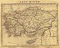
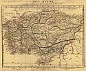
Main Author:   Arrowsmith, A.
Titles/Descriptions:   "Asia Minor" and "Asia Minor"
Publication Info:   London: A. Arrowsmith, 1828; from A Comparative Atlas of Ancient and Modern Geography
Date:   1828
Scale:   1:4,118,400
Original Source:   University of Alabama Map Library
Modern
Ancient
Viewing options:
Viewing options:
JPEG or Plugin
JPEG or Plugin


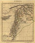
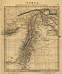
Main Author:   Arrowsmith, A.
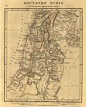
Titles/Descriptions:   "Syria" and "Syria"
Publication Info:   London: A. Arrowsmith, 1828; from A Comparative Atlas of Ancient and Modern Geography
Date:   1828
Scale:   1:3,484,800
Original Source:   University of Alabama Map Library
Modern
Ancient
Viewing options:
Viewing options:
JPEG or Plugin
JPEG or Plugin


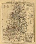
Main Author:   Arrowsmith, A.
Titles/Descriptions:   "Southern Syria" and "Terra Sancta"
Publication Info:   London: A. Arrowsmith, 1828; from A Comparative Atlas of Ancient and Modern Geography
Date:   1828
Scale:   1:1,077,120
Original Source:   University of Alabama Map Library
Modern
Ancient
Viewing options:
Viewing options:
JPEG or Plugin
JPEG or Plugin


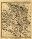
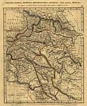
Main Author:   Arrowsmith, A.
Titles/Descriptions:   "The Countries Between the Caucasus and Euphrates" and "Colchis, Iberia, Armenia, Mesopotamia, Assyria com parte Medlae"
Publication Info:   London: A. Arrowsmith, 1828; from A Comparative Atlas of Ancient and Modern Geography
Date:   1828
Scale:   1:4,878,720
Original Source:   University of Alabama Map Library
Modern
Ancient
Viewing options:
Viewing options:
JPEG or Plugin
JPEG or Plugin


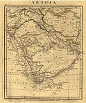
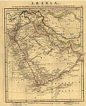
Main Author:   Arrowsmith, A.
Title/Description:   "Arabia" and "Arabia"
Publication Info:   London: A. Arrowsmith, 1828; from A Comparative Atlas of Ancient and Modern Geography
Date:   1828
Scale:   1:12,988,800
Original Source:   University of Alabama Map Library
Modern
Ancient
Viewing options:
Viewing options:
JPEG or Plugin
JPEG or Plugin


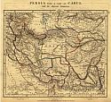
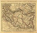
Main Author:   Arrowsmith, A.
Titles/Descriptions:   "Persia with a part of Cabul" and "Regiones intra Mare Hyrcanum, Oxum FL. Indicum Pelagus et Sin, Persicum Sitae"
Publication Info:   London: A. Arrowsmith, 1828; from A Comparative Atlas of Ancient and Modern Geography
Date:   1828
Scale:   1:9,187,200
Original Source:   University of Alabama Map Library
Modern
Ancient
Viewing options:
Viewing options:
JPEG or Plugin
JPEG or Plugin


  Main Author:   Finley, Anthony
  Title/Description:   Turkey in Asia
  Publication Info:   Philadelphia: Anthony Finley, 1829
  Date:   1829
  Scale:   1:8,237,000
  Original Source:   Courtesy of Murray Hudson, Halls, Tennessee
Viewing options:


  Main Author:   Finley, Anthony
  Title/Description:   Asia Minor Antiqua
  Publication Info:   Philadelphia: Anthony Finley, 1829; from Atlas Classica
  Date:   1829
  Scale:   1:4,435,000
  Original Source:   University of Alabama Map Library
Viewing options:


  Main Author:   Society for the Diffusion of Useful Knowledge
  Title/Description:   Turkey Containing the Provinces in Asia Minor
  Publication Info:   London: Baldwin and Cradock, 1830; published under the Superintendence of the Society for the Diffusion of Useful Knowledge
  Date:   1830
  Scale:   1:2,978,000
  Original Source:   Courtesy of Murray Hudson, Halls, Tennessee
Viewing options:


  Main Author:   Society for the Diffusion of Useful Knowledge
  Title/Description:   Asia Minor
  Publication Info:   London: Baldwin and Cradock, 1830; published under the Superintendence of the Society for the Diffusion of Useful Knowledge
  Date:   1830
  Scale:   1:2,978,000
  Original Source:   Courtesy of Murray Hudson, Halls, Tennessee
Viewing options:


  Main Author:   Society for the Diffusion of Useful Knowledge
  Title/Description:   Turkey I. Contaning the Northern Provinces
  Publication Info:   London: Baldwin and Cradock, 1830; published under the Superintendence of the Society for the Diffusion of Useful Knowledge
  Date:   1830
  Scale:   1:2,978,000
  Original Source:   Courtesy of Murray Hudson, Halls, Tennessee
Viewing options:


  Main Author:   Hamm, P.E.
  Title/Description:   Oriens
  Publication Info:   Philadelphia: Carey and Lea, c.1830; The Family Cabinet Atlas, First American Edition
  Date:   1830
  Scale:   1:13,305,600
  Original Source:   Courtesy of Murray Hudson, Halls, Tennessee
Viewing options:


  Main Author:   Hall, Sidney
  Title/Description:   Persia
  Publication Info:   London: Longman, Rees, Orme, Brown and Green, 1830
  Date:   1830
  Scale:   1:5,195,520
  Original Source:   Courtesy of Murray Hudson, Halls, Tennessee
Viewing options:


  Main Author:   Hall, Sidney
  Title/Description:   Turkey in Asia
  Publication Info:   London: Longman, Rees, Orme, Brown and Green, 1830
  Date:   1830
  Scale:   1:3,928,320
  Original Source:   Courtesy of Murray Hudson, Halls, Tennessee
Viewing options:


  Main Author:   Warr, J. and W.W.
  Title/Description:   Map of Assyria, Asia Minor, Etc.
  Publication Info:   Philadelphia: American Sunday School Union, 1830; from Sacred Geography
  Date:   1830
  Scale:   1:10,454,000
  Original Source:   Courtesy of Murray Hudson, Halls, Tennessee
Viewing options:


  Main Author:   Society for the Diffusion of Useful Knowledge
  Title/Description:   Persia with part of the Ottoman Empire
  Publication Info:   London: Baldwin and Cradock, 1831; published under the Superintendence of the Society for the Diffusion of Useful Knowledge
  Date:   1831
  Scale:   1:6,336,000
  Original Source:   Courtesy of Murray Hudson, Halls, Tennessee
Viewing options:


  Main Author:   Society for the Diffusion of Useful Knowledge
  Title/Description:   The Eastern Part of the Ancient Persian Empire
  Publication Info:   London: Baldwin and Cradock, 1831; published under the Superintendence of the Society for the Diffusion of Useful Knowledge
  Date:   1831
  Scale:   1:5,829,000
  Original Source:   Courtesy of Murray Hudson, Halls, Tennessee
Viewing options:


  Main Author:   Hamm, P.E.
  Title/Description:   Turkish Empire
  Publication Info:   Philadelphia: Carey and Lea, 1832; from The Family Cabinet Atlas, First American Edition
  Date:   1832
  Scale:   1:25,000,000
  Original Source:   Courtesy of Murray Hudson, Halls, Tennessee
Viewing options:


  Main Author:   Hamm, P.E.
  Title/Description:   Persia and Arabia
  Publication Info:   Philadelphia: Carey and Lea, 1832; from Carey and Lea's Family Cabinet Atlas, First American Edition
  Date:   1832
  Scale:   1:43,000,000
  Original Source:   Courtesy of Murray Hudson, Halls, Tennessee
Viewing options:


  Main Author:   Delamarche, Félix
  Title/Description:   Judée Divisée en ses douze Tribus Sous Josué
  Publication Info:   Paris: Félix, Delamarche, 1834; No.22 from Atlas De La Géographie Ancienne, du moyen âge, et modern, Adopté Par Le Conseil Royal
  Date:   1834
  Scale:   1:1,297,000
  Original Source:   Courtesy of Adams Antiques, Northport, Alabama
Viewing options:


  Main Author:   Delamarche, Félix
  Title/Description:   Alexandri Magni Imperium et Expeditiones
  Publication Info:   Paris: Félix, Delamarche, 1834; No.32 from Atlas De La Géographie Ancienne, du moyen âge, et modern, Adopté Par Le Conseil Royal
  Date:   1834
  Scale:   1:12,672,000
  Original Source:   Courtesy of Adams Antiques, Northport, Alabama
Viewing options:


  Main Author:   Delamarche, Félix
  Title/Description:   Asiae Minoris Tabula Descripta Conatibus
  Publication Info:   Paris: Félix, Delamarche, 1834; No.51 from Atlas De La Géographie Ancienne, du moyen âge, et modern, Adopté Par Le Conseil Royal
  Date:   1834
  Scale:   1:4,286,000
  Original Source:   Courtesy of Adams Antiques, Northport, Alabama
Viewing options:


  Main Author:   Delamarche, Félix
  Title/Description:   Tableau de la Retraite des Dix Mille
  Publication Info:   Paris: Félix, Delamarche, 1834; No.33 from Atlas De La Géographie Ancienne, du moyen âge, et modern, Adopté Par Le Conseil Royal
  Date:   1834
  Scale:   1:5,338,000
  Original Source:   Courtesy of Adams Antiques, Northport, Alabama
Viewing options:


  Main Author:   Malte-Brun, Conrad
  Title/Description:   Turkey in Asia
  Publication Info:   Boston: Samuel Walker, 1834; from A System of Universal Geography
  Date:   1834
  Scale:   1:10,138,000
  Original Source:   University of Alabama Map Library
Viewing options:


  Main Author:   Bradford, Thomas Gamaliel
  Title/Description:   Persia, Arabia, Tartary, Afghanistan
  Publication Info:   Boston: T.G. Bradford, 1835
  Date:   1835
  Scale:   1:19,960,000
  Original Source:   Courtesy of Murray Hudson, Halls, Tennessee
Viewing options:


  Main Author:   Bradford, Thomas Gamaliel
  Title/Description:   Caucasian Countries and Turkey in Asia
  Publication Info:   Boston: American Stationers Company, 1835; from A Comprehensive Atlas, Geographical, Historical, and Commercial
  Date:   1835
  Scale:   1:9,820,800
  Original Source:   Courtesy of Murray Hudson, Halls, Tennessee
Viewing options:


  Main Author:   Bradford, Thomas Gamaliel
  Title/Description:   Asia Minor
  Publication Info:   Boston: American Stationers Company, 1835; from A Comprehensive Atlas, Geographical, Historical, and Commercial
  Date:   1835
  Scale:   1:9,653,607
  Original Source:   Courtesy of Murray Hudson, Halls, Tennessee
Viewing options:


  Main Author:    
  Title/Description:   Turquie D'Asie Perse et Arabie
  Publication Info:   Paris: Binet, 1836
  Date:   1836
  Scale:   1:21,000,000
  Original Source:   Courtesy of Murray Hudson, Halls, Tennessee
Viewing options:


  Main Author:   Bell, Thomas
  Title/Description:   Persia
  Publication Info:   Glasgow: Blackie Fullarton and Company, 1836
  Date:   1836
  Scale:   1:11,088,000
  Original Source:   Courtesy of Murray Hudson, Halls, Tennessee
Viewing options:


Main Author:   Bell, Thomas
Title/Description:   Syria (North and South)
Publication Info:   Glasgow: Blackie Fullarton and Company, 1836
Date:   1836
Scale:   1:1,584,000
Original Source:   Courtesy of Murray Hudson, Halls, Tennessee
 
North
Viewing options:
 
South
Viewing options:


  Main Author:   Bell, Thomas
  Title/Description:   Asia Minor
  Publication Info:   Glasgow: Blackie Fullarton and Company, 1836
  Date:   1836
  Scale:   1:5,702,400
  Original Source:   Courtesy of Murray Hudson, Halls, Tennessee
Viewing options:


  Main Author:   Malte Brun, Conrad
  Title/Description:   Geographie des Hebreux
  Publication Info:   Paris: Aime Andre, 1837
  Date:   1837
  Scale:   1:16,775,313
  Original Source:   Antique Atlas
Viewing options:


  Main Author:   Malte-Brun, Conrad
  Title/Description:   Carte de la Turquie D'Asie, de la Perse, de la Tatarie Independente, de l'Afghanistan, du Beloutchistan et de l'Aribie
  Publication Info:   Paris: Aime Andre, 1837
  Date:   1837
  Scale:   1:22,017,600
  Original Source:   Antique Atlas
Viewing options:


  Main Author:   Stieler, Adolf
  Title/Description:   Iran und Turan (Persien, Afghanistan, Biludschistan, Turkestan).
  Publication Info:   Gotha: Justus Perthes, 1839; from Hand-Atlas über alle Theile der Erde nach dem neuesten Zustande und über das Weltgebäude
  Date:   1839
  Scale:   1:9,370,190
  Original Source:   Courtesy of Murray Hudson, Halls, Tennessee
Viewing options:


  Main Author:   Stieler, Adolf
  Title/Description:   Mittel-und Nord-Africa und Arabien. Östliches Blatt.
  Publication Info:   Gotha: Justus Perthes, 1839; from Hand-Atlas über alle Theile der Erde nach dem neuesten Zustande und über das Weltgebäude
  Date:   1839
  Scale:   1:14,572,800
  Original Source:   Courtesy of Murray Hudson, Halls, Tennessee
Viewing options:


  Main Author:   Stieler, Adolf
  Title/Description:   Terra inter Euphratem et Indum Antiqua
  Publication Info:   Gotha: Justus Perthes, 1839; from Schul-Atlas der Alten Welt
  Date:   1839
  Scale:   1:13,750,000
  Original Source:   University of Alabama Map Library
Viewing options:


  Main Author:   Stieler, Adolf
  Title/Description:   Asia Minor et Syria
  Publication Info:   Gotha: Justus Perthes, 1839; from Schul-Atlas der Alten Welt
  Date:   1839
  Scale:   1:6,730,000
  Original Source:   University of Alabama Map Library
Viewing options:


  Main Author:   Delamarche, Felix
  Title/Description:   Carte de L'Asie Mineure
  Publication Info:   Paris: Felix Delamarche, 1841; from Atlas de la Geographie Ancienne, d Moyen-Age, et Moderne
  Date:   1841
  Scale:   1:4,435,200
  Original Source:   Courtesy of Adams Antiques, Northport, AL
Viewing options:


  Main Author:   Delamarche, Felix
  Title/Description:   Carte de L'Empire Ottoman et de La Grèce Moderne
  Publication Info:   Paris: Felix Delamarche, 1841; from Atlas de la Geographie Ancienne, d Moyen-Age, et Moderne
  Date:   1841
  Scale:   1:7,391,999
  Original Source:   Courtesy of Adams Antiques, Northport, AL
Viewing options:


  Main Author:   Arrowsmith. John
  Title/Description:   Map of Asia Minor to Illustrate the Journeys of W.I. Hamilton Esqr. 1835-1837
  Publication Info:   London: John Arrowsmith, 1842
  Date:   1842
  Scale:   1:1,520,000
  Original Source:   Courtesy of Murray Hudson, Halls, Tennessee
Viewing options:


  Main Author:   Arrowsmith. John
  Title/Description:   Turkey in Asia
  Publication Info:   London: John Arrowsmith, 1842
  Date:   1842
  Scale:   1:3,485,000
  Original Source:   Courtesy of Murray Hudson, Halls, Tennessee
Viewing options:


  Main Author:   Perthes, Justus
  Title/Description:   Asia Minor et Syria
  Publication Info:   Gotha: Justus Perthes, 1842; from Orbis Terrarum Antiquus
  Date:   1842
  Scale:   1:6,726,000
  Original Source:   University of Alabama Map Library
Viewing options:


  Main Author:   Perthes, Justus
  Title/Description:   Pontus Euxinus cum adjacentibus regionibus
  Publication Info:   Gotha: Justus Perthes, 1842; from Orbis Terrarum Antiquus
  Date:   1842
  Scale:   1:8,922,000
  Original Source:   University of Alabama Map Library
Viewing options:


  Main Author:   Perthes, Justus
  Title/Description:   Aegyptus et Palaestina
  Publication Info:   Gotha: Justus Perthes, 1842; from Orbis Terrarum Antiquus
  Date:   1842
  Scale:   1:5,752,000
  Original Source:   University of Alabama Map Library
Viewing options:


  Main Author:   Perthes, Justus
  Title/Description:   Palaestina
  Publication Info:   Gotha: Justus Perthes, 1842; from Orbis Terrarum Antiquus
  Date:   1842
  Scale:   1:1,643,000
  Original Source:   University of Alabama Map Library
Viewing options:


  Main Author:   Perthes, Justus
  Title/Description:   Terra Inter Euphratem et Indum Antiqua
  Publication Info:   Gotha: Justus Perthes, 1842; from Orbis Terrarum Antiquus
  Date:   1842
  Scale:   1:14,103,000
  Original Source:   University of Alabama Map Library
Viewing options:


  Main Author:   Society for the Diffusion of Useful Knowledge
  Title/Description:   Arabia with Egypt, Nubia and Abyssinia
  Publication Info:   London: Chapman and Hall, 1843; published under the Superintendence of the Society for the Diffusion of Useful Knowledge
  Date:   1843
  Scale:   1:8,554,000
  Original Source:   Courtesy of Murray Hudson, Halls, Tennessee
Viewing options:


  Main Author:   Society for the Diffusion of Useful Knowledge
  Title/Description:   The Turkish Empire in Europe and Asia with the Kingdom of Greece
  Publication Info:   London: Chapman and Hall, 1843; published under the Superintendence of the Society for the Diffusion of Useful Knowledge
  Date:   1843
  Scale:   1:7,286,000
  Original Source:   Courtesy of Murray Hudson, Halls, Tennessee
Viewing options:


  Main Author:   Society for the Diffusion of Useful Knowledge
  Title/Description:   Ancient Syria
  Publication Info:   London: Chapman and Hall, 1843; published under the Superintendence of the Society for the Diffusion of Useful Knowledge
  Date:   1843
  Scale:   1:2,218,000
  Original Source:   Courtesy of Murray Hudson, Halls, Tennessee
Viewing options:


  Main Author:   Society for the Diffusion of Useful Knowledge
  Title/Description:   Syria
  Publication Info:   London: Chapman and Hall, 1843; published under the Superintendence of the Society for the Diffusion of Useful Knowledge
  Date:   1843
  Scale:   1:2,218,000
  Original Source:   Courtesy of Murray Hudson, Halls, Tennessee
Viewing options:


  Main Author:   Wyld, James
  Title/Description:   Turkey in Asia
  Publication Info:   London: James Wyld, 1843; from An Atlas of Modern Geography
  Date:   1843
  Scale:   1:8,870,000
  Original Source:   University of Alabama Map Library
Viewing options:


  Main Author:   Arrowsmith, John
  Title/Description:   The Caspian Sea Khirah and the Surrounding Country
  Publication Info:   London: John Arrowsmith, 1844; from the London Atlas of the Universal Geography, Exhibiting the Physical and Political Divisions of the Various Contries of the World
  Date:   1844
  Scale:   1:2,863,000
  Original Source:   Courtesy of Murray Hudson, Halls, Tennessee
Viewing options:


  Main Author:    
  Title/Description:   Geological Map of the Country bordering the Gulf of Symrna (Turkey)
  Publication Info:   London: John Arrowsmith, 1845; from the Quarterly Journal Of the Geological Society of London, Volume 1
  Date:   1845
  Scale:   1:316,800
  Original Source:   Courtesy of Murray Hudson, Halls, Tennessee
Viewing options:


  Main Author:    
  Title/Description:   Route Through the Taurus and Antitaurus from The City of Diabekr on the Digel Tchai (Tigres)
  Publication Info:   London: John Arrowsmith, 1845; from the Quarterly Journal Of the Geological Society of London, Volume 1
  Date:   1845
  Scale:   1:1,394,000
  Original Source:   Geological Survey of Alabama
Viewing options:


  Main Author:    
  Title/Description:   Route Through the Tarus and Antitaurus from The City of Diabekr on the Digel Tchai (Tigres)
  Publication Info:   London: John Arrowsmith, 1845; from the Quarterly Journal Of the Geological Society of London, Volume 1
  Date:   1845
  Scale:   1:1,394,000
  Original Source:   Geological Survey of Alabama
Viewing options:


  Main Author:   Monin, C.U. and A.R. Fremin
  Title/Description:   Empire d'Alexandre
  Publication Info:   Paris: Armand Aubree, c. 1845; from Atlas Universal de Geographie Ancienne et Moderne
  Date:   1845
  Scale:   1:20,148,480
  Original Source:   Courtesy of Murray Hudson, Halls, Tennessee
Viewing options:


  Main Author:   Monin, C.U. and A.R. Fremin
  Title/Description:   Turquie d'Asie, Perse et Arabie
  Publication Info:   Paris: Armand Aubree, c. 1845; from Atlas Universal de Geographie Ancienne et Moderne
  Date:   1845
  Scale:   1:20,830,274
  Original Source:   Courtesy of Murray Hudson, Halls, Tennessee
Viewing options:


  Main Author:   Bibliographisches Institut
  Title/Description:   Küstenländer des Schwarzen Meeres
  Publication Info:   Hildburghausen: Bibliographisches Institut, 1850-1860; from Atlas der Geographie
  Date:   1845
  Scale:   1:2,191,242
  Original Source:   University of Alabama Map Library
Viewing options:


  Main Author:   Mitchell, Samuel Augustus
  Title/Description:   Turkey in Asia
  Publication Info:   Philadelphia: S.A. Mitchell, 1846
  Date:   1846
  Scale:   1:6,336,000
  Original Source:   Courtesy of Murray Hudson, Halls, Tennessee
Viewing options:


  Main Author:   Tanner, Henry Schenck
  Title/Description:   Persia, Arabia, etc
  Publication Info:   Philadelphia: S. Augustus Mitchell, 1846; from The New Univerisal Atlas
  Date:   1846
  Scale:   1:11,088,000
  Original Source:   Courtesy of Murray Hudson, Halls, Tennessee
Viewing options:


  Main Author:    
  Title/Description:   Das Osmanische Reich in Asien
  Publication Info:   Gotha: Justus Perthes, c. 1847; from Hand-Atlas Über Alle Theile Der Erde
  Date:   1847
  Scale:   1:4,118,400
  Original Source:   University of Alabama Map Library
Viewing options:


  Main Author:    
  Title/Description:   Iran and Turan, Persien, Afghanistan, Beludschistan, Turkestan
  Publication Info:   Gotha: Justus Perthes, c. 1847; from Hand-Atlas Über Alle Theile Der Erde
  Date:   1847
  Scale:   1:9,884,160
  Original Source:   University of Alabama Map Library
Viewing options:


  Main Author:   Hall, Sidney
  Title/Description:   Turkey in Asia
  Publication Info:   Edinburgh: A. and C. Black, 1847; from The General Atlas
  Date:   1847
  Scale:   1:5,069,000
  Original Source:   Courtesy of Murray Hudson, Halls, Tennessee
Viewing options:


  Main Author:   Hall, Sidney
  Title/Description:   Persia
  Publication Info:   Edinburgh: A. and C. Black, 1847; from The General Atlas
  Date:   1847
  Scale:   1:7,286,000
  Original Source:   Courtesy of Murray Hudson, Halls, Tennessee
Viewing options:


  Main Author:   Sohr, K.
  Title/Description:   Asiatische Turkei
  Publication Info:   Glogan und Leipzig: C. Flemming, 1847; from Vollstandiger Hand-Atlas der neueren Erdbeschreibung
  Date:   1847
  Scale:   1:5,512,320
  Original Source:   Courtesy of Murray Hudson, Halls, Tennessee
Viewing options:


  Main Author:   Sohr, K.
  Title/Description:   Westliches Hochasien
  Publication Info:   Glogan und Leipzig: C. Flemming, 1847; from Vollstandiger Hand-Atlas der neueren Erdbeschreibung
  Date:   1847
  Scale:   1:7,603,200
  Original Source:   Courtesy of Murray Hudson, Halls, Tennessee
Viewing options:
 

  Main Author:   Findley, Alexander G.
  Title/Description:   Asia Minor
  Publication Info:   New York: Harper and Brothers, 1849; from A Classical Atlas, to illustrate Ancient Geography
  Date:   1849
  Scale:   1:5,218,000
  Original Source:   University of Alabama Map Library
Viewing options:
 

  Main Author:   Findley, Alexander G.
  Title/Description:   Armenia, Mesopatamia, Assyria et Babylonia
  Publication Info:   New York: Harper and Brothers, 1849; from A Classical Atlas, to illustrate Ancient Geography
  Date:   1849
  Scale:   1:2,957,000
  Original Source:   University of Alabama Map Library
Viewing options:
 

  Main Author:   Findley, Alexander G.
  Title/Description:   Arabia
  Publication Info:   New York: Harper and Brothers, 1849; from A Classical Atlas, to illustrate Ancient Geography
  Date:   1849
  Scale:   1:11,000,000
  Original Source:   University of Alabama Map Library
Viewing options:
 

  Main Author:   Findley, Alexander G.
  Title/Description:   Imperium Persicum
  Publication Info:   New York: Harper and Brothers, 1849; from A Classical Atlas, to illustrate Ancient Geography
  Date:   1849
  Scale:   1:11,000,000
  Original Source:   University of Alabama Map Library
Viewing options:


  Main Author:   Jenks, William
  Title/Description:   Modern Syria
  Publication Info:   from The Explanatory Bible Atlas and Scripture Gazetteer (Fourth Edition), 1849
  Date:   1849
  Scale:   1:3,168,000
  Original Source:   University of Alabama Map Library
Viewing options:
 

  Main Author:   Findley, Alexander G.
  Title/Description:   Syria
  Publication Info:   New York: Harper and Brothers, 1849; from A Classical Atlas, to illustrate Ancient Geography
  Date:   1849
  Scale:   1:2,688,000
  Original Source:   University of Alabama Map Library
Viewing options:


  Main Author:   Vuillemin, Alexandre
  Title/Description:   Turquie d'Asie
  Publication Info:   Paris: [c. 1850]; from Atlas Universel de Geographie Ancienne et Moderne
  Date:   1850
  Scale:   1:9,000,000
  Original Source:   Courtesy of Adams Antiques, Northport, Alabama
Viewing options:


  Main Author:   Vuillemin, Alexandre
  Title/Description:   Empire et Expedition d'Alexanndre
  Publication Info:   Paris: [c. 1850]; from Atlas Unviersel de Geographie Ancienne et Moderne
  Date:   1850
  Scale:   1:30,000,000
  Original Source:   Courtesy of Adams Antiques, Northport, Alabama
Viewing options:


  Main Author:   Vuillemin, Alexandre
  Title/Description:   Expedition de Cyrus le Jeune et Retraite des dix milles
  Publication Info:   Paris: [c. 1850]; from Atlas Unviersel de Geographie Ancienne et Moderne
  Date:   1850
  Scale:   1:6,350,000
  Original Source:   Courtesy of Adams Antiques, Northport, Alabama
Viewing options:


  Main Author:   Vuillemin, Alexandre
  Title/Description:   Arménie, Mesopotamie, Assyrie et Syrie
  Publication Info:   Paris: [c. 1850]; from Atlas Unviersel de Geographie Ancienne et Moderne
  Date:   1850
  Scale:   1:4,000,000
  Original Source:   Courtesy of Adams Antiques, Northport, Alabama
Viewing options:


  Main Author:   Vuillemin, Alexandre
  Title/Description:   Perse Kaboul
  Publication Info:   Paris: [c. 1850]; from Atlas Unviersel de Geographie Ancienne et Moderne
  Date:   1850
  Scale:   1:12,000,000
  Original Source:   Courtesy of Adams Antiques, Northport, Alabama
Viewing options:


  Main Author:    
  Title/Description:   A Geographical View of the Extension of the Medo-Persian Family
  Publication Info:   London: Samuel Bagster and Sons, c. 1850; from An Ethnographic Atlas
  Date:   1850
  Scale:   1:14,256,000
  Original Source:   University of Alabama Map Library
Viewing options:


  Main Author:   Andriveau-Goujon, J.
  Title/Description:   Carte de L'Asie Occidentale comprenant La Turquie d'Asie, La Perse, Le Kaboul et L'Arabie
  Publication Info:   Paris: J. Andriveau-Goujon, 1850; from Atlas de Geographie Moderne
  Date:   1850
  Scale:   1:11,000,000
  Original Source:   Courtesy of Adams Antiques, Northport, Alabama
Viewing options:


  Main Author:   Spruner, Karl V..
  Title/Description:   Regnum Alexandri Magni
  Publication Info:   Gotha: Justus Perthes, 1850; from Historisch-Geographischer Hand-Atlas, Erste Abtheilung: Atlas Antiquus
  Date:   1850
  Scale:   1:15,412,000
  Original Source:   University of Alabama Map Library
Viewing options:


  Main Author:   Spruner, Karl V..
  Title/Description:   Regna Successorum Alexandri Magni circa Medium Saeculumterium ante Christum
  Publication Info:   Gotha: Justus Perthes, 1850; from Historisch-Geographischer Hand-Atlas, Erste Abtheilung: Atlas Antiquus
  Date:   1850
  Scale:   1:8,807,000
  Original Source:   University of Alabama Map Library
Viewing options:


  Main Author:   Spruner, Karl V..
  Title/Description:   Persis
  Publication Info:   Gotha: Justus Perthes, 1850; from Historisch-Geographischer Hand-Atlas, Erste Abtheilung: Atlas Antiquus
  Date:   1850
  Scale:   1:6,291,000
  Original Source:   University of Alabama Map Library
Viewing options:


  Main Author:   Spruner, Karl V..
  Title/Description:   Asia Minor, Syria, Cyprus, Creta et Insulae maris Aegaei
  Publication Info:   Gotha: Justus Perthes, 1850; from Historisch-Geographischer Hand-Atlas, Erste Abtheilung: Atlas Antiquus
  Date:   1850
  Scale:   1:3,829,000
  Original Source:   University of Alabama Map Library
Viewing options:


  Main Author:   Spruner, Karl V..
  Title/Description:   Armenia, Mesopotamia, Babylonia, et Assyria, cum Adjacentibus Regionibus
  Publication Info:   Gotha: Justus Perthes, 1850; from Historisch-Geographischer Hand-Atlas, Erste Abtheilung: Atlas Antiquus
  Date:   1850
  Scale:   1:3,670,000
  Original Source:   University of Alabama Map Library
Viewing options:


  Main Author:   Spruner, Karl V..
  Title/Description:   Palaestina a Temporibus Maccabaeorum Usque ad Eversionem Hierosolymae
  Publication Info:   Gotha: Justus Perthes, 1850; from Historisch-Geographischer Hand-Atlas, Erste Abtheilung: Atlas Antiquus
  Date:   1850
  Scale:   1:1,061,000
  Original Source:   University of Alabama Map Library
Viewing options:


  Main Author:   Spruner, Karl V..
  Title/Description:   Arabia, Aethiopia, Aegyptus
  Publication Info:   Gotha: Justus Perthes, 1850; from Historisch-Geographischer Hand-Atlas, Erste Abtheilung: Atlas Antiquus
  Date:   1850
  Scale:   1:10,008,000
  Original Source:   University of Alabama Map Library
Viewing options:


  Main Author:   Spruner, Karl V..
  Title/Description:   Graecia Tempore Migration is Doricae, circa 1000 ante Christum
  Publication Info:   Gotha: Justus Perthes, 1850; from Historisch-Geographischer Hand-Atlas, Erste Abtheilung: Atlas Antiquus
  Date:   1850
  Scale:   1:3,829,000
  Original Source:   University of Alabama Map Library
Viewing options:


  Main Author:   Spruner, Karl V..
  Title/Description:   Regna Successorum Alexandri Magni post magnum Syriae imperium pugna ad Magnesiam diremtum 190 ante Christum
  Publication Info:   Gotha: Justus Perthes, 1850; from Historisch-Geographischer Hand-Atlas, Erste Abtheilung: Atlas Antiquus
  Date:   1850
  Scale:   1:14,678,000
  Original Source:   University of Alabama Map Library
Viewing options:


  Main Author:   Spruner, Karl V..
  Title/Description:   Pontus Euxinus et Quae Adjacent
  Publication Info:   Gotha: Justus Perthes, 1850; from Historisch-Geographischer Hand-Atlas, Erste Abtheilung: Atlas Antiquus
  Date:   1850
  Scale:   1:4,404,000
  Original Source:   University of Alabama Map Library
Viewing options:


Previous Page
Next Page


© University of Alabama
To purchase map reproductions, submit a quote request.
Download MrSID Plugin