Historical Maps of Alabama

1926 - 1950
Before 1825
1825-1850
1851-1875
1876-1885
1886-1890
1891-1900
1901-1925
1926-1950
After 1950

Previous Page
Next Page

  Main Author:   Salmon, F.A.
  Title/Description:   State Highway Department of Alabama System of State Roads
  Publication Info:   Montgomery: The Brown Printing Co., [1927]
  Date:   1927
  Scale:   1:510,000
  Original Source:   Alabama Department of Archives and History
Viewing options:


  Main Author:    
  Title/Description:   Post Route Map of the State of Alabama
  Publication Info:   [Washington]: Post Office Department, 1928.
  Date:   1928
  Scale:   1:500,000
  Original Source:   Alabama Department of Archives and History
Viewing options:


  Main Author:    
  Title/Description:   Location of 15 Proposed Highway Toll Bridges in Relation to the Alabama State Highway System
  Publication Info:   Montgomery: Alabama State Bridge Corporation, 1928
  Date:   1928
  Scale:   1:2,218,000
  Original Source:   W. S. Hoole Special Collections Library
Viewing options:


  Main Author:   Rand McNally
  Title/Description:   Alabama Industrial Development Board Map of Alabama
  Publication Info:   Chicago: Rand McNally and Co., [1929]
  Date:   1929
  Scale:   1:855,000
  Original Source:   Birmingham Public Library Cartography Collection
Viewing options:


  Main Author:   Bureau of the Census
  Title/Description:   Alabama Minor Civil Divisions (1930 Census)
  Publication Info:   Washington: Government Printing Office, 1934
  Date:   1930
  Scale:   1:1,000,000
  Original Source:   University of Alabama Map Library
Viewing options:


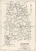
Main Author:   Alabama Department of Archives and History
Title/Description:   Alabama showing points of intereset reached by Alabama State Highway System
Publication Info:   Montgomery: Wilson Printing Co., c.1930
Date:   1930
Scale:   1:1,267,200
Original Source:   Alabama Department of Archives and History
Viewing options:
Viewing options:
JPEG or Plugin
JPEG or Plugin


  Main Author:   Brame, J.Y.
  Title/Description:   Route of DeSoto Through Alabama
  Publication Info:   c. 1930
  Date:   c. 1930
  Scale:   1:887,040
  Original Source:   Alabama Department of Archives and History
Viewing options:


  Main Author:   U.S. Army, Corps of Engineers
  Title/Description:   Choctawatchee & Pea Rivers, Fla. & Ala. Flood Protection
  Publication Info:   Montgomery: U.S. Engineer Office, 1931
  Date:   1931
  Scale:   1: 800,000
  Original Source:   Geological Survey of Alabama
Viewing options:


  Main Author:   Alabama Department of Agriculture
  Title/Description:   Soil Province Map of Alabama
  Publication Info:    
  Date:   1932
  Scale:   1:1,667,000
  Original Source:   University of Alabama Map Library
Viewing options:


  Main Author:   U.S. Geological Survey
  Title/Description:   State of Alabama
  Publication Info:   Washington: Department of the Interior, U.S. Geological Survey, 1933
  Date:   1933
  Scale:   1:500,000
  Original Source:   Geological Survey of Alabama
Viewing options:


  Main Author:   U.S. Geological Survey
  Title/Description:   Alabama, Index to Topographic and Geologic Folios
  Publication Info:   Washington: Department of the Interior, U.S. Geological Survey, 1933
  Date:   1933
  Scale:   1:1,000,000
  Original Source:   Geological Survey of Alabama
Viewing options:


  Main Author:    
  Title/Description:   F.E.R.A. Projects and Activities - Alabama 1934-1935
  Publication Info:    
  Date:   1935
  Scale:   1:1,00,000
  Original Source:   Alabama Department of Archives and History
Viewing options:


  Main Author:   unknown
  Title/Description:   Alabama [Showing mine locations]
  Publication Info:   unpublished
  Date:   1935
  Scale:   1:500,000
  Original Source:   Geological Survey of Alabama
Viewing options:


  Main Author:   Bureau of the Census
  Title/Description:   Alabama, Minor Civil Divisions, Precincts (for the Census of 1940)
  Publication Info:   Washington: U.S. Government Printing Office, 1941
  Date:   1940
  Scale:   1:760,000
  Original Source:   W. S. Hoole Special Collections Library
Viewing options:


  Main Author:   Work Projects Administration
  Title/Description:   Alabama Products and Resources
  Publication Info:   Alabama Writer's Project, 1940; From the WPA Guide, Alabama: A Guide to the Deep South
  Date:   1940
  Scale:   1:950,000
  Original Source:   Alabama Department of Archives and History
Viewing options:


  Main Author:    
  Title/Description:   Alabama Power Company Electrical Transmission and Distribution System
  Publication Info:   [Alabama Power Co.], 1942
  Date:   1942
  Scale:   1:1,330,000
  Original Source:   Alabama Department of Archives and History
Viewing options:


  Main Author:   U.S. Coast and Geodetic Survey
  Title/Description:   Birmingham Sectional Aeronautical Chart
  Publication Info:   Washington: U.S. Coast and Geodetic Survey, 1943
  Date:   1943
  Scale:   1:500,000
  Original Source:   Courtesy of Murray Hudson, Halls, Tennessee
Viewing options:


  Main Author:   U.S. Coast and Geodetic Survey
  Title/Description:   Mobile Sectional Aeronautical Chart
  Publication Info:   Washington: U.S. Coast and Geodetic Survey, 1944
  Date:   1944
  Scale:   1:500,000
  Original Source:   Courtesy of Murray Hudson, Halls, Tennessee
Viewing options:


  Main Author:    
  Title/Description:   Postal Route Map. Alabama
  Publication Info:   Washington: Post Office Department, 1944
  Date:   1944
  Scale:   1:500,000
  Original Source:   Alabama Power Company
Viewing options:


  Main Author:   Alabama State Planning Board
  Title/Description:   State of Alabama Land Capability Map
  Publication Info:   Montgomery: Alabama State Planning Board, 1948
  Date:   1948
  Scale:   1:1,077,000
  Original Source:   Geological Survey of Alabama
Viewing options:


Main Author:   United States Geological Survey
Title/Description:   Alabama Transportation Map
Publication Info:   Washington: U.S. Department of Commerce, Bureau of Public Roads, 1948
Date:   1948
Scale:   1:250,000
Original Source:   Alabama Department of Archives and History
Sheet 2
Sheet 1
Viewing options:
Viewing options:
JPEG or Plugin
JPEG or Plugin
   
Sheet 3
Sheet 4
Viewing options:
Viewing options:
JPEG or Plugin
JPEG or Plugin
   
Sheet 6
Sheet 5
Viewing options:
Viewing options:
JPEG or Plugin
JPEG or Plugin
   
Sheet 7
Sheet 8
Viewing options:
Viewing options:
JPEG or Plugin
JPEG or Plugin


  Main Author:   Bureau of the Census
  Title/Description:   Alabama Minor Civil Divisions - Election Precincts (1950 Census)
  Publication Info:   Washington: Government Printing Office, 1952
  Date:   1950
  Scale:   1:760,000
  Original Source:   University of Alabama Map Library
Viewing options:


Previous Page
Next Page


© University of Alabama
To purchase map reproductions, submit a quote request.
Download MrSID Plugin