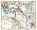
1876 - 1900

1876-1900

Previous Page
Next Page

  Main Author:   Prout, H.G.
  Title/Description:   Foga to El Obeiyad
  Publication Info:   Cairo: [Etat Major General], c.1877
  Date:   1877
  Scale:   1:300,000
  Original Source:   Courtesy of Murray Hudson, Halls, Tennessee
Viewing options:


  Main Author:   Prout, H.G.
  Title/Description:   Route de Khartoum À Obeiyad D'Après Une Reconnaissance du Commandant Prout
  Publication Info:   Cairo: [Etat Major General], c.1877
  Date:   1877
  Scale:   1:800,000
  Original Source:   Courtesy of Murray Hudson, Halls, Tennessee
Viewing options:


  Main Author:   Prout, H.G.
  Title/Description:   Carte de la Route De Souakin A Berber D'Après Une Reconnaissance Faite Par le Commandant du Genie Prout
  Publication Info:   Cairo: [Etat Major General], c.1877
  Date:   1877
  Scale:   1:800,000
  Original Source:   Courtesy of Murray Hudson, Halls, Tennessee
Viewing options:


  Main Author:   Vuillemin, Alexandre
  Title/Description:   Province de Constantine
  Publication Info:   Paris: J. Migeon, c.18789; from La France et Ses Colonies
  Date:   1879
  Scale:   1:1,728,000
  Original Source:   Courtesy of Murray Hudson, Halls, Tennessee
Viewing options:


  Main Author:   Black, Adam and Charles
  Title/Description:   Egypt and Arabia Petraea
  Publication Info:   Edinburgh: Adam and Charles Black, 1879; from The General Atlas of the World, American Edition
  Date:   1879
  Scale:   1:2,851,200
  Original Source:   Courtesy of Murray Hudson, Halls, Tennessee
Viewing options:


  Main Author:   Bartholomew, J.
  Title/Description:   Algeria, Morocco and Tunis
  Publication Info:   Edinburgh: Adam and Charles Black, 1879; from The General Atlas of the World, American Edition
  Date:   1879
  Scale:   1:5,068,800
  Original Source:   Courtesy of Murray Hudson, Halls, Tennessee
Viewing options:


  Main Author:   Migeon, J.
  Title/Description:   Tunis et Tripoli
  Publication Info:   Paris: [c. 1880]; from Geographie Universelle.
  Date:   1880
  Scale:   Various scales
  Original Source:   Courtesy of Adams Antiques, Northport, Alabama
Viewing options:


  Main Author:   Migeon, J.
  Title/Description:   Égypte Moderne
  Publication Info:   Paris: [c. 1880]; from Geographie Universelle.
  Date:   1880
  Scale:   1:10,000,000
  Original Source:   Courtesy of Adams Antiques, Northport, Alabama
Viewing options:


  Main Author:   Migeon, J.
  Title/Description:   Algérie
  Publication Info:   Paris: [c. 1880]; from Geographie Universelle.
  Date:   1880
  Scale:   1:3,500,000
  Original Source:   Courtesy of Adams Antiques, Northport, Alabama
Viewing options:


  Main Author:   Hughes, W.
  Title/Description:   Egypt and Arabia Petraea and Nubia and Abyssinia
  Publication Info:   London: George Philip and Son, [c. 1880]
  Date:   1880
  Scale:   Various scales
  Original Source:   Courtesy of Adams Antiques, Northport, Alabama
Viewing options:


  Main Author:   Migeon, J.
  Title/Description:   Province d'Alger
  Publication Info:   Paris: 1881, from La France et ses Colonies
  Date:   1881
  Scale:   1:1,800,000
  Original Source:   Courtesy of Adams Antiques, Northport, Alabama
Viewing options:


  Main Author:   Migeon, J.
  Title/Description:   Province de Constantine
  Publication Info:   Paris: 1881, from La France et ses Colonies
  Date:   1881
  Scale:   1:1,800,000
  Original Source:   Courtesy of Adams Antiques, Northport, Alabama
Viewing options:


  Main Author:   Migeon, J.
  Title/Description:   Province d'Oran
  Publication Info:   Paris: 1881, from La France et ses Colonies
  Date:   1881
  Scale:   1:1,800,000
  Original Source:   Courtesy of Adams Antiques, Northport, Alabama
Viewing options:


  Main Author:   Migeon, J.
  Title/Description:   La France - Algerie et Tunisie
  Publication Info:   Paris: 1881; from La France et ses Colonies
  Date:   1881
  Scale:   1:5,000,000
  Original Source:   Courtesy of Adams Antiques, Northport, Alabama
Viewing options:


  Main Author:   Stieler, Adolf
  Title/Description:   Nordost-Afrika und Arabien
  Publication Info:   Gotha: Justus Perthes, 1881; for Hand Atlas
  Date:   1881
  Scale:   1:12,500,000
  Original Source:   University of Alabama Map Library
Viewing options:


  Main Author:   Andree, Richard
  Title/Description:   Die Nilländer
  Publication Info:   Leipzig: Velhagen and Klasing, 1881; from Allgemeiner Handatlas
  Date:   1881
  Scale:   1:12,000,000
  Original Source:   Courtesy of Murray Hudson, Halls, Tennessee
Viewing options:


  Main Author:   Stieler, Adolf
  Title/Description:   Das Mittelländische Meer und Nord-Afrika
  Publication Info:   Gotha: Justus Perthes, c.1881; from The Hand Atlas
  Date:   1881
  Scale:   1:7,500,000
  Original Source:   Courtesy of Murray Hudson, Halls, Tennessee
Viewing options:


  Main Author:   Stieler, Adolf
  Title/Description:   Nordwest-Afrika
  Publication Info:   Gotha: Justus Perthes, c.1881; from The Hand Atlas
  Date:   1881
  Scale:   1:12,500,000
  Original Source:   Courtesy of Murray Hudson, Halls, Tennessee
Viewing options:


  Main Author:   Stieler, Adolf
  Title/Description:   Nordost Afrika
  Publication Info:   Gotha: Justus Perthes, c.1881; from The Hand Atlas
  Date:   1881
  Scale:   1:12,500,000
  Original Source:   Courtesy of Murray Hudson, Halls, Tennessee
Viewing options:


  Main Author:   Tunison, Henry C.
  Title/Description:   Tunison's Algeria Tunis and Marocco
  Publication Info:   Jacksonville, IL: H.C. Tunison, c.1883
  Date:   1883
  Scale:   1:2,091,000
  Original Source:   Courtesy of Murray Hudson, Halls, Tennessee
Viewing options:


  Main Author:   Rand McNally and Company
  Title/Description:   Morocco, etc.
  Publication Info:   Chicago: Rand McNally and Company, 1884; from The Indexed Atlas of the World
  Date:   1884
  Scale:   1:7,600,000
  Original Source:   From the personal collection of Dr. Gerald Webster
Viewing options:


  Main Author:   Rand McNally and Company
  Title/Description:   Upper Nubia and Habesh or Abyssinia
  Publication Info:   Chicago: Rand McNally and Company, 1884; from The Indexed Atlas of the World
  Date:   1884
  Scale:   1:5,068,000
  Original Source:   From the personal collection of Dr. Gerald Webster
Viewing options:


  Main Author:   Rand McNally and Company
  Title/Description:   Egypt Arabia Petraea and Lower Nubia
  Publication Info:   Chicago: Rand McNally and Company, 1884; from The Indexed Atlas of the World
  Date:   1884
  Scale:   1:5,068,000
  Original Source:   From the personal collection of Dr. Gerald Webster
Viewing options:


  Main Author:   Letts, Son and Company
  Title/Description:   Egypt
  Publication Info:   London: Letts, Son and Company, 1884; from The Complete Popular Atlas
  Date:   1884
  Scale:   1:2,851,200
  Original Source:   Courtesy of Murray Hudson, Halls, Tennessee
Viewing options:


  Main Author:   Letts, Son and Company
  Title/Description:   Algeria
  Publication Info:   London: Letts, Son and Company, 1884; from The Complete Popular Atlas
  Date:   1884
  Scale:   1:1,900,800
  Original Source:   Courtesy of Murray Hudson, Halls, Tennessee
Viewing options:


  Main Author:   Tunison, Henry Cuthbert
  Title/Description:   Algeria, Tunis, and Morocco
  Publication Info:   Jacksonville, IL: H.C. Tunison, 1885
  Date:   1885
  Scale:   1:2,010,000
  Original Source:   Courtesy of Murray Hudson, Halls, Tennessee
Viewing options:


  Main Author:   Johnston, Keith
  Title/Description:   Africa
  Publication Info:   Boston: Ginn and Company, 1886; from The Classical Atlas
  Date:   1886
  Scale:   1:16,500,000
  Original Source:   Courtesy of Murray Hudson, Halls, Tennessee
Viewing options:


  Main Author:   Grant, A.A.
  Title/Description:   Egypt, Nubia and Abyssinia
  Publication Info:   New York: A.A. Grant, 1887; from The Standard American Atlas of the World
  Date:   1887
  Scale:   1:6,336,000
  Original Source:   Courtesy of Murray Hudson, Halls, Tennessee
Viewing options:


  Main Author:   Cram, George F.
  Title/Description:   Egypt, Arabia, Upper Nubia and Abyssinia
  Publication Info:   Chicago: George F. Cram
  Date:   1889
  Scale:   1:8,550,000
  Original Source:   University of Alabama Map Library
Viewing options:


  Main Author:   Rand McNally and Company
  Title/Description:   Egypt, Arabia Petraea and Lower Nubia
  Publication Info:   Chicago: Rand McNally and Company, 1890; from The Family Atlas of the World
  Date:   1890
  Scale:   1:1,394,000
  Original Source:   University of Alabama Map Library
Viewing options:


  Main Author:   Rand McNally and Company
  Title/Description:   Upper Nubia and Habesh or Abyssinia
  Publication Info:   Chicago: Rand McNally and Company, 1890; from The Family Atlas of the World
  Date:   1890
  Scale:   1:1,394,000
  Original Source:   University of Alabama Map Library
Viewing options:


  Main Author:   Rand McNally and Company
  Title/Description:   Morocco, etc.
  Publication Info:   Chicago: Rand McNally and Company, 1890; from The Family Atlas of the World
  Date:   1890
  Scale:   1:7,286,000
  Original Source:   University of Alabama Map Library
Viewing options:


  Main Author:    
  Title/Description:   Algerie-Tunisie
  Publication Info:   Paris: Librerie Hachette et Cie, c. 1980; from Atlas de Geographie Moderne
  Date:   1890
  Scale:   1:3,500,000
  Original Source:   University of Alabama Map Library
Viewing options:


  Main Author:    
  Title/Description:   Afrique (Partie Nord-Est)
  Publication Info:   Paris: Librerie Hachette et Cie, c. 1980; from Atlas de Geographie Moderne
  Date:   1890
  Scale:   1:15,000,000
  Original Source:   University of Alabama Map Library
Viewing options:


  Main Author:   Stieler, Adolf
  Title/Description:   Afrika (1 and 2 of 6)
  Publication Info:   Gotha: Justus Perthes, 1891; from Hand Atlas of 1891
  Date:   1891
  Scale:   1:10,000,000
  Original Source:   Courtesy of Adams Antiques, Northport, Alabama
Viewing options:
 
Viewing options:


  Main Author:   Fisk and Company
  Title/Description:   Egypt Showing the Egyptian Soudan, Arabia, Etc.
  Publication Info:   New York: Hunt and Eaton, 1892; from The Columbian Atlas of the World We Live In
  Date:   1892
  Scale:   1:14,256,000
  Original Source:   Courtesy of Murray Hudson, Halls, Tennessee
Viewing options:


  Main Author:   Rand McNally and Company
  Title/Description:   Map of Egypt
  Publication Info:   Chicago: Rand McNally and Company, 1892; from The Indexed Atlas of the World
  Date:   1892
  Scale:   1:2,534,400
  Original Source:   Courtesy of Murray Hudson, Halls, Tennessee
Viewing options:


  Main Author:   Rand McNally and Company
  Title/Description:   Map of Algera, Tunis, and Morocco
  Publication Info:   Chicago: Rand McNally and Company, 1892; from The Indexed Atlas of the World
  Date:   1892
  Scale:   1:7,600,000
  Original Source:   Courtesy of Murray Hudson, Halls, Tennessee
Viewing options:


  Main Author:   Rand McNally and Company
  Title/Description:   Map of Abyssinia and Surrounding Countries
  Publication Info:   Chicago: Rand McNally and Company, 1893; from The Universal Atlas of the World
  Date:   1893
  Scale:   1:5,137,300
  Original Source:   University of Alabama Map Library
Viewing options:


  Main Author:   Cram, George F.
  Title/Description:   Egypt, Arbia, Upper Nubiaand Abyssinia
  Publication Info:   Chicago: John F. Waite
  Date:   1893
  Scale:   1: 8,870,400
  Original Source:   Courtesy of Murray Hudson, Halls, Tennessee
Viewing options:


  Main Author:   Kiepert, Henry
  Title/Description:   Aegyptus, Phoenice et Palaestina
  Publication Info:   New York: Leach, Shewell and Sanborn, c. 1894; from Atlas Antiquus- Twelve Maps of the Ancient World, 11th edition
  Date:   1894
  Scale:   various
  Original Source:   University of Alabama Map Library
Viewing options:


  Main Author:   Rand McNally and Company
  Title/Description:   Egypt and Western Arabia
  Publication Info:   Chicago: Rand McNally and Company, 1894; from Library Atlas of the World
  Date:   1894
  Scale:   1:5,068,800
  Original Source:   Courtesy of Murray Hudson, Halls, Tennessee
Viewing options:


  Main Author:   Rand McNally and Company
  Title/Description:   Map of Algeria, Tunis and Morocco
  Publication Info:   Chicago: Rand McNally and Company 1895; from The New General Atlas of the World
  Date:   1895
  Scale:   1:3,421,440
  Original Source:   Courtesy of Murray Hudson, Halls, Tennessee
Viewing options:


  Main Author:   Rand McNally and Company
  Title/Description:   Map of Alyssinia and Surrounding Countries
  Publication Info:   Chicago: Rand McNally and Company 1895; from The New General Atlas of the World
  Date:   1895
  Scale:   1:6,336,000
  Original Source:   Courtesy of Murray Hudson, Halls, Tennessee
Viewing options:


  Main Author:    
  Title/Description:   Algerie et Tunisie
  Publication Info:   Paris: Librairie Larousse, c. 1895; from Atlas Larousse Illustre
  Date:   1895
  Scale:   1:5,905,500
  Original Source:   University of Alabama Map Library
Viewing options:


  Main Author:   Cram, George F.
  Title/Description:   Alexandria
  Publication Info:   Chicago: George F. Cram, 1896; from The Universal Atlas
  Date:   1896
  Scale:   not indicated
  Original Source:   Courtesy of Murray Hudson, Halls, Tennessee
Viewing options:


  Main Author:   Johnston, W. and A.K.
  Title/Description:   Suez Canal
  Publication Info:   Edinburgh, W. and A.K. Johnston, [c: 1897]
  Date:   1897
  Scale:   1:760,000
  Original Source:   Courtesy of Adams Antiques, Northport, Alabama
Viewing options:


  Main Author:   Johnston, W. and A.K.
  Title/Description:   Abyssinia
  Publication Info:   Edinburgh, W. and A.K. Johnston, [c: 1897]
  Date:   1897
  Scale:   1:3,800,000
  Original Source:   Courtesy of Adams Antiques, Northport, Alabama
Viewing options:


  Main Author:   Johnston, W. and A.K.
  Title/Description:   Morocco
  Publication Info:   Edinburgh, W. and A.K. Johnston, [c: 1897]
  Date:   1897
  Scale:   1:3,800,000
  Original Source:   Courtesy of Adams Antiques, Northport, Alabama
Viewing options:


  Main Author:   Johnston, W. and A.K.
  Title/Description:   Lower Egypt. Sinai, etc.
  Publication Info:   Edinburgh, W. and A.K. Johnston, [c: 1897]
  Date:   1897
  Scale:   1:2,850,000
  Original Source:   Courtesy of Adams Antiques, Northport, Alabama
Viewing options:


  Main Author:   Johnston, W. and A.K.
  Title/Description:   Algeria and Tunis
  Publication Info:   Edinburgh, W. and A.K. Johnston, [c: 1897]
  Date:   1897
  Scale:   1:12,670,000
  Original Source:   Courtesy of Adams Antiques, Northport, Alabama
Viewing options:


  Main Author:   Cram, George F.
  Title/Description:   Northwest Africa: Morocco, Algeria and Tunis
  Publication Info:   Chicago: George F. Cram, 1898; from The Universal Atlas, Geographical, Astronomical and Historical
  Date:   1898
  Scale:   1:7,286,000
  Original Source:   Courtesy of Adams Antiques, Northport, Alabama
Viewing options:


  Main Author:   Cram, George F.
  Title/Description:   Northeast Africa: Egypt, Abyssinia, Eritrea, and Egyptian Sudan
  Publication Info:   Chicago: George F. Cram, 1898; from The Universal Atlas, Geographical, Astronomical and Historical
  Date:   1898
  Scale:   1:8,870,400
  Original Source:   Courtesy of Adams Antiques, Northport, Alabama
Viewing options:


  Main Author:   Diercke, C. and E. Gaebler
  Title/Description:   Nilländer
  Publication Info:   Braunschweig: George Westermann, 1898; from Diercke, Schul-Atlas Für Höhere Lehranstalten
  Date:   1898
  Scale:   1:15,000,000
  Original Source:   University of Alabama Map Library
Viewing options:


  Main Author:   Stanford, Edward
  Title/Description:   A Map of the Nile from the Equatorial Lakes to the Mediterranean
  Publication Info:   London: Stanford;s Geographical Establishment, 1898; The map embraces the Eastern Sudan and Abyssinia with the surveys and explorations of Emun, Junker, Stanley, and Company in Eastern Equatorial Africa
  Date:   1898
  Scale:   1:5,977,000
  Original Source:   Courtesy of Murray Hudson, Halls, Tennessee
Viewing options:


  Main Author:   Kiepert, Henry
  Title/Description:   Aegyptus
  Publication Info:   Chicago: Rand McNally and Company, 1898; from Atlas Antiquus, Twelve Maps of the Ancient World
  Date:   1898
  Scale:   1:4,000,000
  Original Source:   University of Alabama Map Library
Viewing options:


  Main Author:   Rand McNally and Company
  Title/Description:   Egypt
  Publication Info:   Chicago: Rand McNally and Company, 1898; from The Indexed Atlas of the World
  Date:   1898
  Scale:   1:950,400
  Original Source:   Courtesy of Murray Hudson, Halls, Tennessee
Viewing options:


  Main Author:   Rand McNally and Company
  Title/Description:   Abyssinia
  Publication Info:   Chicago: Rand McNally and Company, 1898; from The Indexed Atlas of the World
  Date:   1898
  Scale:   1:6,336,000
  Original Source:   Courtesy of Murray Hudson, Halls, Tennessee
Viewing options:


  Main Author:   Rand McNally and Company
  Title/Description:   Algeria, Tunis and Morocco
  Publication Info:   Chicago: Rand McNally and Company, 1898; from The Indexed Atlas of the World
  Date:   1898
  Scale:   1:3,484,800
  Original Source:   Courtesy of Murray Hudson, Halls, Tennessee
Viewing options:


  Main Author:   Cram, George F.
  Title/Description:   Map of Ancient Egypt, B.C. 3000 - A.D. 640
  Publication Info:   Chicago: George F. Cram, 1898; from The Universal Atlas, Geographical, Astronomical and Historical
  Date:   1898
  Scale:   1:5,544,000
  Original Source:   Courtesy of Adams Antiques, Northport, Alabama
Viewing options:


  Main Author:   Smith, Benjamin E.
  Title/Description:   Africa, North-East Part
  Publication Info:   New York: The Century Company, 1899; from The Century Atlas of the World
  Date:   1899
  Scale:   1:1,911,680
  Original Source:   University of Alabama Map Library
Viewing options:


Previous Page
Next Page


© University of Alabama
To purchase map reproductions, submit a quote request.
Download MrSID Plugin